The View from the Summit

Moments Before the Summit

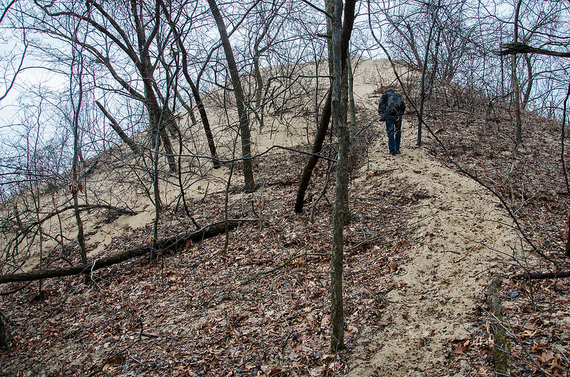
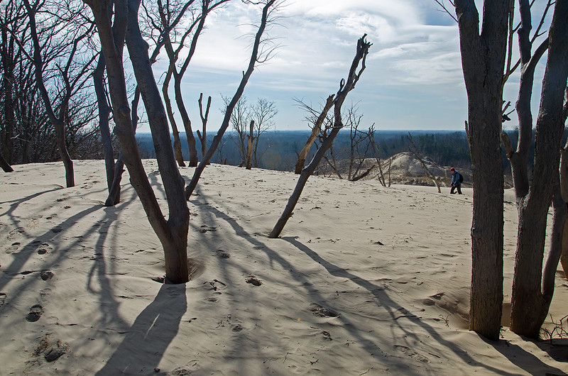
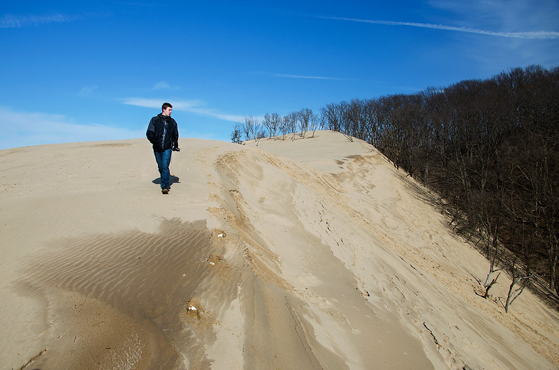
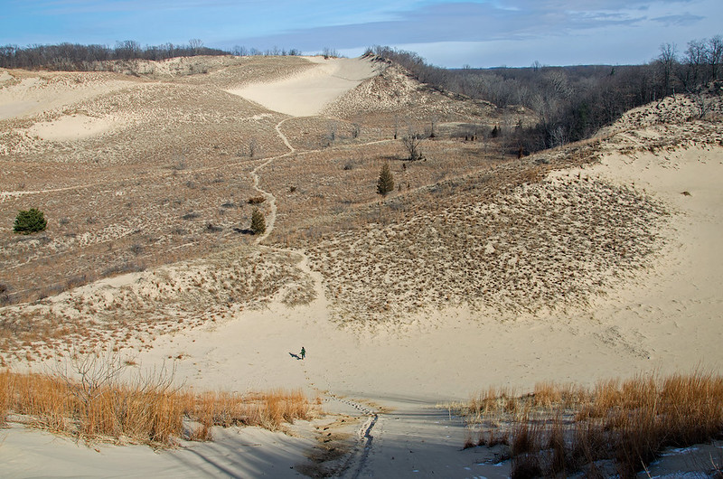
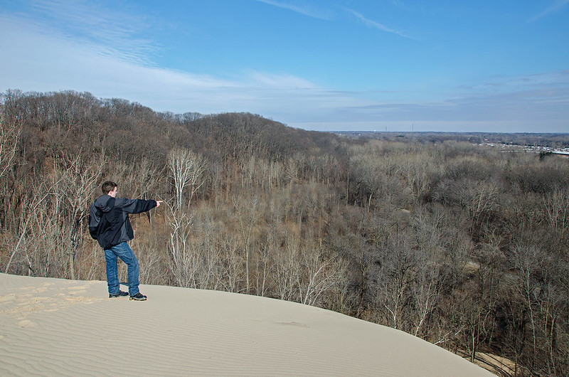
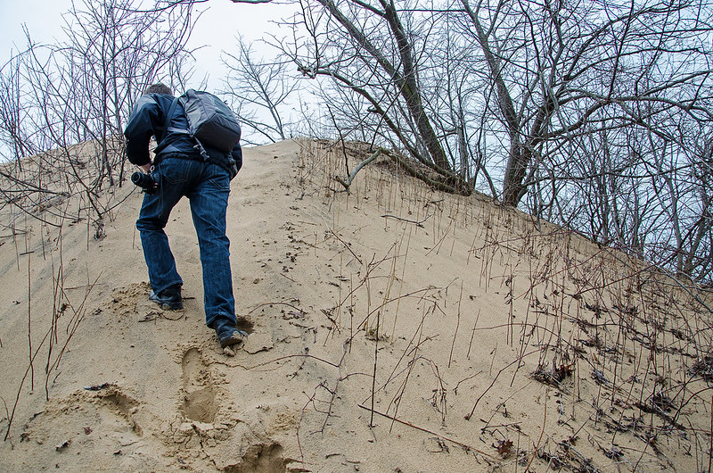
The last few meters of our hike were the most challenging. The loose sand toward the top of the dune was a bit difficult to climb - with each step, we sank into the sand, and slid backwards a little. The angle of the dune also became steeper toward the top.

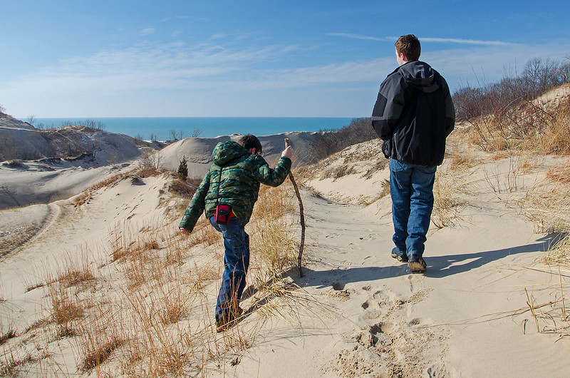
Once we reached the top, we turned south to view the landscape toward the center of Michigan. Up this high, we were above the treetops and could see for miles around us.

The View South

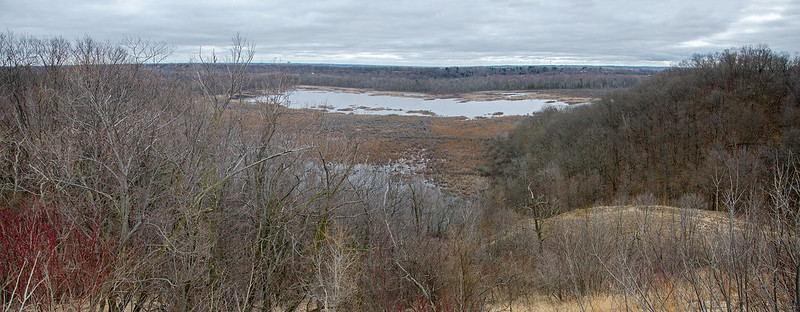
We had a perfect view of South Lake, one of the small lakes within the park.  From this distance we could see several swans on the water, and plenty of other water foul.  I suspect in a few weeks, many migratory birds may call this area home.

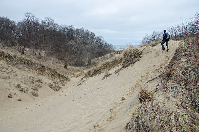
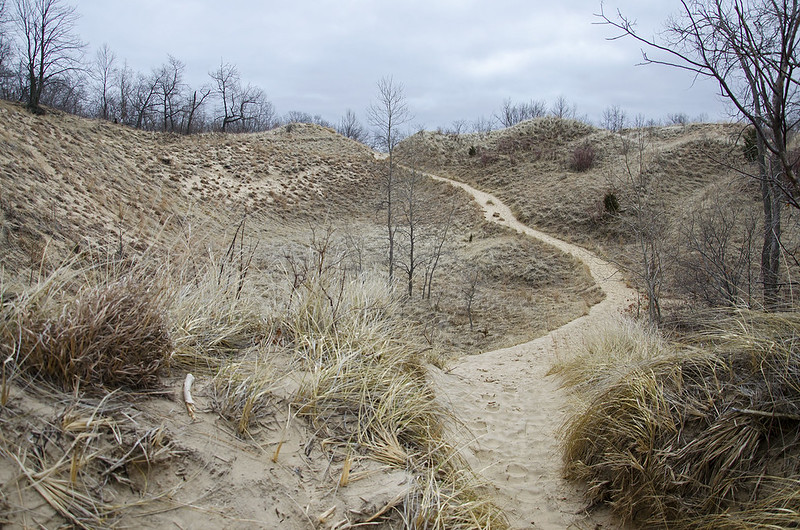
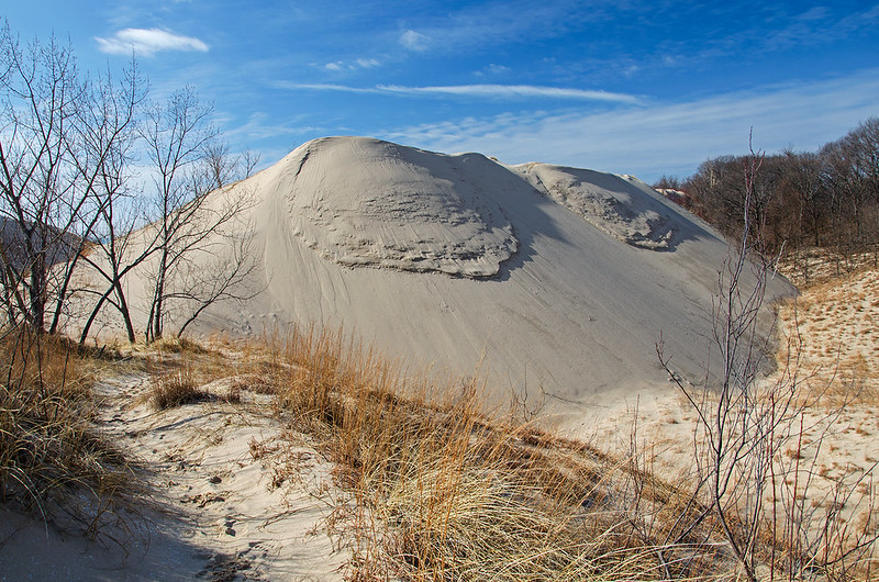
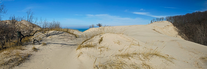
Turning around toward the stiff wind off of Lake Michigan, we finally saw why this wooded dune had a bare sand summit- we were at the living edge of a blowout.  A blowout is a portion of the dune that is devoid of vegetation, and because of this, erodes by the wind.  The sand is blown to the top of the dune, where it falls on the leeward side, burying everything in its path. Here, the sand covered the fallen leaves and small trees near the summit.

The View North

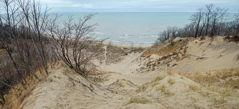
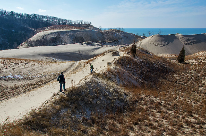
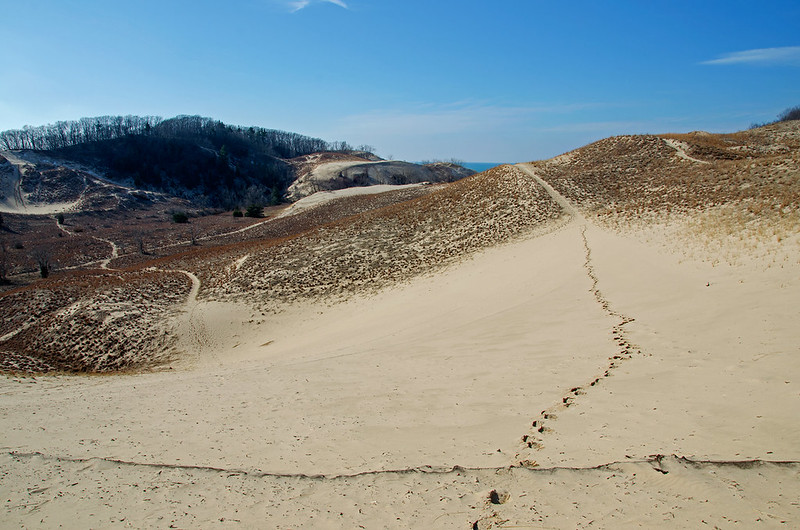
A cold Lake Michigan came into view, along with the maze of smaller fore dunes. We hiked down to the beach and discovered a large amount of objects washed up by the series of storms in the area. Trees, wood from docks, and parts of boats littered the beach. Nothing unusual following a wind winter on the Great Lakes,

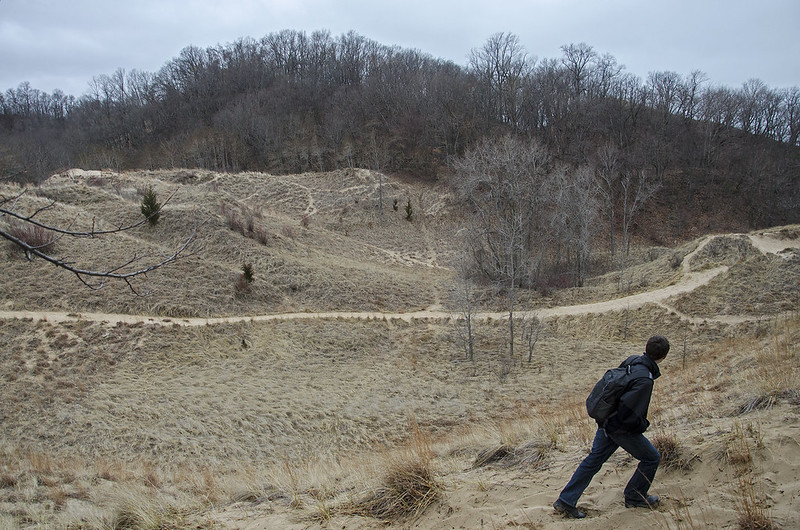
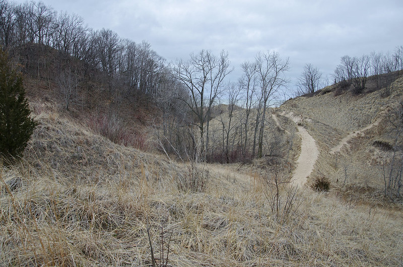
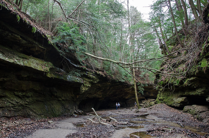
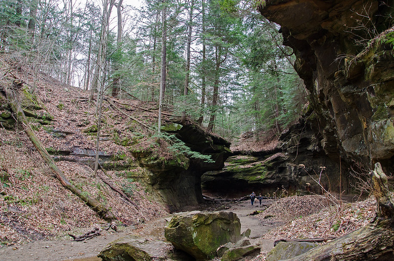
Our hike continued inland.


Eyeing the Summit

Eyeing the Summit

While hiking the meandering paths of the dunes at Grand Mere State Park, Chris noticed the sandy summit of a distant, wooded dune. Bare sand seems unusual on the top of a wooded dune, so he decided we should attempt to find a way up.

What appears to be a few meters away, is almost always a long trek - especially when we want to keep on the trails and not walk across the marram grass.  We followed the winding paths over several dunes until we managed to get closer to the foot of the dune we identified as having the sandy summit.

Rolling Dunes

Following the trail through the wooded dune valley, we spotted a steep trail up to the top of the dune. Having never been on this trail before, we pondered the reason for the sandy summit. Was it a blowout? A living dune? Or was it something created by visitors or the park service?

The Last Few Meters

Only a few more steps up the loose, sandy trail will reveal what's on top, and beyond.

A Hike to Lake Michigan

Lake Michigan Comes into View

On a gloomy, early spring morning, we set off to hike to Lake Michigan through the trails of  Grand Mere State Park. From the parking area, the trail is flat and paved - not the kind of tail I enjoy. I prefer something more natural and rugged, but in this case, I assumed the pavement would lead to natural trails.  After about a half mile, the pavement ended with a climb up a loose sand dune into the landscape seen in these photos.

The Beaten Path

Always mindful of trampling Marram grass and other plants, we stayed on the beaten paths that meandered up and around the dunes. The views from the dune ridges were beautiful in most every direction - Lake Michigan, wooded dunes, grassy dunes, and the three, small inland lakes.

Similar to Warren Dunes, once over the first ridge, and expansive area of rolling dunes is all one can see, giving hikers a real sense of hiking far away from busy cities.

Grand Mere State Park is located in Stevensville, Michigan, only a few miles from St. Joseph. A recreation passport is required to access the park, although in busy times, visitors can pay an attendent for one day access.


Hiking Gypsy Gulch

Hiking Gypsy Gulch

Turkey Run State Park's trail 2 is a one mile, rugged hike that meanders around cliff faces, over hills, and through canyons. One of the more interesting parts of the trail is Gypsy Gulch, a path filled with boulders that have broken away from the cliff walls. Morning fog partially obscured the view of Sugar Creek, seen through the trees in the photo above.

While not necessarily a strenuous trail, it is rugged, forcing hikers to climb over and around boulders to continue on.  A small waterfall drips in Gypsy Gulch, and hikers must walk behind it, under the overhanging rock walls.

Rugged Trail

The old growth trees in this park are beautiful, even in late winter. The Hemlock remain green all year, and are found in the damp canyons of trail 3, but the largest are the Yellow Poplar, also called  Tulip Trees. These straight, tall trees reach a height of 100 feet, with no branches on the bottom 60 feet. Seen in the background in the photo below, the Yellow Poplar towers above the trail, It appears huge even though it's a hundred feet away from the hiker.

Dwarfed by the Landscape

Trail 2 merges with trail 1, which leads to one of Parke County's historic covered bridges, the Narrows Covered Bridge.

Wedge Rock

Atop Wedge Rock

Rugged trail number 3 at Turkey Run State Park in west-central Indiana, is home to a rock formation known as Wedge Rock.  While not really a formation, the feature is the result of a rock fall centuries ago, where this rock refused to roll flat, and remained in this upright position.  The angle is gentle enough to allow safe climbing to the top for a great view of the canyon.

Beneath Wedge Rock

Beneath Wedge Rock, hikers get an idea of just how large this rock is, and a sense of how powerful the event that shook it loose from the canyon wall must have been. The small stream running through the canyon no doubt had some effect on the fall.

Clinging to Wedge Rock

Over time, trees have taken root on the rocky surface. With no soil to speak of, the roots have fastened themselves to the small cracks in the rock, and wandered around to the moist ground below. The trees in this particular part of the canyon are coniferous, and with the neon green moss covering most surfaces, it feels more like a hike in the Pacific Northwest.

Behind Wedge Rock

The backside of Wedge Rock is another interesting place to explore. Lines in the rock seem to have been scoured in, yet are most likely the result of the formation of the rock itself. Fitting to the name of the wedge-shaped rock, hikers must wedge themselves through the small gap between the rocks to explore the backside of this portion of trail 3.

Entering Ancient Indiana

Entering Ancient Indiana

About 60 miles west of Indianapolis, Indiana lies scenic Parke County, home to over 30 covered bridges, and plenty of rolling country.  In the midst of this county is Turkey Run State Park, a natural preserve where visitors can experience Indiana's ancient landscape.

Several canyons dot the park, some with waterfalls, others filled with boulders and trees. One trail in particular, trail 3, brings visitors into a canyon where nature's forces worked over 300 million years to shape what is seen today.  This trail, marked "very rugged" by the park service, is just that, a rugged walk through the canyon.  While not too strenuous, the rugged nature of the trail allows visitors to hike in a more natural setting.  Boardwalks and stairs are in places where necessary, and wooden ladders are necessary to scale portions of the canyons.

Just outside of the narrow entrance to the canyon, along Sugar Creek, the temperature drops substantially.  The colder air of the canyon is well below the temperature of the surrounding area; we could see our breath, and the outside temperature was in the mid 60s.

Hiking Turkey Run

In addition to the cold air, we also noticed the plant life was instantly different.  The park has plenty of old growth trees, some of the tallest I've seen in the region, but the trees here were all old conifers.  Thick, green moss covered the rocks, and fallen trees, while ferns clung to the canyon walls.  Much different than most other parts of the park.

Our six hour hike brought us through most of the canyons, but some fading sunlight forced us to postpone the rest for another day.

The Sap is Running

The Sap is Running

Each spring, The Indiana Dunes National Lakeshore presents an event highlighting the maple sugar production methods of the region. Maple Sugar Days runs the first two weekends of March at the Chellberg Farm, part of the National Lakeshore.

Rangers and volunteers demonstrate the traditional methods of maple syrup collection and production, ranging from the Native American methods to relatively modern methods used on the farm back in the 1930's.

With the warm weather we've experienced, the sap was flowing - slowly dripping from the spiles into the covered buckets. The sap needs the warm days and freezing nights to begin to move up the tree, and the spiles channel the sap from the small hole drilled in the tree, to the buckets. This process only lasts a few weeks. Once the weather is warm enough, the tree begins to gain nourishment from photosynthesis instead of the sap, and the sap becomes bitter.

Collecting Sap

The covers on the buckets keep snow and water from getting into the collected sap, as well as critters that may wander into the bucket for a drink.

Once collected, the sap is taken to the sugar shack where it is boiled down into syrup.

Above the Beach

Above the Beach

With so many unusual stretches of warm weather this winter, the shelf ice on Lake Michigan never developed as vast as usual.  However, some did form, and with the recent days of temperatures reaching 60 degrees, it's disappearing fast.  The break up of the ice is interesting to watch, as each waves batters the mounds of ice until one breaks. This allows the waves to reach the flat ice between the mounds, and they begin to crack and tear apart. These pieces of ice bump into one another constantly, and eventually become round in shape; these formations are called pancake ice.

Pancake IceOur hike brought us to a high elevation on private land, where we could view the lakefront and the ice from above. The extent of the shelf ice, while not as large as most years, is better seen from above. In addition, many textures and patterns are evident from this height, but not from the beach. With no other people around, there is little on the beach to give the images scale, but the mounds of ice were between 15 and 20 feet off of the water.

As we walked on our return trip, the ice was breaking up even faster than before, and more and more pancake ice was forming along the shore, perhaps to become incorporated in the next round of shelf ice should the weather turn cold again.

Remnants of Winter

Remnants of Winter

With many of the Indiana Dunes National Lakeshore beach access points closed due to "Emergency Conditions" as they put it, the areas which traditionally have the best looking shelf ice are difficult to view.  Determined to see the ice before it completely melted, we hiked along the waters edge from Lakeview Beach to Kintzele Ditch - a 3.5 mile hike each way. Even though beach access is closed, the water's edge is part of the public trust zone, hence the public cannot be denied access. For the same reason, property owners along the beach cannot chase away the public from the water's edge.

The 57 degree temperatures and bright sun made this February hike enjoyable. There was plenty of shelf ice left, and many pieces were isolated in the water like islands, no longer attached to the shore by ice.  The waves moved in and removed the smaller, floating pieces of ice, leaving the huge mounds to withstand the pounding waves.

Looking more like a scene from the arctic, the Lake Michigan shore was once again transforming before our eyes.

Exploring Kaskaskia Canyon

Exploring Kaskaskia Falls

As we approached the end of Kaskasia Canyon, we heard voices of some other visitors along with the sound of falling water.  Not surprising, since Kaskaskia Canyon is home to two waterfalls, one substantial and one generally just a trickle. The waterfall was completely frozen over, yet the water ran inside a naturally occuring ice "pipe," created by the falling water and freezing temperatures.

Hearing water inside a frozen waterfall is very common where the flow of water is substantial, but most of the time the water is flowing between the rock wall and the surface ice.  This time, the falling water was encased in ice all the way to the canyon floor.

Frozen Kaskaskia Falls

The two logs that lay in the canyon probably assisted in creating the ice "pipe" as the water followed the logs for a bit, before freezing as it fell to the ground. The logs and ice blocked off most of the canyon overhang, creating a small cave.  Unfortunately, the falling water was not flowing down the canyon, but puddling about 8 inches deep inside the cave, making exploration wet and uncomfortable.  Not to mention the fact that we didn't know the depth of the water under the ice, so venturing inside could have resulted in a fall through the ice into relatively deep water at the foot of a waterfall.

Ice Climbers

The voices we heard in the canyon belonged to two adventurers, climbing the taller of the two waterfalls. Armed with climbing gear, crampons, and ice axes, the climber made his way up the icy waterfall, resting periodically as necessary.

The cold plays a role in tiring out ice climbers.  Keeping one's hands overhead for such a long time can be difficult while climbing, but add to that the fact that warm blood cannot replenish the arms as easily when they're overhead, so the hands become numb and difficult to use.

Ice Climbing

Disappointed I didn't have my own ice climbing gear, I left the canyon in search of more frozen waterfalls.

Frozen Ottawa Canyon

Ottawa Canyon From Above

Our search for frozen waterfalls brought us to another of Starved Rock State Park's canyons, Ottawa Canyon.  Located just past the Council Overhang, Ottawa Canyon is a blind canyon with a generally low flowing waterfall of approximately 50 feet in height.  The low flow portion of this waterfall is evident in the giant icicle pictured below.  The ice formation is at least 40 feet long.

Almost Touching the Ground

It stretches from the rim of the canyon to a point 4 inches short of the floor (by now it might have reached the floor).  If the water was more plentiful, the ice would have built up from the bottom as well, because the water would fall, freeze, and pile upward.  We see this in most every other waterfall in these canyons.

Walking Behind the Frozen Falls

The main portion of the icefall in Ottawa Canyon is more typically formed. Ice hanging from the rim, and ice building from the floor until the two meet. This canyon is such that visitors can easily walk around the icefall, and see the formation from all angles. The size of the column of ice is impressive.

Ottawa Canyon Waterfall

Other interesting features of this canyon include the horizontal bands of color in the rock.  This provides a great contrast to the vertical ice formations. When sunlit, the dark bands take on a warm hue against the bands of cooler colored rock.

Ottawa Canyon Falls

The difference between the two types of ice formations can be easily compared in the photo above. One built from the top down and bottom up, the other, built only from above. We made certain we stayed far away from the hanging formation- figuring it was much more unstable than the others, and could prove fatal if it crumbled onto us.


Backlit Falls

Photographing the Back of the Falls

We were rewarded by some great frozen waterfalls on our return hike to LaSalle Canyon following a week of cold weather. What melted away a week ago, has returned even better than before. The ice growing from the top of the overhang has connected to the ice building up from the canyon floor to create a curtain of ice.

The daylight shines through the ice curtain, illuminating the canyon walls with colors from the sky, rock walls, and minerals suspended in the ice. Ever changing, these curtains continue to grow until the weather warms, and freeze again once the temperatures drop. The intricate patterns on the columns of ice and the canyon floor also grow and change, and get more intricate every day with the addition of more and more ice.

Backlit Falls

Aside from the light filtering through, one of the most interesting things about the ice is the scale of the frozen waterfalls.  Even the small frozen falls are impressive, but when the ice grows to 40, 60, or even 80 feet to the canyon floor below, it's difficult to imagine the size unless you visit the canyon for yourself.

As the water falls from above, it collects on the canyon floor and begins to grow upward, in an ice mound.  The hanging ice eventually touches the growing mound to produce a solid column. The width of these columns can be over 20 feet in diameter, making the impressive icefall desirable for ice climbing.


Dune Shadows

Outrunning a Shadow

To me, one of the most interesting parts of hiking is finding the unexpected.  Whether it's an unexpected view, location, flower, or old piece of machinery, I find it very satisfying to discover something new.

The unexpected can often be something like a cloud, the color in the sky, a shape, or a shadow.  On my latest hike in Warren Dunes State Park, the shadows of objects on the dunes interested me quite a bit.

The shadow of the runner in the image above was stretched by the slope of the sand dune, and distorted to over twice the height of the figure.  As the shadow moved across the dune, it changed size and shape as it encountered the different hills and valleys of the dune.

The Ghost Forest

Another spot creating interesting shadows was at the top of Tower Hill, the tallest dune in the park.  The shifting sand buries trees over time, suffocating them over time until they die.  Their remains cast eerie shadows on the patterned sand.

Above the Treetops

Here, walking above the forest, we can see the process in action. The dune is slowly burying the forest below. In a few hundred years, this living dune will eventually pass over the forest, and the trees will once again become visible, but only as dried remnants of a long time past- when we visited.

Hiking the Ridge

Hiking the Ridge

Continuing our hike through the dunes and blowouts of Warren Dunes State Park in Southwest Michigan, we headed toward Lake Michigan from the big blowout dune. Following trails created by previous visitors (so we did not damage the Marram Grass, or cause unnecessary erosion) we walked on a narrow ridge of the interconnected dunes.

Narrow Ridge

This relatively low ridge sat in the valley between two of the taller dunes in the area, but still provided a great view of the unusual landscape created by Lake Michigan and Midwestern winds.

Toward the Lake

On such an unusually warm day for February, the park had its share of visitors. Walking through the great expanse of these dunes, it's difficult to imagine this park feeling crowded - perhaps just the beach in the summer. We came upon visitors now and then, but still felt as though we were relatively alone.

Living Dunes

On our way, we hiked past a pair of bald, living dunes.  A living dune is a sand dune that continues to move inland.  Generally, they are devoid of vegetation, so the roots don't keep the sand from moving. The winds off of Lake Michigan blow the sand up and over the dune, where it falls on the other side, effectively moving the dune inland, one grain at a time. The photograph above shows some of the sand that was blown over the top of the dune is slowly falling to the leeward side.  It will eventually fall to the bottom, adding a bit more sand to that side of the dune, and burying anything in it's path.

The Dune Valley

Dune Valley

Following our 200 foot climb to the top of the dune, we followed a trail leading into the woods, and off to the ridge of a distant dune. As we arrived, the woods opened up to a grand view of the valley between several dunes and blowouts. What appeared to be a short distance was indeed, much farther than we thought.

The climb down the dune to the valley floor was quite steep - 30 degrees or so is typical of a sand dune; gravity won't generally allow the sand to pile up any steeper. But, the moisture in the sand was still frozen on this shady side, holding the sand together, and not allowing feet to sink into the sand.  So, in places, we slid down, almost like skiing.

On the Valley Floor

Once down on the floor of the valley, we came upon some concrete piers that seemed to be the foundation of a tower - perhaps a power line or antennae, After a few more minutes of hiking, we came upon a rusting piece of machinery with pulleys on it.  Perhaps this was part of the tower? It seemed possible that if the tower was toppled, this could have landed in this spot.  Was it part of a lift, or sky ride?  A bit more research should yield the answer.

From the Blowout

As we reached the distant dune blowout, again we underestimated the size and height.  The climb, however, was well worth the effort, as we were granted a 360 degree view of the surrounding countryside, some 200 feet below. If you look very carefully at the photo above, two people are standing on top of the distant, bald dune, to the left of Lake Michigan. Their size will give you an idea of the distance between me and that dune.

View From the Top

Expansive Dunes

Expansive Dunes

Unusually warm weather melted most of the snow and ice around the area, and the bright sun encouraged us to spend most of the day exploring Warren Dunes State Park in southwest Michigan. Atop the 200 foot tall dune, we could see for miles. What appears to be a small area in the photo above, is in fact many acres across - the bare branches on the top right are full grown trees.

Able to climb the sand dunes from the beach, and hike into the wooded sections of the dunes was a treat for us, since the Indiana Dunes have all but closed access to these types of areas, and the ones which are open, are not as expansive or accessible.

Over the dunes, into blowouts, back up more dunes, over and over again; not an easy hike in the loose sand, or the still frozen portions where downhill was almost like skiing. Certainly worth every step.

Frozen Wildcat Canyon

Wildcat Canyon>

The 80 foot tall waterfall in Wildcat Canyon has once again frozen solid.  Wildcat is one of Starved Rock State Park's many canyons, but one of the few where one can view the canyon from almost every direction, top to bottom.  Many of the canyons are accessible from the floor only, but Wildcat gives visitors the ability to view into the canyon, from high above.

I've often seen ice climbers at this frozen waterfall, testing their skills with melt water pouring down on them as they climb. At 80 feet, this is quite a challenging climb.

Under Wildcat Falls

With a bit of determination, I managed to climb up the icy rock onto the canyon shelf behind the icefall, for a unique look up at the falls and the canyon ceiling.

Wildcat Ice Patterns

Up close, the intricate patterns of ice come into view.  With every drop of water from above, tiny icicles form on top of each other, from the overhang, and from the ground, until the lacy ice interlocks and forms the giant icefall.

Wildcat Canyon Icefall

Wildcat Canyon is one of the easiest canyons to reach at Starved Rock State Park.  It's rather close to the visitor center, and the trail from the lodge is fairly flat and easy.  Be prepared for plenty of stairs if you plan on heading down to the floor of the canyon.

Exploring Tonty Canyon

Exploring Tonty Canyon

At approximately 60 feet in height, the frozen waterfall seen here is one of the two waterfalls found in Starved Rock State Park's Tonty Canyon. Following the often narrow trail that winds about 20 feet above the canyon floor can be a bit tricky in wet weather, but add ice, and it becomes dangerous. So much, that the trail was closed on one end, forcing us to walk to LaSalle Canyon first, just to double back to Tonty.  And of course, leaving the canyon meant doubling back again through LaSalle.

The two waterfalls were frozen, but this one in particular was more complete, and ornate in ice formations. The melting snow above fed the ice fall, and the below freezing temperatures helped build the ice falls.

Ice climbing in Starved Rock is not unusual, and this is one of the ice falls I've seen people climb. Wildcat Canyon's 80 foot waterfall is a popular choice, as it's one of the closest falls to the visitor center and lodge. Luckily, were arrived before the falls became large and strong enough to climb; climbing often ruins the intricate formations on the falls.

Most of the ice falls are hidden from passers by, and require a hike into the blind canyons.  They often reveal themselves dramatically after hikers round the last turn in the canyon, so the condition of the ice is never known until the last minute - but generally well worth the hike even if the ice has not formed.