Climbing into the Devil's Doorway

Looking Through Devil's Doorway

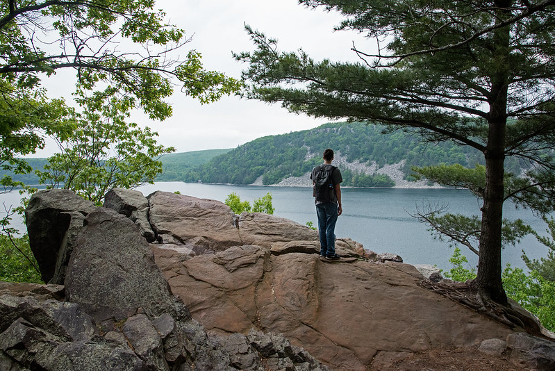
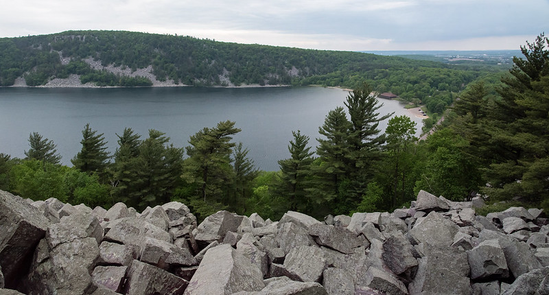
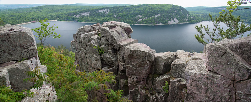
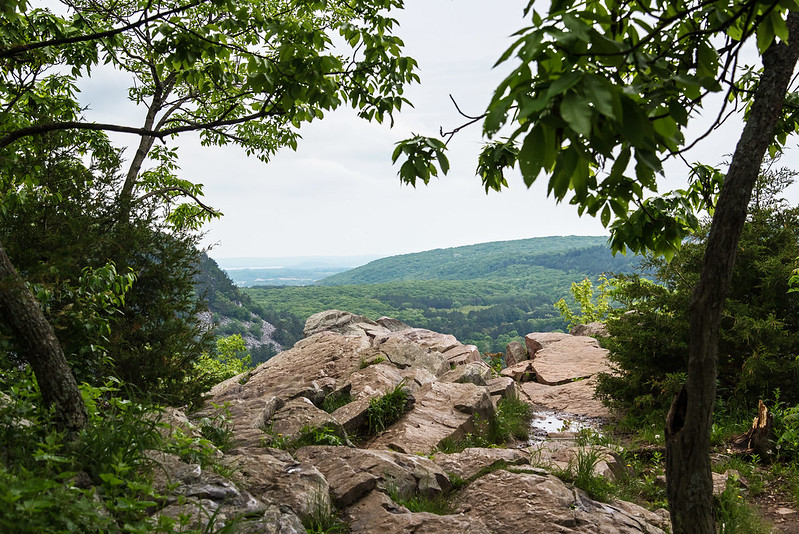
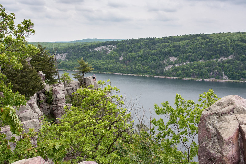
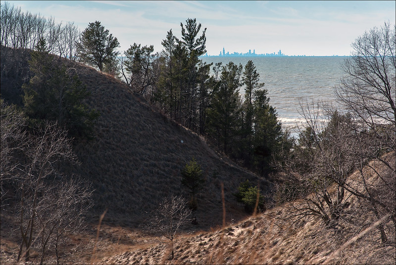
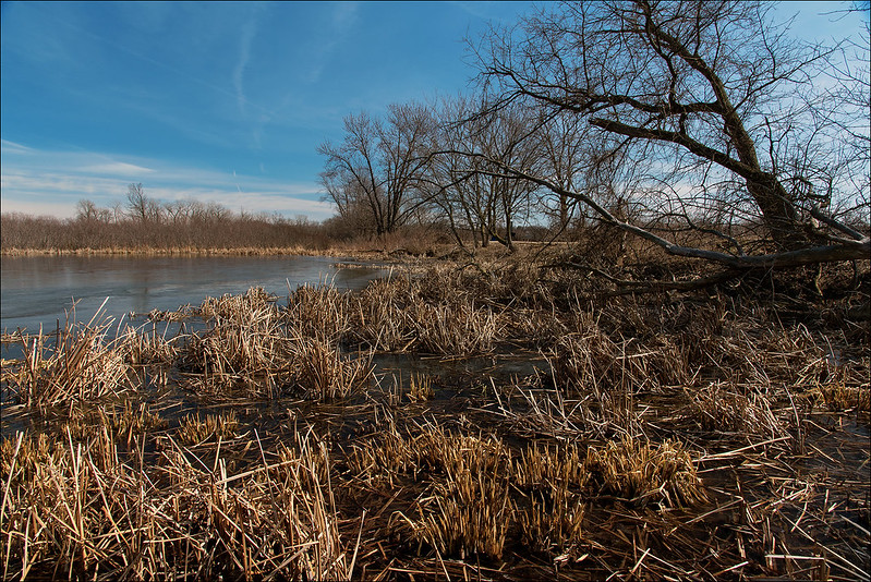
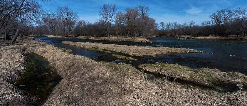
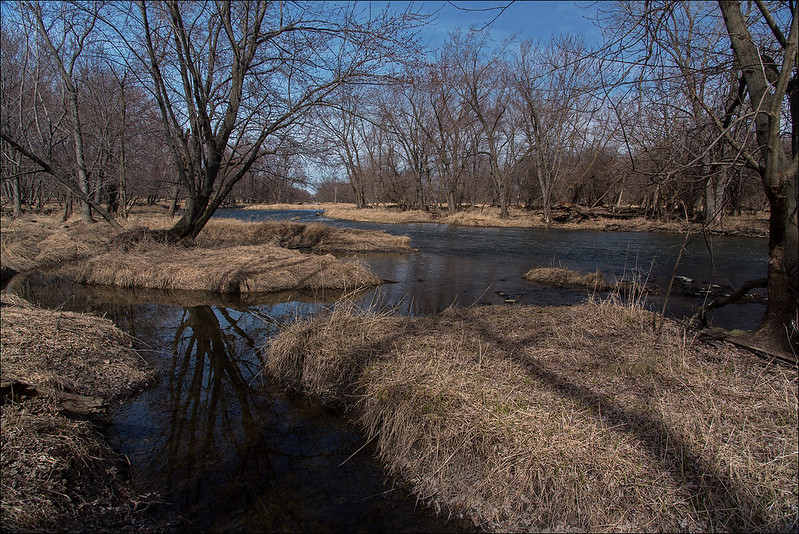
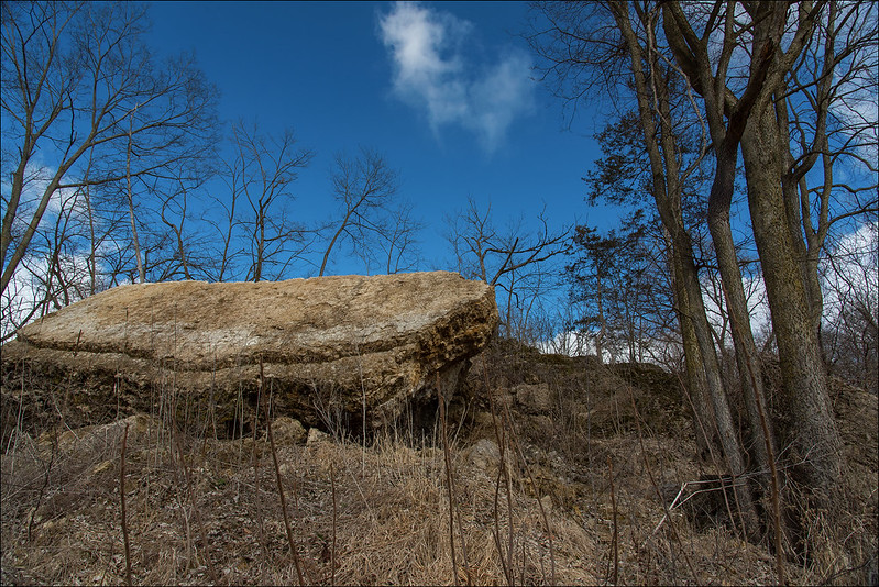
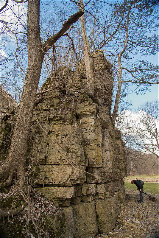
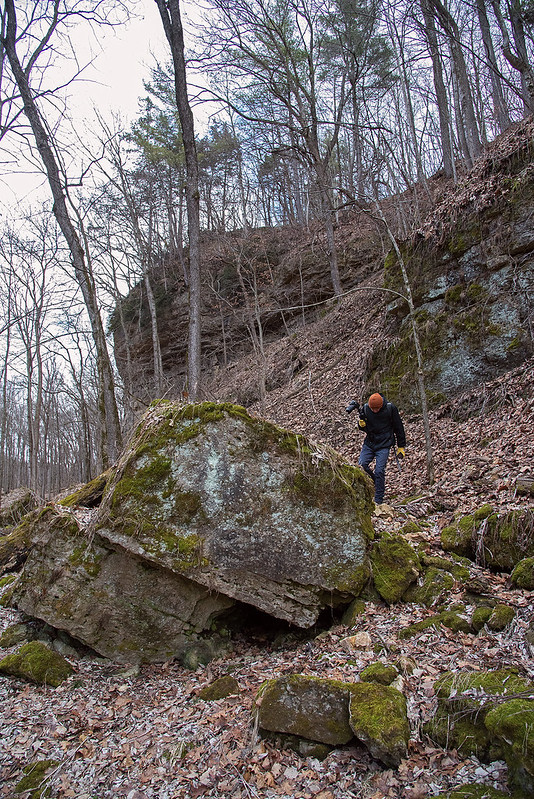
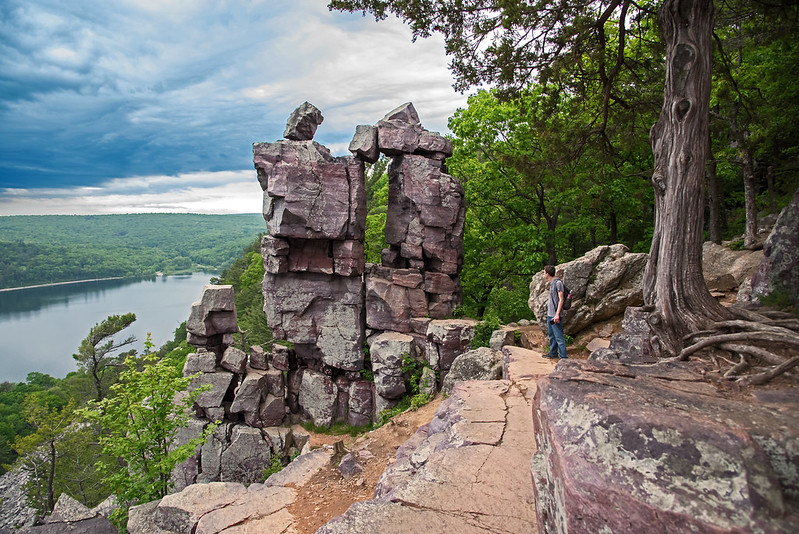
One of the main attractions at Devil's Lake State Park is a rock formation called Devil's Doorway. Set high above Devil's Lake, some 500 feet below, this formation is made of metamorphic rock created over a billion years ago from sandstone that was once the bottom of a sea.  The actions of time, water, and ice have cracked the rock, sending large chunks down the hillside.  What remains are beautiful rock formations dotting the bluffs surrounding the lake.

Climbing Up To Devil's Doorway

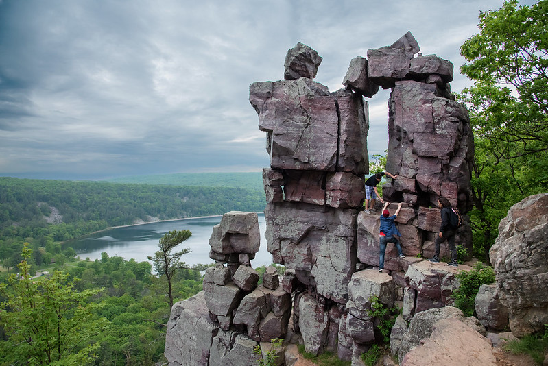
A short spur trail from the East Bluff Trail, the path takes visitors close to the steep drop offs near the formation, where the view is spectacular. Devil's Doorway seems to draw people to itself, as in the short time I visited, more than six people ventured off the trail and climbed up into the doorway itself.

A group of friends helped each other climb up the formation for a great view, a bit of adventure, and of course, a photograph. Carefully explaining which rocks to hold on to and which to jump down on, all three made it safely up and back down to the trail.

Help Through the Devil's Doorway

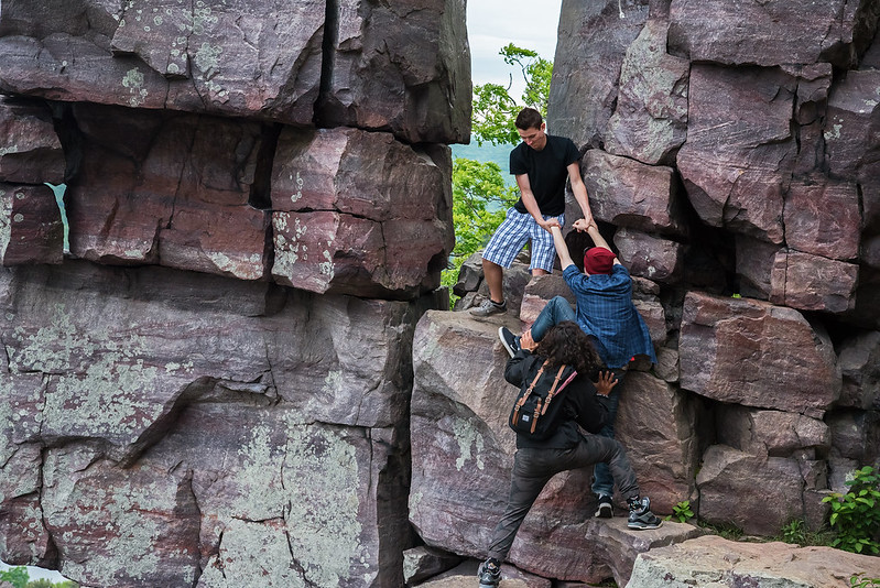
The area directly below the doorway is not a drop down hundreds of feet, but it is about 30 feet onto a small rock base, where one misstep can send the climber down hundreds of feet. So, perfectly safe it is not.

A rope still hangs from a previous climb, but not long enough to assist anyone with the ascent from the bottom.  Who knows how long the rope has been there, and if it's weathered so much it would simply snap under the weight of a climber.

Sitting in Devil's Doorway

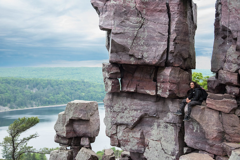
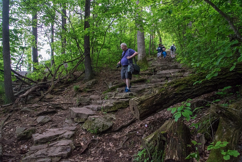
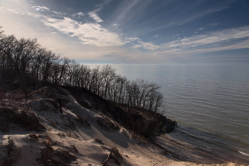
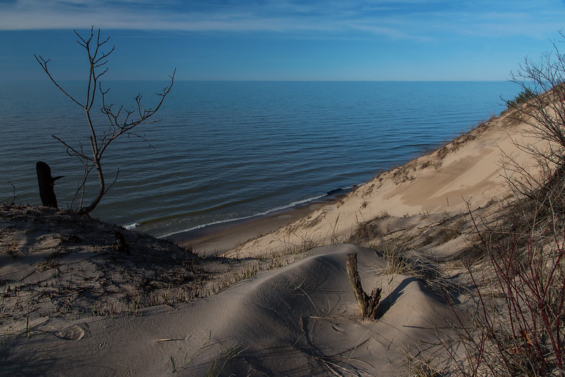
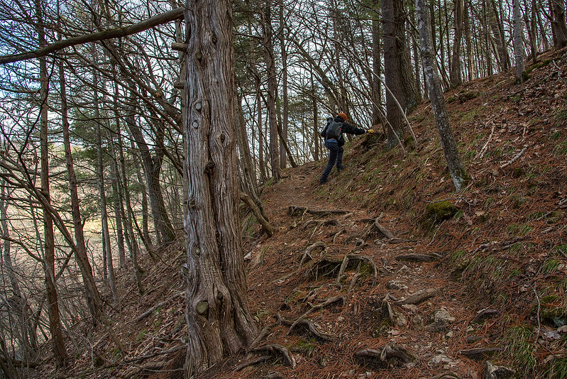
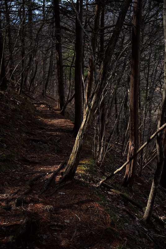
Certainly well worth the rocky climb up. Beginning the trail at the north part of the lake seems a bit easier of a climb - the south end is rocky and interesting to navigate down, but would be a tiring climb up with a backpack full of camera gear.

Beginning the East Bluff Trail

Pausing at Devil's Lake Following our 1.7 mile hike up, across, and down the West Bluff Trail, we crossed the relatively flat south shore of Devil's Lake. The glaciers left a moraine at this spot, dumping a mound of till that helped form the lake by closing off the area between the two bluffs. Decending the West Bluff The hike down the West Bluff was a bit challenging, but made easier by the stone stairs arranged by the park. Some of these areas created bottlenecks where tired hikers slowed down to avoid tripping, while young kids ran past with no thought of danger. View of the West Bluff Once again, the views of the lake below were fantastic, and the town of Baraboo could be seen on the horizon. It was a strange sensation to watch birds glide below us, as they soared on updrafts created by the twin bluffs. We hiked around three miles, and came upon many interesting rock formations, views, and features, but have yet to see the popular formations that attracted us to the park. Those were on the path ahead.

Devil's Lake Overlook

Quartzite Bluffs Our first visit to Devil's Lake State Park, near Baraboo, Wisconsin began with a hike up the West Bluff trail. This trail was well maintained, and interestingly enough, paved with asphalt. Not flat like a road, but following the contours of the natural trail, probably to keep the path from erosion. Being one to prefer natural trails, I was first a bit surprised, but then realized the surface did not take a way from the hiking experience. First OverlookThe trail climbed through dense woods, around erratic boulders, winding its way up 500 feet above the lake below. We were surprised by the first overlook we encountered, a sweeping view of the lake and bluffs in the distance. In many parks previously, we were disappointed by the overgrown trees and lack of sweeping vistas from bluff trails- this was different. Every place we wanted a view, we found one, and more. The rocks of Devil's Lake State Park, are among the oldest outcrops in North America, believed to be 1.6 Billion years old. Originally formed beneath a sea as sandstone, the rocks were then subject to great pressure and heat, the porous sandstone eventually turned to hard metamorphic rock where it was pushed upward by great forces. The seas retreated but filled the area millennia later, only to receive a battering by the Wisconsin glacier during the last ice age. The western bluff was not covered by the ice, but the eastern bluff was. Ice, water, and wind eroded the softer rocks away from the harder quartzite and granite into what we see today. On the Edge On our 6 hour hike, we encountered numerous overlooks and rock formations, all interesting in their own ways.

Overcast

Overcast An overcast morning along the shore of Lake Michigan, give the beach the appearance of a cold and stormy day, yet little wind and warm temperatures made this hike pleasant. A bank of warm gray fog crawled along the horizon, blocking the view of the Chicago skyline, and giving it a dirty look. The clouds appear to be moving fast in this image, but this was captured at a relatively fast shutter speed; the clouds simply looked as if they were moving quickly. That's one of the interesting things about hiking familiar places, you notice when things are different, and you experience the countless moods of the environment.

Kettle Pond

Kettle Pond One of only two such features in the United States, the kettle ponds of Waterfall Glen were created by the retreating glaciers. Large chunks of ice were trapped and pushed into the ground forming a depression in the earth. These depressions filled with water forming ponds. Some kettle ponds dry up during droughts, and replenish in spring after the snow melts, or after wet periods. For this reason, they are devoid of fish, providing a great habitat for amphibians feeding on insects. Just a few yards from the walking path, most visitors to this area probably glance at the pond as they run past, not realizing the significance of this kettle moraine topography. We spent well over an hour exploring the pond from many different angles, encountering some interesting creatures in the process.

Beyond the Dunes

Skyline Beyond the Dunes It's not uncommon to see the Chicago skyline across Lake Michigan from the Indiana Dunes National Lakeshore, but it seems each time I see it, it's different. Either more or less of the buildings are visible, a superior mirage makes the skyline appear upside-down, or the foreground frames the skyline differently. Every few steps along the paths and trails, the view changes in all directions, and it's interesting to see how things change around the constants of the lake and the skyline. Dune Valley Each turn of the trail brings a fresh look at the dunes. The rolling grasses, conifer forests, oak savanna, and beach all combine with each other like no other place I've visited. In fact, the dunes along Lake Michigan are some of the best places to see dune progression - the change in landscape from beach to old wood forest. As the leaves fill out the trees, the views will once again change- and in some places disappear all together.

Meandering Trail

Meandering Trail An evening hike through the dunes along Lake Michigan - an unusual time for us, as we generally hike in the mornings. We followed the narrow, meandering trail from the beach, through the wooded dunes, along the ridge, and finally through the grassy plains, It's interesting to watch this area come back to life after the winter, the brown grasses shining in the sunlight, will soon green up, as will the trees dotting the dunes.

The Ridge Path This place never seems to get old, and always offers us something different no matter how many times we visit. Behind us are the vast waters of Lake Michigan, offering plenty more interesting views.

Low Sun Behind the Dunes

Low Sun Behind the Dunes

Following our three mile hike to the dune, we climbed up to view the expanse of woods to the south, and Lake Michigan to the north. This particular dune stands between dense woods and the beach, generally covered in marram grass, a large blowout developed over many years, creating the bare area in the center.

A recent controlled burn of the area removed much of the dry grass, revealing the sand below, and dozens of old bottles, cans, and other items left over from the old homes that once stood on the site. We explored the dune ridge, careful as always not to trample any vegetation before making our way down to the beach, and our three mile hike back to the car.

Looking off on the horizon in the center of the image, they skyline of Chicago can be seen, some 40 miles across the lake. This was an unusually clear day - at least the atmosphere was clear - allowing us to see much more of the city than usual.  In fact, it also helped to create a superior mirage on the horizon, making parts of the city look as if they were upside down.

Visiting the Indiana Dunes National Lakeshore more than 45 weekends a year, we see plenty of interesting and new things - even the things we visit each time are never the same twice.

After the Burn

The Dune at The Burn Line

A recent controlled burn in the area removed most of the dry vegetation from the tops of these dunes along Lake Michigan. The area was once privately owned, and the buildings were removed about a year ago.  What a great piece of property this was, and the views from the homes was beautiful in all directions - woods to the south, marram grass dunes to the east and west, and Lake Michigan to the north.

 Aftermath of the Burn

The path to the lake can be seen now that the vegetation is gone. The dune at the right was spared this time around, probably to be burned in the next year or two.

Recent rains have started the recovery process here, the roots of the marram grass are sending up green shoots already.  Soon, this area will be lush with thick, green grasses, birds, dragonflies, and cicada wasps.

Superior Mirage

Superior Mirage on Lake Michigan

As the air warmed over Lake Michigan, a light fog developed on the horizon. This created a mirage of the distant Chicago skyline some 40 miles across the lake from our vantage point.

Called a superior mirage, it is created when cold air is near the surface, and warmer air is above. The atmosphere acts like a lens, inverting the skyline. If you look closely around the horizon, you will see the tops of some shorter buildings upside-down in the mirage.

Because of this mirage, objects that are usually hidden by the curvature of the earth can be seen above the horizon, only upside down. The Chicago skyline is usually visible from this vantage point, but the numerous other small buildings are never seen, unless displayed by a superior mirage.

Mirage Behind the Michigan City Lighthouse

Looking up the shoreline toward Michigan City, the lighthouse is visible, but generally nothing beyond.  It's unusual to see any land beyond the lighthouse, but the superior mirage along the horizon refracted the objects below the horizon, and displayed them above, just inverted.

An interesting effect created by the perfect weather conditions.

Rocky Beach at Sunset

Rocky Beach at Sunset

Following a long hike up, over, around, and down some dunes, we spent the final hour of daylight on the rocky shore of Lake Michigan. Depending upon the wind and waves, the beach can be sandy and soft, or filled with stones and rocks with little or no sand.  Rocky days are great for fossil hunting; we often find fossils of some sort or another.  In fact, evey time I've been to Central Beach or Mt. Baldy (when there is no snow) I've found a fossil crinoid - every time.

Setting the aperture on the camera to a high F stop, not only eliminated a lot of bright light from the image, it also created somewhat of a starburst out of the setting sun. Something you don't want to do when the sun is high in the sky or very bright, you can damage your camera's sensor with such bright light.

As summer approaches, the sun will appear to migrate directly over Lake Michigan, and for a time, right behind the Chicago skyline.  I'm looking forward to that.

Evening at the Dunes

Young Dune

A week before winter weather returned to Northwestern Indiana, it felt more like late spring, as the setting sun illuminated the dry, dormant Marram grass with a warm amber light. I generally hike the dunes in morning, so it was a treat to see them during the golden hour.

This young dune was at the top of a blowout, a bare area of a dune where no vegetation grows. The lack of vegetation encourages erosion by the driving winds off of Lake Michigan.  The sand is blown up and over the top of the blowout, where it accumulates, forming another dune.

This dune appears to be only a few years old, and is one of the smallest living dunes I've seen.  A living dune is one that is growing and moving - all due to the wind and erosion.  The sand blown over the top settles on the other side, making the dune move inland.  On its slow journey inland, everything in its path is buried.

Evening Between the Dunes


Dolomite Stream

Dolomite Stream

Cutting through the 425 million year old deposit of dolomite, this small stream equalizes the levels of two wetlands located in the Lockport Prairie Nature Preserve, along the bank of the Des Plaines River. Looking at the rounded rocks in the stream, it seems this has been flowing here for a long while, not just an occasional passage for floodwaters. Some other areas of this park show signs of flooding, and are located out in the open, but this stream was hidden behind an old stand of trees toward the end of the trail.

While the majority of the park is mostly flat, the area just beyond the trees surprised us with an eight foot deep gulch cut by this stream.

Lockport Wetland

Flowing into this wetland, the stream's waters probably flow eastward toward the Des Plaines River, only a few hundred feet away. Exploring that area was difficult due to the deep, sticky mud - best saved for a warmer day, or in winter when the ground is frozen.

Dozens of Islands

Des Plaines River

For years, I've driven over the Des Plaines River just west of Lockport, Illinois, and viewed the network of small islands below. Each time I wondered what it would be like to get down into this area.  On March 1st, this area reopened to the public, and I took advantage of a sunny Sunday afternoon to investigate the area.

Once a garbage dump, then managed by the Chicago Metropolitan Water Reclamation District, this Dolomite prairie is home to waterbirds, and plenty of insects and plant species. Hiking the area, one runs across thousands of pieces of broken glass, rusted metal drums half buried in the ground, yet they don't take away from the beauty of the area.

Lockport Prairie Waterway

Just east of the river, we noticed a tugboat working on the Sanitary and Ship Canal that runs parallel to the river, a reminder we were near a large metropolitan area.  Even though the city of Lockport was just to the east, and IL 53 was to our west, we could hardly hear any traffic or industry - an island of nature surrounded by urban life, all at the end of a dead end road.

Millville Remnants

Resting Rock

Once a town along the Chicago - Galena Stagecoach route, boasting as many as 300 people, Millville, Illinois is now only a memory. Settled in 1835 on the banks of the Apple River, the town once stretched about 10 blocks long. After the railroads all but eliminated the stagecoach routes, the town fell to as little as 30 people.

Remnants of Millville

Following the heavy rains of 1892, the flooded Apple River washed away the town structures, leaving nothing behind. The entire town was gone without a trace. Today, inside the Apple River Canyon State Park, a small plaque on the side of these rocks marks the location of the town.

The Hidden Waterfall

Just above the former site of Millville stands Tower Rock, a rock cliff on the bank of the Apple River. A hike along the ridge yielded some interesting trails, along with a hidden waterfall.  Once at the top, we heard falling water, and decided to search for the source of the sound. In a narrow gully between two ridges were several waterfalls ranging from one foot tall to five feet tall.  The water lead from the cracks in the rocks to the river below.

After a challenging hike down to the gully, we explored the waterfalls for quite some time. The stream lead to the river with no way to hike out other than the way we came from the ridge. We headed back up, only to hike back down.


Apple River Canyon Hike

View From Tower Rock
Apple River Canyon is a small state park in the northwest part of Illinois well suited for fishing and hiking.  While the trails aren't very long, they can be interesting and challenging at times.

Our fist hike was up to a lookout point on Tower Rock, one of the rocky cliffs that line the Apple River.
Wooded Path

At times steep, but always narrow, the path led to the top of the canyon wall, where a sweeping view of the river below came about. In summer, the leaves from the trees would obstruct most of the view, but in winter we were able to see most of the canyon below.

Dappled Path

The morning light was mostly flat due to the overcast sky, but every so often, the sun would appear for a few moments, illuminating portions of the wooded trail. Toward the bottom of the Tower Rock cliff, large boulders lay in the flat areas next to the river, providing interesting areas to explore.

Canyon Exploration

Sawmill Creek

Horseshoe Bend

A popular hiking destination southwest of Chicago, Waterfall Glen offers almost 11 miles of hiking trails for jogging, walking, cycling, or horseback riding.  The 2400 acre forest preserve surrounds Argonne National Laboratory, and contains woods, wetlands, ponds, and a popular waterfall which is actually a man made dam.

Walking on the Waterfall

The waterfall is one of the biggest draws of the park, enticing couples, children, families, and dog walkers alike to Sawmill Creek, the stream that flows through the park.

Attractive in all seasons, the park provides a great get-a-way close to the busy urban life of the Chicago suburbs.

Growing Shelf Ice

Dunes Shelf Ice

It's been a relatively warm winter after a snowy December, and the shelf ice around Lake Michigan has all but disappeared. Last week, temperatures dropped below freezing again, so the shelf ice along the shore is building again.

While it's not mounded as high as past years, and doesn't extend hundreds of feet out into the lake, it's still interesting to view. One of the good things about this type of ice is that quite a bit of it does not extend over the water, so we were able to explore a bit of it - the parts that formed over the sand.

Frozen Beach

Should this ice crumble beneath our feet, we would simply drop about two feet to the beach below, not into the freezing, churning waters of Lake Michigan, as if we ventured out onto the shelf ice. Shelf ice is dangerous to walk on, and unless one knows the area very well, even walking on the ice near the shore can cause injury or death.

This ice was formed during heavy surf, so the chunks and mounds formed on dry land, and we did not venture near the portions that extend over the water like a shelf.

Distant Skyline

Far beyond the chunks of ice, the Chicago skyline peeks over the horizon in the image above. As dangerous as it can be, and as cold as the temperatures are on the beach, one of the best times to visit the Lake Michigan shore is winter.

Triplets

Clear Lake Triplets

A thin layer of ice covers the surface of La Porte's Clear Lake, leaving the three locally famous cypress trees surrounded.  Sometimes on shore, sometimes submerged, the cypress trees are sometimes referred to as three sisters, or triplets.

The trees are said to have been planted in memory of three young girls who met with an untimely death.  But they could have been planted in memory of three children who fell through the thin ice of clear lake in 1928.

Another cypress tree stands a few hundred feet away, so perhaps they just grew naturally.  Either way, the three sisters inspire countless people in the city of La Porte.

The Night Sky

Chicago at Night

On our Friday night trip to the Lake Michigan shore, we stopped at the Indiana Dunes National Lakeshore to view the beach at night. The Chicago skyline is not an unusual sight - located about 40 miles across Lake Michigan at this point. On clear nights, the skyline looks like a gem sparkling on the black water of Lake Michigan.

One of the more interesting things for me is watching the numerous airplanes coming and going.  To me, they look like bees leaving the hive, and with a long exposure, you can see the light trails they leave.

Night Sky

Due to the light pollution from Chicago, not too many stars can be see around the city, but turn 180 degrees, and the sky is dark enough to see for light years. On this cold, windy night, the moon was in the sky, making it more difficult to see deep into space.

I'm not sure which stars and galaxies are visible here, but I find the bright, glowing light just to the left of center to be very interesting.  It must be a star cluster or galaxy.