The Solar Eclipse

Eclipse With Sun Spots

The solar eclipse of 2017 reached 87% in the Chicago area. The morning began partly cloudy, but as noon approached, the clouds became dense, and blocked the sun completely.

Right around 1PM, the clouds broke, and the sun was visible allowing us to watch the peak of the eclipse.

The photo above shows the sun as the moon was moving away from it. Looking closely, you can see a nice group of sunspots to the right of the moon.

Eclipse at 87%

With the cloud cover we experienced, this was the most the sun was blocked by the moon. Still an impressive view for us here in the upper Midwest.

Eclipse

The light clouds actually made the eclipsed sun appear very similar to the moon on a cold, Fall evening.  While still bright, the light from the sun appeared a bit odd, more diffused than normal.

The next eclipse nearby will arrive in just a few years.

The Potholes of Falls Creek Gorge

Potholes

Deep in rural Warren County, Indiana, lies a hidden gorge with a remarkable sandstone canyon riddled with potholes. This part of the stream is actually called The Potholes, and it lives up to its name. Over thousands of years, flowing water and loose boulders carved the soft sandstone creek bed into round pockets or potholes. Boulders caught in the current of the water moved in small circles when trapped in a depression. This action caused the depression to get larger and larger into the current creek bed.

The water in most parts of the creek is about six inches deep, however, dozens of potholes hold two or three feet of water. Walking around this creek is difficult, as you may need to step into a three foot deep pothole to get around.  Plenty of rain caused the creek to rise, and we tried to keep dry from the knees up, so it was impossible for us to walk the length of the canyon, and had to double back once from the downstream side, and again from upstream.

The walk through the creek was a bit difficult due to the narrow ledges between deep potholes. If one does not watch, a slip into a pothole may cause a fall or injury, but overall, if you expect a challenging walk, and watch, the walk is great fun.

Exploring the Potholes

Colors, shadows, and reflections play off one-another, creating what is described as one of the most beautiful places to visit in western Indiana.  It does not disappoint.

On our way out, we ran into three local teenagers in swimsuits, heading down to the potholes. That is truly the way to experience the potholes - each one is round and smooth, about two to three feet wide and deep - built like small, individual whirlpool baths!

Falls Creek Downstream

If you're lucky enough to find your way to this hidden gem, you'll find a parking area large enough for three or four cars, that's it.  The Nature Conservancy describes the gorge as, "loved to death" over the past few years, so a small parking lot may help insure a low number of visitors.


Punch Bowl From Above

In the Punch Bowl

Past the waterfall and challenging narrows of Trail 3, a short turn-off to a blind canyon appears.  This leads to the famous Punch Bowl, a canyon with a small waterfall that flows into a little, round pool. The waterfall was barely flowing this time, but it's still an interesting canyon to explore.

From above, one can see how narrow the short canyon is, and get a sense of scale compared to the larger canyons of Trail 3.

Colorful Reflection

Even without a rush of water falling into the Punch Bowl, the view from inside the canyon is beautiful. The water on the creek bed reflects the colors of the sky, trees, rock, and moss, creating an interesting "abstract painting" on the canyon floor. With every step, the view and colors change - especially on a day when clouds obscure the sun for a short period.


The Narrowing of Trail 3

Trail 3 Canyon
Following the climb up the waterfall, trail 3 narrows considerably, and the stream flows a bit faster due to this narrowing. There are two ways to navigate through this area, and in summer, people seem to stay on the canyon floor and walk through the flowing creek.  There are some grooves and potholes that make the hike a bit tricky in spots, but overall, it's a simple walk.

The Canyon Narrows

The second way is to follow the small steps carved into the canyon wall.  These were obviously carved by those wishing to keep their feet dry, and were probably not intended for those with backpacks.  The steps barely fit your shoe, but there are also some hand holds carved into the rock to help hikers keep their balance. The narrow path on the wall is about 8 feet above the canyon floor, so not too high, but care must still be taken as one slip could result in an injury.

The High Road or Low Road

In the photo above, most people are taking the route through the creek bed. Judging by the look on their faces as I walked up the wall, I think in this case, many people didn't realize there was another option.

The only problem with the high path is when another hiker is heading the other way.  There are very few places to step aside to pass, so people must simply look ahead before they climb up.

Negotiating Trail 3

While this portion of trail 3 is a bit challenging, it's not beyond the ability of most hikers - providing they don't mind wet feet.

Toward the Light

The Dark Canyon

After passing Wedge Rock, the trail turns, widens a bit, then deepens toward the next turn, where hikers must walk up the running stream into a narrow, more challenging channel. The canyon walls are shaded from the sun by the dense canopy of leaves above, creating high contrast patches of light and shadow. The light is very dramatic, and often bright green from the trees above.

Heading toward the light, up the creek bed brings you to a small cascade of water you must walk through. Standing on rocks or logs helps keep your feet dry.

Up the Creek

During periods of rainfall, this portion of the trail can have much more running water. While I've never seen it rushing over the entire surface, I have seen it several inches deep on this incline, flowing down as hikers attempt to walk up. Expect to get your feet wet if you visit trail 3.

Toward the Light

The logs and rocks only provide dry walking area for a while, then one must jump off and look for the shallowest parts of the stream to walk through.  Unless of course, you wear water shoes, which would work well here.

Once past this area, the canyon narrows and funnels hikers into a picturesque channel where there are two options:  Get your feet wet and walk through the stream, or stay dry and climb the narrow path carved into the canyon wall.

The Hike to Wedge Rock

The Approach to Wedge Rock

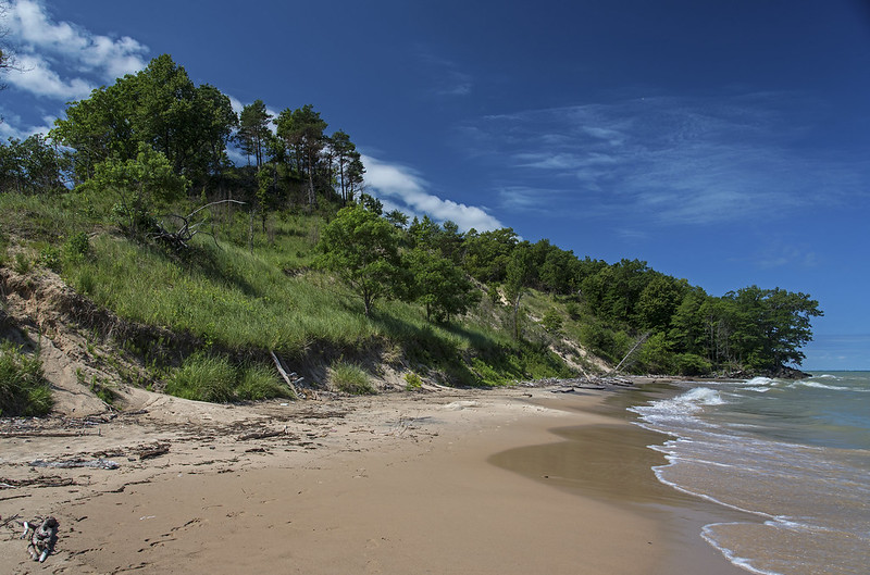
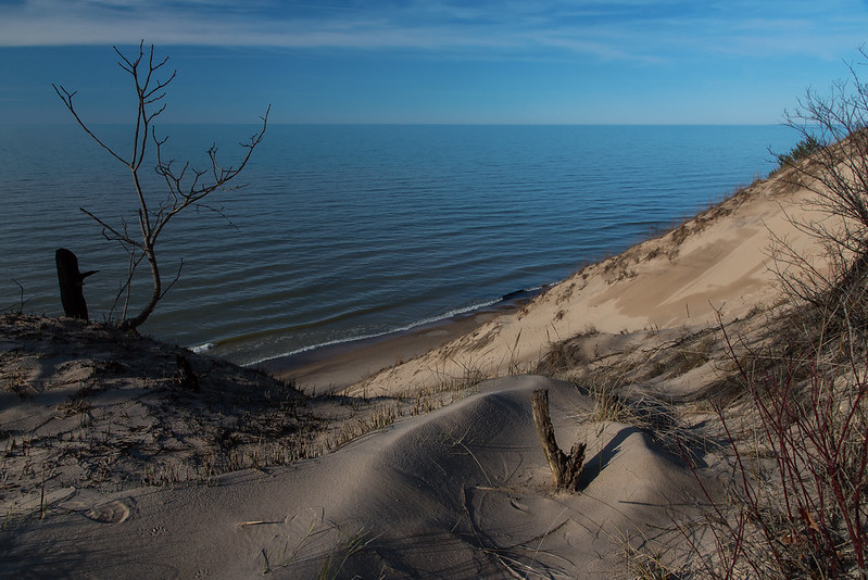
Following several days of heavy rain, the level of Sugar Creek rose several feet, closing many of the poplar destinations around Parke County, Indiana. All canoe livery services were closed, and many of the trails in Turkey Run State Park were closed due to the high water.

We watched all week hoping the trails would reopen by the weekend so we could hike the canyons of Turkey Run, and upon our arrival we discovered all of the trails were open again.

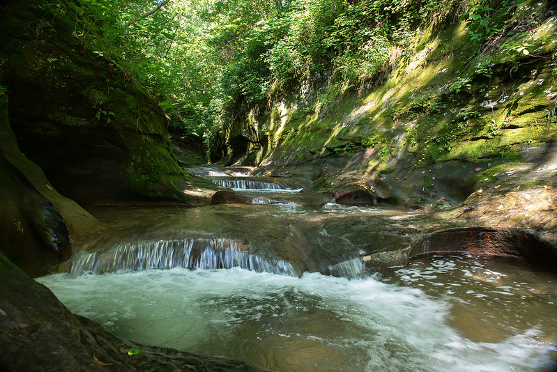
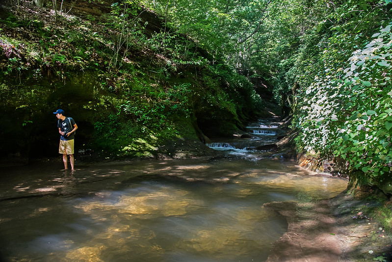
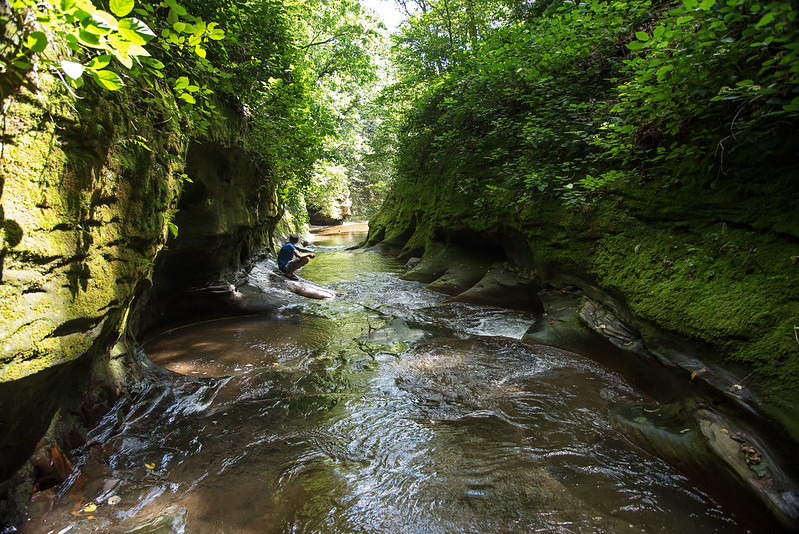
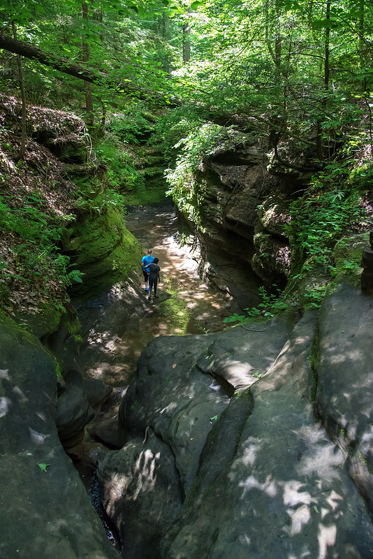
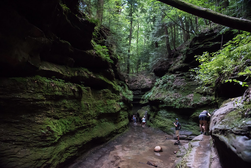
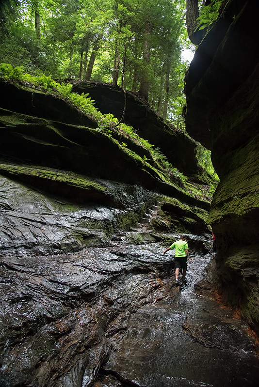
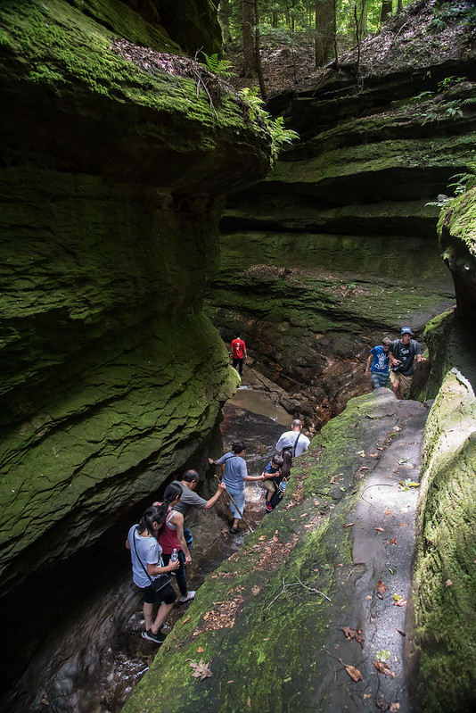
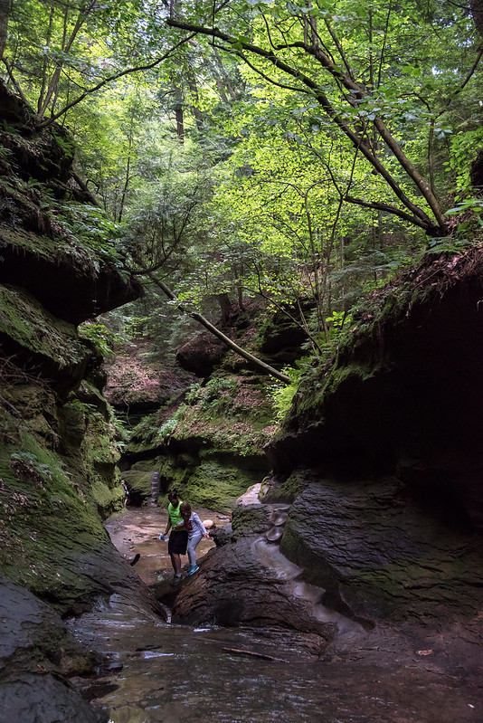
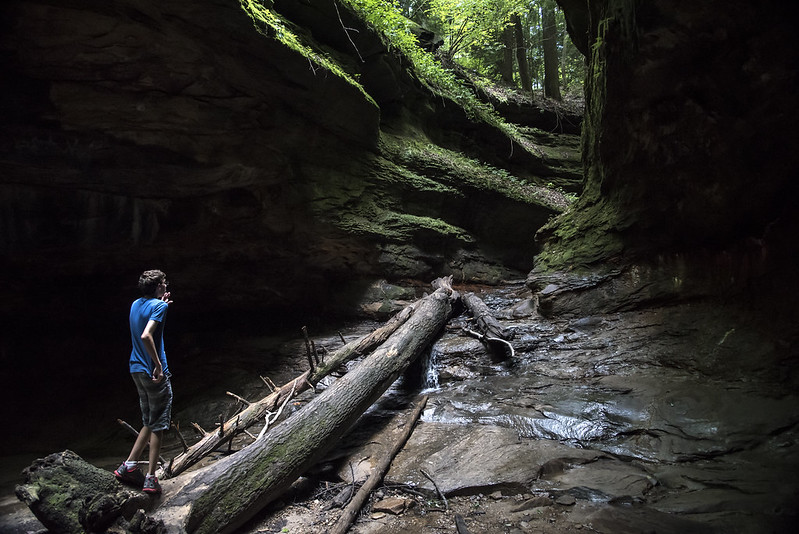
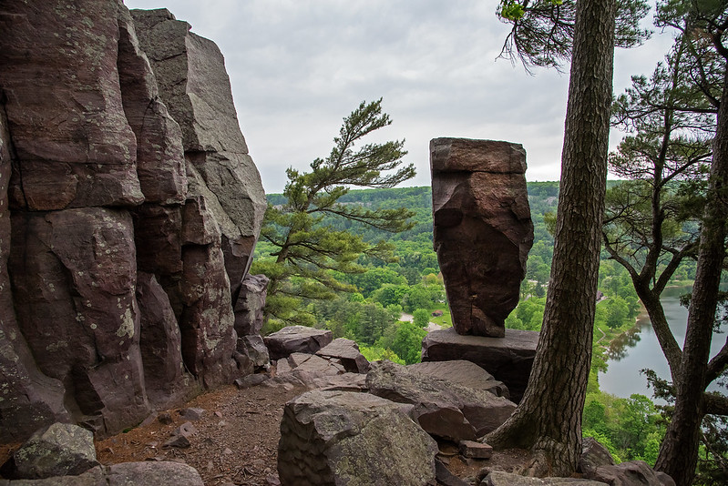
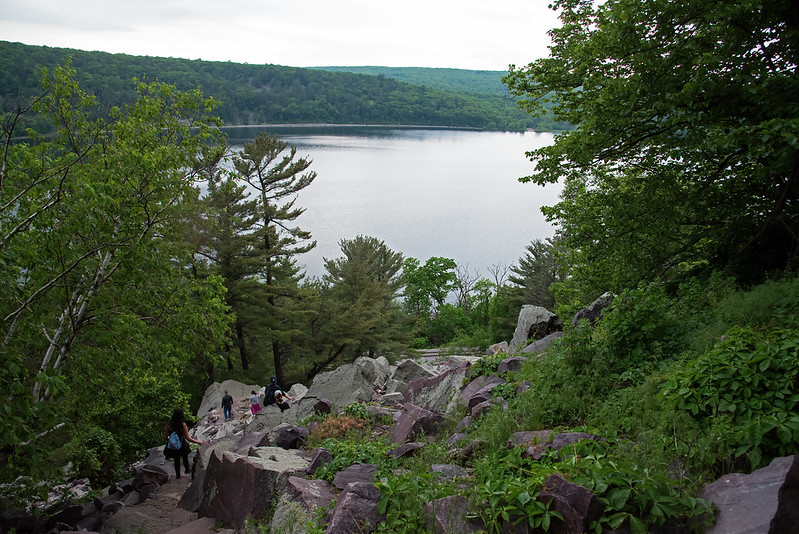
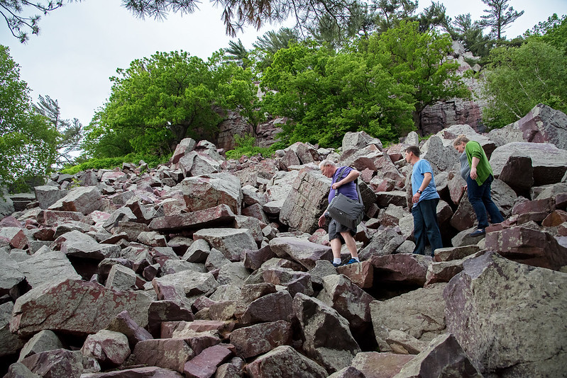
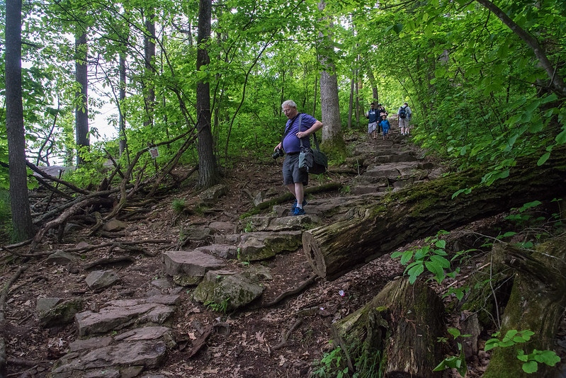
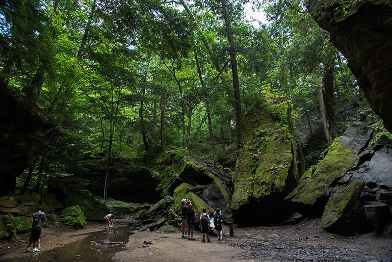
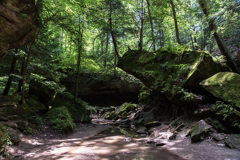
Our favorite trail is Trail 3, which takes visitors on a journey through a densely canopied canyon. Labeled as rugged, hikers must walk through the shallow stream in areas, up a small waterfall, and over countless boulders. Nothing too difficult, but it's certainly interesting to hike where the trail is actually the creek bed.

Trail Canyon

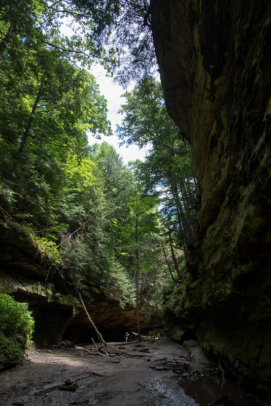
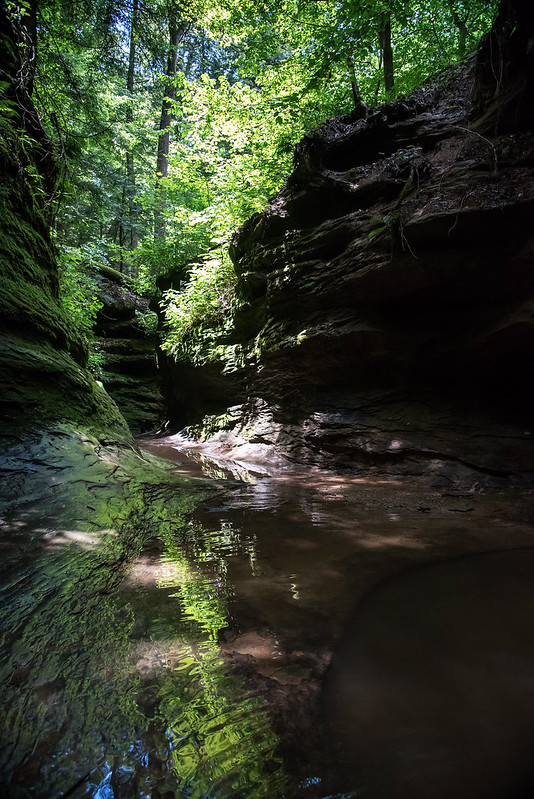
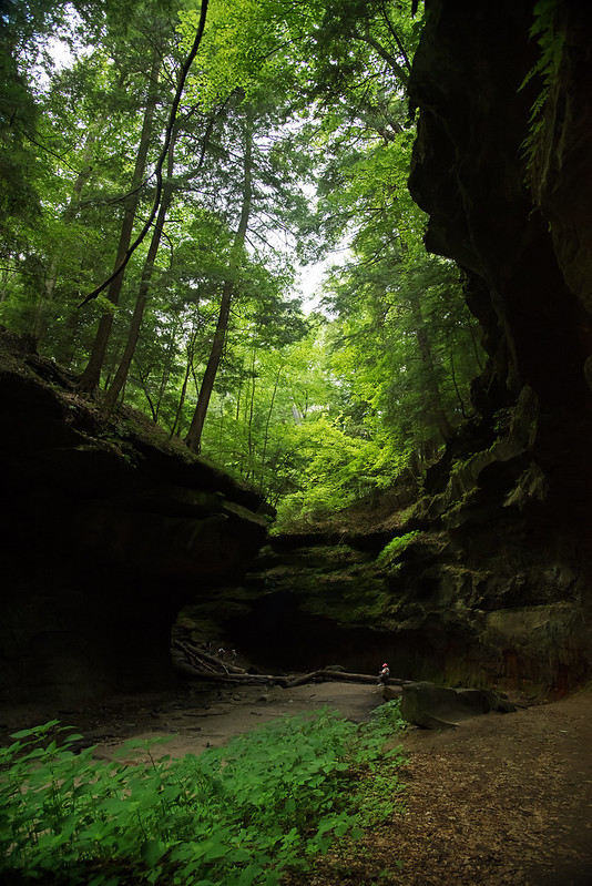
The first thing one notices is the drop in temperature. The canyon is quite a bit cooler than the surrounding area, even in the summer. The forest above changes as well.  Many more coniferous trees surround the canyon, and deep green moss grows on most surfaces, making the canyon appear to be something from the Pacific Northwest.

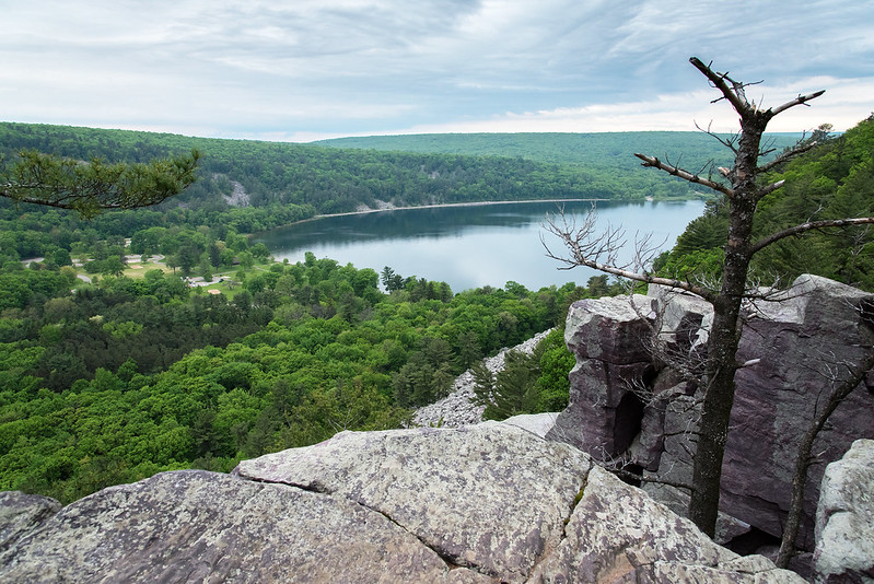
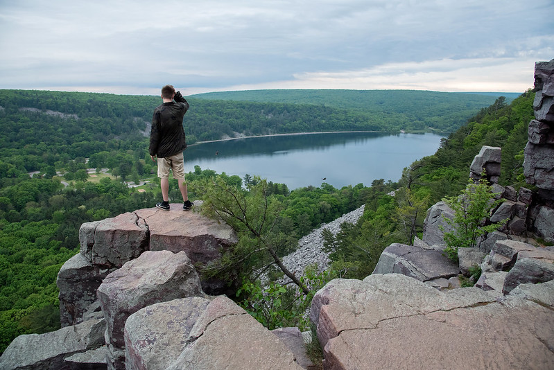
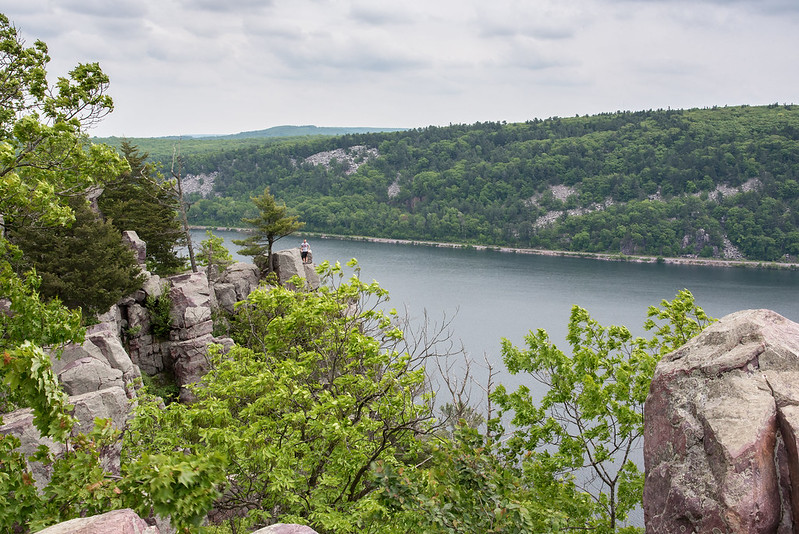
The scale of the canyon is also something to take note of.  While certainly nothing of the scope of the American West, these canyons make visitors feel very small indeed.

Climbing Wedge Rock

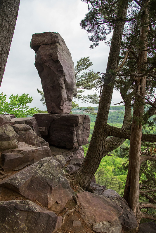
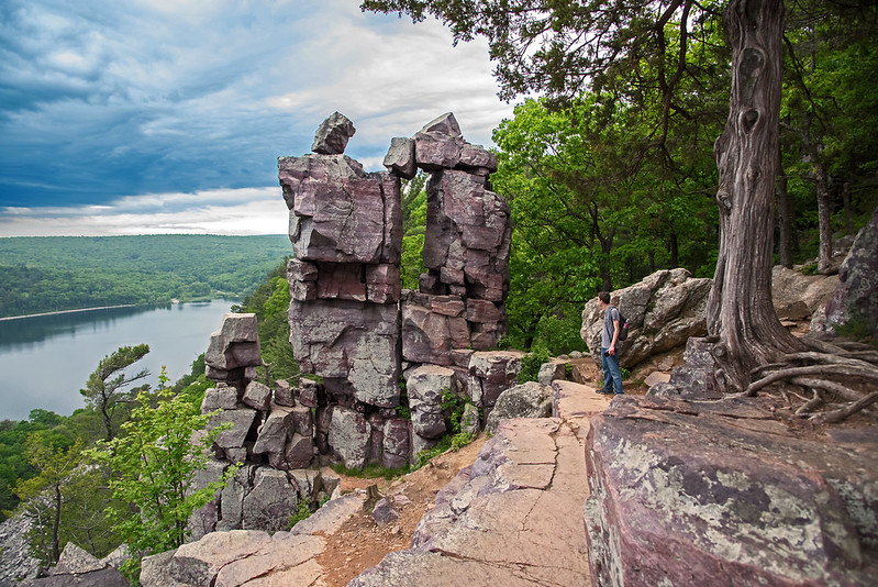
Wedge Rock was the first formation of significance of Trail 3 on our hike.  A large rock torn from the canyon wall thousands of years ago by water and ice expanding over time.  The rocks appear like giant tumbled dominoes, and the trail wanders directly under one domino.  Viewed from the trail, the tip of the rock formation seems to be about 35 feet up, and very difficult to reach, but walk around the back of the rock, and it's a relatively easy walk up a 30 degree slope to the tip. The coniferous tree at the top has managed to grow despite the lack of soil, and the meandering roots can be seen winding their way around the rock to reach water.

On Top of Wedge Rock

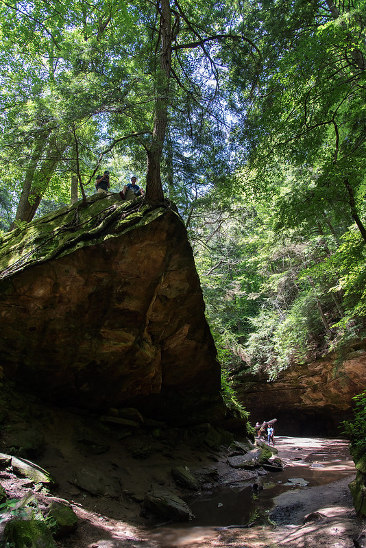
It wouldn't be a trip through Trail 3 without a careful climb to the top of Wedge Rock. The view of the canyon is great from this vantage point, as it sits right on the turn in the trail.  While at the top, this can certainly be a dangerous place to walk or sit, however, the climb up the root-covered rock is quite easy and safe.

Nature's Sandcastles

Lush Dunes

Walking along the foot of the Central Beach dunes is a bit more difficult these days. Lake Michigan waves often reach the dune itself now that most of the beach is gone.  This wave action will cause more of the dunes to crumble into the lake, at a faster and faster rate.

Sandcastle

These dunes change every day, and the small details can change by the moment.  As ground water moves down to the clay bottoms of the dunes, it finally finds its way to the end where it seeps out and falls to the beach. A bit of sand is carried by the water, and in places, sand stalagmites form where it falls. Much like the sandcastles kids build by letting very wet sand pour out of their hands to make towers, the sand creates collections of little towers. These towers may only last a few minutes until a wave wipes them out.

Natural Castles

These towers were washed away by a wave moments after this photo was taken.  I imagine they were created in about an hour by the dripping water, unlike their stone cousins the stalagmites, which take thousands of years to create.

Always looking for something new and interesting along the national National Lakeshore, and nature never disappoints.

Balanced Rock

Balanced Rock

Tucked away, just off the East Bluff Trail stands Balanced Rock, a formation created by the weathering of the cliffs of Devil's Lake State Park.  Water seeped into the cracks in the very hard rock and eventually cracked the rock.  Pieces fell away leaving behind several rock formations along the bluffs.

A View of Balanced Rock

This formation looks like a man made monument, yet it's a natural formation. It stands about ten feet tall, and overlooks the lake below.

The chunks that fell away litter the foot of the hills on both sides of the lake.  It's hard to image this place thousands of years ago when many of those boulders were still part of the bluff.

The Path Down

A short .4 mile trail, Balanced Rock Trail is described as a difficult, steep climbing trail, and it certainly is. Well worth the effort, but care must be taken when moving from stone step to stone step.  These steps were created by moving the boulders around a bit and adding some reinforcing concrete in some areas, keeping the experience as natural as possible.

Negotiating the Boulders

Narrow passages and winding switchback trails lead down the bluff through the boulder rubble. This rubble looks like gravel from a distance, but as you hike through it, you realize the rubble averages about 4 feet in diameter.

Trail on the Edge

Baraboo Hills

Devil's Lake State Park's East Bluff Trail winds up the bluff to most of the well-known rock formations in the park.  Devil's Doorway is just off the main trail, and has a very short loop trail for the best viewing of the formation.

Most trails in the park take advantage of the natural rock formations in place, or rocks stacked to create stairs to make the climb safer especially in slippery weather. These narrow trails take hikers very close to the edge of the bluff, and in some cases, if the visitor is daring, right to the drop-off, where a slip could mean a fall of hundreds of feet.

Trail on the Edge

This narrow flat trail gives the best view of Devil's Doorway, and has a small buffer of rock between the path and the steep drop-off.  This didn't stop a young man from jogging down the trail, and then taking two short jumps to the rock at the edge. It was drizzling, and the rocks were a bit slippery, we were certain he would slide right off the edge; luckily he did not, and just stood on the edge enjoying the view.

Above the Soaring Birds

You can see the platform he was standing on, and how there is nothing to stop his fall for well over a hundred feet at this point. I was amazed at how many people simply decided to get a better view by climbing on the rocks without regard to what was (or wasn't) below them. Some of the areas of the trail down were challenging enough for most hikers, without the danger of falling hundreds of feet to the bottom of the bluff.

Climbing into the Devil's Doorway

Looking Through Devil's Doorway

One of the main attractions at Devil's Lake State Park is a rock formation called Devil's Doorway. Set high above Devil's Lake, some 500 feet below, this formation is made of metamorphic rock created over a billion years ago from sandstone that was once the bottom of a sea.  The actions of time, water, and ice have cracked the rock, sending large chunks down the hillside.  What remains are beautiful rock formations dotting the bluffs surrounding the lake.

Climbing Up To Devil's Doorway

A short spur trail from the East Bluff Trail, the path takes visitors close to the steep drop offs near the formation, where the view is spectacular. Devil's Doorway seems to draw people to itself, as in the short time I visited, more than six people ventured off the trail and climbed up into the doorway itself.

A group of friends helped each other climb up the formation for a great view, a bit of adventure, and of course, a photograph. Carefully explaining which rocks to hold on to and which to jump down on, all three made it safely up and back down to the trail.

Help Through the Devil's Doorway

The area directly below the doorway is not a drop down hundreds of feet, but it is about 30 feet onto a small rock base, where one misstep can send the climber down hundreds of feet. So, perfectly safe it is not.

A rope still hangs from a previous climb, but not long enough to assist anyone with the ascent from the bottom.  Who knows how long the rope has been there, and if it's weathered so much it would simply snap under the weight of a climber.

Sitting in Devil's Doorway

Certainly well worth the rocky climb up. Beginning the trail at the north part of the lake seems a bit easier of a climb - the south end is rocky and interesting to navigate down, but would be a tiring climb up with a backpack full of camera gear.

Beginning the East Bluff Trail

Pausing at Devil's Lake Following our 1.7 mile hike up, across, and down the West Bluff Trail, we crossed the relatively flat south shore of Devil's Lake. The glaciers left a moraine at this spot, dumping a mound of till that helped form the lake by closing off the area between the two bluffs. Decending the West Bluff The hike down the West Bluff was a bit challenging, but made easier by the stone stairs arranged by the park. Some of these areas created bottlenecks where tired hikers slowed down to avoid tripping, while young kids ran past with no thought of danger. View of the West Bluff Once again, the views of the lake below were fantastic, and the town of Baraboo could be seen on the horizon. It was a strange sensation to watch birds glide below us, as they soared on updrafts created by the twin bluffs. We hiked around three miles, and came upon many interesting rock formations, views, and features, but have yet to see the popular formations that attracted us to the park. Those were on the path ahead.

Devil's Lake Overlook

Quartzite Bluffs Our first visit to Devil's Lake State Park, near Baraboo, Wisconsin began with a hike up the West Bluff trail. This trail was well maintained, and interestingly enough, paved with asphalt. Not flat like a road, but following the contours of the natural trail, probably to keep the path from erosion. Being one to prefer natural trails, I was first a bit surprised, but then realized the surface did not take a way from the hiking experience. First OverlookThe trail climbed through dense woods, around erratic boulders, winding its way up 500 feet above the lake below. We were surprised by the first overlook we encountered, a sweeping view of the lake and bluffs in the distance. In many parks previously, we were disappointed by the overgrown trees and lack of sweeping vistas from bluff trails- this was different. Every place we wanted a view, we found one, and more. The rocks of Devil's Lake State Park, are among the oldest outcrops in North America, believed to be 1.6 Billion years old. Originally formed beneath a sea as sandstone, the rocks were then subject to great pressure and heat, the porous sandstone eventually turned to hard metamorphic rock where it was pushed upward by great forces. The seas retreated but filled the area millennia later, only to receive a battering by the Wisconsin glacier during the last ice age. The western bluff was not covered by the ice, but the eastern bluff was. Ice, water, and wind eroded the softer rocks away from the harder quartzite and granite into what we see today. On the Edge On our 6 hour hike, we encountered numerous overlooks and rock formations, all interesting in their own ways.

Overcast

Overcast An overcast morning along the shore of Lake Michigan, give the beach the appearance of a cold and stormy day, yet little wind and warm temperatures made this hike pleasant. A bank of warm gray fog crawled along the horizon, blocking the view of the Chicago skyline, and giving it a dirty look. The clouds appear to be moving fast in this image, but this was captured at a relatively fast shutter speed; the clouds simply looked as if they were moving quickly. That's one of the interesting things about hiking familiar places, you notice when things are different, and you experience the countless moods of the environment.

Kettle Pond

Kettle Pond One of only two such features in the United States, the kettle ponds of Waterfall Glen were created by the retreating glaciers. Large chunks of ice were trapped and pushed into the ground forming a depression in the earth. These depressions filled with water forming ponds. Some kettle ponds dry up during droughts, and replenish in spring after the snow melts, or after wet periods. For this reason, they are devoid of fish, providing a great habitat for amphibians feeding on insects. Just a few yards from the walking path, most visitors to this area probably glance at the pond as they run past, not realizing the significance of this kettle moraine topography. We spent well over an hour exploring the pond from many different angles, encountering some interesting creatures in the process.

Beyond the Dunes

Skyline Beyond the Dunes It's not uncommon to see the Chicago skyline across Lake Michigan from the Indiana Dunes National Lakeshore, but it seems each time I see it, it's different. Either more or less of the buildings are visible, a superior mirage makes the skyline appear upside-down, or the foreground frames the skyline differently. Every few steps along the paths and trails, the view changes in all directions, and it's interesting to see how things change around the constants of the lake and the skyline. Dune Valley Each turn of the trail brings a fresh look at the dunes. The rolling grasses, conifer forests, oak savanna, and beach all combine with each other like no other place I've visited. In fact, the dunes along Lake Michigan are some of the best places to see dune progression - the change in landscape from beach to old wood forest. As the leaves fill out the trees, the views will once again change- and in some places disappear all together.

Meandering Trail

Meandering Trail An evening hike through the dunes along Lake Michigan - an unusual time for us, as we generally hike in the mornings. We followed the narrow, meandering trail from the beach, through the wooded dunes, along the ridge, and finally through the grassy plains, It's interesting to watch this area come back to life after the winter, the brown grasses shining in the sunlight, will soon green up, as will the trees dotting the dunes.

The Ridge Path This place never seems to get old, and always offers us something different no matter how many times we visit. Behind us are the vast waters of Lake Michigan, offering plenty more interesting views.

Low Sun Behind the Dunes

Low Sun Behind the Dunes

Following our three mile hike to the dune, we climbed up to view the expanse of woods to the south, and Lake Michigan to the north. This particular dune stands between dense woods and the beach, generally covered in marram grass, a large blowout developed over many years, creating the bare area in the center.

A recent controlled burn of the area removed much of the dry grass, revealing the sand below, and dozens of old bottles, cans, and other items left over from the old homes that once stood on the site. We explored the dune ridge, careful as always not to trample any vegetation before making our way down to the beach, and our three mile hike back to the car.

Looking off on the horizon in the center of the image, they skyline of Chicago can be seen, some 40 miles across the lake. This was an unusually clear day - at least the atmosphere was clear - allowing us to see much more of the city than usual.  In fact, it also helped to create a superior mirage on the horizon, making parts of the city look as if they were upside down.

Visiting the Indiana Dunes National Lakeshore more than 45 weekends a year, we see plenty of interesting and new things - even the things we visit each time are never the same twice.

After the Burn

The Dune at The Burn Line

A recent controlled burn in the area removed most of the dry vegetation from the tops of these dunes along Lake Michigan. The area was once privately owned, and the buildings were removed about a year ago.  What a great piece of property this was, and the views from the homes was beautiful in all directions - woods to the south, marram grass dunes to the east and west, and Lake Michigan to the north.

 Aftermath of the Burn

The path to the lake can be seen now that the vegetation is gone. The dune at the right was spared this time around, probably to be burned in the next year or two.

Recent rains have started the recovery process here, the roots of the marram grass are sending up green shoots already.  Soon, this area will be lush with thick, green grasses, birds, dragonflies, and cicada wasps.

Superior Mirage

Superior Mirage on Lake Michigan

As the air warmed over Lake Michigan, a light fog developed on the horizon. This created a mirage of the distant Chicago skyline some 40 miles across the lake from our vantage point.

Called a superior mirage, it is created when cold air is near the surface, and warmer air is above. The atmosphere acts like a lens, inverting the skyline. If you look closely around the horizon, you will see the tops of some shorter buildings upside-down in the mirage.

Because of this mirage, objects that are usually hidden by the curvature of the earth can be seen above the horizon, only upside down. The Chicago skyline is usually visible from this vantage point, but the numerous other small buildings are never seen, unless displayed by a superior mirage.

Mirage Behind the Michigan City Lighthouse

Looking up the shoreline toward Michigan City, the lighthouse is visible, but generally nothing beyond.  It's unusual to see any land beyond the lighthouse, but the superior mirage along the horizon refracted the objects below the horizon, and displayed them above, just inverted.

An interesting effect created by the perfect weather conditions.