South Haven Snowfall

Through the Snow

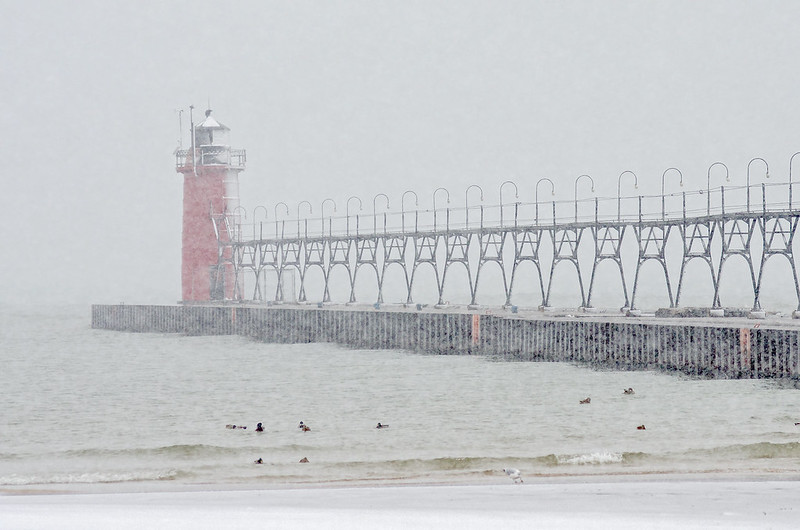
A relatively early snowfall in southwest Michigan arrived before Thanksgiving, reducing visibility considerably.  Not a blizzard, yet heavy snowfall at times, but the accumulation wasn't as much as expected.

South Haven Winter

Still, the snow managed to convert the town of South Haven into a winter postcard. The weather seemed to keep most shoppers away from the downtown area, as the streets seemed empty.

Winds were absent, making the walk through the snowy downtown streets enjoyable, and a future look into the fast approaching Christmas shopping season.

Flocked Park

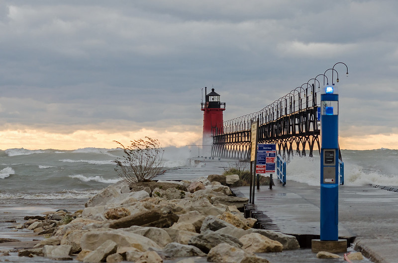
Surprisingly, not too many visitors bothered to walk on the beach or near the lighthouse.  In the past two years,  bad weather attracted spectators to the lighthouses of the Great Lakes, but for now, people remained in their warm homes.

Translucent Waters

Translucent Waters

Photographing distant subjects in high winds isn't always easy. Even when mounted on a tripod, the camera can move slightly, and in this case, sand and water are constantly blowing on the camera. Add shooting into the sun to the equation, and things get interesting.

Compensating for all of the above, and attempting to keep the shutter fast to capture splashes, I played around a bit to silhouette the lighthouse against the yellow sky. No splashes here, but doing so brings out the rich color of the sunset instead of washing it out and turning it white.  At this moment, the low angled sun only reached the tips of the breaking waves. The foamy water was highlighted by the sun, and in some places, the light came through the water, giving the waves a translucent quality.

Several times while I stood on the beach, waves reached my position, in two cases, I was standing in water almost to my knees, and up to the tops of my boots. Not the first time I've gotten wet here.  A few years ago I was splashed by a breaking wave, soaked from head to toe in 20 degree Fahrenheit temperatures. I did manage to keep the camera dry.

Washing Over

Washing Over

Waves pushed by 40 plus mile per hour winds wash over the pier at South Haven, Michigan, on a stormy November afternoon.

Relatively common to the area, high waves collide with the lighthouse and pier creating dramatic splashes that can exceed 70 feet in height. While not a record storm, this storm brought winds and waves for a few days in a row, pushing the waters of Lake Michigan into the Black River, where water overflowed the banks and poured onto the nearby picnic area.

Up the River

Visitors needed to stay back, not only to keep dry, but also to keep from being knocked over and possibly washed into the cold, churning lake.

Always fickle, some days, Lake Michigan is as still as a pond, yet storms often turn the body of water into a dangerous but beautiful monster.


Lighthouses at Sunset

Lighthouse at Sunset

Following several days of wind and waves, a great deal of which were overcast, the sun peeked out through a break in the clouds near the horizon, just before sunset. The low angle of the sun washed the lake and lighthouses with an intense amber light - it was, in fact, the golden hour.  Generally perfect for photography, but in this case, I was not taking advantage of the light in the normal sense. When I turned my back to the sun, the shore was brilliantly lighted by the golden hour. The colors were in perfect contrast to the dark sky, but I focused on the lighthouse and the lake, photographing into the golden light.

This has many disadvantages including lens flare, silhouetting the subject, and overexposure of the sky -all of which I dealt with as I metered the scene. However, the main advantage of this direction was the illumination of the sprays of water cast up by the waves. The water captured the golden light as it was cast into the air, even the small sprays on top of the breaking waves were golden.

The low, amber light may have softened the scene, but it intensified the power of the waves.

November Wind Storm at South Haven

South Haven Storm Lake Michigan's fury continued up the shore for yet another day. At South Haven, Michigan, the piers and lighthouse were battered by high winds sending 20 foot waves over seawalls, and up the Black River. Washing over the seawall, the waves crashed onto the picnic area, flooding the sidewalk with several inches of water, creating a temporary stream of runoff cutting its way toward the beach.
Up the River With weather such as this, one would expect an empty beach, yet kite surfers rode the waves, and people lined the parking area to witness the pounding waves. Only a few weeks away from freezing temperatures, when these splashes turn the lighthouses into 40 foot ice sculptures.

Illuminated Splash

Illuminated Splash

Following an afternoon of roof repair due to the strong winds in the region, I made it to Lake Michigan just before sunset. Winds in the area were gusting to 30 miles per hour, creating waves on Lake Michigan exceeding 20 feet.  These waves pound the pier and lighthouses along the shore, creating dazzling splashes that often exceed the height of the 35 foot tall outer lighthouse.

In winter, these splashes freeze to the surfaces of the pier and lighthouse, covering them in thick ice.

On this afternoon, the sun appeared a few minutes before sunset, casting an intense, low angled light onto the lighthouses. This light illuminated the splash producing a beautiful pink-orange spray of water. The waves often reached as far up the beach as the dunes, it was a good thing I decided to wear boots, because more than once, knee-high waves reached the area I was standing.

Here's a quick sequence of images I captured from the shore. It gives an idea of the waves and splashes that pound the pier.

lighthouseanimation

While these waves and splashes were not the largest I've captured over the years, this was one of the most interesting as far as color.

From the Bluff

From The Bluff

The Kankakee River over time has cut through and eroded solid rock on its journey from St. Joseph, County, Indiana to the Illinois River. There are some areas where this rock is still prominent along the bank of the river. Outcroppings and small canyons are common in the Kankakee River State Park, and they're interesting to explore.

This bluff is a popular place to relax and view the waters rushing by; it's beautiful in winter too, when ice is carried by the river, and fog rolls onto the bank.
Tree and Pancake Ice

Stairs and railings lead up to an observation deck, but this rocky area just a few yards away is more natural and provides a better view.

Colorful Kankakee River

Colorful Kankakee River The low waters for the Kankakee River reveal moss covered rocks and colorful leaves on the river bed. The afternoon sun highlights the changing leaves still on the trees along the bank, and the rock outcroppings carved by the river over thousands of years. Kankakee River State Park near Bourbonnais, Illinois offers many interesting views of the Kankakee River and the canyons of Rock Creek, a small stream that flows into the river within the park. While rock climbing is not allowed, it's sure tempting, but there are many areas designated to view the formations from almost all vantage points. Interesting in all seasons, the park is open year-round.

Fall on the Prairie

Fall on the Prairie

Late afternoon at Goose Lake State Prairie, and the signs of Autumn are everywhere. What was once lush green tallgrass, sprinkled with wildflowers, is now brown and mangled, ready for the changes and cleansing of Winter.

At 2,500 acres, Goose Lake Prairie is the largest prairie remnant in Illinois. A great portion of "The Prairie State" once looked much like this.  Early settlers drained the 1,000 acre Goose Lake in this spot, and removed the clay for pottery and brick making. Coal mining took place in the 1800's, and much of the surface land was scoured.

Today, the prairie appears much as it did before the settlers - minus the lake - with a mound of soil from mining times that offers the highest vantage point in the park.

St. John Cantius Parish

St John Cantius Interior

Completed in 1898, the "Polish Cathedral" style church is a remarkable example of sacred Baroque Architecture. A thriving parish today, the church draws thousands to worship each week. Masses are celebrated in both the Ordinary Form, as well as the Extraordinary Form, in English and Latin.

Altar of St. John Cantius

St. John Cantius offers the daily Holy Sacrifice of Mass in the Extraordinary Form, often called the Tridentine Latin Mass.

St. John Crucifix

On this All Souls Day, the parish offered a Pontifical Latin High Mass including the Mozart Requiem, sung by the choir with orchestral accompaniment. No microphones were used for the Latin Prayers, some said at a whisper, adding a mystery to the service, but really, this is the time for the congregation to meditate on the former parts of the Mass.

Balcony View

St. John Church

The 2 hour and 15 minute Mass was filled with tradition not regularly seen in Catholic Churches today, such as kneeling at the Communion Rail for the Eucharist, and the use of patens by the altar servers to catch any particles of the Host that may drop.

Entering St. John Cantius

St. John Cantius is located in Chicago, just one mile west of the famous Chicago Water Tower, and the Magnificent Mile.

Crucifix

St. John Altar

Colorful Reflections

Colorful Reflections

A peaceful walk on the Hennepin Canal towpath is enhanced by the low, late afternoon sun, and the colorful leaves of Autumn. Located a couple of miles outside of Wyanett, Illinois, Lock 20 was the location of a lock tender's home.  This lock tender served Lock 20 and 21, which are both in very close proximity to one another.

Today, the house is vacant, and in ruins. If you believe in such things,  it is also said to be haunted, or at least some supernatural events have been experienced by locals.

The Hennepin Canal runs from the Illinois River to the Mississippi River, thus linking Chicago to the Mississippi, and ultimately to the Gulf of Mexico. Completed in 1907, it was the first major American canal made with concrete, and due to the success of railroads, it was obsolete the moment it was built.

Autumn Afternoon

Autumn Afternoon

The Princeton, Illinois covered bridge on a warm, sunny autumn afternoon. The changing leaves provided the perfect backdrop to the historic structure.  Built in 1863 over Bureau Creek, the 149 foot long bridge remains open to vehicular traffic.

Under the Covered Bridge

A small park is located at the foot of the bridge, allowing visitors, to use the area for picnicking, playing, photography, and fishing. A narrow path gives access to the creek for exploring. Kids love skipping rocks, fishing, and catching frogs under the old, wooden structure.

Heading Up

Heading Up

The 3.4 mile Long Lake Trail is one of three trails at the Indiana Dunes National Lakeshore's West Beach. The loop begins with an ascent up a sandy dune, and follows the dune ridge through the rather dense woods first bordering the beach, then overlooking the grass of the Great Marsh.

The second half of the loop follows the foot of the dunes past Long Lake, and through the grassy, flat areas filled with prickly pear cactus, and pitcher's thistle.  You might even spot a few six lined racerunner lizards in the summer months.

This trail is one of the few places at West Beach one can still hike up a sandy dune - something that is becoming increasingly rare at the Indiana Dunes National Lakeshore (all in the name of erotion prevention). It seems to me that blocking off the paths through the dunes does very little execpt create more erosion due to ignorant visitors walking around the signs and fences. Instead of one path, many more are created, and in the process, more and more plants are trampled adding to the problem.

If the traditional paths are left open to those who have walked them for decades, as well as new hikers, not only will visitors enjoy them, new, destructive paths won't become a problem.

Instead, visitors can admire the dunes from the asphalt parking areas, and tell their grandchildren storys of how they once walked on top of the dune.

Lake Willowmere

Lake Willowmere

Autumn color reflected in the still waters of Lake Willowmere, inside Chicago's Graceland Cemetery. A picturesque and calm final resting place for many of Chicago's famous people.  A walk through the cemetery yields familiar names such as Louis Sullivan, Marshall Field, George Pullman, McCormick, Kimball, Newberry, and Goodman.

Reflected in the lake, stands the tomb of Potter Palmer, the businessman responsible for most of the development of Chicago's State Street.

The 119 acre Graceland Cemetery, once stood two miles outside Chicago's boundary. Now surrounded by the city, and only a stone's throw from Wrigley Field, the cemetery is open for the public to view the magnificent memorials to Chicago's rich and famous.

On a Clear Day....

On a Clear Day You Can See Chicago

...You can see Chicago.  From atop the tallest sand dune of West Beach, Chicago is 28 miles across the lake; easily seen on a clear, crisp day.  This morning was the coldest in six months, yet the cold air or high winds didn't keep us from hiking the progression trail, taking us from the beach to the top of the wooded dunes, where the urban skyline became a backdrop to the natural environment around us.

We were greeted by a cold wind as we approached the top of the dune, reminding us of the winter ahead, and how most of our trips to the beach for the next few months will require plenty of warm clothes and a bit of determination to get to our destination.

Day's End

Day's End

The calm end to a windy, Fall day in rural LaPorte County, Indiana. It seems at times when the sunset is obscured by clouds, it's best to wait about 20 minutes after sunset to photograph the sky.  The colors are often vibrant for a short time, and when combined with the still waters of a lake, the reflections can be just as brilliant.

It was a fitting end to a day of hiking the Indiana Dunes, the remains of the Kingsbury Ordinance Plant, and some areas around our property.

Everything seems to calm down in the evening here - no matter how busy or windy the day was.

Stargazing

Stargazing

Following a full day of hiking and exploring new places, we stopped at the beach just before 11pm. Because the moon was out of sight, the sky was relatively dark, allowing the stars to shine through. As usual, light pollution from Chicago affected us 40 miles across Lake Michigan, but along with the high, whispy clouds, it added interesting light and color to the horizon.

You can see the Chicago skyline on the horizon - no fireworks this time, but sometimes we watch the colorful blurs of distant fireworks launched from Navy Pier.

We gazed up at the stars, watched the airplanes taking off from Chicago, and wondered what made the sounds in the woods behind us.


A Taste of Fall

Fall is in the Air

Giving us a taste of what's to come, the blustery weather kept most people away from the beaches on this cold morning. In fact, we were the only people there. The high winds continued from the day before, eroding a lot of the sand from the beaches, exposing many interesting rocks and fossils.

Even though I enjoy hot weather most, days like these are some of my favorite. We can experience nature by ourselves, with no other human distractions.  It's interesting how civilization is just a mile or two away, but if you look around, you don't see anyone - you're seemingly in the middle of nowhere. Very cold winter days are very similar, except the blanket of snow often muffles the sounds of nature, making it seem even more remote and tranquil.

The beaches will fluctuate from summer-like to blustery until November, giving us an opportunity to experience the last of summer, and a taste of the bitterness of the winter to come.

Interdunal Pond

Interdunal Pond

One of the interdunal ponds of The Indiana Dunes National Lakeshore's West Beach, on an overcast morning. These ponds form between two dune ridges, when water is unable to flow away, or drain into the earth.  These wetlands are a haven for a number of creatures including waterbirds, frogs, and insects, plus they provide water for many forest creatures.

Some of these ponds are hidden quite well from view, especially if they're off the beaten path, just over a distant dune ridge. In that case, the wildlife is more plentiful, as humans don't frequent the area. These areas can give one the feeling of being far removed from civilization, even though cars and trains are just a few hundred feet over the ridge.


Calm Summer Morning

Calm Summer Morning

Two boys play in an unusually calm Lake Michigan on a hot summer morning. Throwing stones into the lake, skipping rocks, and hunting for fossils were the top activities of the morning.

Two of the most popular beaches have been closed this summer - Mt. Baldy (closed to the public since 2013), and Central Beach (closed since July). This puts a lot of pressure on the few beaches left - visitors must arrive before 10 am for a chance at a parking space.  The beaches themselves do not seem overcrowded, since there is little parking available.

With any luck, the two beaches will reopen next year, allowing visitors to walk once again on the sands of Lake Michigan next to the wooded sand dunes.

Harry Evans Covered Bridge

Harry Evans Covered Bridge

The 65 foot long Harry Evans Covered Bridge spans the small Rock Run Creek 1/2 mile from the town of Coxville. This bridge is still open to vehicular traffic on this out-of-the-way gravel road, but a concrete ford built just downstream allows larger farm vehicles to cross the creek.

Through the Bridge

Built in 1908 using a single span Burr Arch design, the bridge gets its name from the farmer who owned the land near the bridge at the time.

Harry Evans Covered Bridge

This covered bridge was in the most peaceful area of all the bridges we visited.  So remote and quiet, we could have spent hours with our feet in the creek and probably would not have seen another person.

harryevansspansm

Summer Skyline

Summer Skyline

A jetskier enjoys the waters of Lake Michigan - just off Monroe Harbor- on a hot summer afternoon. One of the best places to view the Chicago skyline if you're a land lubber is from Solidarity Drive and the breakwater around the Adler Planitarium.  The skyline is clearly visible, behind Grant Park, and the lakefront trail, with Monroe Harbor in the foreground- an all around great combination.  It's best to arrive early in the day when the buildings are washed with sunshine, or after sunset when they are illuminated.  Anytime near sunset the buildings will be in shadow because the sun sets behind them.

Many years ago, I used to walk out on the Easterly Breakwater to view the city, but the last few times I've tried to access it, it's been closed.


Meteors and the Milky Way

Milky Way with Meteors

A dark summer night in rural LaPorte County, Indiana presented a great opportunity to view the Milky Way Galaxy.  The crescent moon hadn't risen yet, so the sky was very dark - except for the light pollution from big cities many miles away.

While gazing up at the stars, we noticed a meteor or two traverse across the sky, so I was hoping my camera captured one or two.  I used exposures from 10 seconds to 20 seconds, and in the photo above, found four meteors, one very difficult to see unless zoomed in.

Milky Way

At first, I thought the light streaking at the bottom left was an airplane, but in a 20 second exposure, the light would have appeared like a zipper, with dots every second as the plane's lights flashed.

I remember staring up at the sky on a warm summer night as a high school kid, in a rowboat in the middle of a small lake, and viewing the Milky Way. Shading my eyes from the lights on the shore, and letting them adjust to the darkness.  It seemed the longer I looked up, the more stars I saw. I was able to experience that same feeling again last night.

The Mecca Covered Bridge

Mecca Bridge Spanning Big Raccoon Creek since 1873, the 150 foot long Mecca Covered Bridge is a historical centerpiece of the small town of Mecca, Indiana. Once called Maidstone, the town may have been renamed after a group of Syrian Muslims settled the area and frequented the mill on Big Raccoon Creek. The Bridge to Mecca The bridge is no longer open to traffic, US 41 passes a short distance away from the town, but the residents adore their covered bridge. The bridge is decorated for Christmas, and caroling takes place inside. At Easter, a sunrise service is held in the bridge. We noticed old electric lights inside the bridge - no doubt easily added due to the proximity of "modern" electric lines so close to the bridge. Gazing out the Window The bridge contained a single window allowing people crossing the bridge to view oncoming traffic on the curving road ahead. A small park including an old schoolhouse are on the grounds, making this covered bridge easily accessible for drivers who wish to stop and explore the bridge without blocking traffic. Mecca Covered Bridge

Roseville Covered Bridge

Roseville Covered Bridge This 263 foot long covered bridge is the third bridge built across Big Raccoon Creek at this site. In 1910, the previous bridge burned and a concrete bridge was considered as a replacement. Instead, the Roseville covered bridge was constructed, and remains today. Not far away in Armiesburg, a concrete bridge was built in 1917 to replace the wooden covered bridge, it collapsed after only 13 years! Roseville Covered Bridge The Roseville covered bridge uses two Burr Arch spans to cross the creek, and has a cut sandstone foundation. It's set on a gravel road, in an out of the way portion of Parke County, and only a block away from a very small cafe and bakery, very easy to miss while driving on adjacent Coxville Road. The local people seem to care for this bridge - an assortment of colorful flowers grows near the entrance.

Bridgeton Mill and Covered Bridge

Bridgeton Covered Bridge and Mill Indiana's most famous covered bridge, is the 267 foot long, double span Burr Arch bridge in the historic town of Bridgeton. Adjacent to the old Bridgeton Grist Mill, the original bridge was built by J. Daniels in 1868. Destroyed by arson in 2005, the community gathered to rebuild the bridge using the original plans and traditional materials and methods. The current bridge was completed in 2006. Bridgeton Mill and Covered Bridge The bridge spans Big Raccoon Creek at the dam constructed for the mill. The flow of water over the nine foot tall, 220 foot wide dam is usually contained to only a portion of the dam, but in high water situations such as in the photo above, the water cascades over the entire structure. The oldest operating grist mill in Indiana, and possible the entire region, Bridgeton Mill has operated in some way for the past 180 years - from milling wood to grinding grain. Open today for demonstrations, visitors can watch as grain is milled to flour using the 2000 pound French Buhr stones, and feel the floor vibrate as the massive stones turn. Bridgeton Bridge Approach Certainly one of the most interesting covered bridges in Parke County, Indiana.