Out of the Shadows


Starburst Canyon

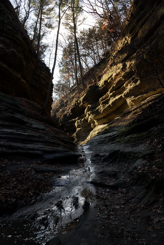
On an unusually warm winter day, the streams and waterfalls in the canyons of Starved Rock State Park were flowing with water from recent rain storms. Usually at this time of year, ice would begin to form along some of the streams and waterfalls, setting the foundation for the solid icefalls to come in the upcoming weeks and months.
 
Late in the afternoon, the sun illuminates and warms only portions of the canyon walls, creating an interesting sunburst, and dramatic contrast between the canyon walls and the floor. Access was certainly easy due to the lack of ice - winter can be dangerous here in French Canyon, where ice cleats are a necessity just to gain access to the canyon. Today, we barely got our boots wet.

  Out of the Shadows

The drama between the shadows and light in these canyons is always interesting, but today's sunlight made them even more dramatic. The photographs appear black and white in the shadows and warm color in the light, equally amazing in person. 

This was the first trip to Starved Rock in two years; with no ice build up last year, I kept away. But even in the barest, most boring of times, these canyons still hold a beauty worth exploring.

Between the Dunes

Morning at the Interdunal Pond

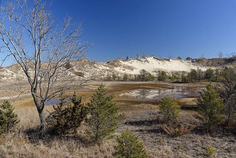
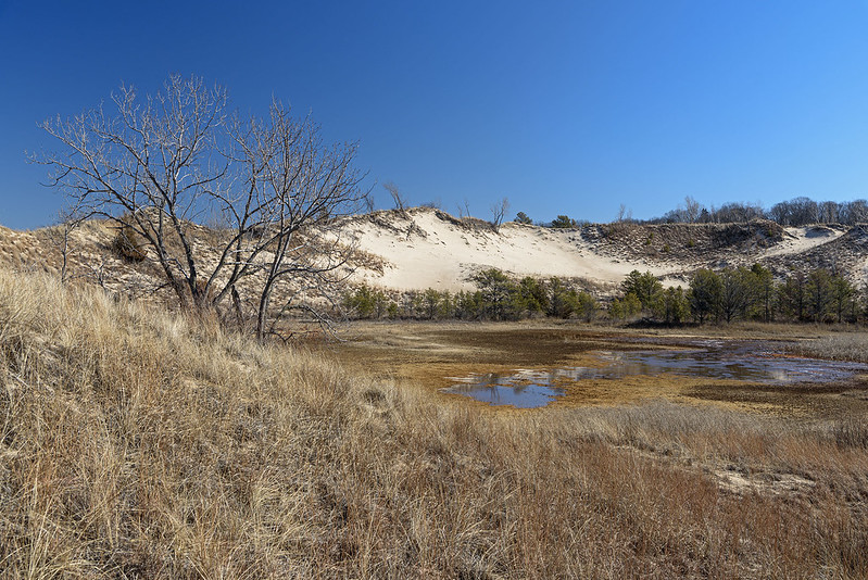
It's been an unusually warm and dry winter so far, and this is evident when visiting the Indiana Dunes National Park. One way to see we're lacking a bit in moisture is the level of this interdunal pond; it's quite low. Usually, the pond extends to the taller grasses by the foot of the surrounding dunes, but now, only a fraction of the water is in place. This isn't extemely unusual, the water levels often fluctuate, but I'm so used to seeing this pond larger.

An interdunal pond is a small body of water that forms between dunes. There is really no escape for the water that ddrains into this area, other than evaporation or absorption, so it collects into a pond. These type of ponds are havens for all sorts of animal life including birds, frogs, turtles, lizards, insects, and small mammals. The dunes can get quite dry in the summer months, and these interdunal ponds can provide support for these creatures. Of course, this particular dune is just a few hundred feet from Lake Michigan, but some of these small animals will never travel that far.
A View of the Pond

As with so many other views in this national park, this view looks as if it comes from a totally different region, something more often found in the western United States. The conifer trees here around this pond, and throughout the park mark the farthest southern reach of Jack Pine in the country. These glacier leftovers were able to remain behind when most others died off due to the change in climate after the last ice age thousands of years ago. The Indiana Dunes National Park boasts the fourth most diverse variety of plants of any US National Park. A total of 1130 native species of flowering plants call this area home - and you thought the Indiana Dunes National Park was just a beach with hills.
Between the Dunes

This photo better illustrates the location of this interdunal pond, it is completely surrounded by dunes. It's a shame one can't explore all the sides of this pond, but I imagine venturing around this pond could disturb quite a few living things that rely on this unique environment for their survival.

Michigan City East Pierhead Lighthouse in Winter

Michigan City Lighthouse

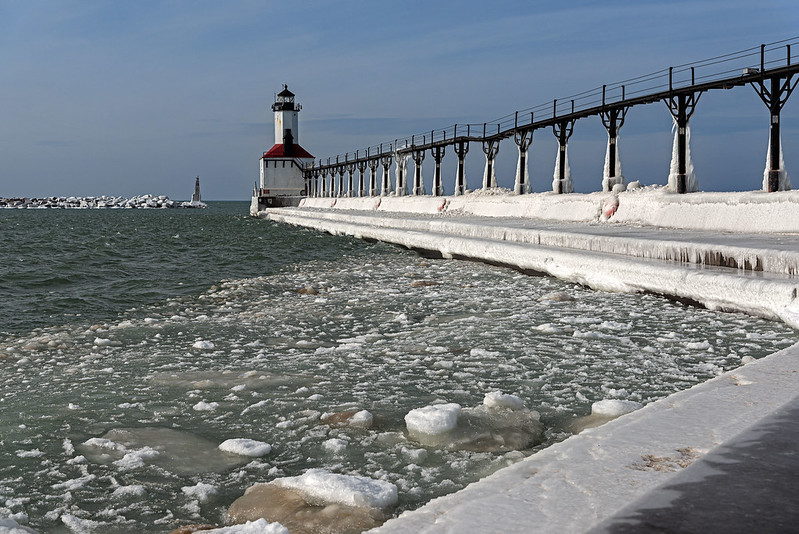
A winter visit to Lake Michigan would not be complete without a visit to some lighthouses. While the Michigan City East Pierhead lighthouse is rarely covered in dramatic ice, it's always beautiful nonetheless. A lot of the Michigan lighthouses are covered annually by thick layers of interesting ice created by high waves and wind, but the MC lighthouse is surrounded by boulders in the water that break up high waves and prevent powerful splashes. These splashes and sprays are what eventually cause the thick ice coatings on the lighthouses and the piers. Here, they only cover a bit of the catwalk uprights and the pier surface.

Just a few hours before this photo was taken, Trail Creek was full of pancake ice. Here, the winds blew the ice far out into Lake Michigan, leaving only a small amount trapped in the bend of the pier. This ice can be mesmerizing to watch as it rises and falls with the waves. The pier can be very hazardous when it's covered in ice. The surface is sloped to water washes off easily, so this incline can be very slippery in winter, and falling could result in a slide right into the water. Even though you can see how dangerous this could be, families with small children were walking on this ice to get closer to the lighthouse.

East Pierhead in Winter

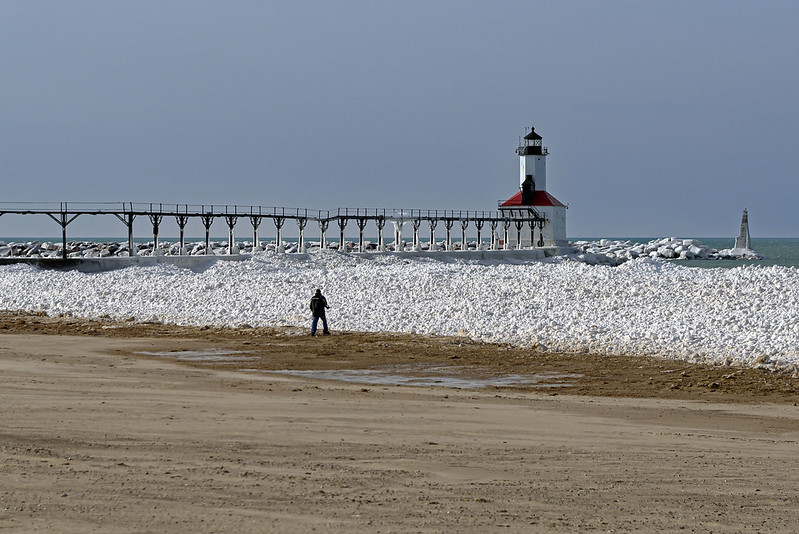
The view from the shore was dramatic as well in the early afternoon sun. The ice was brilliant white against the blue water and sky. What took only a week to create in the cold weather, is probably gone already after three days of warmer weather.

The Blowout


The Blowout

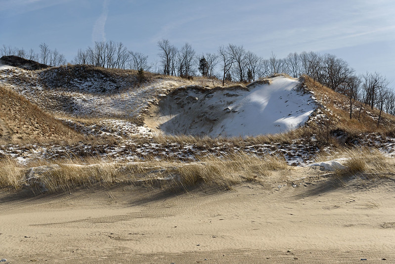
Once up the dune ridge trail, we made our way to the lake side of the dune. From this vantage point, the blowout could be seen, the area of the dune that was eroded from wind. Dunes are the most unstable landforms, and seeing a blowout reinforces this. No matter how much vegetation is on a dune, something can upset the balance and create a bare spot creating a blowout. Once established, a blowout will tend to increase in size as the edges erode further and further. The loose sand of the blowout will fall to the bottom of the dune, or can be blown over the top of the dune by high winds. Once the sand begins to blow over the dune, it is deposited on the leeward side, building the dune on that side. This is called a living dune, as the dune seems to move inland by itself.

The View From the Blowout

The view of Lake Michigan from the top of almost any dune is spectacular, combined with sun and floating ice, it becomes even more special. This year, there is very little ice on the lake (so far) so any is a sight to behold. The beach in the photo above is about 80 feet below, and its about 700 feet north to the water. It doesn't look that high or distant until you begin to climb up, or walk to the water. A few trails can be seen if you look closely. On clear days, the Chicago skyline can be seen from this vantage point; the city is approximately 30 miles across Lake Michigan as the crow flies.

Dotted With Conifers

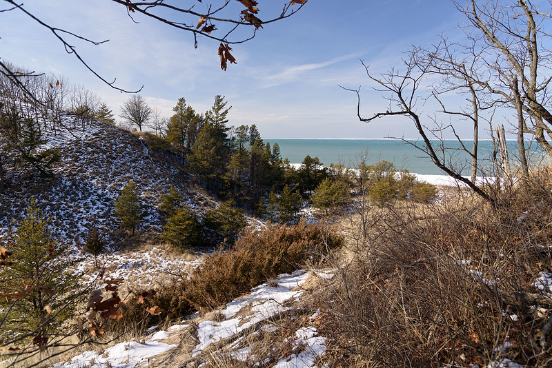
As dunes form and evolve, different vegetation begins to take hold. Here, conifer trees can be seen dotting the marram grass. They're generally the first wood to take hold, and seem to be declining in numbers here at the Indiana Dunes National Park, at least in my estimation. There are a few places where they seem to thrive, West Beach is one area, and it's very special to hike through these conifer micro-forests. The sights and odors are so different from the surrounding area.

Hiking The Ridge Trail


The Warm Colors of Winter 
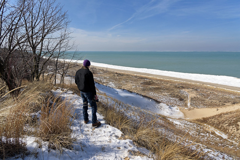
I love bringing people to areas they've never seen, and this hike was even more special. My brother John came along for a winter hike through the winding, hilly trails of what I call the Ridge Trail. This is not the official name of the trail, it's a nickname I've given it - I honestly don't know the "real" name of this trail, and don't particularly care either. This trail starts out on the Lake Michigan beach, heads off into the grassy dunes, then through the wooded dunes to the ridge where it meanders for a half a mile or so around savannas, woods, and blowouts, until it comes back to the beach. It's a quick hike for a cold or hot day, and a great place to introduce someone to the Dunes.
 
Hiking The Ridge

Of course, John has been to the dunes before, but not to this particular area, and although I like to use this relatively short trail to introduce people to the dunes, he could hike for hours non stop, and we did continue after this trail.
 
One thing I like to do is to keep people looking ahead as they hike, then stop in certain places and ask them to look back. Here, John was hiking, and a few moments after this photo, I told him to look behind him. The view of the rolling dunes, conifers, and partially frozen lake are a relative surprise when you turn around. You don't realize the expanse of the area until you stop and take it all in.

The Path Ahead

Just ahead is a large dune with a winding trail up to the top. This is the backside of a large blowout - an area of a dune that has been eroded by wind and/or waves. The area looks like a large, bare depression in the dune, it's quite striking, but from the backside, everything looks normal. As we hiked further up, we would encounter the blowout, and the way down from the tall dune.

The Gelid Shore

Ice Fault


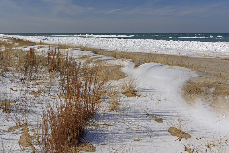
So many weeks of warm weather finally turned cold enough to form ice on the shoreline of Lake Michigan. Unlike most previous winters, the shelf ice only extends a few meters out, and it's only about half a meter in height. Bitter cold temperatures combined with high winds create the "best" shelf ice and mounds on the shoreline. On this day, the ice was being pushed off shore by southern winds. Looking closely at the ice on the lake, you can see it out in the middle of the lake.


Gelid Shore

Visitors to the lake in winter often see these tall mounds of ice and figure they're thick and solid enough to walk on. This day proves that shelf ice is not attached to the bottom of the lake - in fact, it's floating with the exception the first few meters where the waves break. Here, it's thick enough to touch the bottom, but that doesn't mean it's safe. 

The large mounds of ice seen here now away from the shore, were once attached to the ice near the shore. The winds blowing off shore moved them slowly to their positions now. Imagine, venturing onto these mounds when they suddenly break off and begin floating out!


Ice Line

At the times of high winds, the ice mounds up often 10 or 15 feet tall. In times of low winds, the ice simply forms on the surface of the water. These jumbles of floe ice seen in the image above will form after the mounds and freeze together into this boulder-like texture on the water's surface. Then, if winds come again, mounds will form on the outer side of these flat areas, as the ice builds up. It can often extend 100 meters into the lake. At times, the floe ice covers all of the water that can be seen from shore, perhaps a mile or two out.