The Winter Beach

The Winter Beach

A visit to Mt. Baldy on a warm winter afternoon was on the schedule after a morning of ice fishing on a small lake nearby. Temperatures in the upper 30's made this hike comfortable, if not a bit too hot dressed in winter gear - my coat was open the entire time.

Closed for two or three years, Mt. Baldy opened again last year, with a new path to the beach, avoiding the potentially dangerous parts of the main dune.  We noticed the new trail was being taken over by erosion as well.  A good part of the approach to the beach was missing, making the hike down to the beach a bit difficult.  In winter, the sand freezes, so it does not allow your feet to sink in, and the steep angle requires you to slide down the last 10 feet.
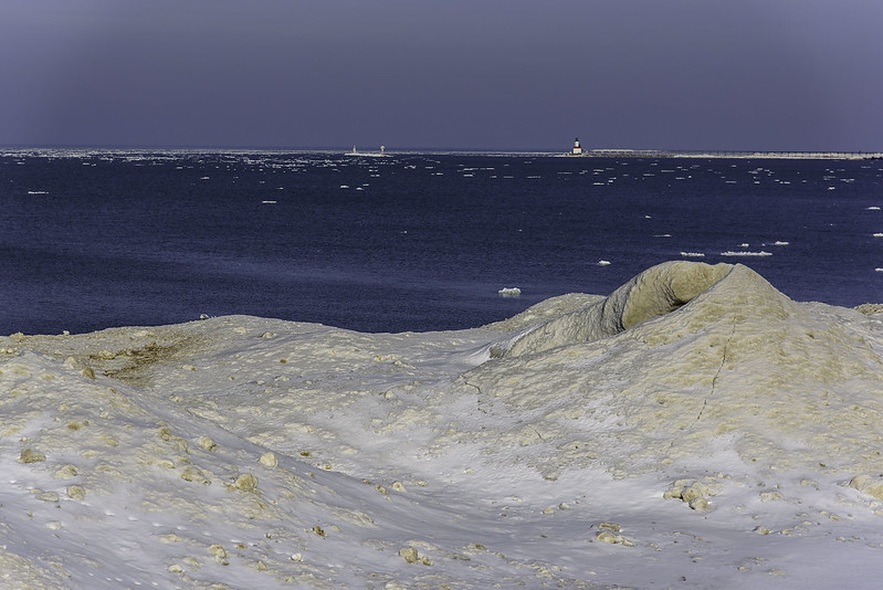
Ice Mounds

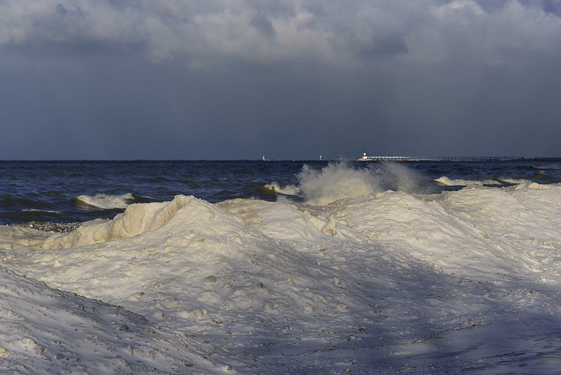
The views from the top of the dune are great, especially with the drift ice floating in Lake Michigan. The Michigan City lighthouse could be seen in the distance, beyond the mounds of shelf ice on the shore. Winds were blowing out toward the lake, so much of the ice drifted out away from shore. As soon as the winds shift back to normal, the ice will pack against the shore once again, creating more and more shelf ice.

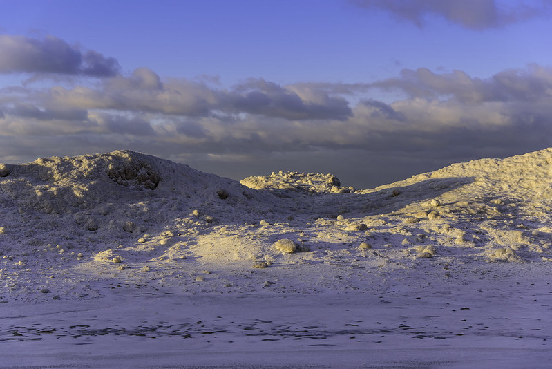
Shelf ice is made up of these chunks packed together and piled up by the crashing waves, it's not solid. These variations create an unstable mound of ice that appears strong, but in reality, is quite fragile and inconsistent.
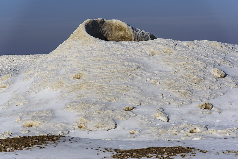
Shelf Ice Detail

The action of the waves creates mounds much like volcanoes, with holes through the center. These holes are often covered over by a thin layer of snow, creating hidden dangers for those who walk on the ice mounds. These holes, cracks, and other inconsistencies can potentially lead to death should one fall into them.

Visiting the winter shore is quite interesting, but one must remember to remain on solid ground at all times, and resist the urge to climb the shelf ice.

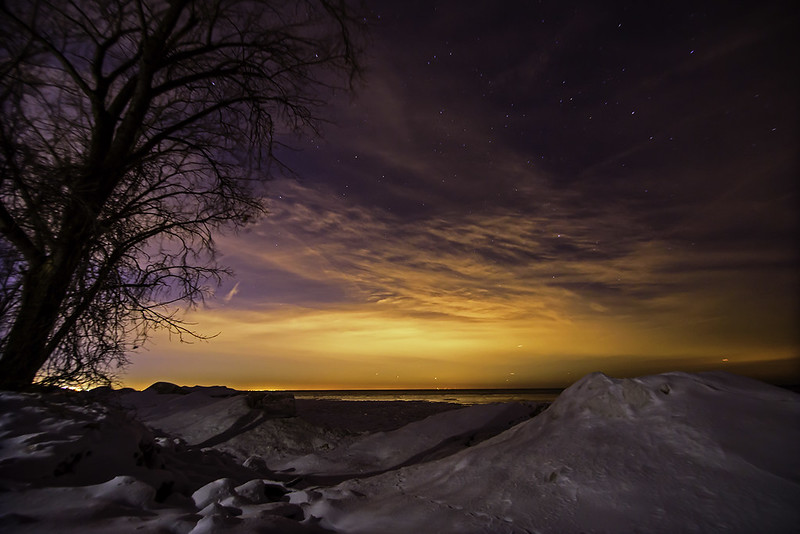
Winter Night on Lake Michigan

Chicago Lights

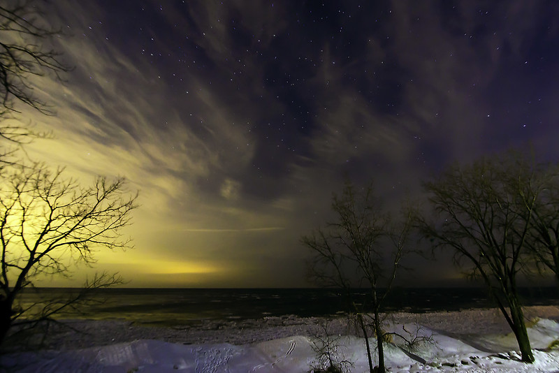
An unusually warm night for January, allowed us to explore the winter shore in relative comfort, despite the high winds which played havoc with long exposure photography. The trees moved, the camera moved, everything moved during the 4 second exposures.

During our hour or two visit, we didn't see or hear another person anywhere, not even passing on the road nearby. This is not unusual for a cold, winter visit, but this evening was right around 32 degrees, I expected to see a few people on the beach.

Plenty of footprints lead from the viewing area to the beach, and then onto the mounds of shelf ice.  Large cracks and hole can be seen in this ice, and especially with the high winds creating waves, the mounds can break off and roll into the freezing cold water. 

Winter Night

The yellow light pollution from the city of Chicago, some 40 miles away, illuminated the sky, making the horizon look almost like sunset, but looking up a bit, the stars can be seen.  The evening began cloudy, then as we explored the shore, the clouds rolled out a bit, exposing the stars over Lake Michigan.

The warm weather is expected for a couple of days, then back to the cold again.  Time will tell how the changes in temperature, wind speed and direction will affect the mounds of shelf ice along the shore. Generally, these changes create much more interesting shapes and mounds - I'll certainly visit again soon to see for myself.


Frozen Beach

Frozen Beach

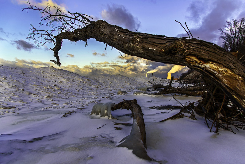
Walking the narrow beach in winter brings great views, interesting observations, and something new every day. The setting sun illuminates the NIPSCO cooling tower in the distance, bathing it in warm sunlight - a stark contrast to the cold foreground objects.

The constant erosion of the foredunes brings full grown trees down to the beach, creating obstacles for visitors. In all seasons, these trees block the way, but in cold weather, it's not possible to walk around them. The freezing cold water keeps people from accessing some parts of the beach (unless they don't mind getting wet). In the freezing weather, it's possible to walk around some trees, however, the closer one gets to Kintzele Ditch, the more dangerous this can become. The ditch is a stream flowing between two dunes into Lake Michigan. The constant battering of waves moves the outlet of this stream hundreds of feet some days. If the ice covers the beach, there is no way of knowing where the stream is, and falling through the ice into this stream could be deadly this time of year. If you did manage to get out of the water, the walk back to the parking area is about a mile, in that time, hypothermia can set in, not to mention your clothing would be frozen stiff, preventing you from moving easily.

Ice Mounds

Knowing the beach in summer, certainly helps keep one safe in winter while viewing the forming ice mounds of Lake Michigan.

We Dare Go No Further

Dare Go No Further

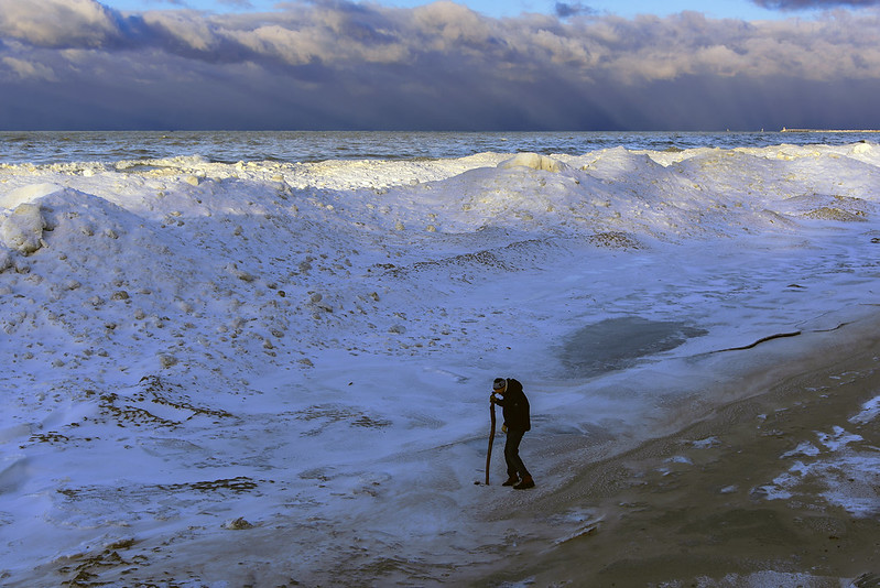
It wouldn't be winter without a walk on the beach! The beach is probably one of the most interesting places in winter- especially the beaches of the American Great Lakes. Many people who visit during the warm months don't realize what a special place the beach is in winter.

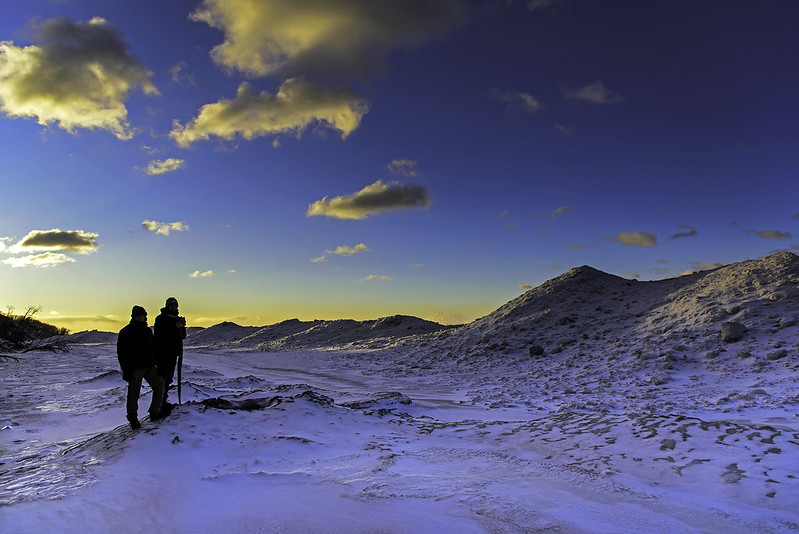
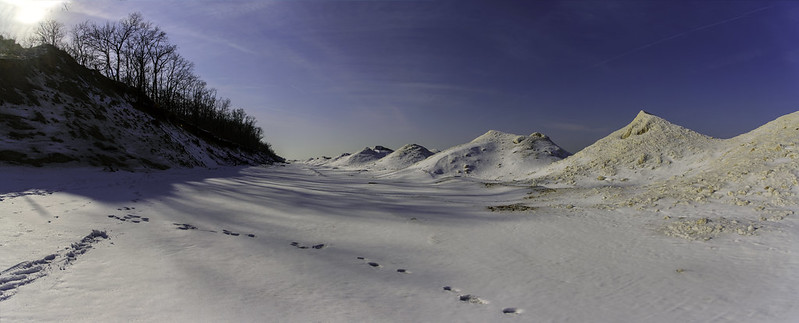
Vast fields of ice form as the waves crash into the shore, splashing and piling ice onto the shore. These piles grow as much as 20 feet in height, then can extend hundreds of feet into the lake. The ice mounds resemble arctic mountain ranges, and one feels they are wandering in the arctic while walking on this Indiana beach.

Distant Snow

Although it's tempting, it's never safe to wander out on this shelf ice. Hidden cracks and holes lead directly to the freezing water below, with absolutely no chance of getting out. As much as I would love to climb the ice mounds, I know it's not worth the chance.

On this afternoon, the sun was setting, and the waves were crashing into the shelf ice. Walking on the beach is eerie, there is little sound on the beach, except for the occasional crash of water and chunks of ice thrown onto the ice piles by the waves. This is how the mounds form, little by little, inch by inch, the waves create the shelf ice.
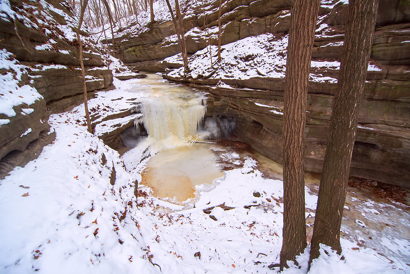
Beyond the Ice Shelf

Walking on these beaches in winter seems like walking though a canyon. Tall sand dunes on one side, and hills of ice on the shore. The beach is certainly a different place in the winter, and one everyone should safely experience.

The Frozen Waterfall of Tonti Canyon

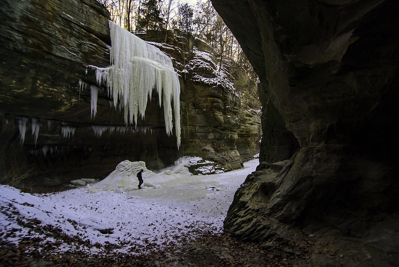
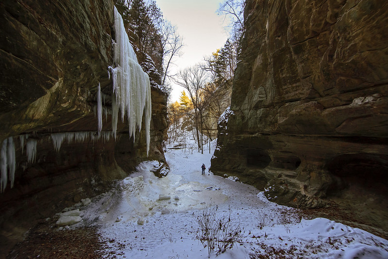
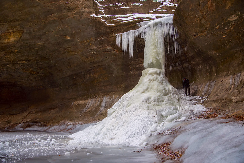
Leaving Tonti Canyon With daylight waning, we continued our hike from LaSalle Canyon to nearby Tonti Canyon. One of the few canyons of Starved Rock State Park that boasts two waterfalls. As we entered the canyon, we could see only one frozen waterfall; the first was only a series of icicles hanging from the canyon wall. With a bit of warm weather, water should begin flowing enough to form larger icefalls. Most canyons in this state park are blind, meaning the canyon is a dead end, and that end usually has a waterfall. Tonti is a canyon with tall vertical walls that narrow at the end, but the two waterfalls are about 100 feet from the end, and on opposing sides of the canyon. This arrangement allows visitors to take in the view of the canyon from the very end.
  The Growing Falls of Tonti Canyon

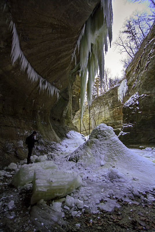
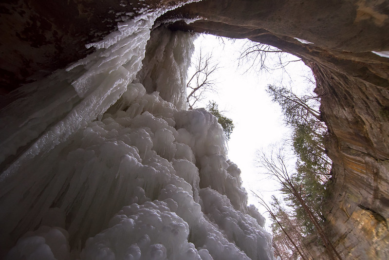
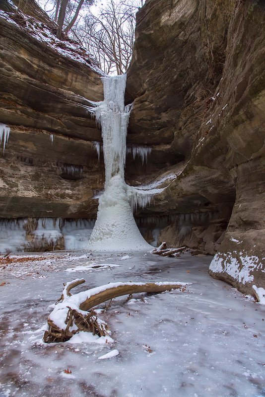
 The waterfall is well on its way to reaching the ground. The falling water freezes into long icicles, while the water that does reach the ground, piles up slowly and grows toward the icicles above. After a while, the two meet forming a solid column of ice. Perhaps it's the slow trickle of water, but something in this canyon makes very intricate twists and turns in the ice, and in my experience, when this icefall reaches the ground, it's the prettiest in the park.
  Deep in Tonti Canyon

Ice climbers frequent the park, and often climb this icefall when it's safe enough to do so. The climbing gear generally ruins the intricate formations, so it's best to visit the park before the ice climbers arrive. Warm temperatures are expected over the next three days, so these icefalls will undergo some extreme changes. They should all receive more water, so as long as the temperatures drop back below freezing at night, the falls should continue to grow.

Frozen Waterfall of La Salle Canyon

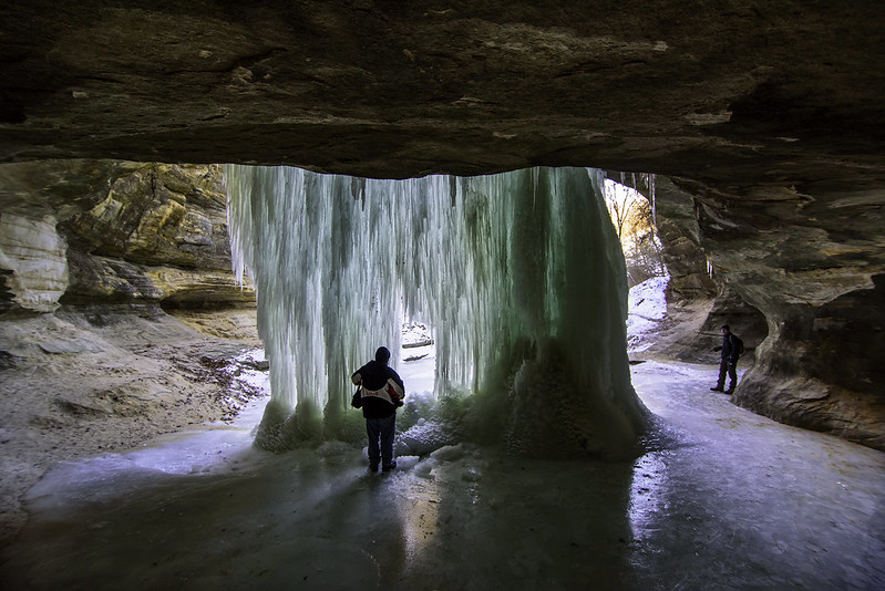
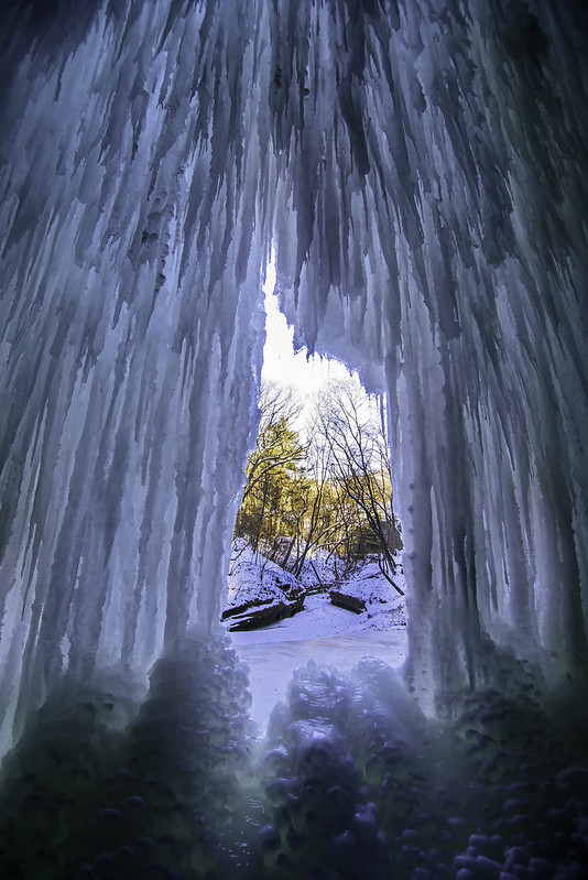
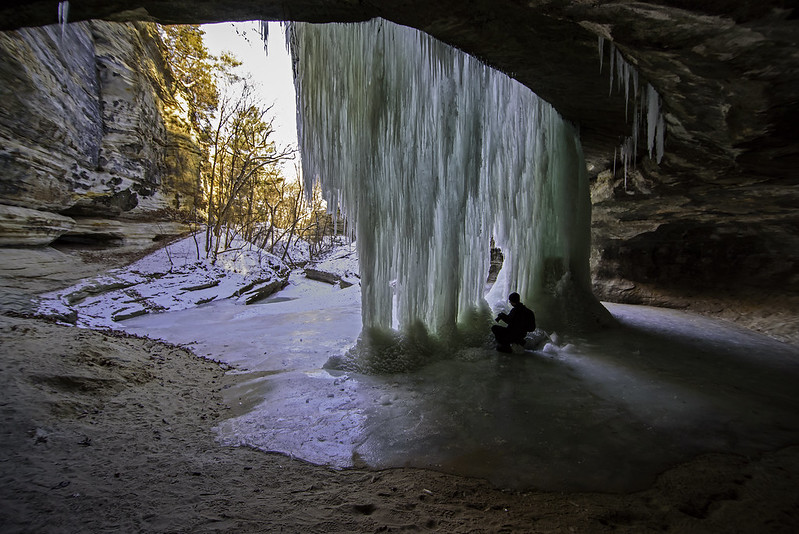
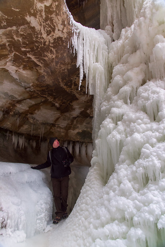
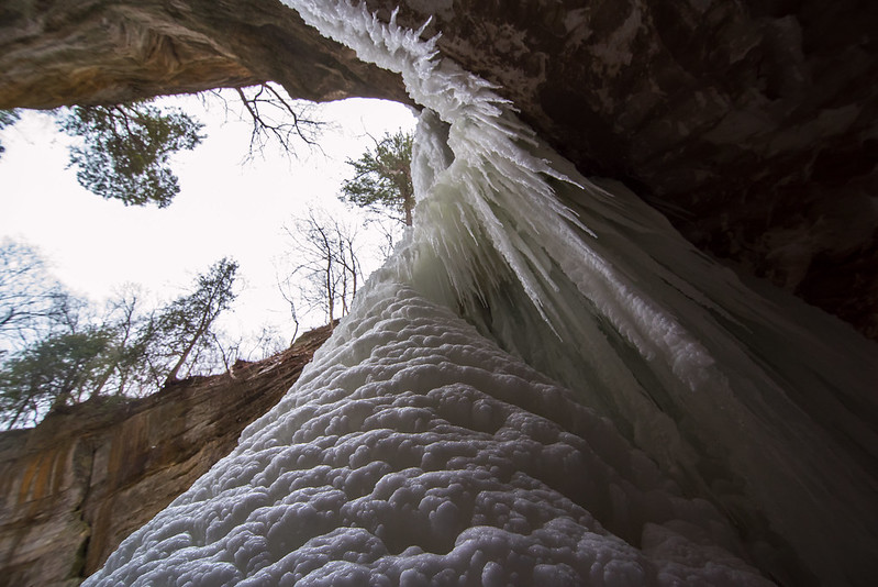
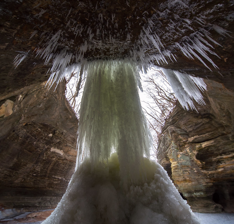
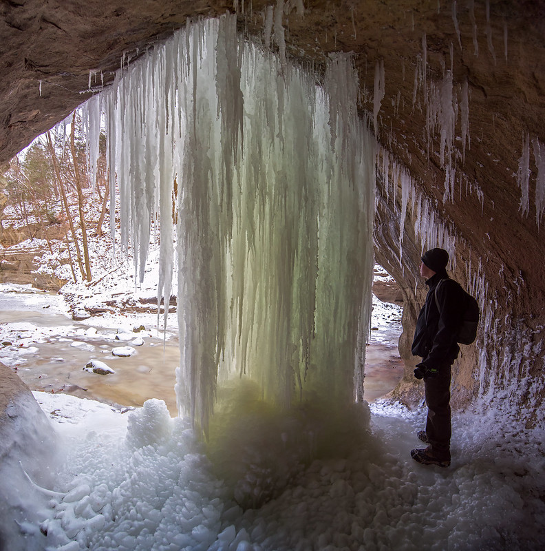
Exploring Behind the Falls An additional week of extremely cold weather in Northern Illinois has allowed the waterfalls of Starved Rock State Park to increase in size. The waterfall of La Salle canyon has grown about four times the size it was only a few days ago. Some parts of the waterfall are cracking and breaking off either due to its own weight or people hanging or climbing on it. Still impressive, these falls continue to grow hour after hour as long as a bit of water trickles over the rock ledge above. Through the Ice Exploring the backside of the falls is always impressive, as the light filters through the ice formations. Today, the ice took on a green tint from the light entering the canyon. A small portion of the icefall was broken off in the center, giving us a view of the canyon beyond. Backlit Falls The size of these frozen waterfalls isn't clearly understood without actually walking next to them. This photographer next to the falls, however, gives a good idea of the scale of the icefalls. The weather is supposed to warm up quite a bit next week, then drop again. Any rain or melt should freeze in a couple of days adding to the intricate designs of these Illinois ice falls.

St. Louis Canyon in Winter

Up From St. Louis Falls Following our hike in Matthiessen State Park, we headed over to nearby Starved Rock State Park. This park has many more canyons and trails, so the possibility of seeing frozen waterfalls is very good. The first stop was St. Louis Canyon, one of the more popular areas in the park, and one I tend to avoid when visiting - no real reason, maybe it's just too easy to access. The cold weather had already turned the waterfall into a complete icefall. We explored the falls from a distance first, then made our way around and under. St. Louis Canyon Falls A lot of times when I visit the frozen waterfalls, it's difficult or impossible to access the area behind the icefalls. It's either too slippery, or blocked by too much ice. Visiting early in the season, I was able to get behind the ice for a completely different view. Careful of falling ice, I explored the 40 foot tall ice column from beneath. The dripping water splashed onto me a bit, and in the single digit temperatures, froze on my camera immediately. Exploring the Back of the Falls Ice cleats are a must when visiting Starved Rock or Matthiessen State Parks in winter. Even when most of the snow has melted, the trails are often packed with ice from thousands of visitors, and most of the canyons are shaded most of the day. The trails are probably the last things to melt, and can be extremely dangerous in winter. Not only can a person slip and fall down, but that fall can result in a drop into a canyon on some narrow trails. The cleats allow you to walk on solid ice and packed snow without slipping at all. Beneath St. Louis Falls
Frozen Cascade

Frozen Cascade

The second stop on our trip to Matthiessen State Park was Cascade Falls.  Located in the lower dell portion of the park, it takes a bit of a hike to reach, even though you can view the area from the trail head.

Right after heavy rain or snow melt, the lower dells can be flooded, making it impossible to reach the canyon floor to view the caves and waterfall. But on this trip, we were able to make the full trip to the foot of the falls.

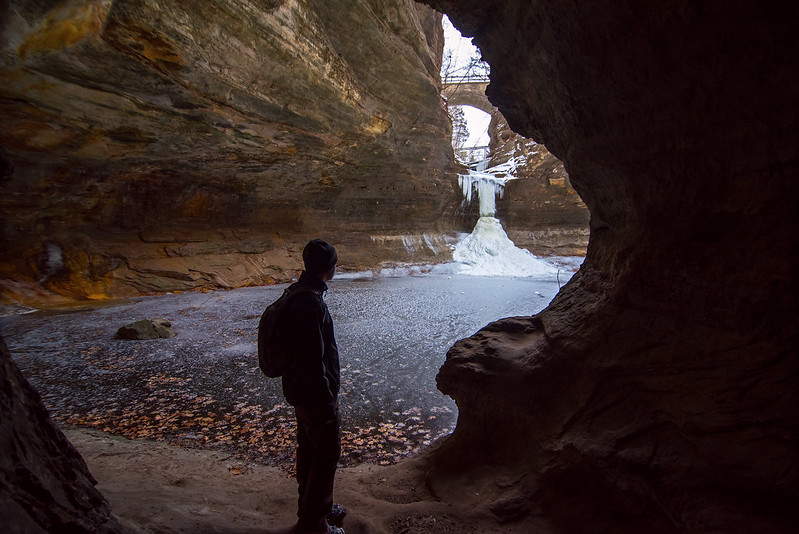
Behind the Ice Cascade As a matter of fact, we were also able to climb behind the frozen falls to view the ice from below, something that becomes increasingly more difficult as the ice increases in size. It's always interesting to see the ice illuminated from behind. Through the Cave Entrance Another feature of the lower dells are small caves. These caves are large enough to walk through, and some connect with each other via smaller passages. One cave opens up to the end of the canyon with a view of Cascade falls in the distance.

The First Frozen Icefalls of the Winter

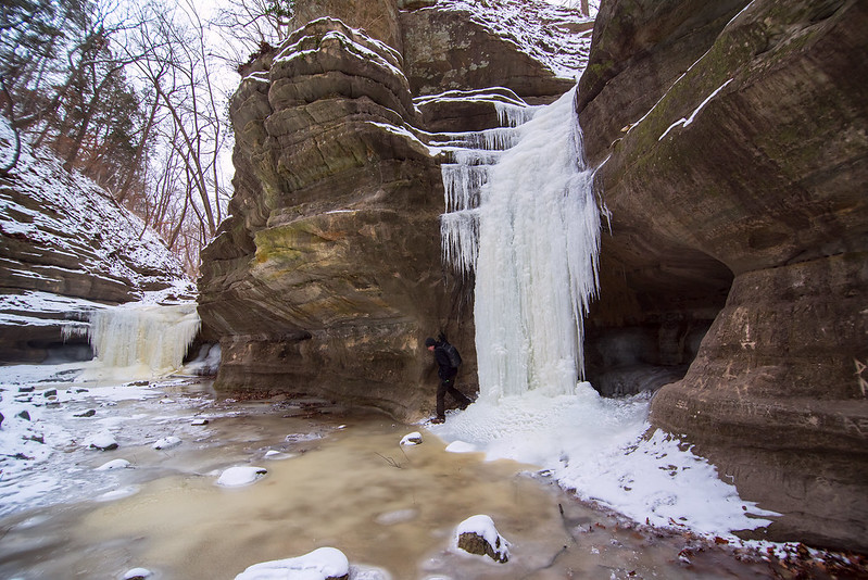
Twins Beyond Cedar Point Over a week of frigid weather has turned the waterfalls of Matthiessen State Park into fantastic icefalls. Each winter, we make the trip out to Starved Rock and Matthiessen State Parks to view the canyons and especially the frozen waterfalls. The recent below zero temperatures turned the waterfalls into icefalls in a matter of days, and they're only going to get larger over the next several days.
  Ice Fall Approach
 Often, these frozen falls don't last very long, any warm weather can destroy the delicate formations; large chunks break off from above and crash into the canyon below, tearing up the intricate ice on it's way down. The forecast is for very cold weather to continue, so it appears the icefalls will last a few more weeks at least. Behind the Falls On many visits, the rock cut-outs are completely covered over by ice. Other times, such as today, the back of the ice was accessible, and we made our way behind the ice. Daylight filters through the ice, illuminating the formations from the back, and seemingly from within. The falls are continually growing, as water falls inside and around the ice formations, freezing, and adding layer upon layer of new ice. The area near the ice is always wet and slippery, so clothes and camera gear get splashed up - something you don't want in the winter. It can make the trip back pretty uncomfortable. The Falls From Above These two falls beyond Cedar Point are not often found by visitors of the park, and can go unnoticed. They're certainly worth the effort to find and reach them during the winter months when they're transformed into huge ice sculptures.
Sand Formations

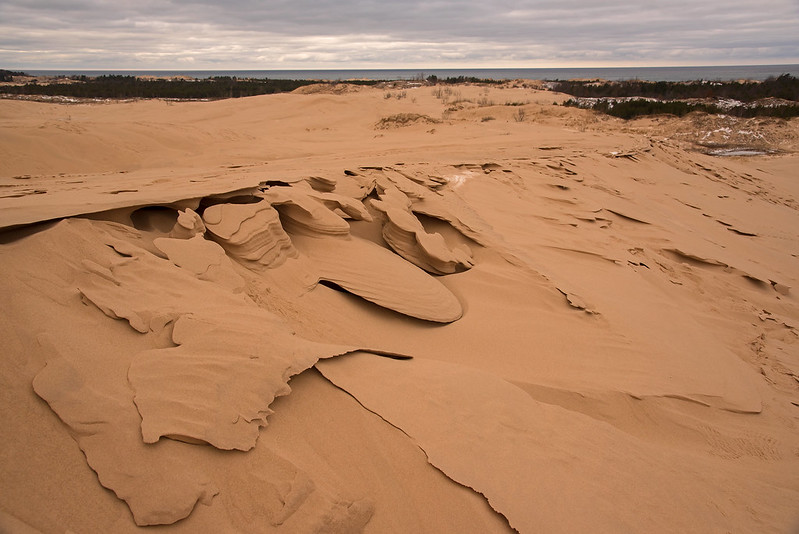
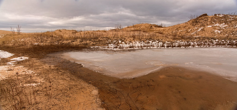
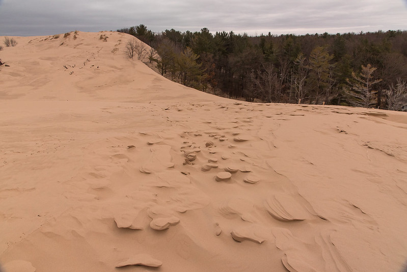
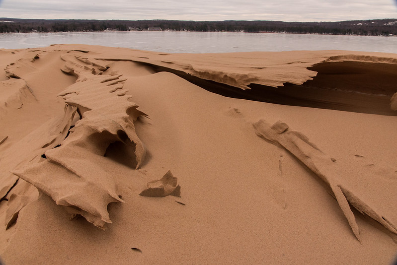
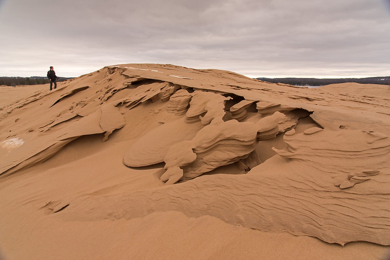
Dune Sculptures Wind, sand, snow, and ice combined formed these interesting structures on the vast, rolling dunes of Silver Lake State Park, near Mears Michigan. Arriving at the top of the first dune, we readied ourselves for the long hike to Lake Michigan -it appears much closer than it really is. We then noticed mother nature's handiwork on the tops of the dunes. As the snow fell, and the wind blew, layers of snow and sand piled up over a foot tall in places. Then, some of the snow melted getting the sand wet, and the wet sand froze in some areas. The wind continued to blow away the loose sand, but the frozen sand stayed in place creating these formations. Sand Formations We didn't expect to see such patterns and formations, but they were a welcomed addition to our normally interesting hike through the dunes and forests of Silver Lake State Park. On this day, we had the entire park to ourselves, we didn't see another person all day; I suppose most people prefer the beach and dunes in the summer months. Our hike here usually includes a visit to some interdunal ponds, small bodies of water collecting between sets of dunes. These areas are vastly different than their surroundings, and they are home to many different plants and animals not found in the other areas of the park. Conifer forests often border these ponds, creating homes for birds and other wildlife. Interdunal Pond Now iced over, these small ponds blend in to their surroundings much more than in the warmer months. The conifer forests, however, were buzzing with birds gathering seeds in the cold winter air. They were such a different environment than the areas surrounding - like islands of life in the desert. The temperature was much warmer in these areas too, sheltered by the tall dunes on all sides, and buffered by the jack pine trees. This was a nice break from the cold wind found everywhere else in the park.

Waves of Sand

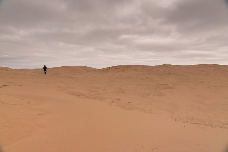
Expansive Dunes One of the most interesting areas of sand dunes along the eastern Lake Michigan lie within Silver Lake State Park near Mears, Michigan. Over 3,000 acres of rolling sand dune set between Lake Michigan and a smaller inland lake, Silver Lake. In addition to a huge expanse of bare, rolling sand dunes, there are countless interdunal ponds, grass prairies, and stands of conifer trees. Visitors can experience all these environments in a single hike. The hike, however, isn't going to be easy. The climb from the parking area is a steep walk up a loose sand dune, through a forest that is in the process of being buried by the ever-moving dunes. Once on top, the expanse of the park comes into view. Close to 1/2 mile of rolling sand separates you from the first stand of conifer trees, and they're not even half way to Lake Michigan. Taking Over the Forest Appearing more like an African desert than a Great Lakes field of dunes, Silver Lake State Park doesn't disappoint those who make the trek over the entire range of dunes to the lake. On this visit, we encountered something unusual on the dunes - patterns and waves of sand carved by the wind. While wind created patterns are nothing special here, these creations were unlike most. Following high winds, freezing temperatures, and snowfall, the sand and snow built up in thin layers, then, warmer weather began to melt some of the ice and snow. During this process, the layers of snow melted into water, wetting the sand which froze again. More winds eroded the sand that wasn't frozen, and these special formations appeared. Delicate Shapes on the Dune Some of these formations appeared like paper, thin layers of frozen sand, bent or stacked on top of one another. Others looked like turned vases, while others looked like a miniature canyon from the Western United States. I'll post many more photos of the interesting formations in the days to come.

A Winter Morning at Little Sable Point

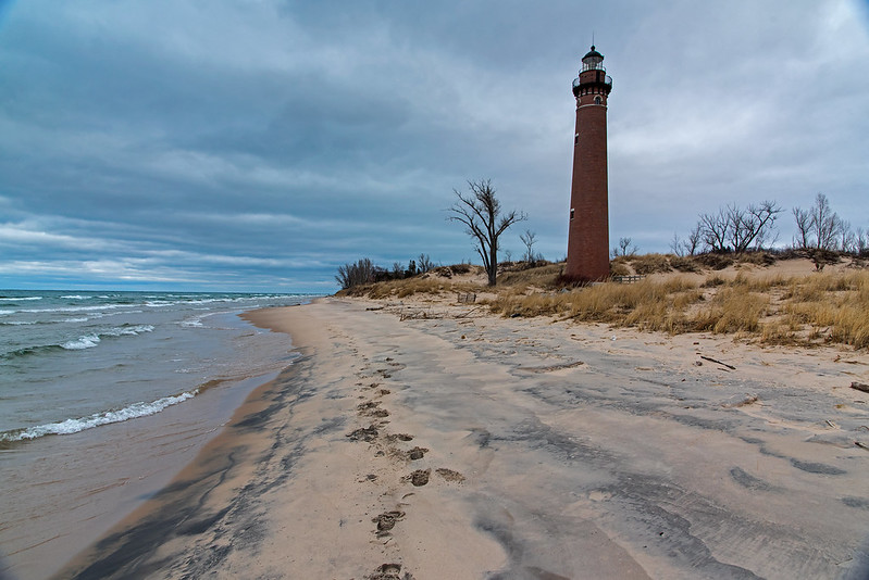
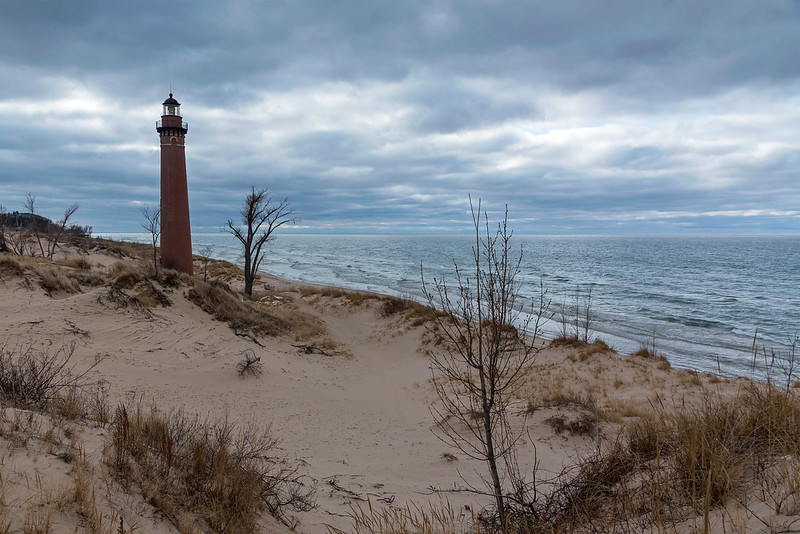
Morning at Little Sable Point Following a long, early morning drive, we arrived at Silver Lake State Park, just south of Ludington, Michigan and began our hike. It wouldn't be a trip to this area without a visit to the Little Sable Point Light. The 107 foot tall brick tower was constructed in 1874, and has survived many cold winters on the shore of Lake Michigan. The lighthouse is open for tours during the warm months of the year, but today, we were the only two people in sight - the entire day. It seems, nobody enjoys the beach in the winter. Little Sable Point Lighthouse Ice has not yet formed along the shore of this area of Lake Michigan, usually this forms a bit later in the winter. Snow, however, was all around us, but it seems the sand retains heat a bit better than the surrounding surfaces, allowing the snow to melt from the dunes. Sitting directly in the sand of the beach, this lighthouse is one of the few on the southern shore of Lake Michigan not on a long pier marking a river or port. The lighthouse still has a third order Fresnel lens, and it's still operational - one of only 16 on the Great Lakes (70 in the United States).

Exploring the Dunes

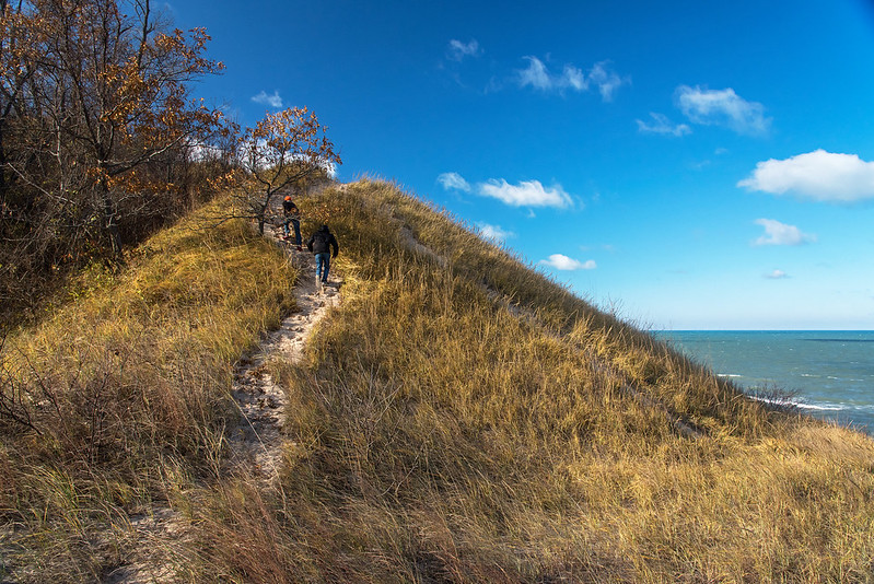
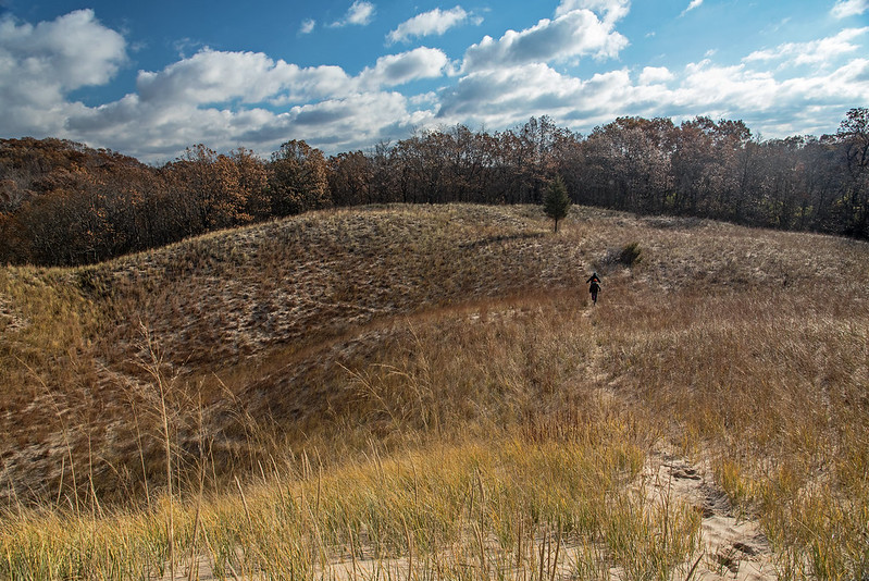
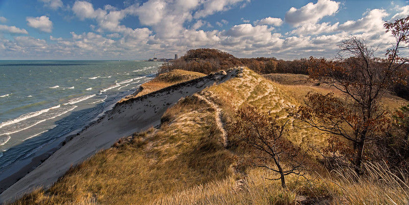
The Path to the Top The high winds and cold temperatures reminded us that winter is approaching. While standing on top of the fore dunes, we felt the full brunt of the weather, but just over the ridge the winds were blocked, and temperatures were much more tolerable. On windy days, the beach all but disappears, so it's a perfect time to explore the secondary dunes, and the nearby woods. Most visitors are attracted to Lake Michigan and the beaches along the shore, but there are so many other aspects of the Indiana Dunes National Lakeshore that can't be found anywhere else in the area. These are the places I like to explore. To The Woods Certain areas of the park show a perfect dune progression from beach to forest; West Beach is one example. But the progression can be seen to some extent at all the beaches. It's these unusual areas that attract me, the woods that seem to begin at the foot of a grassy dune, almost as if they were planted by hand, purposefully. Why are there single conifer trees in the middle of a Marram grass meadow? These landmarks can be seen from quite a distance, and are often the target of our hikes. I've explored the dunes for many years, most weekends each year, and I still find new things to explore. What's also interesting is the change that takes place over time to places I visit, things are rarely the same twice.

Morning Hike on the Fore Dunes

High Atop the Dunes

A morning hike along the tops of the fore dunes was a great way to start Thanksgiving weekend. Despite the cold temperatures and very windy conditions, we enjoyed the time away from people shopping in earnest for black Friday bargains - they can browse the aisles while we browse the treetops and meandering trails.

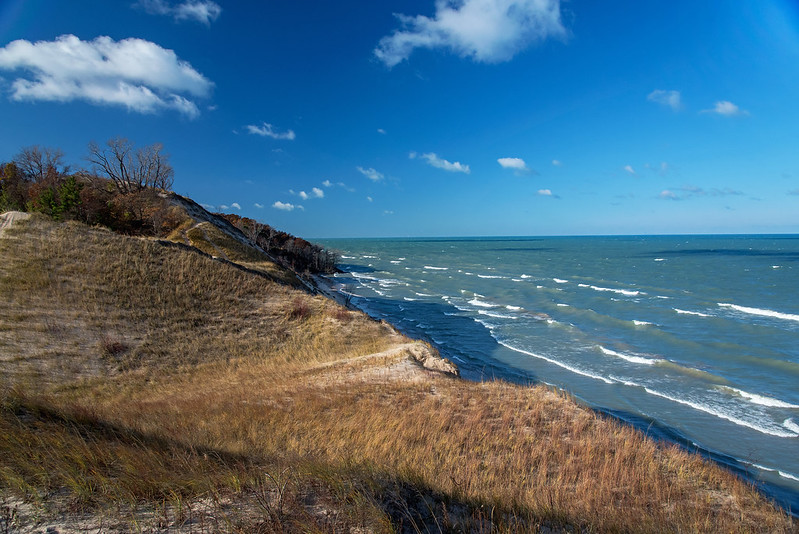
The fore dunes are the first line of dunes from the shore. Over the past few decades, these have taken a hit by erosion. Much of the beach below is now underwater, making it difficult to walk on the beach during days with high waves. This is a natural process, that has taken place since the dunes were built by winds, in fact, it's the same process that created the dunes. The dunes change by the day in some places, other places remain untouched for centuries. These are the places where trees take hold and form conifer forests or oak savannas. The winds will probably bury them in time too.

The Foredune

Looking closely at the beach below, we saw two other people on the beach. They are barely visible in the photo above, just emerging from the trees along the shore. I find very few people on the shore in cold weather. I'm often the only person in view for miles around when I visit this place in the winter, and I enjoy the solitude. On calm days, the quiet creates an eerie environment where you feel completely alone, yet you're only a few miles from a busy city, and 40 miles across Lake Michigan to the third largest metropolitan city in America.

We're lucky to have this area set aside for us so close to the bustling cities.

Colorful Litter

Colorful Surroundings

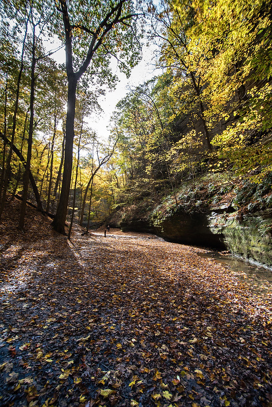
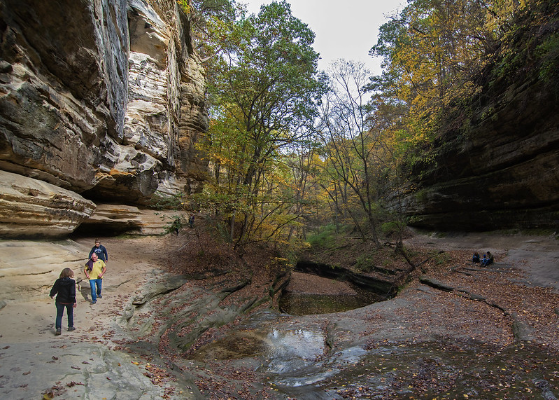
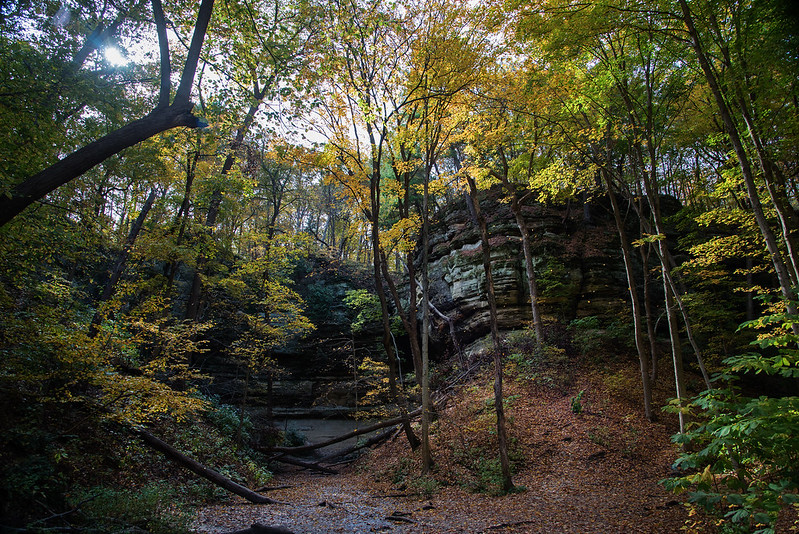
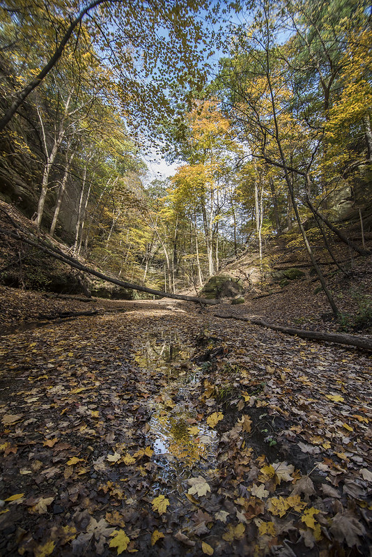
At certain times of the day, sunlight does not enter the depths of the canyons. This provides an interesting contrast between the mono-chromatic rocks and the sunlit, colorful fall leaves. The newly fallen leaves litter the canyon floor, providing even more color to the autumn display.

Fallen Color

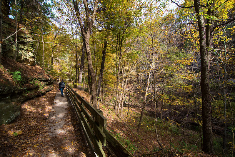
The shallow streams of the canyons help to gather fallen leaves, creating a carpet of color on the trail.

Hiking the Colorful Canyon

Every way you turn, the park is filled with color. The trees, the canyon floor, and even the rocks that form the canyon walls. As you progress through the park, the sun changes the angle of the light, and the same canyon takes on a completely different look.

Canyon Pool

LaSalle Canyon Pool
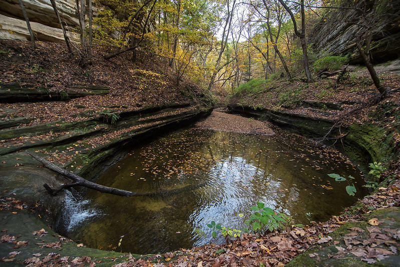
Most large waterfalls create a pool underneath themselves, due to erosion of the falling water.  This very small waterfall in LaSalle Canyon has a rather large pool beneath, sparking questions as to how it was formed. Was the waterfall much more active at one time? Was the main waterfall in the canyon over this spot at one time in the past? Or did some other force of erosion create the pool?

Either way, this tranquil body of water is the perfect spot to rest after a hike into the canyon. In Autumn, the water is surrounded by colorful leaves, and also turns colorful with many fallen leaves floating in the pool.

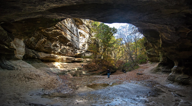
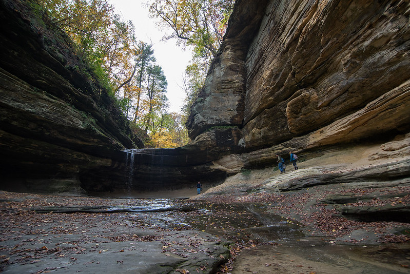
Path to LaSalle CanyonAs one enters the blind canyon, the series of small waterfalls comes into view. Hikers must walk behind the main waterfall at the back of the canyon, and curve around to the other side to continue their journey to nearby Tonty Canyon.

I enjoy the winter season most of all at Starved Rock State Park. The waterfalls often freeze, creating beautiful ice sculptures some over 80 feet in height. Visiting the park in the warmer months gives me the opportunity to see where the deeper waters are in the streams and natural pools.  Viewing the frozen waterfalls often involves walking close to them, and I need to remember just how deep the water may be at the bottom of the falls. Breaking through the ice into a foot of water is one thing, but breaking through the ice into 4 feet of water makes for an uncomfortable 3 mile hike back to the car.

Fall in LaSalle Canyon

Blind Canyon

One of the longer hikes at Starved Rock is to LaSalle Canyon, a blind canyon where visitors must hike behind the waterfall to continue on the trail. The water cascades over an overhang carved thousands of years ago by running water. Generally just a soft trickle of water, at times when rain is plentiful, the waterfall can increase in flow.

Winter is one of the best times to visit this canyon. The falls turn to ice and create a wall in the center of the overhang.  Hiking behind the ice falls is spectacular.

LaSalle Canyon

While not the deepest or longest canyon in the park, LaSalle Canyon is certainly worth the hike. The multicolored St. Peter sandstone walls, green leaves and moss create an environment more suited to southern islands. In fact, even in winter, lichen, moss, and ferns often stay green, and I've seen dozens of insects crawling and flying in the snow covered canyons.

Hiking LaSalle Canyon

Once off the main overhang of rock, the water flows on the canyon floor, down a few gentle drops, and finally into a round pool which eventually flows out to the Illinois River. This serene pool is the perfect location for a short rest, or even a backpack lunch.


Autumn in the Canyon

Fall Path

In a matter of moments, it seems, the weather has gone from hot and sunny, to cool and windy - a sure sign of Fall. And with Fall comes colorful landscapes, at least in some places. It seems this year's fall color is selective, vivid is some areas, while lacking in others.

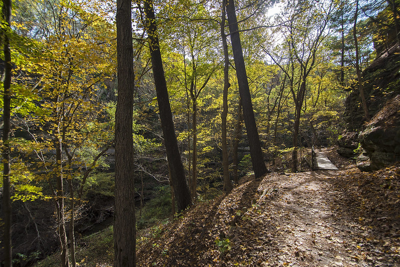
As we walked through the canyons of Starved Rock State Park, we encountered pockets of color peppered around the park. Generally, the fall color happens all around at the same time, depending upon the type of tree, but this year, some maple trees were colorful, while others remained green.

The colorful leaves offer a beautiful contrast against the pale rock-walled canyons.

Autum Trail

A positive thing about the sporadic color changing is the possibility of color later in the month - a longer period of fall color.

Harvest Time

Yellow Dent Corn

Nothing beats a long walk in the country on a sunny day, and at this time of year the crops are ready for harvest. Fields of yellow dent corn dry in the early Fall sun, while their brown leaves crackle in the wind. This is often the only sound heard on the rural roads of LaPorte County, Indiana.

On this day, we heard machinery too - farmers harvesting the bean crop just across the road. A few semi trucks waited their turn for the reaper to fill up and unload the beans into their trucks.

Harvest Time

As I walk past these farms, I wonder if the farmers themselves are harvesting using their own equipment, or rented equipment, or, are they using a harvesting service that does everything for them.  I'm sure it depends upon the farm, but a huge amount of equipment is needed to plant, harvest, and maintain a farm these days. How could anyone afford it all?

Soon, the Yellow Dent corn will reach the perfect stage for harvest as well - it's the black layer, and this is when the corn is mature enough to harvest, and contains the least amount of moisture. If it's dry enough, it can be stored in silos until needed, if it's not, it can be dried before storage.

Probably by next week, the walk down the rural roads will be a lot different. The tall corn that blocked the view of the horizon will be gone, and the only sounds we'll hear will be the birds eating what the combine missed.