Dune Valley

Dune Valley Our hike inland through the grassy and wooded dunes began at the beach, where we found a trail through the valley between two dunes. The size of the dunes don't show so well on the photos - they are much larger than they appear - especially when you hike up and down. We decided to head between the dunes for just a bit, then take the trail up the dune on the right side to hike the ridge all the way around the series of dunes near what is called the blowout. This time of year is perfect for hiking in the tall Marram grass. The temperature is a bit cooler for the climbing portions, and there are no ticks to worry about. Along with the ever-changing plants of the dunes, we always encounter some sort of animal or insect. We were once startled by a very loud turkey we surprised as we came over this ridge. He all of a sudden flapped his wings and screamed as he flew away, waking up every creature within a mile on a very quiet early morning. View From the Dune After taking the trail up the dune, we were able to view the valley floor, and the spot where the top photo was taken. Lake Michigan doesn't always appear this deep blue, most of the time it's a bit lighter in color. This is probably due to the time of year, time of day, and the overall weather conditions. It does, however, provide a great contrast to the sky and sand near it.

Beached on Beverly Shores

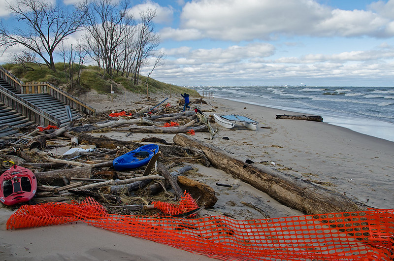
Beached on Beverly Shores Just a few steps away from the famous Indiana Dunes National Lakeshore's Century of Progress Homes, and across the street from the lakefront homes of Beverly Shores, these boats add some color to the landscape of green Marram Grass and tans sands. It's surprising to me that these boats are left untied so close to the unpredictable waters of Lake Michigan. While it's doubtful the waves ever reach this far up, anything is possible when the north winds kick up the lake. Ten foot waves are not unusual here, and these boats have been in this spot through so many heavy storms. Every so often, after a very windy storm, tons of wood, debris, and boats of all sorts, wash up on the beaches here, proving just how items along the shore can be washed away in a moment. The photo below shows the aftermath of one of those storms about five years ago. All Washed Up

Eroding Dunes

Disappearing Dunes Contrary to what many people believe, the dunes along the southern shore of Lake Michigan are ever-changing - have been, and will continue to be. The forces of nature such as rain, wind, and the waves erode parts of the beach and dune, and build another.

Rising water levels this year, along with some "starving" of the beach are contributing to the collapse of portions of the windward sides of the dunes in the Indiana Dunes National Park. A starving beach is one where the natural replenishment of sand is slower than the loss of the sand due to wind and wave action, so the beach and associated dunes lose sand.

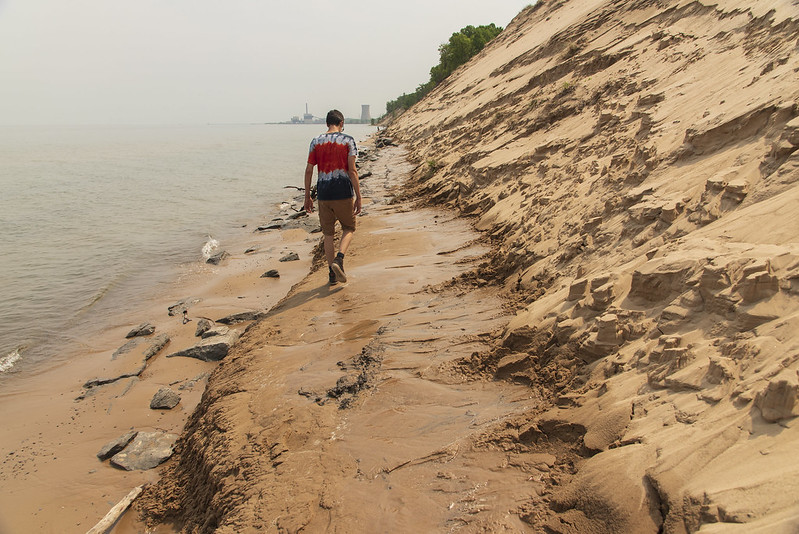
These dunes are crumbling at a relatively fast rate.  The paths and trails that once meandered along the ridge are long gone - washed into Lake Michigan - not because of people walking on them, as many will attempt to mislead the visitor. Walking on some sand dunes and plants will certainly disrupt the natural state of the dunes, and often kill the plants that hold the dunes in place. But this is a case of the lake taking over, not human activity. The Michigan City pier a mile or so away has been blamed for some beach starvation, and while this may be true to some extent, it seems unlikely that the single pier could affect the beaches miles away to such a great extent.

The trees seen in this photograph were growing on the top of the dune just a few weeks ago.  The waves undermined the foot of the dunes, and slowly collapsed the side.  Some trees fell sideways and were washed away by the waves, but these just slid down in an upright position, and the waves buried them in sand. They appear to have been there for years, but in fact, they have only been there a few short weeks.

Weathered Dune
Wind, rain, and gravity have all combined to create some interesting formations as the dunes erode.  These formations look a lot like the mountains and stone formations of Bryce Canyon National Park. They change right before your eyes, small amounts of sand slide slowly down the dune, others crumble and chunks roll down.  Some of this movement resembles waterfalls, but of sand. Beautiful fans of sand form at the foot of the dunes, but are quickly washed away by the waves as soon as the winds pick up on Lake Michigan.

Sand Details
While it's sad to see some of these majestic dunes crumble - especially the ones I used to frequent, it's all just a natural part of the dune's life cycle.

First Quarter Moon

First Quarter Moon

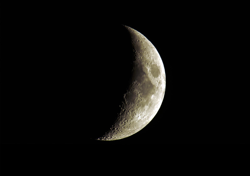
A perfectly clear evening gave us a great view of the first quarter moon in rural LaPorte County, Indiana.

Just a few days before the Perseid meteor shower the skies were fairly dark. The peak of the meteor shower will take place just a few days prior to the full moon, so the meteors will be just a bit difficult to see due to the bright sky. I'll certainly brave the mosquitoes and attempt to photograph some meteors this weekend.


Wall Cloud

Wall Cloud

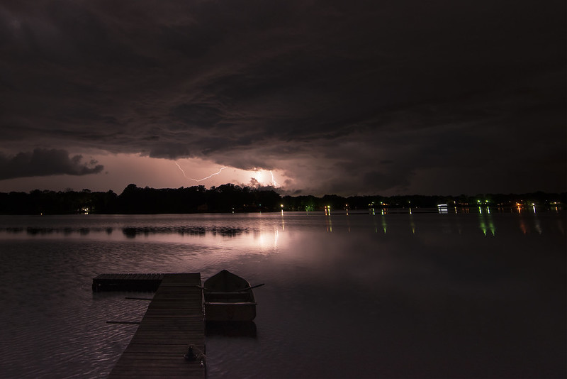
The storms were supposed to stay a few miles northwest of us, but they managed to reach us anyway. Out of the blue, this ominous wall cloud headed toward us. Rather than run inside like most people, we stayed outside to watch. There was no sign of lightning, so some of us headed out in kayaks, and others kept swimming.

Passing Storm Clouds

Not a drop of rain fell as the clouds passed overhead. The 90 plus degree temperatures dropped suddenly, and the winds picked up a bit, but the change was only temporary, giving us relief for just a few minutes.

Ignoring the Storm


Miller Woods Trail

The Trail at the Foot of the Dune

Continuing our hike through Miller Woods, we reached the Grand Calumet River. At this point the river appears to be a lake, or group of lakes.  It's this demarcation where the landscape changes dramatically.  The first mile or two of the trail winds through Black Oak Savanna, a relatively rare landscape, while on the other side of the river, the landscape turns into sand dunes.

The trail follows the foot of these dunes along the river for quite some distance before turning toward Lake Michigan.

Changing Trail

The trail allows views of hundreds of plant species, a good representation of the 1,100 found in the park, reinforcing the fact that the Indiana Dunes National Park is ranked 7th in plant diversity of all the US National Parks.

Thunderstorm

Approaching Storm

For over an hour, we watched the distant storm on the horizon. It never seemed to come closer from sunset until almost 10 PM, when the winds kicked up and the lightning intensified. We then decided to put all the yard furniture and boats away just in case the storm was severe. As we packed everything away, the storm got closer and the winds picked up dramatically.

Distant Lightning

I enjoy watching storms approach, but usually they arrive rapidly, and there isn't much time to watch and enjoy the lightning.  This time, the storm seemed to sit in place and move left to right, giving us plenty of time to view the storm.

Miller Woods Ponds

Interdunal Pond

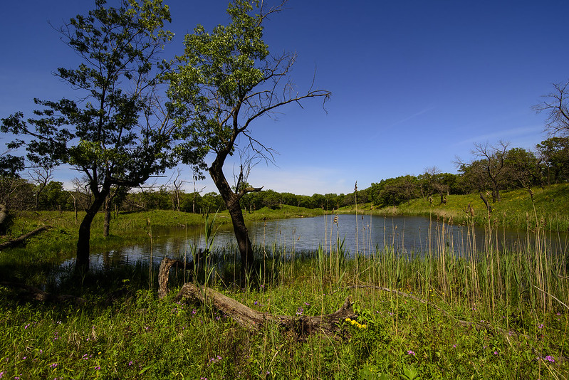
Our hike through Miller Woods continued, as we encountered dozens of ponds and interdunal ponds. The ponds dotted the landscape, in the oak savanna, the woods, as well as the grassy fields. Many varieties of spring flowers were in bloom, adding plenty of color to the mostly green fields.

The trail to the beach was a bit over two miles long, and there was something new to be seen at every turn, and over every hill. I suspect this trail would be perfect for bird watching, judging by the variety of ecosystems and the birds we saw on this day.

Colorful Field

Along the trail we noticed quite a few areas where there were dead standing trees.  Most were not near any standing water, so I could only guess at the cause. One possibility was that these trees were killed by insects or disease. Perhaps they were ash trees damaged by the emerald ash borer, or oak trees damaged by oak wilt.  Another possibility is intentional removal of damaged trees or non-native species - some of these trees had ribbons tied around them, suggesting a mark for removal, treatment, or study.

Larger lakes were encountered during the hike as well, not to mention Lake Michigan, which was our destination on this hike.

Oak Savanna Hike

Rolling Oak Savanna

A late spring hike through Miller Woods offered a wide range of landscapes to explore. Located within the Indiana Dunes National Park, Miller Woods includes trails ranging from a quarter mile to over two miles one-way from the trail head to the beach. Hundreds of plant species can be viewed in this area of the park, lots of wildlife, and quite a few ponds and lakes.

Shadowed Savanna

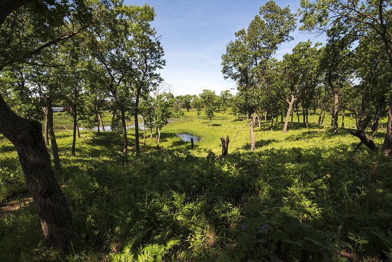
The first half mile or so of the beach trail includes some peaceful ponds and lakes, some of which are rather large, and surrounded by oak savanna. Unlike most wooded areas in the Midwestern United States, these woods are as they naturally were before invasive plants were introduced to the area. Commonly, the invasive plants litter the floor of the forests, and create an impenetrable mass of vegetation; often, one can't even see through it.

In a natural state, the oak savanna has large spaces between oak trees with only short plants covering the ground. These areas have the best preserved oak savanna in northern Indiana. I imagine the rolling dunes dotted with small ponds discouraged farming and industry in this area, so the landscape never really changed much.

Long Pond

Recent rainy weather for the past two months has filled up many of the small lakes and ponds in the Miller Woods. However, only a few small areas of the trail were slightly flooded. These ponds pepper the landscape, we encountered one after another as we hiked the rolling land.

Located right next to the Lake Michigan shore, and at the boundary of the city of Gary, Indiana, this portion of the park is a huge surprise to anyone driving through the area.

Disappearing Beach

Exposed Clay Layer

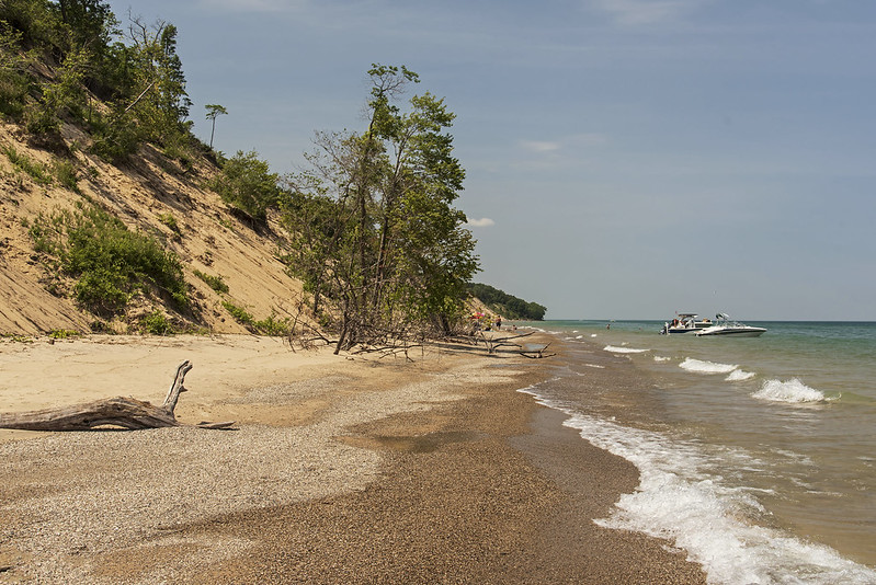
Water levels on Lake Michigan have risen over the past few years, causing some erosion along the Indiana shoreline. Central Beach has been disappearing for some time, due in part to rising waters, but also because of the piers marking Michigan City's Trail Creek. These piers prevent the waves from carrying sand to the beaches down shore, and instead, deposit it on the windward side of the pier.

I remember reports of the dunes of Michigan and Indiana crumbling into Lake Michigan back in the 1980's, but have witnessed an accelerated erosion over the past five years or so.  The park service prevents people from walking along the dunes, saying they are contributing to the demise of the dunes. Anyone can easily see, the lake is the culprit- in fact, the paths that were once on top of the dunes are somewhere in Lake Michigan now. Many meters of the dunes are gone, including the trees which were completely uprooted and eventually washed away by waves. This wasn't caused by people walking on the dunes, but it is a convenient excuse for the Park Service to keep people off of the dunes. --See, we're doing something to save the dunes. I suppose someone will buy it - I don't.
Disappearing Beach

Not long ago, Central Beach was a great destination for those looking to spend a day on the sand.  Now, even when the water is flat calm, there is barely any sand to walk on. Perhaps now that the Indiana Dunes has National Park status, something can be done about the disappearing beaches of Indiana. But that something needs to be the right thing, not just the appearance of conservation, or simply doing something to say something is being done.


Slowly Unfolding

Fiddlehead

With the quick and extreme changes in weather over the past few weeks, it's hard to believe plants are even able to emerge.  Temperatures have reached the high 70's and 24 hours later, they drop low enough for two inches of snow to accumulate.

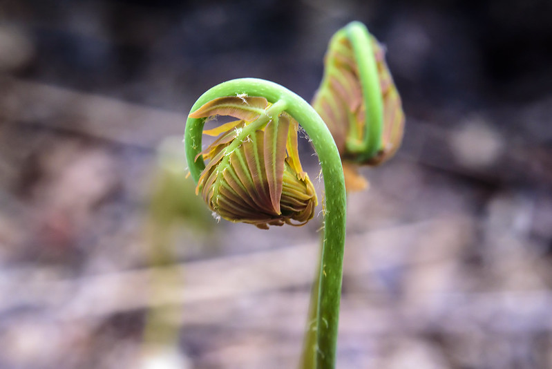
Our hike through the wetlands of the Kemil Beach trail revealed thousands of ferns unfolding, getting ready for the warmer weather.  Two types of ferns could be found here, and these were smaller and few in number.

Slow Emergence

From what I remember during hikes over the last few years, these ferns will turn into tall, thin plants with three or four fronds at the top. They grow to a height of 18 inches or so, and litter the forest floor.

The larger, more robust ferns were abundant and still in tight, round fiddleheads. Of course, just an hour after this photo was taken, it began to snow again.

Lonely Sunset

Lonely Sunset

A red sky over Lake Michigan a few minutes after sunset mark the end of a windy day at the Indiana Dunes National Park. The wind blowing over the cold waters of the lake made the 55 degree air temperature feel like the mid 30's. In fact, the cold water often reduces the actual temperature near the lake.

The high winds and cooler air seemed to keep a lot of people away from the beaches, even though the day was clear and sunny. Earlier in the day, as we hiked from the beach to the rolling dunes inland, we had to remove our jackets because the temperature was much warmer just a quarter mile away from the water.

As we left the National Park, these benches seemed so lonely; in the summer, this beach is often overrun with people until after 9 pm. On this day, we had it to ourselves.

The Trail to the Cave

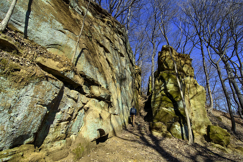
Exiting the Narrow Passage

After hiking through the narrow passage next to Steamboat Rock, the landscape opens up a bit, and the trail leads to a nearby cave. The cave is quite a bit above the trail, and requires a bit of climbing just to see inside.

Perched by the Cave Entrance

Here again, we were surrounded by names and initials carved into the soft sandstone, some dating back to the early 1900's. Looking around, it's interesting to think about who passed through this area, and why. The Mississippi River is only a mile or two away, perhaps some of the visitors making their way down the river ventured through these cliffs.


Steamboat Rock

Narrow Pass at Steamboat Rock

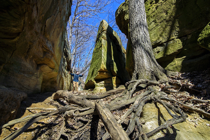
One of the rock features of Iowa's Wild Cat Den State Park is Steamboat Rock. This large rock was separated from the rock cliff some time ago, and one of the pieces resembles the prow of a ship. The trail splits here, one part takes hikers between the rocks, and the other takes them around the outside of the "steamboat."

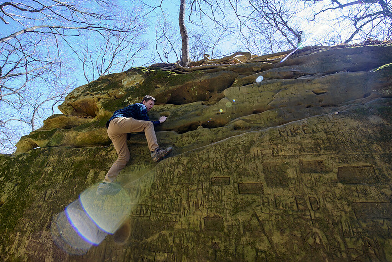
Evidence of visitors to this place is everywhere. Names and initials carved into the soft sandstone are everywhere, including some rather difficult to access places. Some date back to the 1800's if you can believe them, but they do appear old and worn, and written in a typeface not too common anymore.

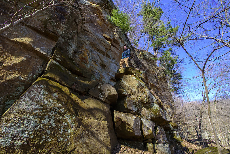
On the Bow of Steamboat Rock

Steamboat Rock isn't too tall, perhaps 30 feet, but it does seem like people like to climb up to the top for the view or the challenge. Here, one person takes in the surroundings after the climb up.

The Easy Way Up

The easy way up was to climb along a diagonal rock process until some fingerholds were found toward the top of the rock. The carved initials are well defined on this particular rockface, these being in a place relatively easy to reach.

Wild Cat Den State Park, while not overwhelmingly large, offers some interesting trails and formations through a variety of terrain. Visitors can hike all of the trails in a single day.

The Hike to the Ridge

Heading Toward the Ridge

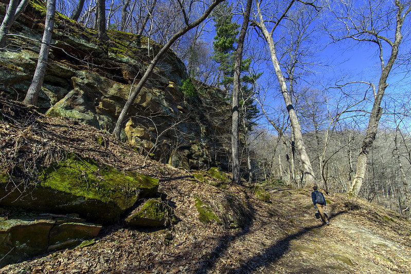
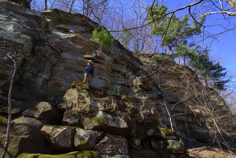
Fresh out of the Devil's Punch Bowl- the name of the previous canyon- we hiked along the foot of the sandstone cliffs toward Steamboat Rock. People can't resist climbing up the rockface for a better view of the surrounding area. "Real" rock climbing is not allowed, and is not a good idea on sandstone anyway, but these places seemed quite safe and worn from previous adventure seekers.

Half Way Up the Rockface

One of the best things about photography for me is the chance to get outdoors and enjoy nature. Every so often, you just need to stop and notice your surroundings, taking in the sights, the sounds, and the smells. It would be a shame to simply capture images without enjoying what nature really is.

Pausing on the Way Up

One of the benefits of hiking and exploring this area in early spring is the lack of leaves on the trees. You can see more of the rock formations when the trees are bare. Of course it's a bit less lush and green, but more of the distant features can be seen, and once found, they may deserve a closer investigation.

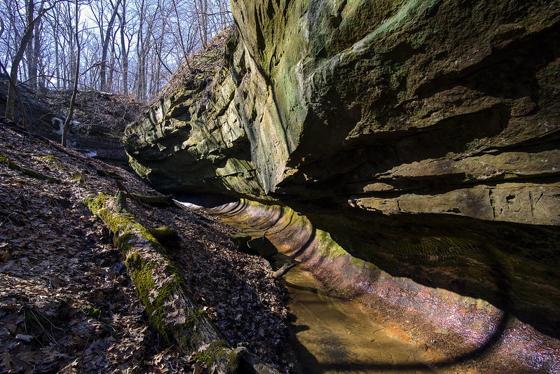
Wild Cat Den State Park's Undercut Canyon Wall

Walking the Undercut

Located 12 miles outside of Muscatine, Iowa, and about a mile west of the Mississippi River, lies Wild Cat Den State Park. This park is home to several small sandstone canyons, ravines, and some historic structures including a schoolhouse and a mill.

We began our morning hike on one of the five miles of trails, the one we thought would have the most interesting rock formations. Hiking the Punch Bowl Trail would take us through wooded ravines and canyons to a waterfall called the Devil's Punch Bowl. Before we explored the punch bowl, we headed to another interesting looking canyon with round, undercut walls. The undercut was most likely cut into the 300 million year old sandstone by rushing water.

Undercut Canyon

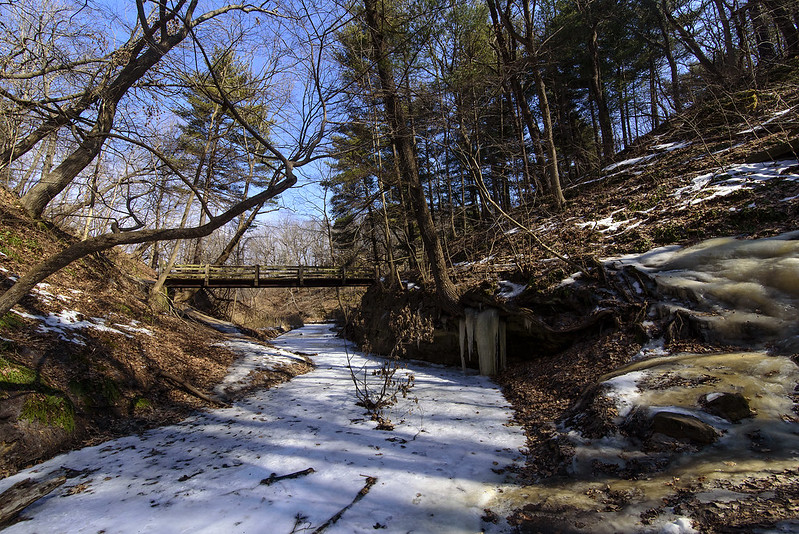
The shady canyon still showed signs of winter, with a frozen waterfall still intact. The bright sun and warm air was a big contrast to this winter water feature.

Undercut Detail

Hearing this park could be quite crowded in the warm months, and knowing some of these parks offer better views of the canyons when the trees are bare, we decided to visit in early spring. While the immediate landscape can appear a bit dull at this time of year, the surrounding landscape is visible without the foliage in the way.

This small canyon was just the beginning of our hike, and the rock features only got better and better as the day went on.

Sandhill Cranes

Sandhill In Flight

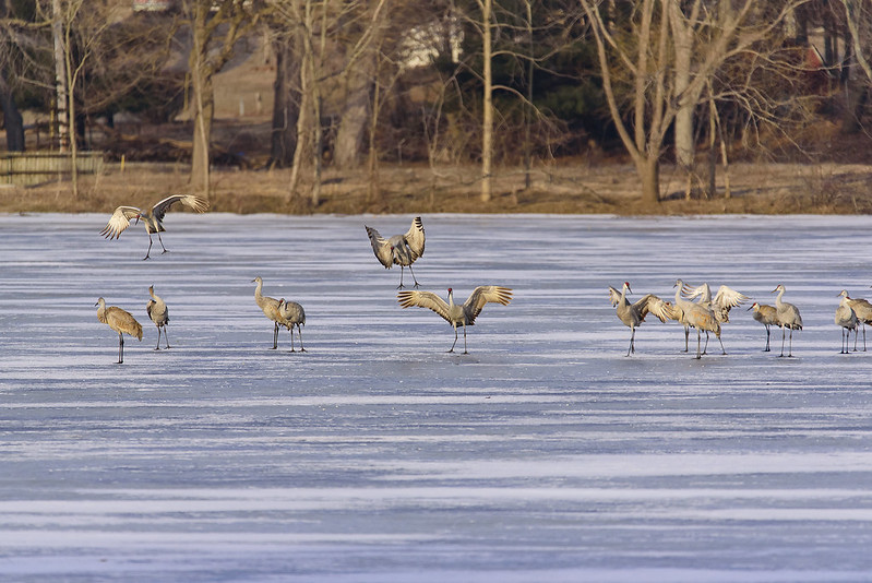
Each spring, thousands of Sandhill Cranes migrate through Indiana, and many make stops in rural LaPorte County. Hearing the calls late at night, I figured the cranes were spending the night on the frozen lake, and sure enough, in the dim light of the morning, I saw hundreds of cranes in two groups.

As the morning went on, the birds began leaving the ice, taking flight in small groups. Several flew directly overhead, so I couldn't resist capturing a few photographs.

Morning on the Ice

Their interactions are interesting to watch. In the photo above, the crane on the left looks over his shoulder to see another crane landing nearby. This was comical to me, as the groups of birds seem to communicate with each other on their way to the empty farm fields nearby to forage for food during the day.

Thousands of Sandhill Cranes pass through the area each year, and the Jasper-Pulaski Fish and Wildlife Area is a prime location to see them. The small lake in LaPorte County is about 45 miles northeast of that wildlife area, so that may be an indication of just how widespread the cranes are during the migration.

The cranes will linger in this area each spring for about three weeks or so, then the fields will be quiet again until next spring.

The Beginning of the Warm Up

The End of Winter>

A little over a week before spring, the frozen canyons of Illinois receive a day of sunshine, the beginning of the warm up that would quickly melt the remaining ice and snow. Temperatures began to climb into the 40s while hiking through Tonty Canyon, in Starved Rock State Park. Crackling sounds were echoing off the rock walls, from the ice moving, cracking, and falling as it warmed up.

A few more hours of sunshine, and the creek would soon be a hazardous place to walk, the ice would soften enough for someone to fall through. This would most likely be the last time for walking on the frozen stream that cuts through the narrow canyon.

Winter Creek

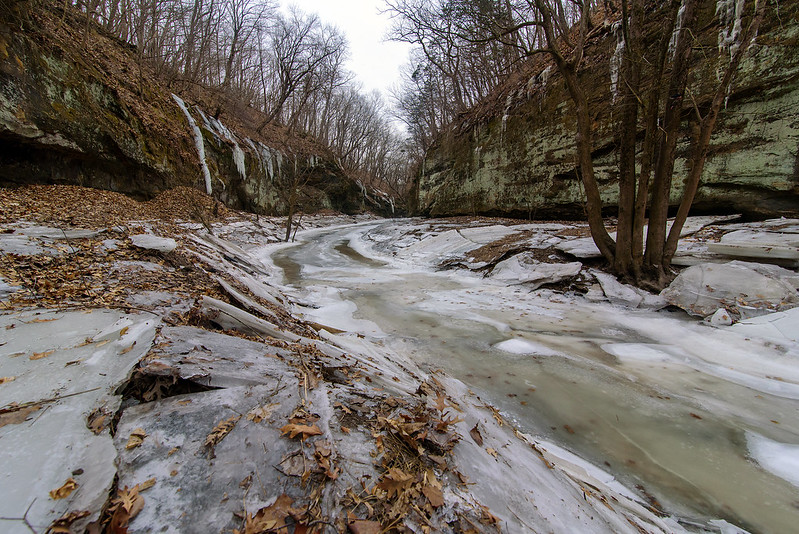
The stream in Matthiessen Park's upper dells was also frozen on this day. Evidence of times with higher water could be seen along the bank of the stream. Large blocks of ice litter the area, once the top layer of ice on the water when the stream was flooded. Once the water level lowered, the ice lost support, cracked and fell to the canyon floor. These blocks of ice were around five inches thick, and some as long as 10 feet.


Climbing Wildcat Canyon

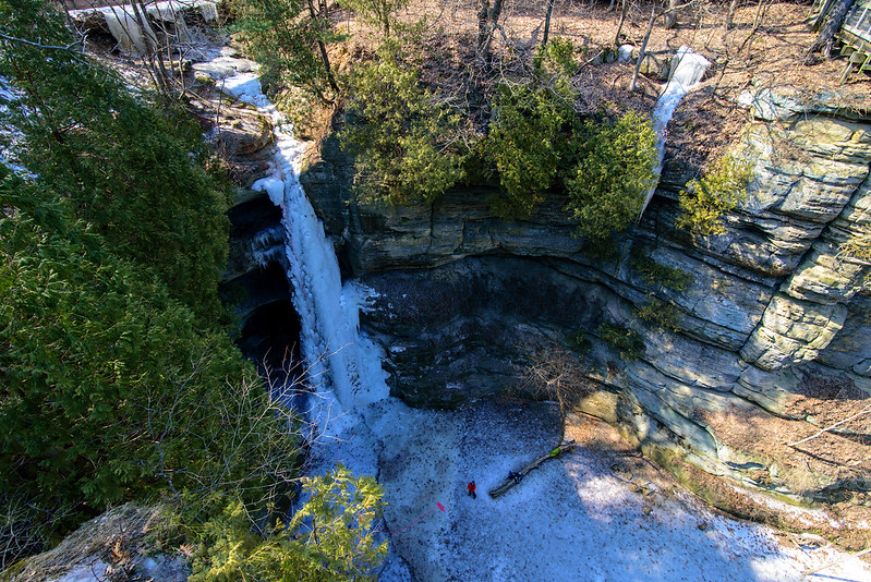
Above Wildcat Canyon

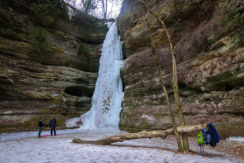
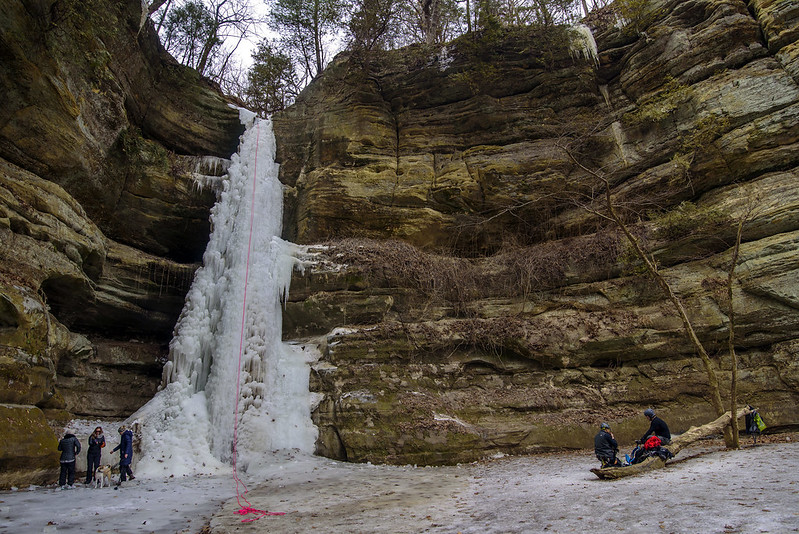
Each winter, the waterfalls in Starved Rock State Park freeze, creating beautiful ice formations that are fantastic to view, and when conditions are right, a lot of fun to climb. One of the most popular waterfall to climb is found in Wildcat Canyon. The 80 foot waterfall is a challenge many ice climbers can't resist.

Planning the Climb

This year, there were two frozen waterfalls in Wildcat Canyon, but the second looks a bit fragile, and probably was not strong enough to safely climb.

The waterfalls attract visitors all season, and the visitors are treated to an additional spectacle of people attempting to climb the slippery ice formations. Certainly not for the casual climber, ice climbing must be done using crampons, and ice tools similar to the ice ax used in mountaineering, but specialized for climbing. The difficulty of the vertical climb is increased by the cold air, the cold surface, and the constant running water around the ice. Keeping your arms over your head for long periods of time keeps the blood flow to them lower than normal, and this makes the hands colder and colder the longer you climb.

Resting Between Climbs

That said, ice climbing is certainly an appealing sport for those who crave adventure. The short ice climbing season in Illinois doesn't allow for much practice or time on the ice, but it does keep the passion alive and flowing all year long in anticipation of the next hard freeze.

Melting Lake Falls

The Melt Begins
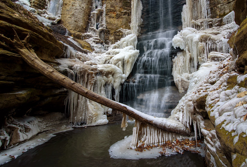
Winter is finally loosing it's grip on the frozen waterfalls of Illinois. Matthiessen's Lake Falls was running free on this morning, and the last of the ice remained clinging to the canyon walls, along the side of the rushing water.

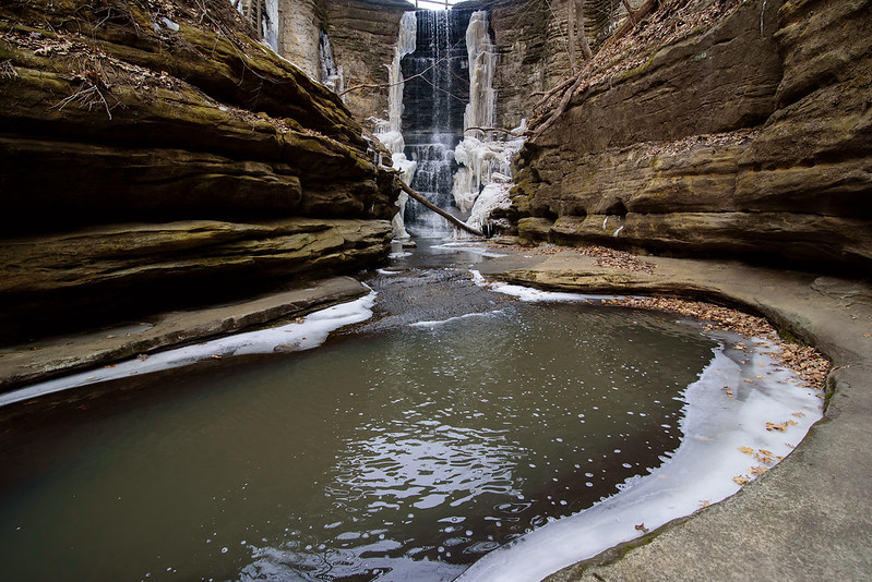
The canyon here is natural, however the waterfall was created when a dam was built between this narrow passage. The canyon floor is riddled with potholes and textures formed by rushing water of the centuries, so it helps to know where you're walking in winter - where are the shallow spots, where are the deeper pools. Stay to the right for the most part.

Thawing Lake Falls

This waterfall attracts plenty of visitors, and is a beautiful place to visit in any season, but Fall and Winter are the most picturesque.

On this day, I had the canyon to myself, in fact, I had the entire park to myself for about two hours when a few hikers showed up. Winter seems to keep people away because of the cold, but even when the weather warms up a bit, the packed snow trails of these canyons makes walking difficult and sometimes dangerous. A good pair of ice cleats is a necessity.

I would guess most if not all of the ice around this waterfall is gone by now, and while I enjoy visiting and photographing the canyons in winter, I'm looking forward to warmer weather and some life appearing outdoors once again.