Williamsport Falls

Williamsport Falls

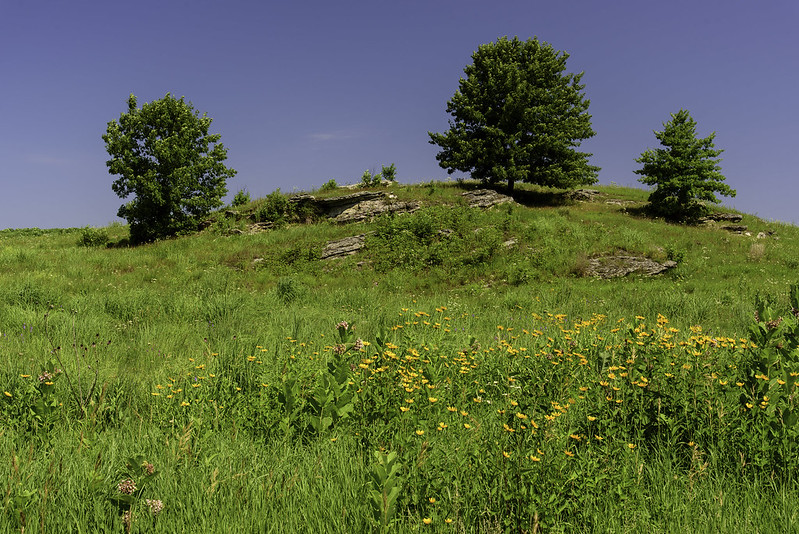
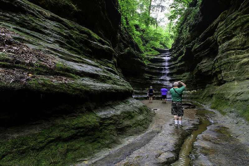
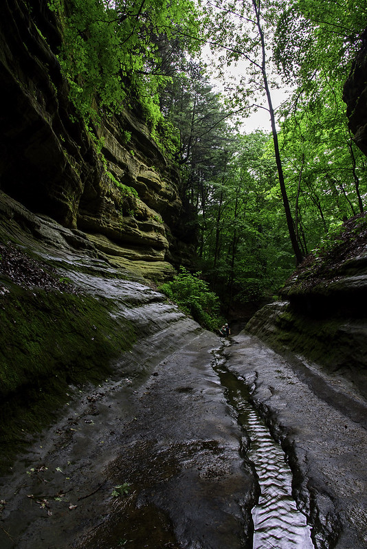
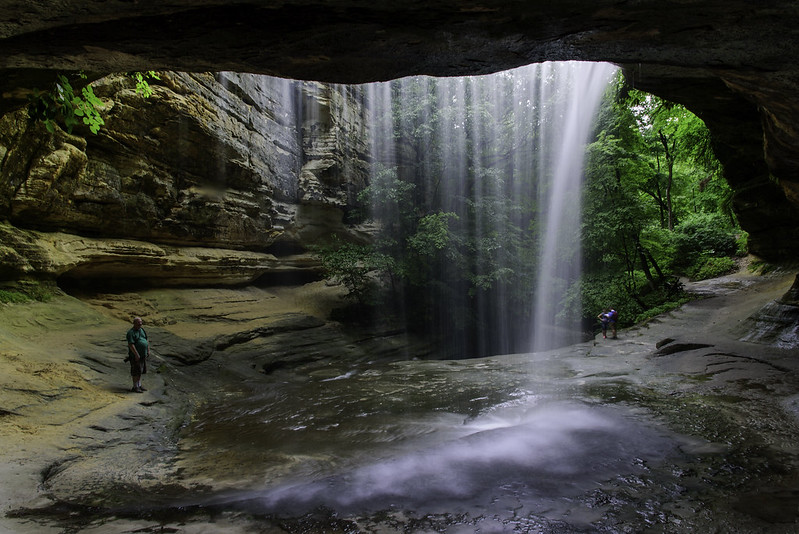
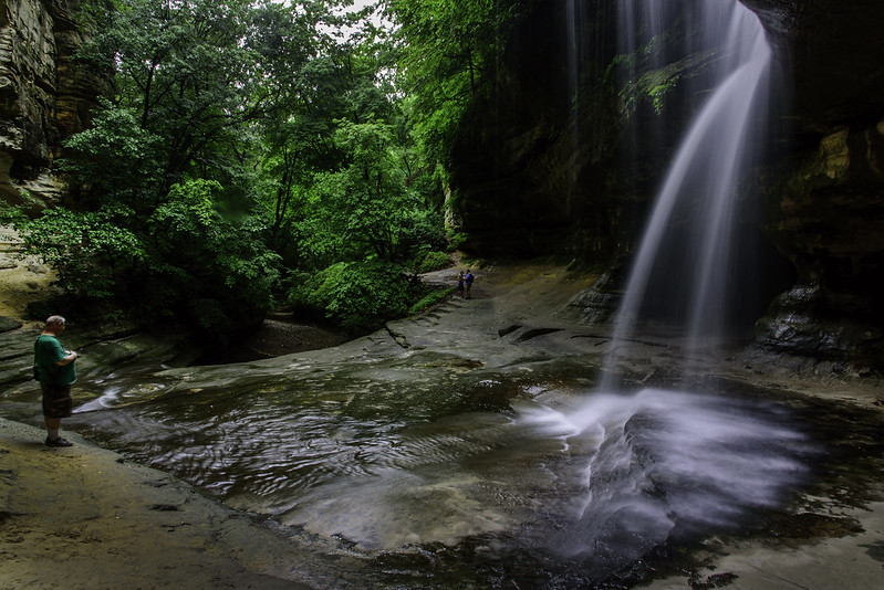
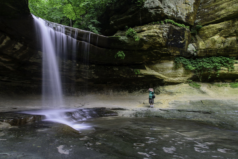
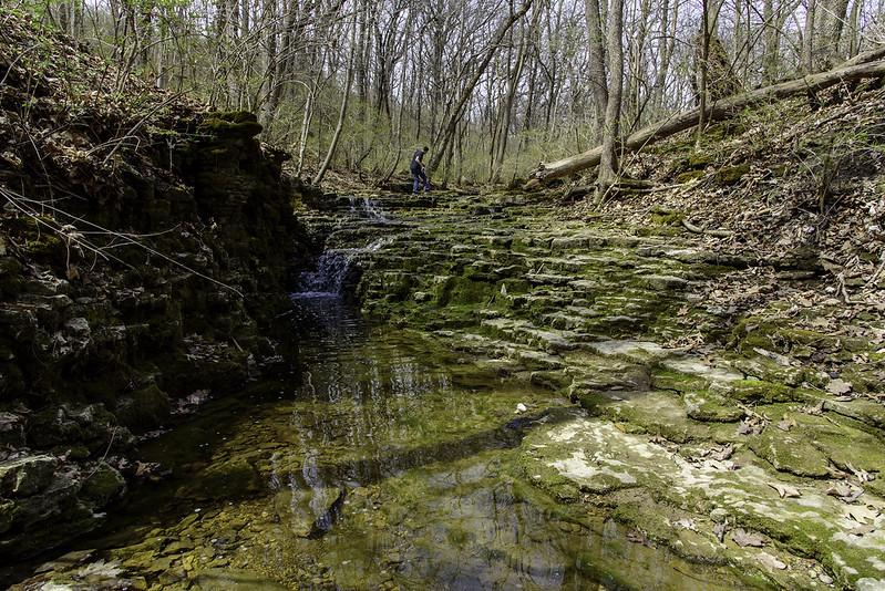
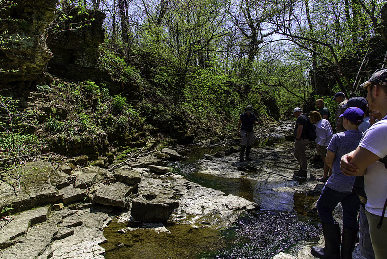
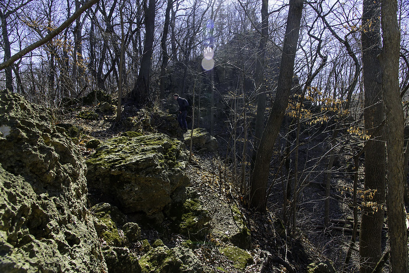
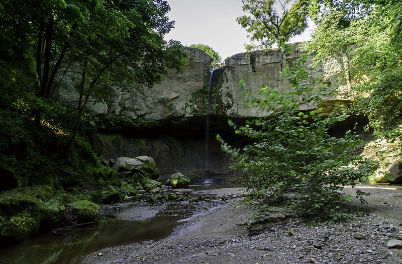
Said to be the tallest free-falling waterfall in Indiana, Williamsport Falls is located in the middle of the town of Williamsport, steps away from the old train station. It's a surprise to see such a canyon hidden right in the downtown area of a town. It's a short hike along what appears to be a steep old road through the woods, and down to the creek where you can hike a little way along the creek to the foot of the waterfall.

Williamsport Waterfall

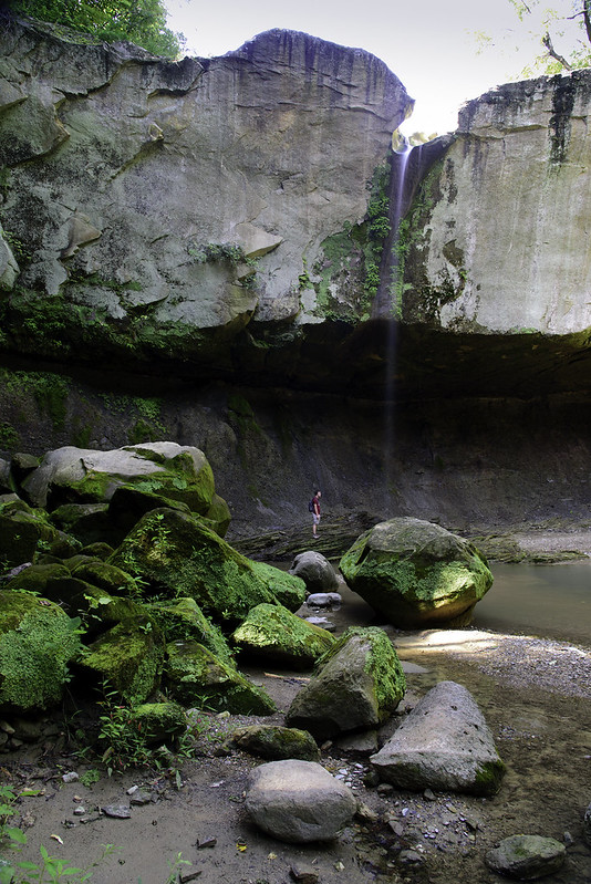
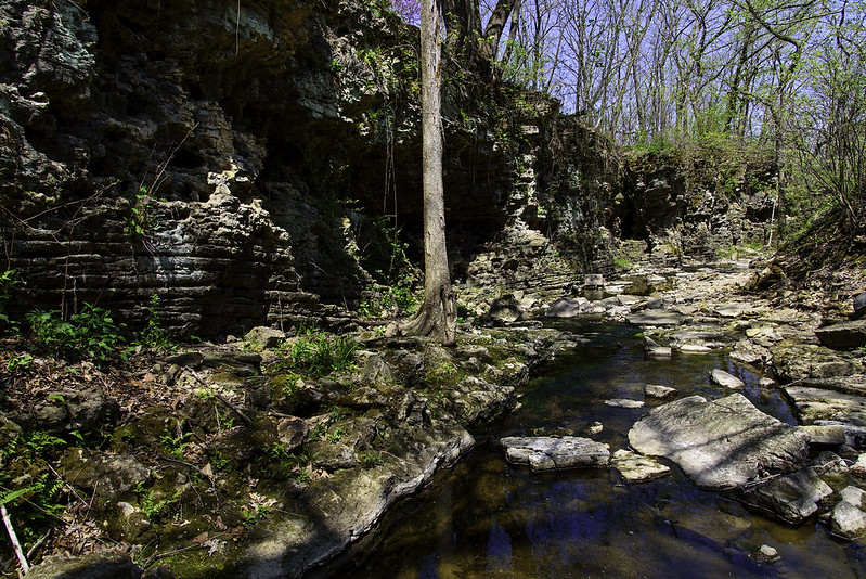
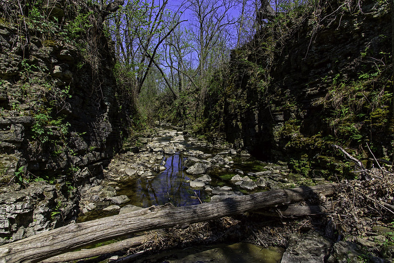
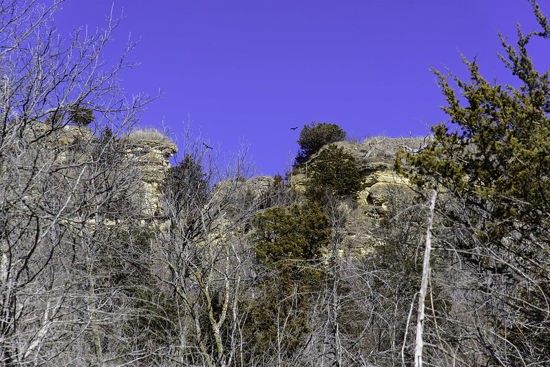
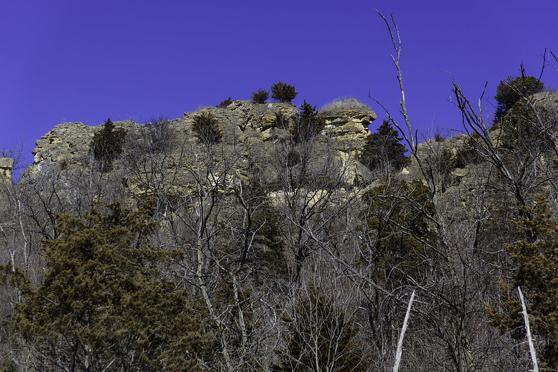
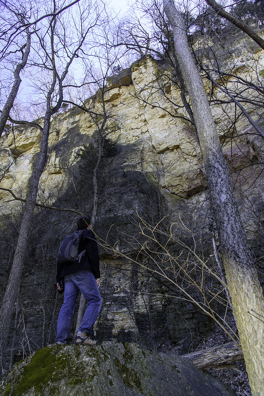
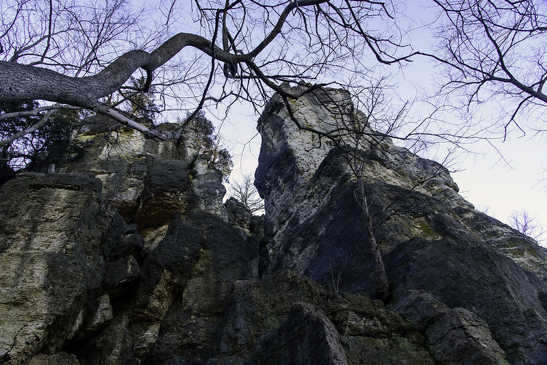
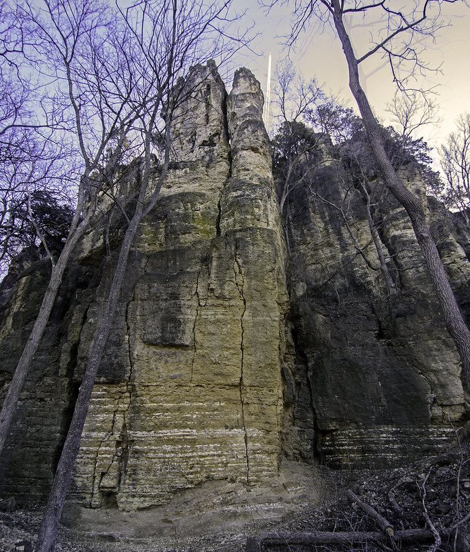
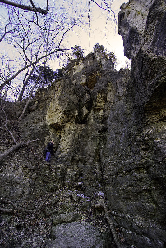
The sandstone cliffs are quite impressive, especially considering their proximity to the railroad an roads above. This area was quarried many years ago for stone blocks for the local buildings. This quarrying may have made the waterfall a bit deeper, but the creek appears to be at a natural level, so perhaps the cliff was simply cut back and not cut deeper.The waterfall is said to have a height of 90 feet, but it looked to me more like 60 feet or so, but of course, I didn't measure.

Sunlit Falls 
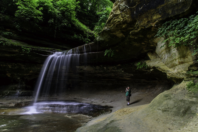
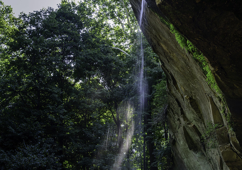
The depth of the canyon keep a bit of the direct sunlight off of the rocks and falls, but depending upon the time of day, the sun highlights the falling water against the thick woods beyond. Williamsport Falls is an easy to access waterfall that is certainly worth the detour from the more traveled parts of western Indiana.

First Quarter Moon

First Quarter Moon

As the moon "grows" larger in the sky, it reflects more light into the atmosphere, blocking out the distant and dimmer stars. Photographing the Milky Way, stars, or planets becomes more difficult, so I simply captured the cause of the problem - the moon.

This image was captured hand-held (no tripod) with a 600mm lens, with a 2x tele-converter attached. The tele-converter doubles the aperture, so this was capture at the lowest possible for this set up, F13. It's a good thing the moon is actually very bright, with an aperture that low, it's often necessary to bump up the ISO or drastically lower the shutter speed, which can introduce noise or camera shake.

In addition to the set up above, the camera was put into DX mode. This crops the image area when using DX lenses on a full frame camera. This "trick" increases the magnification of a lens by 1.5 times. So, the equivalent magnification here is 1800mm.

I prefer to capture images of the moon when it's less than full. The craters cast long shadows making them easier to see in the photograph.

Interdunal Pond

Interdunal Pond

Nothing beats a walk through nature on a summer morning. This view, while very close to industry and other activity, conveys serenity, and was the perfect side trip on our way to the trails along the dunes.

This area of the Indiana Dunes National Lakeshore was restored after industry left. Toxic remnants were removed during the restoration, including acid ponds very close to this spot. The dunes create valleys and in places, rainwater has no way of absorbing through the ground. The small bodies of water formed in these valleys are called interdunal ponds, and are often a haven for small animals.

This pond shows signs of animal activity - a few trails meander through the wetland in and around the pond. Other interdunal ponds in the national lakeshore are home to many more animals. They are generally larger ponds, out of view of a lot of activity. West Beach has one such pond that is just off the trail, but shielded from view; the wildlife can enjoy a bit of privacy there. The photo below was taken quite a few years back.

Interdunal Pond

Meteor Crossing the Milky Way

Meteor Crossing the Milky Way

The Perseid Meteor Shower of 2018 happened on a calm, clear night, allowing us to view the show - and comfortably I might add. While we only spent about an hour looking at the sky, we saw seven or eight meteors, but I was only able to capture three or four. Of course, where I pointed the camera was the wrong spot most of the time! 

I'm not a night sky photographer, but I do find it challenging to capture the Milky Way and meteors, and in the summer, I don't mind spending a long time trying to capture an image. The main problem is light pollution, and there's plenty of it around Chicago.  Even in rural LaPorte County, Indiana, Chicago casts a yellow light on the western horizon, and bluish tones to the rest of the sky when long exposures are attempted.

I have to settle for this image of the meteor, not the two long, bright meteors that passed just under my camera's view. There's always next year!

Sunset Rays

Sunset Rays

Following a rainy morning and early afternoon, the weather turned partly sunny for the rest of the day. Toward sunset, more clouds rolled in, and at different levels, creating the perfect pallet for the sun to create beautiful rays stretching high into the evening sky.

As usual, the rays only lasted a few minutes - changing every few seconds along with the colors in the clouds.

The location can be the same everyday, but the view is always different, and constantly changing.

Exploring Nachusa Grasslands

Outcropping on the Prairie

Just outside of Franklin Grove, Illinois, and a few miles from Dixon, lies 3600 acres of Illinois prairie. Much of it is in the process of restoration, but there are many rare remnants of natural prairie, savanna, and wetlands withing the boundaries.

Volunteers work to remove non-native species of plants from the grassland, and also plant native prairie plants and flowers. Visiting Nachusa gives visitors a glimpse back into Illinois natural history, before agriculture and the introduction of European and other non-native plants. This is what the real prairie was, and IS.

View From the Top

I have to admit, at first I was a bit lukewarm to the thought of exploring a prairie. I can think of flowers, bugs, and birds as subjects for photography, but not much else. After reading a bit about the prairie restoration, and realizing this wasn't like any "prairie" I've seen before, I was intrigued. Many of the plants I've come to think were prairie plants were actually invasive, and absent from Nachusa. I began to appreciate the prairie a lot more without these tall, spiny weeds I see everywhere else.

Another strong motivating factor was the fact that Nachusa allows - actually encourages- visitors to explore on the trails AND OFF. You can go where you want. If you wish to walk through the 4 foot tall plants to see the rocky hill, go ahead. They even encourage you to wade or swim in the creeks along some of the trails. Where else can you do that?!

Most state parks discourage and fine visitors for wandering off the trail - this is so refreshing. My son had the right response to allowing people to walk anywhere in the prairie: "Two feet walking through the prairie will do a lot less damage than the bison that roam here."  And there are bison here, around 100.  The bison areas and the crumbling rocks are the only places off limits to visitors - that makes sense, it's for their own safety.

The Only Shade on the Prairie

I never really thought of prairie as having rolling hills or rocky hills sprinkled around every so often, but this is real Illinois. I'll bet these rocky areas prevented people from farming them - and in doing so, kept them intact for the Friends of Nachusa to preserve, restore, and share with everyone.

French Canyon

Blind Canyon

One of the closest canyons to visit in Starved Rock State Park is French Canyon.  Just a few hundred meters from the parking area, it's a popular destination for visitors.  However, the narrow canyon makes it just a bit tricky to walk up a short portion of the stream. The canyon narrows to about 4 feet, and the running stream to about 18 inches, so one must walk in the water to access the end of the blind canyon and see the dramatic waterfall.

While only your shoes will get wet, you can climb up without getting any water on you what so ever.  Pressing a foot against the right side of the canyon wall, then quickly pressing the other against the left wall, then repeating.  This way, you never set foot in a drop of water.  Winter... that's a different story.

Narrow Canyon

The waterfall is known for the multi-level cascade where the water never leaves the rock face. This creates a spectacular frozen sculpture in winter, and a soothing fall all year round.

Visiting the Falls in LaSalle Canyon

Through the Falls

The recent rainfall in Illinois increased the amount of water falling in the canyons of Starved Rock State Park. The waterfall in LaSalle Canyon is a popular destination for hikers, and the trail goes behind the falls. The view through the falling water is not seen that often in the other canyons of Starved Rock, so this is a treat for visitors.

Visiting LaSalle Falls

The rain certainly kept a lot of people away from the trails, but we encountered a few people here and there on our four hour hike. The trails do get a bit slippery when they get muddy, but I was surprised they weren't soft and impassible.

Falls at the End of LaSalle Canyon

The lack of crowds allowed us to concentrate on photographing details we would often pass by. The big waterfalls are always captured, but some of the small falls are quite interesting as well.

The Waterfalls of LaSalle Canyon

LaSalle Canyon in the Rain

The rain let up just before we arrived at Starved Rock State Park, allowing us to view the waterfalls at their full flow. Summer often dries up most of the waterfalls, and leaves the others dripping a trickle of water to the canyon floor, but luckily they were all flowing for our visit.

LaSalle Canyon rarely disappoints in any season.  In winter, the falls are frozen and create an ice cave under the overhang of the canyon wall. In warmer months, the trail through the canyon runs behind the waterfall, allowing visitors to see the canyon through the flowing water.

First View of LaSalle Falls

The canyon isn't difficult to access, but it is about equidistant from the two main parking areas, making it a bit less crowded than most of the canyons closer to the trailheads. The distance doesn't keep everyone away, as this is still one of the most popular canyons in the park.

I'm often in this canyon during the winter months, so it was a rare experience for me to see the lush, green plants surrounding the canyon.

Photographing the Falls

Another surprising thing was the lack of mud on the trails we followed. Some areas were a bit soft and slippery, but mostly, they were surprisingly hard packed and easy to hike.

Color Returns to the Dunes

Lupine in the Woods

Following a colder than usual spring, the colors and flowers are back again along the rolling dunes of the Indiana Dunes National Lakeshore.  A large cluster of wild lupines blooms just over the ridge of a wooded dune, just a few yards from Lake Michigan.

The Trail Ahead

Following the path through the woods, we came to a vast open area of Marram Grass dotted with shrubs. The open space, while not filled with blooming flowers, was deep green, with blue Lake Michigan beyond. This open area leads to a very large blowout facing Lake Michigan, which is now off limits to visitors.  A blowout is an area of the dune devoid of vegetation, so it begins to erode, creating a sort of depression in the dune.  These are naturally occurring, and not necessarily created by people walking on the dunes, yet, the park seems to close them all with hopes of stopping the erosion.

A Line of Puccoon

Crossing the backside of the blowout, we headed back toward the beach and Lake Michigan. On the journey, familiar clumps of yellow flowers appeared all over the landscape. These flowers are called Puccoon, and were once used to make dyes by native people of the area. Some varieties have also been used for medicinal purposes.

Most of the flowers of the Indiana Dunes blossom for just a short period of time, so make sure to visit often to see as many as you can.


Canyon Waterfall

DuPage Waterfall

Waterfall Glen forest preserve is known for miles of hiking trails and a popular waterfall almost everyone loves to visit. But that popular waterfall is not what it seems, it's a man-made waterfall built in the 1930s.  The real attraction at Waterfall Glen is the lesser known waterfall (unknown waterfall) referred to as a secret waterfall.

This eight foot high fall is the only natural occurring waterfall in Waterfall Glen - and, reportedly, the only natural waterfall in DuPage County, Illinois. The park does not publicize the actual location of this waterfall, in an attempt to keep it secret and pristine. While locals have visited the area for decades, they've respected the land, and kept the location to themselves.

Hiking the Falls

The creek is quite a distance from the popular hiking trails of the rest of the park, and even farther from any parking area outside the park. I'm looking forward to visiting this waterfall in all seasons, especially winter.

Before you ask - NO, I'll also keep the location of this waterfall a secret.

Sagawau Canyon

Dolomite Canyon

Sagawau Canyon near Lemont, Illinois, is Cook County's only natural canyon, and a protected environment. It's not only a protected area to save the intricate dolomite canyon walls, but the canyon supports some rare and endangered plants and even some wildlife - a micro environment for some interesting life not common anywhere else in Cook County.

Sagawau Canyon Tour

The canyon is open to visitors during scheduled naturalist-led tours, which run periodically from Spring to Fall. The tour lasts about two hours, and touches on the geologic history of the region, as well as the plant and animal life found in the canyon. The tours also stress the importance of walking carefully through the canyon to avoid damaging the rare plants - something I do anywhere I hike, regardless of the plant species.

Sagawau Canyon

While not a strenuous tour, some of the rocks in the canyon are loose and slippery, so it's not unlikely your shoes can get wet, especially after a rain. Wooden stairs lead into the canyon, and natural dolomite stairs lead out, which can be challenging for those who may not be used to climbing steps greater than 14 inches tall.

Sagawau Canyon is certainly a Cook County gem, and well worth the visit. Check their website for canyon tour dates, and stop by to hike the grounds until 4pm daily.

The Restricted Cliffs of Hanover Bluff

The Cliffs of Hanover Bluff

The tall stone cliffs of Hanover Bluff Nature Preserve seen from afar. The area is now restricted, and not open to the public. We wandered around the area for quite some time, looking for an open trail, but were not successful. A DNR officer happened to drive by so we flagged her down and asked about access, and were told the area is no longer open to the public because of fragile and endangered species in the area.

We continued our walk down the dirt road with hopes of seeing some cliffs, and we did find a few.  It seems the outer cliffs were the only ones that could be seen from the public road. Beyond these cliffs, another row of cliffs exists with a flat, low area between them. There was at one time some sort of mining operation in this area, and that may have created the dual bluffs seen today.

As we walked along, we noticed plenty of large birds flying around the bluffs, without worry about any human bothering them.

 The Outer Cliffs of Hanover Bluff

It was pretty disappointing not to be able to explore the area between the bluffs, but at least we did get to wander through the areas that were not restricted, and take in the views of the area below.

Perhaps one day the area will open again to the public.

The View From Hanover Bluff

The SVAD From Hanover Bluff

After a long hard climb to the top of the bluff, we were rewarded with a fantastic view of the valley below. No trails led to this open area on top of the wooded bluff, well over 100 feet above the flat Mississippi River valley, but we managed to navigate our way up and find the only clearing on the bluff,

This portion of Hanover Bluff is part of a large wooded series of rolling hills and stone cliffs. Most of this area is restricted, so the public is not allowed to enter. The areas we were initially looking for were clearly marked "Restricted" so we continued until we found an area that was not closed to hiking. While we weren't able to explore the rocky cliffs we came so far to find, we did manage to find an elusive clearing with a great view.

High Above the Mississippi Valley

Below us was the old Savanna Army Depot (SVAD), a sprawling military installation used between 1917 and 2000. Zooming into the images here, you can clearly see dozens of buildings in this installation. Even farther away are farms across the Mississippi River in Iowa.

This area was very difficult for us to reach, the hills were very steep, and at times, we slid down uncontrollably, only to have to climb back up. Ever careful of stepping on plants or small creatures, we slowly made our way up until we reached the clearing.

With every intention of climbing the rolling, wooded hills all the way to the rock cliffs, we headed toward their general direction with no trail or markers to follow. A short distance later, we encountered another "Restricted" sign; this ended our exploration for that particular hike. A future hike in the area is planned, and with any luck, we'll received authorization to explore the restricted areas including the rocky cliffs of Hanover Bluff.

Upton's Cave

Exploring Upton's Cave

Following a narrow trail worn into the side of the sloping ground at the foot of the tall, stone bluffs, we eventually came to Upton's Cave. Driving past this area in winter helped us find this cave; every other visit was in the warmer months where the dense foliage obstructed the view of the cave.

Not a very large or deep cave, it was interesting to explore it a bit. The only worry was a cave-in due to the explosive demolition of the nearby bridge to Sabula, Iowa. The cave itself was about 20 feet deep, then it narrowed and the opening shrank, but again opened up to another small room.

Entering Upton's Cave

It seems this cave has an interesting history. It's been said the cave is named after a man who hid from attacking Native Americans. The very small settlement nearby the cave was attacked, and Mr. Upton was out hunting at the time. He hid inside for a couple of days, until it was safe to head out.

View From Upton's Cave

Locals have visited the cave for decades, and surprisingly, there is little trash or graffiti inside. The Mississippi River is in view the entire hike along the base of the bluffs, but the view of the river from inside the cave is somehow more striking.

Hiking the Foot of the Bluff

The Bluffs From Below

After investigating the Twin Sisters, we found a little used trail that followed the foot of the bluffs running parallel to the Mississippi River. While a few hundred feet away from the river, we were still in view of it the entire time.

These trails have been used since the Native Americans used them. Some were improved by the CCC (Civilian Conservation Corps) in the 1930's, and this one seems as though it hasn't been touched since then. Hardly recognizable as a trail in some places, it's obviously not used too often - it's March and I walked into numerous spider webs, so I was the first person to walk here since September perhaps.

Deep in the Valley

The narrow trail was cut on the slope of the hill at the foot of the bluff, right in the center, and at times there was little level ground beneath our feet. We noticed evidence of a trail every so often, a board here or a post and rail there, but nothing really until we encountered a rotten foot bridge across a gully.

Hiking Between Twin Sisters and the Sentinel

Every so often we could spot fossils in the bluffs, and we'd stop to investigate for a while. We also found a few small caves with some interesting local history connected to them. One in particular we heard about, and just had to keep hiking until we found it. Almost all the way back to the town of Savanna, IL, we finally found and explored the cave called Upton's Cave. A bit about that soon.

Twin Sisters

Twin Sisters at the Palisades

For some reason, the Twin Sisters rock formations were always elusive to us on our many trips to Illinois' Mississippi Palisades State Park. I've tried to find these formations a few times in the past, and each time I've missed them.  I thought I followed every trail, but apparently not.

On this visit in winter, there were no leaves on the trees, allowing us to easily see these towering rocks from a distance.  We spent a bit of time exploring the parts of this park we haven't yet seen. There is a lot more than I initially thought, and some very interesting things to see.

The Other Twin Sister

The Twin Sisters are described as two human-like towers of rock sticking out of the forested bluffs.  Human-like is a bit of a stretch, but they are rather impressive when you stand near them.

Some of the trails leading to and around these formations seem quite old, and as I read a bit of the history on this area, Native Americans created many of these trails while hunting in the area. Of course, they were improved a bit over time for everyday hiking, but one trail in particular leading from the Twin Sisters to Upton's Cave (coming up in the next post) shows little modern improvements.

Evening in Fulton, Illinois

Mighty Mississippi Sunset

The Mark Morris Memorial Bridge spans the Mississippi River between Fulton, Illinois and Clinton, Iowa. Also called the North Bridge, the steel truss glows as the sun sets on a cold, late winter evening. Situated near the center of Fulton's waterfront, Kiwanis Park and the riverwalk offer views of the Mississippi River and the bridge.

Another attraction along the waterfront of Fulton is the Dutch Windmill, called the De Immigrant Windmill. The fully functional 100 foot tall windmill was built in the Netherlands and shipped to Fulton where it was erected by Dutch craftsman. The windmill was dedicated in 2000, and has become one of the most iconic attractions in the area.

Fulton Windmill

The setting sun gave us some interesting color in the sky, as we watched white pelicans fly overhead, looking for a place to rest overnight.

Hanover Bluff Nature Preserve

Apple River Bend

Always on the lookout for new places, we came across Hanover Bluff Nature Preserve, near Hanover, Illinois. Our expectations were to find rock cliffs and bluffs, and we began our hike from a small parking area, and walked the mowed trail for quite some time.

Coming across some interesting hills, a lake, and the Apple River, we kept hiking until the trails ended, and the land ahead proved too flat for bluffs.

Apple River Valley

Not finding any bluffs or rock formations, we still enjoyed the views of the rolling farmland beyond the river and the small lakes. While still in late winter, the area gave off the feeling of springtime, and the flocks of robins and calling blackbirds made it all the more like spring.

This area is open to the public for hiking, fishing, and hunting, but one must double check the hunting schedule prior to visiting. Wandering into a wooded area during hunting season can be dangerous.

At this time of year, we were the only people in sight, no crowds, no noise, and surprisingly, no trash anywhere.

Hiking in Hanover

The Sentinels

Beneath the Sentinels Rising around 180 feet above the Mississippi River, the limestone bluffs called The Sentinels are one of the interesting rock formations of the Mississippi Palisades State Park. Located at the north eastern part of Illinois, right on the Mississippi River, the state park offers sweeping views of the countryside, the river, and nearby Iowa. The park allows rock climbing at times, and it appears to offer some challenging climbs. The Sentinels are two, tall spires of rock, separated from the rest of the bluff about 10 feet, making them free standing, and able to be climbed from different faces. The Sentinels The lines in the limestone show the geologic history of the driftless area of Illinois, the area of northern Illinois spared from the scouring glaciers. The rocks in this area are unusual here, as most everywhere else in northern Illinois they were destroyed during the ice age. Distinct bands toward the bottom contain completely different contents than the rest of the bluff, deposits such as these are of interest to the amateur geologist in our group. climbingsentinelssm
A bit of easy climbing to view the rock deposits and fossils contained in the bluff was in store. This bluff seemed to be crumbling a bit, and was closed to any "real" climbing, but our climbing was limited to the easily accessed areas of the Sentinels bases. Exploring the Sentinels
Some snow and ice was still in place on this cold morning, not what we expected because it was relatively warm over the last few days. But deep in the forest and in shaded areas, ice remained, making the hike to see some of these formations a bit tricky. In all the years we've visited the Mississippi Palisades, we never explored the Sentinels. Most of our visits were during the summer, when trees and leaves blocked the view of the formations, keeping them out of site from us. The bare trees allowed us to see these and investigate them in detail. As with many of the places we frequent, we always notice things we haven't seen before. They may not be as prominent of these, sometimes tiny or hidden, but they always keep us interested, and eager to return.