High Above the Frozen Shore

High Above the Ice 
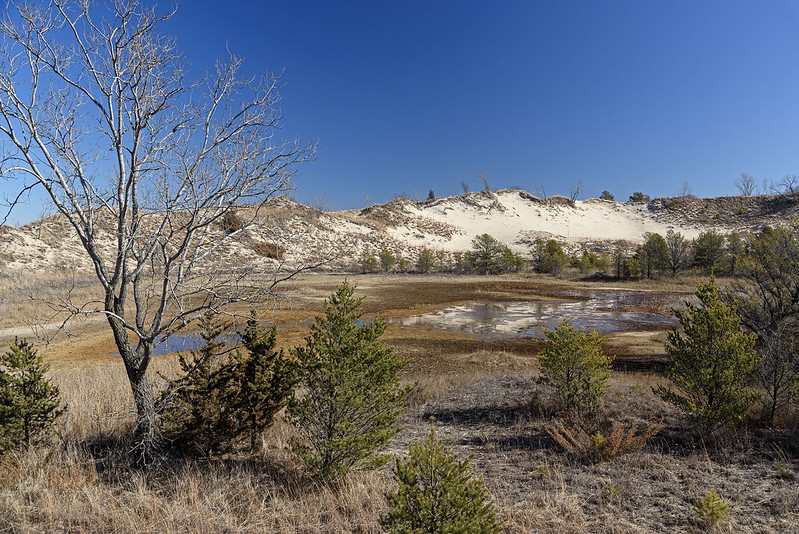
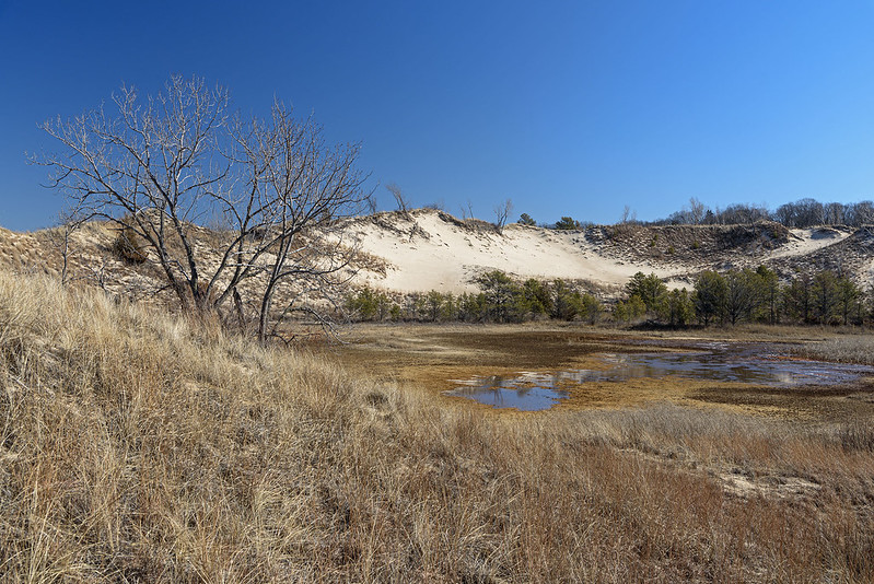
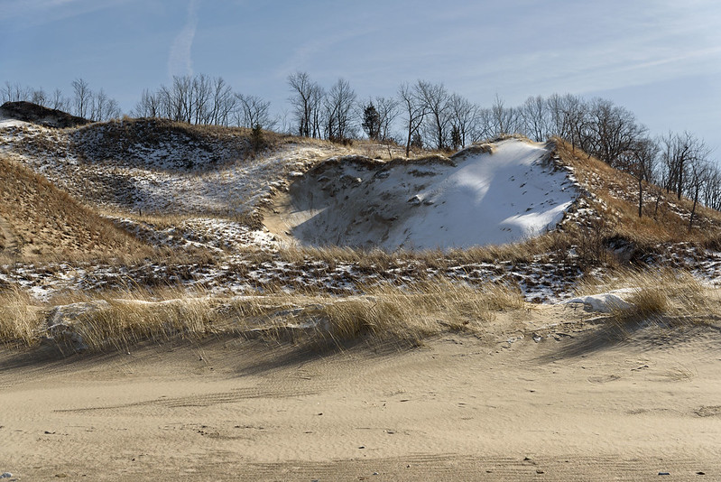
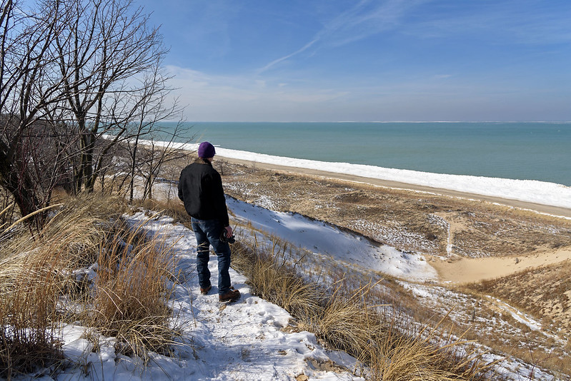
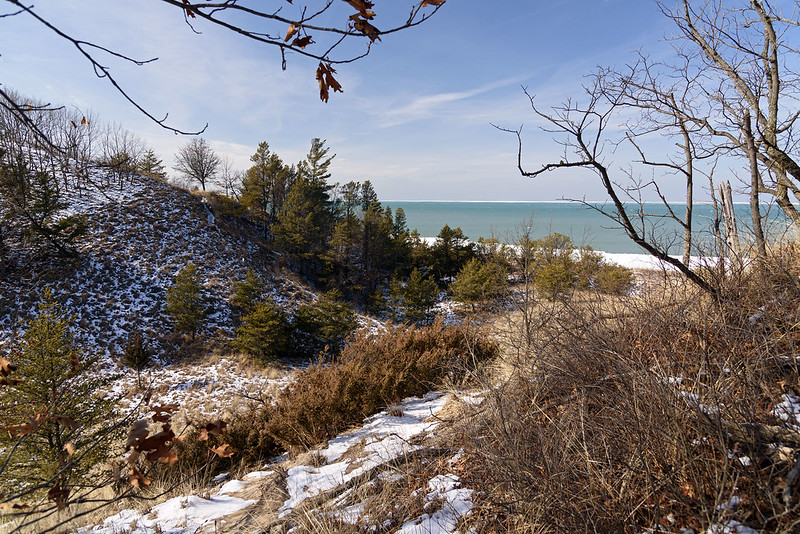
Walking on the beach when there are mounds of shelf ice on the shore is quite the experience; you're surrounded by dunes and ice - even the sound is muffled. But what's even more interesting is viewing the shelf ice mounds from above. Of course you can't climb the ice mounds safely, and most of the dunes on the beach are closed to hiking, but the few areas that are allowed certainly guarantee a fantastic view. 

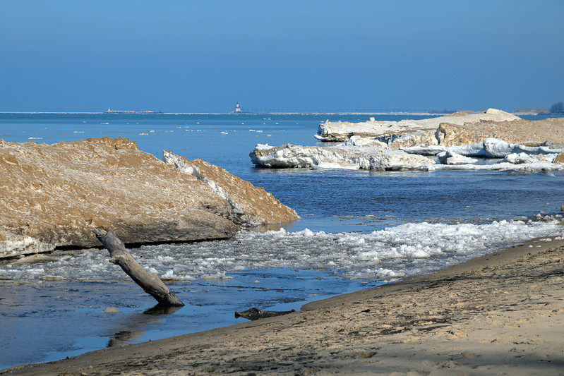
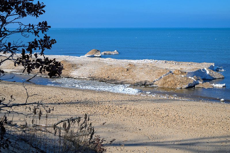
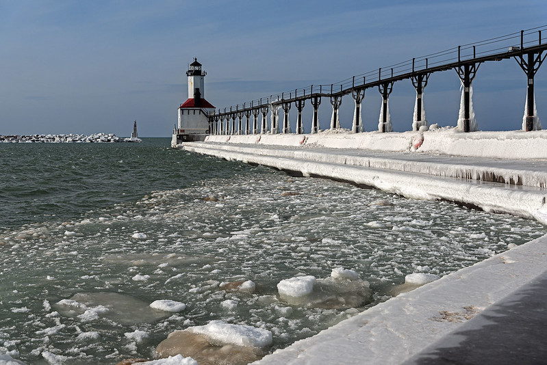
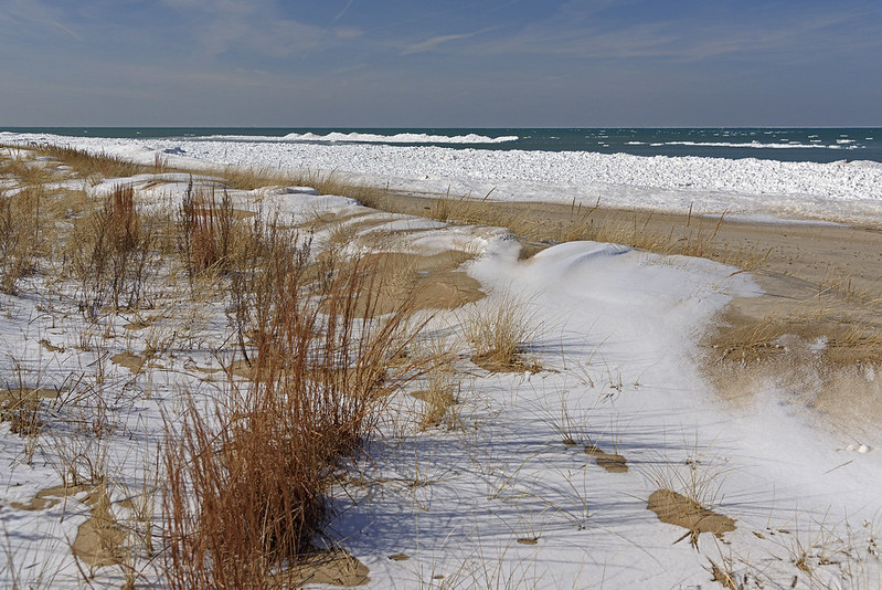
With the ice melting this week, a lot of the chunks were floating away from shore, and being this high, you could see white ice almost to the horizon. As the breeze blew, the ice slowly moved away from us, only to be deposited somewhere along the shore when the winds change.
  Frozen Overlook 
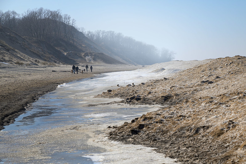
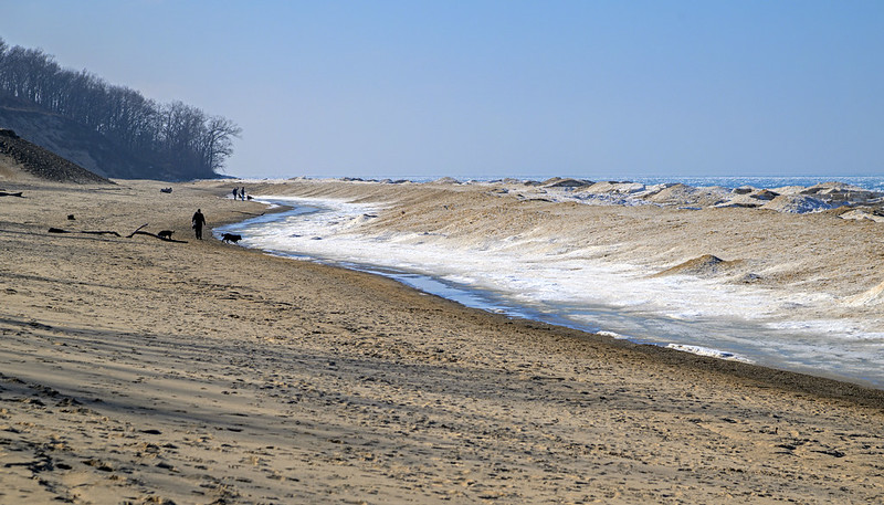
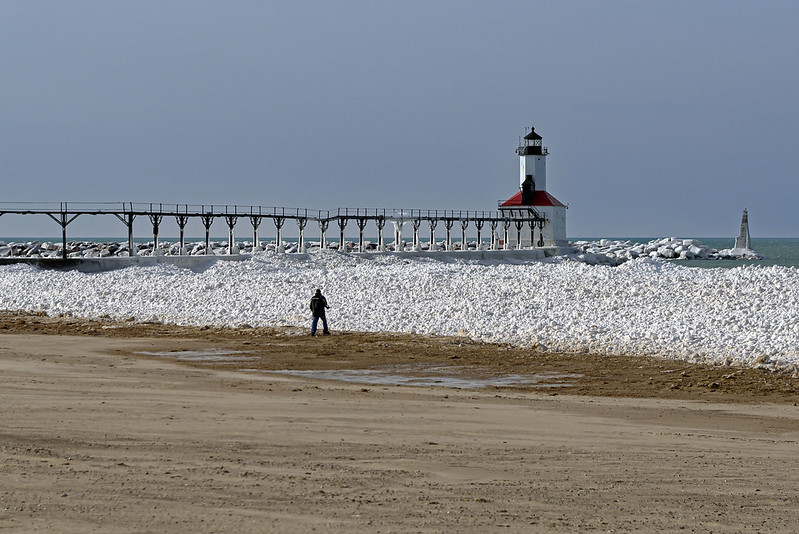
Depending upon the angle of the sun, the trees at and near the top of the dunes cast shadows on the beach below. It's often difficult to get a sense of scale in such an environment, but the visitors walking their dogs give an idea of just how high the dunes are, and how vast the beach and lake really are. 

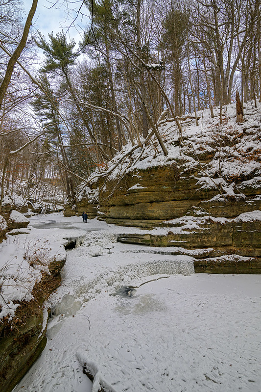
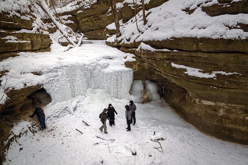
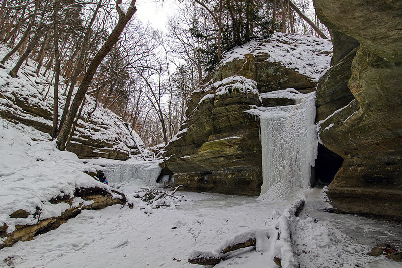
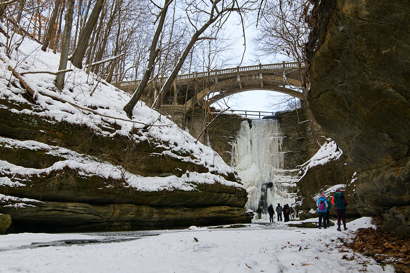
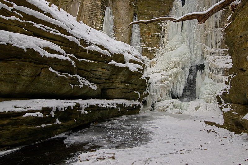
There isn't much time left to see these ice formations, I suspect they'll be broken down in a week or so. Now is the time to head out to see them for the last time until next winter.

Winter Stroll on the Beach


Winter Stroll 
 A welcome visit by the sun helped warm things up the newest national park, and people headed to the beach for a leisurely stroll. It's odd walking on the beach at this time of year, first because practically nobody visits the beach in winter, but also because you're sandwiched between sand dunes and ice mounds, and the shoreline is pretty much a valley between the two.

 Even though the sun was shining, at times the ice and cold water of Lake Michigan created some fog that hung around the dunes. The fog appeared and disappeared a few times as the afternoon progressed.
  Wide Beach 
 Two years ago, the Park Service introduced fees to visit the Indiana Dunes National Park. Sure the money will go into park improvements, but I highly doubt anyone was happy about the fees, especially those people who live close by and visit almost daily to walk their dogs, or just unwind on a walk by themselves. 

I haven't seen too many empty days here, so it would seem people are paying the fees - or they simply take their chances by parking without a valid park pass. My best guess is that locals do the latter judging by the lack of hangtags in the cars.
  Leftover Snow 
 In a matter of days, the rest of this ice will melt, and the waves of Lake Michigan will once again pound the shore, moving the sand, rock, and logs, in a dance that takes place day after day, month after month, and year after year - no matter who visits the park.

Ice Breakup at Kintzele Ditch


Breakup at Kintzele Ditch 
Several days of unusually warm weather is taking it's toll on the shelf ice along the Indiana shore of Lake Michigan. Formed by very cold weather and pounding waves, the ice mounds build rather quickly in stretches of frigid weather, at times piling up 15 feet tall and extending into the lake hundreds of feet. 

Temperatures in the 40s often begin the melting process, even though the water is still 34 degrees, the ice breaks up. The running water of Kintzele ditch assists this process by eroding the ice quickly, and the chunks broken off the mounds collide with other ice, breaking more and more ice away.
  Shrinking Ice 
Unlike last weekend, the sun was out in full force this day, brightening up the ice and deepening the blue waters of Lake Michigan. It's hard to believe people will swim in this spot in just a couple of months time. 

The sunshine brings a warmth to the view, even if the temperatures at this time were only in the 30s Fahrenheit. Walking between the dunes and ice, you are blocked from most of the wind, and for all by two minutes of hiking, I was ready to remove my coat. Once we climbed the dune to the Central Beach access, it was cold again. Layer are the key, they can be removed and added quickly.
  Shelf Ice Remnants 
Getting a bit of height over the shelf ice mounds, the lake and floe ice come into view. When we arrived at the beach, there was a lot more floe ice floating just off shore. But within a couple of hours, the breeze blew most of the ice west. It's interesting how you don't notice the ice moving as you look into the lake; just like clouds, they're always moving and changing but you really don't notice the movement unless you pay close attention.

The Upper Dells in Winter


Upper Dell Canyon in Winter

Matthiessen State Park's canyons are referred to as Dells; there are upper dells and lower dells. If you look up the term "dell" it means a grassy hollow or dried stream bed, often covered in trees. The landforms of Matthiessen are nothing like dells! They're certainly more like canyons, steep walls of rock, flowing streams and waterfalls, not small "u" shaped valleys formed by long gone streams. I suspect the terminology was carried down from Wisconsin's own Dells, where steep rock walls line the river. 

Whatever you call them, they're spectacular to visit at any time of year - especially when the weather is cold enough to freeze the waterfalls flowing over the canyon walls.

  Giant's Bathtub 

 My unofficial count of waterfalls in Matthiessen is 9, including the popular falls everyone sees, and some that are off the beaten path (a couple on no paths whatsoever that take a bit of climbing to view). I've been unable to find any document listing all of the names of the waterfalls and canyons, even looking at historic items from when the park was called Deer Park. Lake Falls, Giant's Bathtub, Cascade Falls, Devil's Paintbox are commonly viewed and well known, but if anyone knows the names of the other falls throughout the park, let me know.

Dunes of Snow and Ice


Blocking the Shore 
Walking along the Indiana shore of Lake Michigan, one can't help but notice tall sand dunes. They extend for miles and miles, and often well inland in some places. There's something very interesting about visiting in winter, you have dunes on both sides of the beach! The natural sand dunes are on one side, and the dunes made of ice and snow are on the other, and you walk right down the center of them in a sandy valley that is actually the shore of Lake Michigan. 

I've often thought these mounds of shelf ice give visitors the impression they are high above the Alps, looking down at the snow covered mountains. Framed correctly, a portrait taken here could be mistaken for one taken in a mountain range.
  Dunes of Snow 
 If you're high enough to see over the mounds, Lake Michigan's waves can be seen battering the windward side of the shelf ice, you can see just how these mounds are built - one splash at a time. The Michigan City East Pierhead lighthouse is also able to be seen on the horizon, dwarfed by the ice and high waves.

Capturing the Ice at Kintzele Ditch


Capturing the Ice at Kintzle Ditch 
A frequent hike for us along Lake Michigan is from Central Beach to Kintzele Ditch, a stream flowing between dunes into the lake. It's ever-changing, and especially interesting in winter when the ice and snow create all sorts of creations. 

Knowing the beach and this area is key to keeping dry (and safe) because the stream changes course on the beach due to wave action. One week the stream flows directly into the lake, the next week it jogs right for 200 feet, then the next it's left 100 feet. One must be careful not to walk on any ice that forms on this stream, it's always thin, and because the water level changes so often, it's often hollow beneath. Fall through and you'll be wet up to your knees - unless you trip and you'll be soaked from head to toe with a mile walk back to the parking lot.
  Above Kintzele Ditch 
 No matter how easy or challenging the hike might be (depending on conditions), it's always worth the trek. It's a bit off the well-beaten path of beachgoers, but it is a rather popular place to seek out and enjoy. 

Kintzele Ditch divides Central Beach and Mt. Baldy, making it a turning around point for walking on both beaches. In warmer weather, or if you don't mind cold, wet feet, you can walk through the stream to reach the adjacent beach.

Several years ago, before all of the regulating of trails and paths, one could hike up the stream for quite a way, and enjoy a completely different experience at the dunes, one I don't think was available anywhere else in the park.
  Blocked by Ice 
The ice along the shore of the lake is only around for a few short weeks each year. Once the weather warms up for a while, the ice will break up and melt, and unless there is another period of very cold weather, it's gone until next year. Get out and see it while it's there - but stay off the ice.

Shelf Ice at the Indiana Dunes National Park


The Winter Dunes 
 Each winter, I look forward to ice along the shore of Lake Michigan, especially the mounds of shelf ice that form during cold, windy periods. For over a week, the area experienced temperatures as low as minus 10 Fahrenheit, and snow as deep as 36 inches. 

While the snow has all but melted because of recent temperatures in the 40's, the shelf ice remains. Today, high winds created waves that pounded the outer edge of the shelf ice mounds, possibly creating more shelf ice, or breaking it down - it's difficult to tell with the warm weather. Every few moments, a hollow thud could be heard, and a spray of water would shoot up in the distance onto the ice mounds. This constant pounding is what creates the ice mounds when it's cold enough, and the same action erodes it when warm enough. Only time will tell which is happening this week.
  Shelf Ice From the Beach 
 Keeping off the ice, and staying a safe distance from it is the only way to enjoy winter along the shore of the Great Lakes. The shelf ice can be deadly, and even though it's 12 or 15 feet thick, there can be holes and cracks that lead right to the freezing cold water below. The wave action can break off chunks of ice 40 feet wide or more, and roll them right into the lake. Standing on this ice not only illegal, it's really hazardous. 

If you decide to visit the lakeshore in winter, remember to view the ice from a distance. One way to easily tell if you're safe -even if the sand is covered with snow - is to look for the slope in the ground. The beach slopes down toward the lake, and the lake begins where the ice slopes up away from shore. Going no further than this valley will ensure your safety, besides, the best views are from the lookouts on the dunes anyway. But walking along the beach is beautiful as well, you no longer can see the water, just ice, but being sandwiched between tall dunes and ice mounds is pretty special.

The Dual Waterfalls Beyond Cedar Point


Down Into the Dell 
 Hiking Matthiessen State Park's trails is relatively easy and quick, you can see the upper dells and the lower dells in just about two hours. Depending upon the water level of the stream, you can reach a relatively hidden couple of waterfalls - hidden from most people at least. In winter, the footprints in the snow are a dead giveaway that there is another canyon to explore just across the stream, but in warmer weather, most folks don't care to walk through a foot of water. 

 This canyon has two waterfalls, about 60 feet from each other, and almost every winter, you can squeeze behind the ice and head into the ice caves that are formed as the waterfalls freeze across the openings in the canyon.
  Double Frozen Falls 
Venture behind the icefall and you can see all sorts of interesting ice formations, some large, some tiny, but all interesting. 

If the ice along the canyon walls isn't terribly slippery, you can actually walk along the 12 inch wide path above the canyon to reach the top of the waterfall. There, you will encounter a few smaller falls as you head upstream. This area is not marked, but there are steel rings on the canyon wall to assist with balance and safety, although I'm not certain they were installed by the park service. Is it an official trail or off limits? Not sure.

Ice Formations at Lake Falls


Viewing Lake Falls 
Just a short distance from Starved Rock State Park is another series of canyons and waterfalls called Matthiessen State Park. At the head of the upper dell area is a man-made lake, created by a dam across the width of the canyon. The dam forms a scenic waterfall that can be seen from a footbridge as well as from the canyon below. The waterfall is called Lake Falls, and it's spectacular in all seasons, especially winter. The water cascades over the rocks and spreads across the dam, forming intricate shapes of ice, instead of a simple column of ice.
  Ice Details 
 The falling water creates some air turbulence in the canyon, making it rather difficult to keep camera gear dry in the warm months, and beautiful ice crystals in winter. The icy weather allows visitors to easily approach the frozen falls to inspect the formations. 

No matter how cold the weather gets, there is always water flowing inside the icefall. At times, it's not visible as it is in the images here, but the flowing can be heard when up close.
  Icy Canyon 
 The warm, brown sandstone on the canyon walls provides a deep contrast between the white ice of the waterfall. Looking closely at the canyon walls, plants remain green through the entire winter - plants I've only seen in canyons such as these. 

With all of the grand beauty surrounding you, it's often easy to forget about the tiny details of the canyons. When visiting, stop a moment and take in everything around you, look at the details too.

Behind the Ice Pillars of LaSalle Canyon


Behind the Pillars 
There are a couple of frozen waterfalls in Starved Rock State Park that one can easily walk behind, and the most popular is the one in LaSalle Canyon. 

A bit over a mile walk from the nearest parking area, and what seems like 300 stairs, the canyon is tucked deep in the rock formations, well off the river trail. 

This canyon has gotten more and more popular in the winter over the past few years, and for good reason, it's fun to walk behind the ice.
  Panoramic View Behind the Falls 
Careful not to get too close to the ice formations, you can walk completely around them without any trouble. Other icefalls have smaller spaces behind and you'll need to crawl or squeeze to access them. 

There are almost always cracks in the ice columns due to water movement and the weight of the ice. Seeing this, I always keep my distance; a person can be crushed if these let loose. 

The approach to these icefalls can be slippery - of course, they're made by running water and the water has to flow away from the falls. Ice cleats are a must unless the weather makes the surface slushy.
  Ice Pillars 
 In what I refer to as "Good years," the ice fills in the space between the ice columns creating a wide ice curtain that is relatively thin (maybe a foot thick) and the sunlight passes through the ice. This year was just a bit underwhelming when compared to the "Good years," but perhaps after this week's warm up, there will be a freeze and the curtain will once again be drawn across the overhang.

Approaching LaSalle Canyon

LaSalle Sunburst

One of the most popular canyons of Starved Rock during the cold, winter months is LaSalle. It's a bit of a hike from any trailhead and parking lot, more than a lot of people are up for in the cold, but well worth the trek. The approach to the waterfall is lengthy, probably a quarter mile or more from the river trail, and it builds up suspense. Will the waterfall be completely frozen or partially? Will it be a complete curtain of ice, or columns? 

On this trip, following the frigid weather last week, the waterfall was frozen. And relatively crowded for such cold weather - it's good to see so many people exploring the trails. While it can be a bit frustrating waiting for people to move along, I like to include people in the image for scale and interest. There are, however, some easy ways to capture multiple images of the exact same scene in crowded areas and stack them to remove the people, so it could be done.

Taking in LaSalle Falls

This is certainly a time when people stop and take in the scenery, some stopping for a brief view, while others sat in the snowy canyon for 30 minutes or more. As we ventured around the ice, the sun began peeking around the rock formations creating sunbursts and some very warmly illuminated rock surfaces. With an F stop of 14 or more, the camera will take some great sunbursts, depending upon the lens used, and a bit of technique and luck. 

My friend Ken is the master at capturing sunbursts - he's pictured directly in front of the sunburst in the first image.
  Entering LaSalle Canyon  
As one approaches the end of the blind canyon, there are two waterfalls, one obvious at the very end, and another right at the entrance flowing from the large waterfall into the pool that flows into the Illinois River. It's a bit uneventful in winter, yet you can see it in the foreground of the image above. 

The weather is set to warm up this week with some rain heading this way. Too bad it won't stay cold for a few more weeks, I'd love to see how large and intricate these icefalls would get with a bit more time. But, the rain might just help these grow a bit as the temperatures drop again in the evenings. I'll have to head out again soon to check the progress.

Frozen French Canyon

Visiting the Falls in French Canyon

Visiting French Canyon in winter can be challenging. The path to this blind canyon is at times a stream, and in winter, it's ice cascading over slippery rock; ice cleats are a must. Several years back, I overheard a park ranger advising some other visitors to stay out of French Canyon in winter, "It's treacherous, nobody should even try." At times, I agree, and if I'm wearing ice cleats I disagree. There are no steep areas where safety is an issue, and if you straddle the narrow creek on your way up to the falls, you'll be safe. 

On this visit, to my surprise, the canyon was icy, but slushy overflow ran on top of the ice, making the hike into the canyon very wet, but not a slippery as usual - a trade off.
  Frozen French Canyon 
Once inside, the 45 foot tall frozen waterfall came into view, and after a week of sub zero Fahrenheit weather, the falls were beautifully frozen. In these canyons, the clear ice often takes on the colors of the surrounding environment, browns, yellows, and greens. This particular icefall begs to be climbed, but ice climbing is only allowed by permit, and at specific canyons - French Canyon was not on the list this time. 

Starved Rock State Park in Illinois is the second most popular visitor attraction in the state, following Navy Pier in Chicago. One visit to Starved Rock and you'll wonder why Navy Pier is even on the list. 

In all seasons, this park is spectacular, but in winter, it's magical. In years past, I was often the only person in each canyon, only bumping into a person here and there, but lately, the word has gotten out about how beautiful this place is in winter, and it's unusual not to see anyone in the canyons.
  Warm Canyon 
 Even in the 8 degree Fahrenheit weather, the sandstone and conifer trees bring warmth to the hike. And no matter how cold it is, the canyons are always warmer. Protected from the winds, the canyons bring a bit of relief after hiking along the exposed riverbank. Or perhaps when you enter the canyon, you forget about the weather.

Cold Bath for a Giant

Devils Bathtub

A bit more than halfway from Mattiessen's Cedar Point to Lake Falls is a small but dramatic waterfall cascading into Giant's Bathtub, a small pond on the upper dells. In times of high water, it's a bit difficult to reach without getting wet, but it's generally well worth the trek. If your balance is good, you can stay dry by stepping on rocks, logs, or whatever happens to be in the stream at the moment. This waterfall can be reached from an access upstream as well as downstream, but in both cases, you need to walk through the stream at some point.

The best way to see this waterfall, I think, is from the downstream approach, from Cedar Point. The site reveals itself as you walk up to it, rather than seeing it from the top when you're almost falling over it. Heading to the Lake Falls access, you'll need to walk through the stream at the very top of the waterfall. This can be a bit tricky if the surface is icy or otherwise slippery - one slip and you can end up falling down into the falls, and into Giant's Bathtub. Be prepared to get your shoes wet as you walk through the 6 to 8 inch deep running stream.

Visiting lake Falls


A Visit to Lake Falls 
It's impossible to visit Starved Rock State Park without a quick hike through the dells of nearby Mattiessen State Park. Lake Falls, a manmade waterfall at the head of the upper dells, is a popular spot to visit. It's a quick hike along a fairly level trail, but you need to head down about 100 stairs total - generally not a problem for most people, it's the way back up that may be taxing. 

More scenic routes lead to the same waterfall, one includes walking along the floor of the canyon through the shallow stream, and the other require a bit of trail and a bit of traversing across the stream. Of course, this all depends on the water levels, and on this visit, the level was a bit higher than normal, so waling from one waterfall to another required getting wet or doubling back and taking another route.

  Bright Falls 

In anticipation of cold days when the waterfalls and the stream are frozen, I took note of the areas of the stream that were deep, and where they are shallow. Using this knowledge, I can remain dry (and safe) when I return to the frozen canyon - knowing where the deep areas are now, can help me avoid a cold fall through the ice later. None of the areas are very deep, but waling back to the parking lot soaked to the waist is no fun in zero degree weather - ask me how I know! 

Unlike last year, with any luck, the weather will turn cold enough to freeze the waterfalls this winter, and I'll be standing by.

Out of the Shadows


Starburst Canyon

On an unusually warm winter day, the streams and waterfalls in the canyons of Starved Rock State Park were flowing with water from recent rain storms. Usually at this time of year, ice would begin to form along some of the streams and waterfalls, setting the foundation for the solid icefalls to come in the upcoming weeks and months.
 
Late in the afternoon, the sun illuminates and warms only portions of the canyon walls, creating an interesting sunburst, and dramatic contrast between the canyon walls and the floor. Access was certainly easy due to the lack of ice - winter can be dangerous here in French Canyon, where ice cleats are a necessity just to gain access to the canyon. Today, we barely got our boots wet.

  Out of the Shadows

The drama between the shadows and light in these canyons is always interesting, but today's sunlight made them even more dramatic. The photographs appear black and white in the shadows and warm color in the light, equally amazing in person. 

This was the first trip to Starved Rock in two years; with no ice build up last year, I kept away. But even in the barest, most boring of times, these canyons still hold a beauty worth exploring.

Between the Dunes

Morning at the Interdunal Pond

It's been an unusually warm and dry winter so far, and this is evident when visiting the Indiana Dunes National Park. One way to see we're lacking a bit in moisture is the level of this interdunal pond; it's quite low. Usually, the pond extends to the taller grasses by the foot of the surrounding dunes, but now, only a fraction of the water is in place. This isn't extemely unusual, the water levels often fluctuate, but I'm so used to seeing this pond larger.

An interdunal pond is a small body of water that forms between dunes. There is really no escape for the water that ddrains into this area, other than evaporation or absorption, so it collects into a pond. These type of ponds are havens for all sorts of animal life including birds, frogs, turtles, lizards, insects, and small mammals. The dunes can get quite dry in the summer months, and these interdunal ponds can provide support for these creatures. Of course, this particular dune is just a few hundred feet from Lake Michigan, but some of these small animals will never travel that far.

A View of the Pond

As with so many other views in this national park, this view looks as if it comes from a totally different region, something more often found in the western United States. The conifer trees here around this pond, and throughout the park mark the farthest southern reach of Jack Pine in the country. These glacier leftovers were able to remain behind when most others died off due to the change in climate after the last ice age thousands of years ago. The Indiana Dunes National Park boasts the fourth most diverse variety of plants of any US National Park. A total of 1130 native species of flowering plants call this area home - and you thought the Indiana Dunes National Park was just a beach with hills.

Between the Dunes

This photo better illustrates the location of this interdunal pond, it is completely surrounded by dunes. It's a shame one can't explore all the sides of this pond, but I imagine venturing around this pond could disturb quite a few living things that rely on this unique environment for their survival.

Michigan City East Pierhead Lighthouse in Winter

Michigan City Lighthouse

A winter visit to Lake Michigan would not be complete without a visit to some lighthouses. While the Michigan City East Pierhead lighthouse is rarely covered in dramatic ice, it's always beautiful nonetheless. A lot of the Michigan lighthouses are covered annually by thick layers of interesting ice created by high waves and wind, but the MC lighthouse is surrounded by boulders in the water that break up high waves and prevent powerful splashes. These splashes and sprays are what eventually cause the thick ice coatings on the lighthouses and the piers. Here, they only cover a bit of the catwalk uprights and the pier surface.

Just a few hours before this photo was taken, Trail Creek was full of pancake ice. Here, the winds blew the ice far out into Lake Michigan, leaving only a small amount trapped in the bend of the pier. This ice can be mesmerizing to watch as it rises and falls with the waves. The pier can be very hazardous when it's covered in ice. The surface is sloped to water washes off easily, so this incline can be very slippery in winter, and falling could result in a slide right into the water. Even though you can see how dangerous this could be, families with small children were walking on this ice to get closer to the lighthouse.

East Pierhead in Winter

The view from the shore was dramatic as well in the early afternoon sun. The ice was brilliant white against the blue water and sky. What took only a week to create in the cold weather, is probably gone already after three days of warmer weather.

The Blowout


The Blowout

Once up the dune ridge trail, we made our way to the lake side of the dune. From this vantage point, the blowout could be seen, the area of the dune that was eroded from wind. Dunes are the most unstable landforms, and seeing a blowout reinforces this. No matter how much vegetation is on a dune, something can upset the balance and create a bare spot creating a blowout. Once established, a blowout will tend to increase in size as the edges erode further and further. The loose sand of the blowout will fall to the bottom of the dune, or can be blown over the top of the dune by high winds. Once the sand begins to blow over the dune, it is deposited on the leeward side, building the dune on that side. This is called a living dune, as the dune seems to move inland by itself.

The View From the Blowout

The view of Lake Michigan from the top of almost any dune is spectacular, combined with sun and floating ice, it becomes even more special. This year, there is very little ice on the lake (so far) so any is a sight to behold. The beach in the photo above is about 80 feet below, and its about 700 feet north to the water. It doesn't look that high or distant until you begin to climb up, or walk to the water. A few trails can be seen if you look closely. On clear days, the Chicago skyline can be seen from this vantage point; the city is approximately 30 miles across Lake Michigan as the crow flies.

Dotted With Conifers

As dunes form and evolve, different vegetation begins to take hold. Here, conifer trees can be seen dotting the marram grass. They're generally the first wood to take hold, and seem to be declining in numbers here at the Indiana Dunes National Park, at least in my estimation. There are a few places where they seem to thrive, West Beach is one area, and it's very special to hike through these conifer micro-forests. The sights and odors are so different from the surrounding area.

Hiking The Ridge Trail


The Warm Colors of Winter 
I love bringing people to areas they've never seen, and this hike was even more special. My brother John came along for a winter hike through the winding, hilly trails of what I call the Ridge Trail. This is not the official name of the trail, it's a nickname I've given it - I honestly don't know the "real" name of this trail, and don't particularly care either. This trail starts out on the Lake Michigan beach, heads off into the grassy dunes, then through the wooded dunes to the ridge where it meanders for a half a mile or so around savannas, woods, and blowouts, until it comes back to the beach. It's a quick hike for a cold or hot day, and a great place to introduce someone to the Dunes.
 
Hiking The Ridge

Of course, John has been to the dunes before, but not to this particular area, and although I like to use this relatively short trail to introduce people to the dunes, he could hike for hours non stop, and we did continue after this trail.
 
One thing I like to do is to keep people looking ahead as they hike, then stop in certain places and ask them to look back. Here, John was hiking, and a few moments after this photo, I told him to look behind him. The view of the rolling dunes, conifers, and partially frozen lake are a relative surprise when you turn around. You don't realize the expanse of the area until you stop and take it all in.

The Path Ahead

Just ahead is a large dune with a winding trail up to the top. This is the backside of a large blowout - an area of a dune that has been eroded by wind and/or waves. The area looks like a large, bare depression in the dune, it's quite striking, but from the backside, everything looks normal. As we hiked further up, we would encounter the blowout, and the way down from the tall dune.

The Gelid Shore

Ice Fault


So many weeks of warm weather finally turned cold enough to form ice on the shoreline of Lake Michigan. Unlike most previous winters, the shelf ice only extends a few meters out, and it's only about half a meter in height. Bitter cold temperatures combined with high winds create the "best" shelf ice and mounds on the shoreline. On this day, the ice was being pushed off shore by southern winds. Looking closely at the ice on the lake, you can see it out in the middle of the lake.


Gelid Shore

Visitors to the lake in winter often see these tall mounds of ice and figure they're thick and solid enough to walk on. This day proves that shelf ice is not attached to the bottom of the lake - in fact, it's floating with the exception the first few meters where the waves break. Here, it's thick enough to touch the bottom, but that doesn't mean it's safe. 

The large mounds of ice seen here now away from the shore, were once attached to the ice near the shore. The winds blowing off shore moved them slowly to their positions now. Imagine, venturing onto these mounds when they suddenly break off and begin floating out!


Ice Line

At the times of high winds, the ice mounds up often 10 or 15 feet tall. In times of low winds, the ice simply forms on the surface of the water. These jumbles of floe ice seen in the image above will form after the mounds and freeze together into this boulder-like texture on the water's surface. Then, if winds come again, mounds will form on the outer side of these flat areas, as the ice builds up. It can often extend 100 meters into the lake. At times, the floe ice covers all of the water that can be seen from shore, perhaps a mile or two out.