The Mouth of Kintzele Ditch

The Mouth of Kintzele Ditch

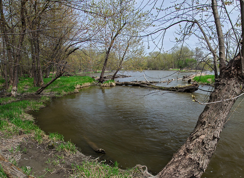
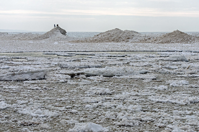
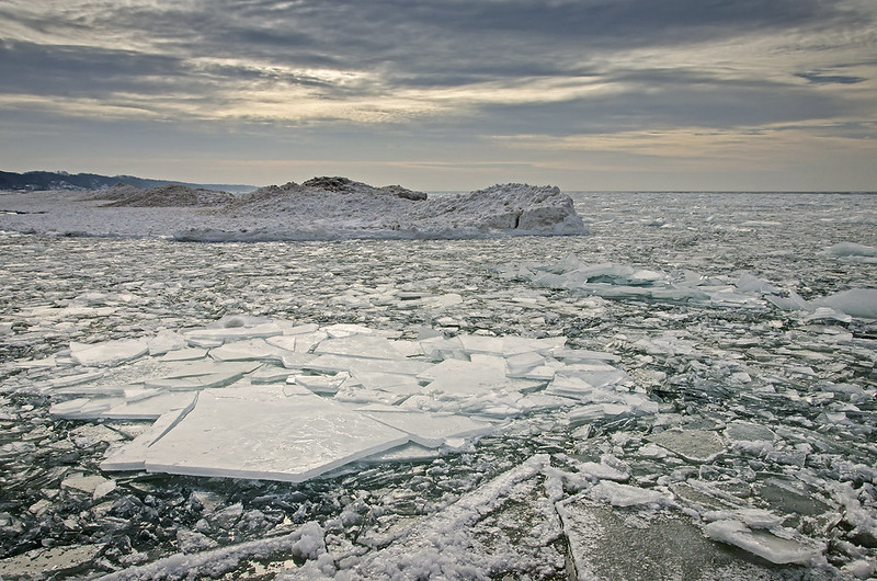
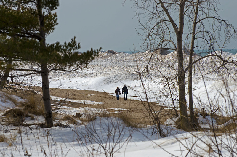
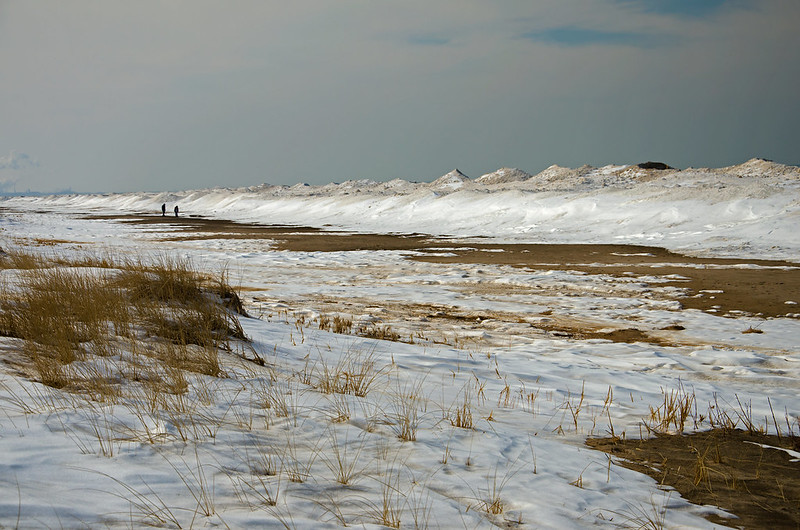
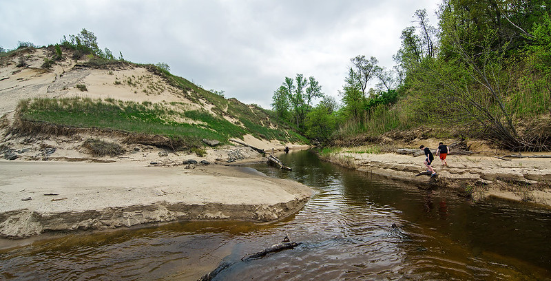
Shaped by the waves of Lake Michigan, the mouth of Kintzele Ditch changes constantly. The changes can be subtle, or extreme - sometimes 180 degrees in direction and hundreds of feet in distance.

The stream itself is a difficult waterway to explore. Walking along the bank is not possible because of the steep sand dunes on either side, and kayaking or canoeing is often impeded by fallen trees. Perhaps it's this difficulty that seems to attract us the most; always thinking we can explore a little further each time. But respect for the environment keeps us from trekking over the plants that boarder the stream, walking only where allowed and only where there are no plants to trample.

Every year I plan on following the stream as far as possible, and every year I'm stopped by some obsticle - natural or political.  I'll say it again- this is the year I'll find the source of Kintzele Ditch.

Effects of Winter

Effects of Winter

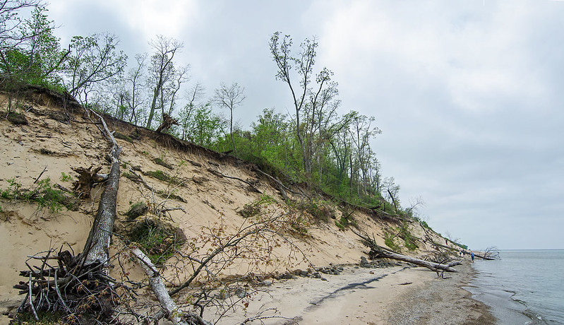
The effects of winter are quite evident on the dunes at Central Beach, part of the Indiana Dunes National Lakehsore. Waves washed away sand from the foot of the dunes, causing a collapse of the sand above, taking with it, large trees.  These trees litter this area of the beach, some even reach from the dune to Lake Michigan.

The Michigan City pier located about a mile up the shore has created a starving beach situation on the beaches downwind of the pier.  Wind and water carry away sand from the beach, but since the pier captures sand against it, the sand doesn't have a chance to replenish the beaches downwind.

Mt. Baldy is another example of a starving beach.  The living dune there is moving about four feet a year inland, yet new sand is not replenishing the moving sand.

Emergency conditions are in play here - people are no longer allowed to walk on most of the dunes in the National Lakeshore.  This is to prevent further erosion.

One look at the effects of winter on the dunes, and anyone can see the erosion is NOT due to foot traffic.  As a matter of fact, any erosion due to foot traffic on these dunes has long washed away into Lake Michigan by mother nature.

Keeping visitors off of all of the dunes only encourages people to walk around the barricades, killing the Marram grass, creating wider and additional paths.

The National Lakeshore needs to assess what is really at fault, instead of closing area after area to foot traffic in the name of conservation. Mt. Baldy remains closed following the sinkhole that swallowed a visitor who wandered into a closed area of the dune. Efforts to determine why it happened and if it could happen again are moving at glacially slow speeds. Coincidence?  I think not. It's a great excuse to keep visitors off of the newly planted Marram grass.
Greening Up

Greening Up

Hiking near the Des Plaines River as nature wakes up from a long winter.  The grass is turning green, the trees have buds, and creatures are out by the dozen.  We encountered some snakes wandering in the tall grass, and even climbing the trees.  The water levels were up a bit due to the recent rains, and portions of the wooded island were under several inches of water.

The water rushed between islands, and where the river narrowed, some pretty heavy rapids formed for short distances.  Warm weather birds are just beginning to make their appearance, adding some interest to the shore and sky.


Confluence

Kankakee Confluence

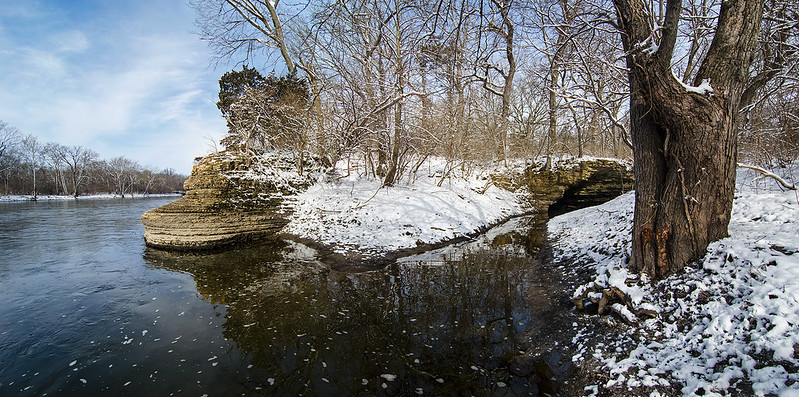
The morning after a spring snowfall, the outcroppings of rock on the bank of the Kankakee River were highlighted with snow. The Kankakee State Park was empty - as it often is on cold days, but signs of spring were everywhere.  The new fallen snow covered the early spring plants, but the river was once again free of ice, and birds were stopping along the river on their migration north.

This portion of the Kankakee River is quite scenic, with the outcropping of rock along the banks, and several overhangs and small caves nearby.  One of the overhangs can be seen on the right side of this photograph. About 15 feet high, it marks a turn in the stream just before it merges with the river. Over time, the stream and river have worn away the rock at the water level, forming a concave face on the rock wall.

The rock point seen in the center of the image has worn away much the same way.  The strata of the rock wall can be clearly seen, because each layer wears away at a different rate.  Standing on that point gives the feeling of being aboard a ship - as the water moves past the point, you feel as though you're standing on the prow of a moving ship.

One positive thing about a spring freeze - the muddy bank of the river was solid, so hiking was easy.

Symmetry

Symmetry

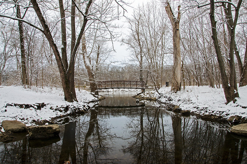
Visiting the area to explore the "Indian Caves" in what should be the area's last measurable snowfall of the Spring, the reflections of the bridge and trees in the stream were rather soothing after a cold, mile hike.  The stream was shallow enough to walk through without getting too wet, allowing me to not only capture this image, but also to explore one of the caves near the end of the canyon.  The mud was frozen - keeping me from sinking in, and the recent snowfall highlighted the contours and texture of the canyon walls, providing an attractive, yet difficult to capture photographic opportunity.

In summer months, local children climb the canyon walls, and follow the stream through the canyon. To me, the rocks don't seem stable enough to climb, but I am going back for a walk through the canyon stream....

View From the Indian Caves

The View from the Indian Caves

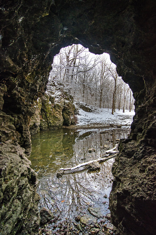
A spring snowfall highlights the walls of the canyon locals call "The Indian Caves".  This small canyon is riddled with holes and caves its entire length.  The elevation change is approximately 30 feet, with small waterfalls near the end of the canyon where the stream empties into the Kankakee River.

This cave was large enough to walk into, but only about 25 feet long; just deep enough for the walls and ceiling to create a dramatic frame for the snow covered woods on the other side of the stream.

Not the largest or most dramatic canyon in Illinois, it is, however, a very interesting place to visit and explore. Located in Bradley, Illinois, just a few meters away from the Kankakee River, and about a 3/4 mile hike from the nearest parking, one gets the feeling of being much farther away from town than they really are, even though the parking area is right in the business district of the town.

View From the Bluff

South Haven Overlook

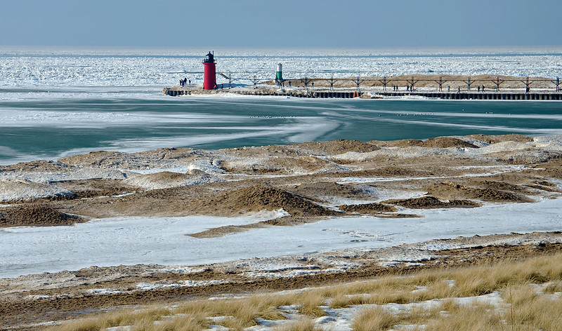
With hardly any snow left around land, walking on the bluff overlooking Lake Michigan surprised us, as the lake was still in winter's icy grip. Signs of a warm up are evident if you know where to look: Plenty of sand on the ice piles; smooth, grey ice between the ice mounds (melt water frozen again); and little or no ice on the lighthouse.  Yet, it still appeared we were looking at an arctic seascape, littered with car-sized drift ice. and bordered by snow covered mountains.

Days like these are some of the best for visiting the lakeshore - especially for those who can't cope with the freezing weather often associated with winter along the Great Lakes. Not only is it very comfortable to walk the shore, but you can witness so many changes happening right before your eyes, as the ice begins to retreat.

Mysteries in Ice

They Came in Peace

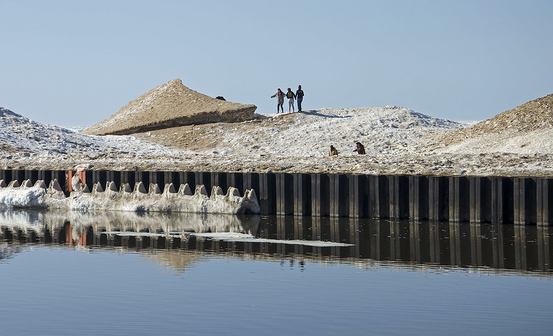
The frozen Lake Michigan shore is always interesting, but as the ice begins to melt, even more interesting things can happen.  With a little imagination, the shore can create some fun stories.

 For instance, this ice mound takes on the appearance of an alien ship that landed on the shelf ice.  Here, people are carefully approaching the craft to investigate the landing craft.

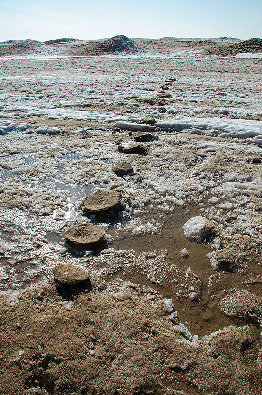
Inverted Footprints

Just a few hundred feet away, negative footprints lead out onto the shelf ice.  Perhaps related to the alien ship in the photo above?  Most likely, these were hard-packed footprints in deep snow that filled with sand, blown in by the wind.  When the ice began to melt, the sand shielded the ice from the sun, and the packed ice melted slower than the surrounding ice, leaving these stepping stones on the frozen lake.

It's a bit early for April Fool's day, but fun none the less.


Ice Packed

Ice Packed

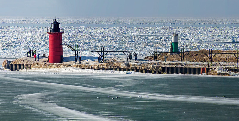
Even after many days of warm, spring temperatures, the ice remains on lake Michigan.  The lighthouse in South Haven, Michigan, still surrounded by ice, attracts dozens of visitors on this warm afternoon.  Temperatures near 50 degrees - a heatwave after months of below freezing temperatures - brought crowds of people to the beach, lighthouse and downtown shopping district.  With the exception of piles created by snow plows, snow was rather difficult to find anywhere else around town.  One look at Lake Michigan, and it seemed as though the area was still in a deep freeze.

Melt water seems to have filled much of the shelf ice between the shore and the ice mounds near the edge of the ice shelf. Refrozen, it creates a beautiful, abstract gray surface for seagulls to explore.

This is most likely one of the last weekends of the year for the frozen shore of southern Lake Michigan; don't let it slip past, get out and experience it first-hand.

Winter at the Beach

Winter at the Beach

Temperatures in the 40s attracted visitors to the Lake Michigan beaches over the weekend - even before the snow and ice had a chance to melt.

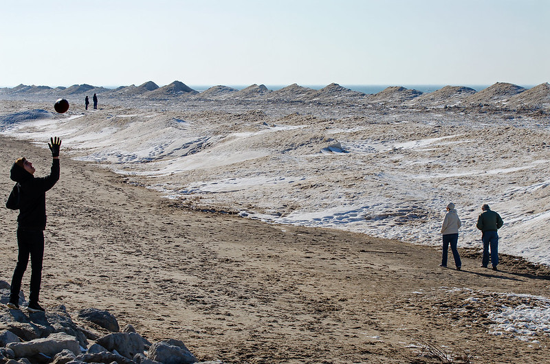
Walking and playing on the beach at this time of year has a very different look and feel than any other season. The mounds of ice just off shore block the view of the lake, but suggest a view of a different environment, one of the arctic.  From the beach, the mounds of ice look like a mountain range viewed from a great distance, eventhough they are only about 15 feet tall and a few hundred feet away.

These icy views will only last a few more days, so get out there and enjoy them before they melt away.

The Shack in the Sugar Bush

The Sugar Shack

Early farming in the northern United States often included Maple Sugar production.  If you were lucky enough to have plenty of Maple trees on your property, you didn't have to purchase cane sugar or molasses from the southern states. This was a matter of Northern pride during the Civil War.

Walking through the sugar bush (a wooded area which includes trees for sap collection), you'd often find buckets hanging from spiles pounded into trees.  The sap runs when temperatures fluctuate above and below freezing, and it drips into the buckets where it collects, ready for farmers to gather up.  Farmers then boiled the sap to reduce it into maple sugar or syrup.

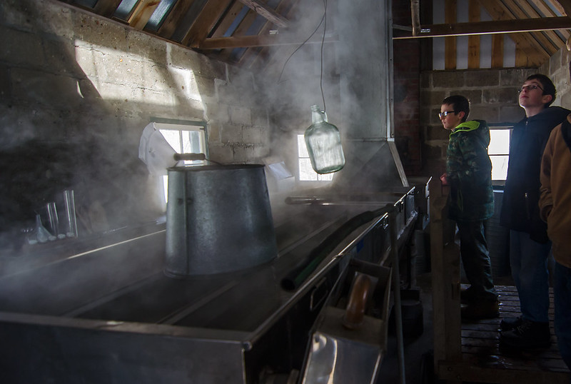
To protect the workers and equipment from the elements, a sugar shack was built.  This housed supplies as well as the wood-fired stove and evaporator used to boil the sap. The sugar shack pictured above, is part of the historic Chellberg Farm, located within the Indiana Dunes National Lakeshore.

The Sugar Shack

The Maple Sugar Shack

It's that time of year again!  Warm days and freezing nights - the perfect weather for Maple sap to begin running.  The fluctuations in temperature expands and contracts the fibers in the tree, allowing the sap to flow.  Tapping the trees, and collecting the sap is just the first step in making Maple sugar.

Warming the Syrup Jug

Maple Sugar Time at the Indiana Dunes National Lakeshore is the perfect place to learn how maple sugar was processed throughout history.  Found only in the northern United States and Canada, maple sugar production is unique to our continent. Native Americans collected the sap in wood bowls, then added hot rocks to the sap to get the liquid to boil.  Later, European settlers to the area used large kettles to boil the sap over open fires, increasing production.  In the early 1900's, shallow metal evaporators were placed over wood stoves to heat more sap much faster.  The operation was housed inside a small building called a "sugar shack."

All of these methods are demonstrated by volunteers and park rangers at the historic Chellberg Farm, located within the national Park.  Children can also try their hand a tapping  a tree, and carrying buckets of sap hung from a yoke.

Maple Sugar Time takes place annually, on the first two (full) weekends of March.

Build Up

Ice Build Up

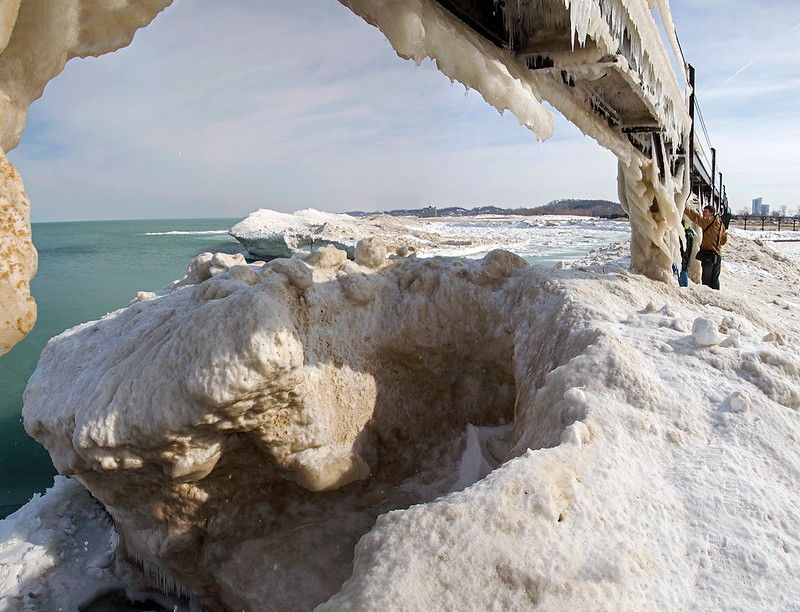
Viewed from the windward side, the shelf ice along the Michigan City, Indiana lighthouse and pier, virtually takes over the structure.  Rising at least 15 feet above the water's surface, one can touch the catwalk, and at some points, climb right up.

Here, the thickness and size of the ice is evident due to the hole in the ice seen in the foreground. Following some snow and wind, this hole could be completely covered over by a thin layer of snow and ice.  A person can unknowingly walk on that thin ice and plunge to the icy water below.

Here, we were safely over the concrete pier, and in no danger of falling through the shelf ice.


Dawn

Dawn

It's been said, you need to focus on the task at hand.  That's perfectly true, however, it also pays to take your eye off of that task and look around.  That's what happened here, as I focused all of my attention on photographing the ice covered lighthouse in St. Joseph, Michigan.

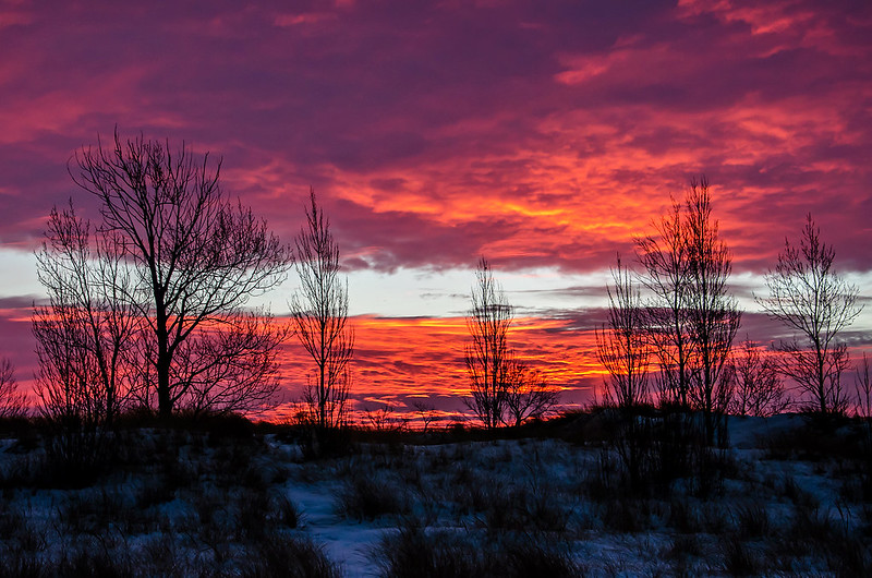
It was early morning, and as the sun began to illuminate the beach, I focused on the subject at hand, the reason I drove 100 miles, and woke up at 4 am - the frozen lighthouse. Moving from place to place along the beach, I kept my back toward the dunes, and hoped for the rising sun to illuminate the white ice against the dark clouds in the sky. It did.  But what was more interesting, and almost overlooked, was the eastern sky, moments before the sunrise.

As I changed location, I glanced back to see the red light of the rising sun playing in the clouds, with the dunes and trees silhouetted in front.

I only wish I was off shore, and able to capture this magical sunrise behind the frozen lighthouse. Maybe next time.

Carelessness

Ice and Carelessness

While on the pier at Grand Haven, Michigan, I noticed dozens of visitors walking on the shelf ice off shore of the public beach.  These particular people, decided to walk as far as they could, and made it to the very edge of the shelf ice.  Once there, they climbed the highest mound and stood on top, taking in the view.

Sounds like a great vantage point - probably was.  But that walk could have easily ended in tragedy if one foot fell through the ice on the way out or the way back.  Shelf ice is never safe to walk on.  Cracks and faults in the ice lead directly to the freezing water below.  The large mound can crack off of the rest of the ice shelf, and roll into the lake - taking everyone with it.

These people probably weren't aware of the danger, or simply figured they knew better.  I watched as they made their way back to shore, expecting one to simply disappear at any moment.  Luckily, they all returned safely.

Broken Ice

Sheets of Ice
Large sheets of ice, broken up by the waves of Lake Michigan, gather together in piles, soon to become pancake ice. Pancake ice is created when ice collides with other chunks of ice in moving water.  They collied and turn slighthly, over and over again.  The random movement creates round formations that look like pancakes or donuts. Notice how the broken ice is beginning to form round bunches on the water.

These large, flat pieces of ice came from the Grand River, and collected here, near the mouth of the river at Grand Haven, Michigan. Though they look rather small, the larger chunks measured about 10 feet across, and at least four inches thick.

As they moved in the water, an odd squeaking, cracking sound could be heard.

Winter Stroll

Winter Stroll

A Walk on the beach in winter is really a trip to another world.  Viewing Lake Michigan from a sand dune may be the only way to actually see the lake. Once you're down on the beach, the lake is invisible, obstructed by the 15 foot tall ice mounds created by the pounding waves and freezing temperatures. These mounds appear like mini-volcanos, slowing growing as the waves force water up though the cones of ice. Walking safely on the sand, it appears as if you're walking in the arctic, on top of a mountain range, viewing another mountain range from a distance, but the "mountain range" is in reality, only 15 feet tall.

Ice Mounds

If you haven't been to a Great Lakes beach in winter, put it on your list of things to do.  You've got another month at least to experience the magical, frozen landscape first-hand.  Remember to stay off of the ice mounds. Read why here, on my Huffington Post blog:
http://www.huffingtonpost.com/tom-gill/the-winter-shore-beautifu_b_6431724.html

Frozen Pierhead

Frozen Pierhead

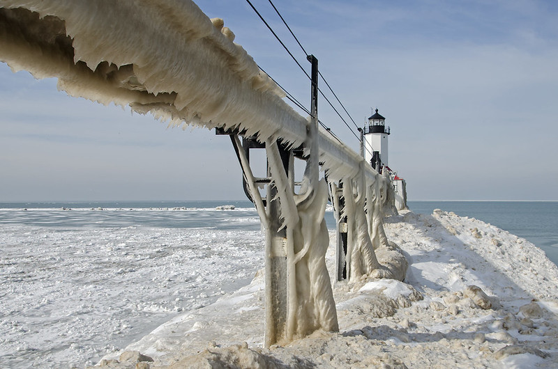
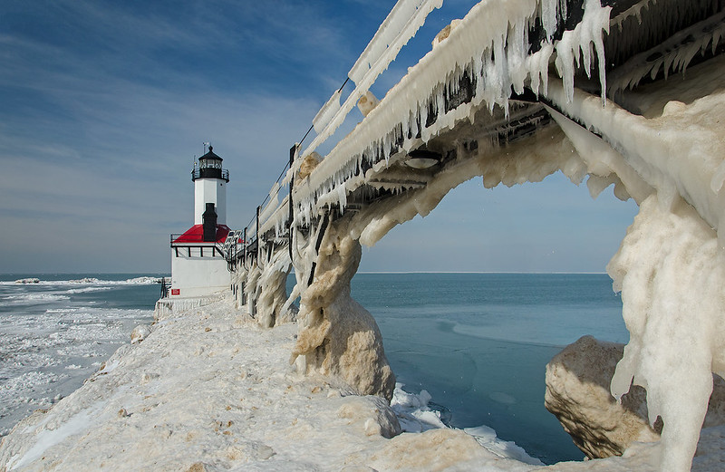
A pier on Lake Michigan, in winter, covered in piles of ice chunks several feet tall doesn't seem to be a prime destination for many, but for us, it was a perfect weekend getaway.  Most people visit beaches in the summer, and when I mention I'm heading to the beach in February, they seem to think I'm heading to the tropics.  I wouldn't pass up an opportunity to walk on the frozen shore - I could see a tropical beach any time of the year, but the ice boulders and shelf ice are only here for a while. Mix in giant icicles created by frozen spray from Lake Michigan, and we have the perfect spot to visit on a sunny winter afternoon.

Locked in Ice

We headed onto the frozen pier carefully; it was my youngest son's first time up close at a frozen lighthouse. Knowing the area and the construction of the pier is important, especially when bringing someone else with you.  It was easy to see where the concrete pier ended even though it was covered in ice that extended many feet into the lake.  We remained safely on the concrete areas, and avoided any areas where a slip would result in a slide into the cold lake. We stopped a few meters from the lighthouse, noticing the piles of ice further up were large enough to carry a falling person into the water like a toboggan.

From the vantage point of the pier, we could view the shelf ice from the windward side, the side facing the lake. Thankfully, on this visit, nobody was spotted walking on the dangerous shelf ice.

Michigan City Pierhead Iced Up

Michigan City Ice

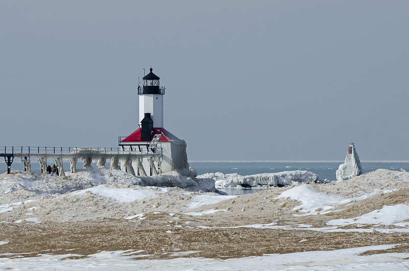
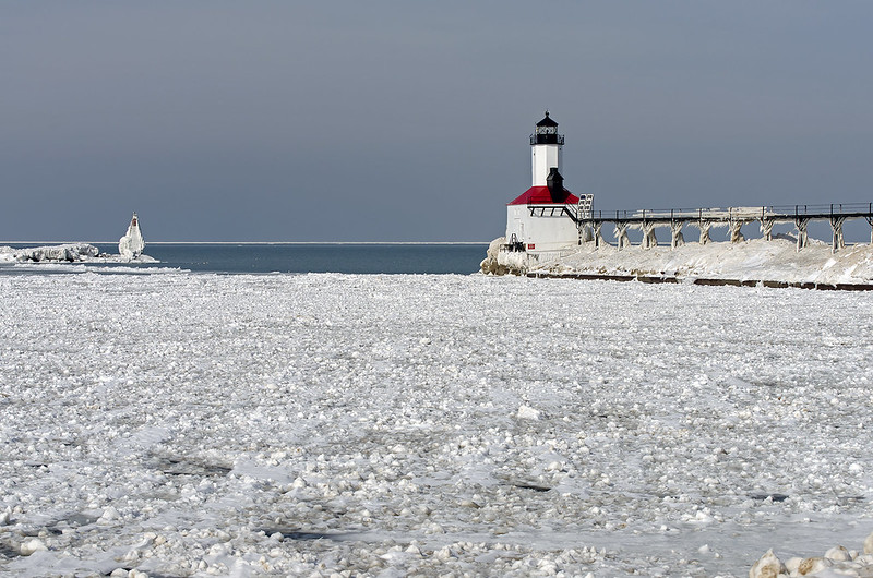
The sunny afternoon brought temperatures near 40 degrees, making for a very comfortable visit to Michigan City, Indiana's Washington Park. The lakefront park is a convenient place to view the winter shore. A lot of the lakefront parks at the Indiana Dunes National Lakeshore are closed during the winter, so this is one place to view the shelf ice.  It also provides a great view, and access to the Michigan City East Pierhead lighthouse, and this year, it had quite a bit of ice on it. I haven't seen this lighthouse covered in ice as dramatically as some lighthouses in Michigan, but this year was different.

We decided to see how far we could walk out on the frozen pier before it got too dangerous.  The ice boulders washed up by the waves provided pretty good footing, preventing us from accidentally sliding off of the pier. The shelf ice can be safely viewed from the pier, and it was rather large and dramatic.

Ice Packed Harbor

As we climbed up and down the mounds of ice on the pier, we were reminded of the warm weather by the constant dripping coming from the melting ice on the catwalk.  At times, the ice was mounded so high, we were able to see over the catwalk.

More snow, cold, and wind this week, possibly adding to the ice on the pier in Michigan City.

Beneath Wildcat Falls

Beneath Wildcat Falls

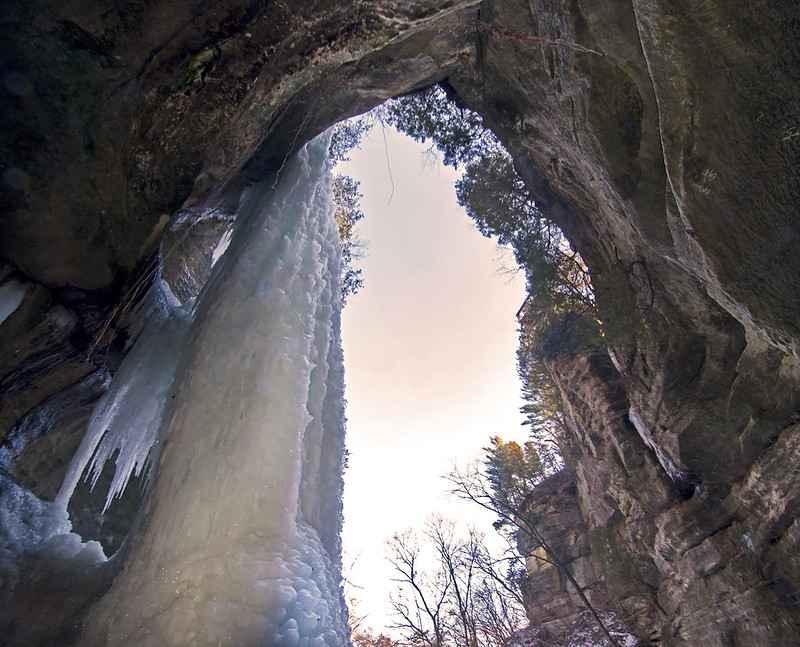
Starved Rock's Wildcat Canyon features an 80 foot tall waterfall that freezes into a solid column of ice in winter.  Used by some for ice climbing, the column grows to at least eight feet in diameter, and is a wonder to stand near.

I was able to climb up a small, icy rock outcropping just behind the frozen waterfall. Here I could view the back of the waterfall - the portion toward the inside the concave canyon wall.  Water continued to drip from the stream above, and echoed inside the small cave created by the ice column. From the bottom of the frozen fall, one gets a unique perspective of the ice in relation to the canyon.

After years of visiting Starved Rock in winter, I'm still amazed at the scale of these icefalls.