Winter in the Oak Savanna

Winter at the Oak Savanna

The trails wind through the snow covered oak savanna of Miller Woods in early February. An odd year with very little snow, and relatively warm temperatures (for a Midwest winter) kept the woods looking brown and boring, so this snowfall was a welcome site.

The trails wind for miles through these rolling woods, up and down and around dunes, hills, and dozens of interdunal ponds and wetlands. This area offers great sights in every season, and winter is no exception. I was hoping for clear skies and dark blue liquid ponds, but the cold temperatures the days prior to my visit turned the ponds to ice. The ice was very thin, but perfect for throwing stones onto it to make the metallic and otherworldly sounds as the stones skip along the ice.  This only happens when the ice is just forming, and once the ice thickens, it no longer rings with these sounds.

Frozen Edge

These first days of ice can be quite interesting, especially in areas that border the water. Tall grass, weeds, and other plants poke through the thin ice, and often form unusual shapes and patterns in the ice. These patterns can be fleeting, only lasting a few hours until the ice completely freezes.


Snowflakes

Resting Snowflake

A quick look around the yard just after a snowstorm yielded some interesting snowflake configurations, but the warming temperatures and winds quickly degraded the intricate shapes of most snowflakes.  The warm air began to make the crystal structures turn bloated, yet a few snowflakes kept some of their shapes.

Snow Bridge

Probably less than 1/2 inch, this tiny snow bridge was created by a bunch of snowflakes gathering together. Again, the warm temperatures quickly began melting the intricate crystals.

Transitions

Transition

This marks the 14th anniversary of my blog. It's hard to believe it's been that long.

Generally at this time of year, the dunes are covered in snow and ice, but this winter has so far been different. The dunes are brown and seemingly dull- until you look a bit closer. In the warmer months, leaves fill the trees and block a lot of the features of the dunes themselves. Here in the photo above, you can see the transition from Lake Michigan to the wooded dunes, then to the grassy dunes. The leaf-covered ground is brown and grass-less under the trees, and the transition to the grassy area is quite abrupt. The trails are also easier to see now, as are some of the low growing plants and shrubs. There hasn't been a time I've visited this trail when I haven't discovered something new or different; and I've been hiking this dozens of times each year. Some of the grand things don't change, but if you pay attention, things change week to week all year long. Rolling Dunes Once we climbed the first series of dunes, we headed down into the valley, then up again on the taller dunes. Looking back, we can see the rolling dunes we traversed - hill after hill after hill, some small, others quite challenging. Carrying my usual 40 pounds of camera gear on my back, and a tripod in one had, climbing some of these trails can be difficult, especially those that pass close to shrubs and trees. I tend to get caught up on every possible branch. Winter hiking can be a bit uncomfortable here. There are even transitions in temperature and wind. On the unprotected beach, the wind can go right through you, while in the valley between dunes, there is little or no wind. Dressing in layers certainly helps, you can keep warm while on the beach and remove some layers when in the protected areas where it gets warm. You just need to remember the old saying, warm to start, cold to finish; cold to start, warm to finish. Start off being a bit cool and try to keep from sweating, then if you're not sweating, you'll stay warm for the walk back. It's very uncomfortable on the hike back if you stay so warm at first you begin perspiring. Still, it's well worth the time to hike the dunes in winter - even if you freeze on the way back.

The Seven Pillars of The Mississinewa

The Seven Pillars of Peru A sacred gathering place for the Miami Indians in years past, the Seven Pillars of the Mississinewa lie on the north bank of the Mississinewa River. The 25 foot tall limestone formation was carved by wind and water over thousands of years. The "rooms" created by erosion within the rock face were used by The Miami Indian Council for meetings and other activities for generations. Peru's Seven Pillars One of Indiana's best kept secrets, the Pillars of Mississinewa are owned by the Acres Land Trust along with many acres of land directly across the river where the Pillars can be easily viewed. A 1.8 mile moderately strenuous trail winds through the hilly, wooded preserve where beech and maple trees flourish. The Seven Pillars of Peru A feeling of calm was in the air when visiting this site. I wonder how many tribal meetings and important events took place here over the years. The Miami Indians still gather here today.

The Ladders

The Ladders While hiking trail three in Turkey Run State Park, one must use "The Ladders" - large wooden ladders set up to assist with some drastic elevation changes within the canyon. While not too precarious, the ladders do create a small bottleneck for visitors. It takes a bit of work to turn your back to the drop-off and grab the ladder to descend to the canyon floor - especially when you have 40 pounds of camera gear on your back, a camera and tripod in one hand, and the ladder is icy. A Slippery Time on the Ladders On one visit, people were backed up on the top and the bottom of the canyon, waiting to use the ladders. One at a time, people climbed or descended the ladders. While we waited our turn at the top of the canyon, a person in my group backed up just a bit too far and slid down the side of the canyon. Luckily, he only fell about 6 feet to a ledge, but the ledge had a pool of water about two feet deep. Wet from the knees down, he continued to hike the rest of the day. That could have been a disaster if he was standing a few feet left or right. Each time I visit and hike this trail, I'm grateful the park did not build stairs in this area. The ladders keep this part of the trail a bit more rustic, and make for a more strenuous and interesting hike.

Ice in the Punch Bowl

Ice on the Punch Bowl Winter temperatures created a bit of ice along the edges of the waterfall called the Punch Bowl in Parke County Indiana's Turkey Run State Park. This feature is located just after navigating a tight walled canyon where you either need to hike through a narrow stream, or climb up the side of the canyon wall using some carved hand and foot holds. While not overly difficult, it does offer a bit of a challenge while hiking. Located on a short branch trail, the punch bowl is a narrow waterfall approximately 15 feet tall that flows into a small pool at the bottom of the canyon. Generally this fall is running throughout the year and varies from a trickle to a full flow, so it's a dependable waterfall to freeze during the winter months. Frozen Punch Bowl In warmer times, we enjoy a short additional hike up to the top of the Punch Bowl's waterfall. The small stream meanders through a series of turns and potholes before cascading down to the Punch Bowl, and it's an interesting and mesmerizing flow of water. Entering the Punch Bowl

Squeezing Through the Canyon

A Squeeze In the Canyon Immediately after climbing the small waterfall on trail 3, the canyon narrows. Depending upon the amount of recent rainfall, the stream could be a bit too deep to walk through (or in cold weather, even 3 inches of water is too much), so small stairs and hand-holds have been carved into the canyon walls. These "stairs" are about six inches wide and four inches deep, and barely have enough room for the tips of your shoes, but they are handy if you wish to keep your feet dry. We decided to stay on the ground and risk getting our feet wet because the recent snowfall made the canyon walls and "stairs" a bit too slippery. When the park is crowded this is usually a bottle neck as people wait their turn to navigate the small carved stairs. A Walk Through the Canyon Soon after these two tight areas of the canyon, you reach the turn toward the Punch Bowl, a small waterfall with some very interesting canyon features. Heading forward, the canyon begins to open up, and with the person walking along the trail, you get the idea of just how large this part of the canyon is.

The Last Light of the Day

Last Light of the Day With the short days of Fall and Winter, we found ourselves in the canyons of Turkey Run State Park late in the day, and after sunset. The park was open until 11 PM, but signs warned visitors to return to the suspension bridge before dark. I imagine it can be quite difficult to find your way around the canyons in the dark. Our pace increased a bit as we noticed the last of the sunlight hitting the treetops. Trail 3 brings visitors through deep canyons, narrows, and up on the surface through dense woods, so it has a bit of everything - even ladders to climb. The First Freeze The recent snowfall added a pretty contrast to the dark sandstone canyon and the tall trees. The low temperatures froze the ground water seeping through the walls of the canyons, turning it to decorative icicles all along the trail. This part of the trail takes you up a small waterfall into a narrow canyon. You need to walk through the shallow, flowing stream, and on this cold day, the edges of the stream were icy, making the trek up the waterfall a bit difficult. I found it best to walk through the water rather than try to keep out of it, at least the stream bed wasn't icy and dangerous.

Wedge Rock in Winter

Wedge Rock in Winter The first prominent feature along Turkey Run's trail 3 is the famous Wedge Rock, a large chunk of rock that fell away from the canyon wall long ago. This rock is much larger than it looks, allowing hikers to walk beneath, and until recently, they were "able" to climb up to the top to take in the view of the entire canyon. On this visit to the park, we noticed a few new fences keeping people away from the back of Wedge Rock. In summer, this trail is lush with ferns, moss, and the trees above, and it stays well below the outside temperature, making the hike through this area very comfortable, and almost otherworldly. On this day in December, the temperatures were above normal, so it was difficult to determine if the opposite happens, if the temperature is warmer than the rest of the park. Heading Toward Wedge Rock From this angle, Wedge Rock appears so small in contrast to the canyon walls, and the towering tulip poplar trees on top of the canyon. Usually there are plenty of visitors on this trail, helping to give the formations scale, but on this day, we encountered only three other people on our three hour hike. This is another great benefit of visiting this park in winter, it's not crowded, and the snow and ice bring a whole new look to the landscape. When visiting in winter - even if the snow melts, wear ice cleats. The sun doesn't make it down to the canyon floor, so the packed snow and ice remain in place for quite a while, and some areas of the icy trail could lead to dangerous falls.

Frozen Narrows

Frozen Narrows The Narrows Covered Bridge spans the frozen Sugar Creek which runs through Indiana's Turkey Run State Park. It spans a narrow spot in the creek, and seems to collect quite a bit of ice in the early winter. I estimate 5 to 6 inches of snow fell on the park last week, and on our visit, the snow was still looking fresh. I think the cold weather keeps most visitors away from parks. It was easy to see where the visitors roamed by their footprints. In high traffic areas, the snow had already turned to hard, slippery ice, so it might have been best for us to bring our ice cleats, but we managed fine without them. I wouldn't go without them on any future visits this winter - it's only going to get worse. narrowsbridgesm Built in 1883 by J. Britton, a popular bridge builder in this part of the country, the bridge has stood the test of time. Located in Parke County, Indiana, this is one of 31 covered bridges in the county - far more than the famous Madison County of movie fame (which has only 6). This is certainly the place to visit if you wish to see beautiful covered bridges - they even have an annual covered bridge festival in October. Narrows in Winter The park has so much to see in addition to the covered bridges. Canyons, waterfalls, woods, hiking, and even a beautiful inn for dining and lodging.

The Chellberg Farm

A Horse in the Pasture While hiking the colorful trails of the Chellberg Farm, I headed toward the old farmhouse and barn. These building are open from time to time, to demonstrate farm life of the 1800's. In the past two years, the barn and fields have been the home to a few farm animals including two horses. As I approached the barn, the horses immediately came outside to greet me. I stood only a foot or two away from the fence, and they walked up to me. I tried to put a few feet between us so I could capture some photos, but they kept following me, staying right with me. I spent a little time with them, then continued on my way to the other side of the pasture. From there, I was able to capture some photos of the horses from a distance. Of course, this horse noticed me right away, then began heading toward me again. Farmhouse The old farm house wasn't open on this day, but I was still able to wander the grounds. In March, the Maple Sugar Days will be held here, and the kitchen will be filled with the scent of fresh cookies baked on the antique wood stove. For now, I can only imagine how many children played on that porch and in the field in front of the house. Autumn Path Behind the farm house and barn, lies the colorful sugarbush, the maple tree - filled woods bursting in color at this time of year.

Nestled in the Woods

Nestled Away

A hike through the woods of the Bailey Homestead on a cloudy, Fall morning brought us to a few small log cabins. Similar cabins were used in this area for trappers, and even homesteads. Set against the colorful Fall colors, the cabins stand out quite well.

Cabin in the Woods

At certain times of the year, these cabins are open to the public for historical demonstrations of the homestead. This particular cabin was used to demonstrate traditional music and dance, while the cabin below is a trapper's cabin complete with tools of the trade and furs.

Trapper's Cabin
This area is only about a half mile down the trail from the golden leaves of the Chellberg Farm's sugar bush, making this area very easy to visit while at the farm.

The Sugar Shack in Autumn

The Sugar Shack

One of the staple features of the Chellberg Farm in Spring, the sugar shack rests atop a hill surrounded by Fall color. The maple trees which provide sap for the maple sugar process turn a vivid gold at this time of year, and create one of the most impressive displays of autumn color at the Indiana Dunes National Park.

There are many other areas within the park with beautiful Fall color, but this area is in my opinion the most spectacular. Hiking the trails through the sugar bush, one is surrounded by the golden leaves not only on the trees, but on the forest floor.

Hidden Shack


An Autumn Expanse

fallvalleysm

The Chellberg Farm sugar bush is an expanse of Fall color at this time of year. There are a few trails meandering through the woods, and each offers great views of the rolling landscape. Unlike the natural oak savanna in this area, these woods are more dense, cutting off distant views, but concentrating the color. 

This particular trail winds through the lower portion of the sugar bush, where a few small creeks flow.  Foot bridges cross the creeks and ravines, and some staircases assist with the steeper climbs, but the rest of the trail is the natural soil.

Footbridge

The bridges seem to divide the area into zones, and crossing them leads you into another micro environment within the park. The trails in this area are not strenuous, but more or less leisurely walks through a beautiful part of northern Indiana.

Descent Into Autumn

Descent Into Autumn

One of the most striking autumn hikes in the Indiana Dunes National Park is the Chellberg Farm trail through the sugar bush.  Planted decades ago by the land owners, these woods are primarily maple, and were used for their sap to make maple sugar. In autumn, these trees glow bright yellow-green, turning the woods into a magical place.

The trail winds through the rolling landscape, crossing several small creeks which tend to flow only after some rainfall.  The rain on this day darkened the sky and the forest floor, giving a nice contrast to the glowing leaves.

The Forest Floor

Because of the rainfall, I encountered only two other visitors walking the trails. Sometimes poor weather makes for great hikes.

Autumn Creek

I find it a bit unfortunate that visitors must keep to the trails and not wander off into the woods, but I completely understand why this is. Views such as this make me wish I could follow the valley between the hills, just to see what is beyond my view.


Overcast Over The Lake

Overcast Over The Lake

It's amazing how a bit of overcast weather will keep visitors away from Lake Michigan. Cloudy days make for empty parking lots, empty beaches, and even lighting for photographs. It seems that if the sun isn't shining brightly, people don't even think about heading to the beach, but they're missing out.

Soon, the cold winds will blow across the lake and discourage even more people from visiting. It may get very uncomfortable to walk along the shore, but winter can be one of the best times to explore and experience the beach.

Rocks and Reflection

The shore changes constantly with the wind and waves.  From a sandy beach to a rocky beach, to no beach when the waves are too high, it's never the same twice. The small streams that empty into the lake also change their path because of the waves -they can change 180 degrees in a day. These streams become obstacles when the weather turns cold, one can no longer simply walk across because the water is too cold, a narrow portion needs to be found in order to continue walking down the beach.  Many winter hikes have been cut short due to these streams.

Dune Valley

Dune Valley Our hike inland through the grassy and wooded dunes began at the beach, where we found a trail through the valley between two dunes. The size of the dunes don't show so well on the photos - they are much larger than they appear - especially when you hike up and down. We decided to head between the dunes for just a bit, then take the trail up the dune on the right side to hike the ridge all the way around the series of dunes near what is called the blowout. This time of year is perfect for hiking in the tall Marram grass. The temperature is a bit cooler for the climbing portions, and there are no ticks to worry about. Along with the ever-changing plants of the dunes, we always encounter some sort of animal or insect. We were once startled by a very loud turkey we surprised as we came over this ridge. He all of a sudden flapped his wings and screamed as he flew away, waking up every creature within a mile on a very quiet early morning. View From the Dune After taking the trail up the dune, we were able to view the valley floor, and the spot where the top photo was taken. Lake Michigan doesn't always appear this deep blue, most of the time it's a bit lighter in color. This is probably due to the time of year, time of day, and the overall weather conditions. It does, however, provide a great contrast to the sky and sand near it.

Beached on Beverly Shores

Beached on Beverly Shores Just a few steps away from the famous Indiana Dunes National Lakeshore's Century of Progress Homes, and across the street from the lakefront homes of Beverly Shores, these boats add some color to the landscape of green Marram Grass and tans sands. It's surprising to me that these boats are left untied so close to the unpredictable waters of Lake Michigan. While it's doubtful the waves ever reach this far up, anything is possible when the north winds kick up the lake. Ten foot waves are not unusual here, and these boats have been in this spot through so many heavy storms. Every so often, after a very windy storm, tons of wood, debris, and boats of all sorts, wash up on the beaches here, proving just how items along the shore can be washed away in a moment. The photo below shows the aftermath of one of those storms about five years ago. All Washed Up

Eroding Dunes

Disappearing Dunes 
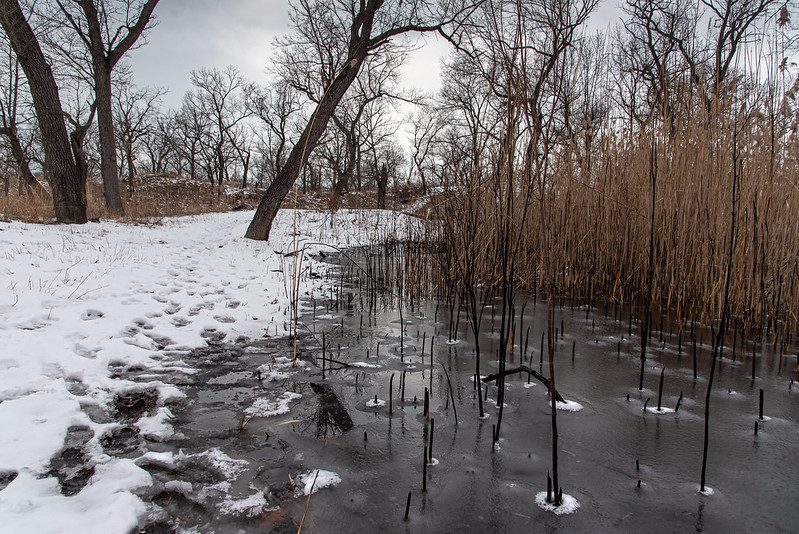
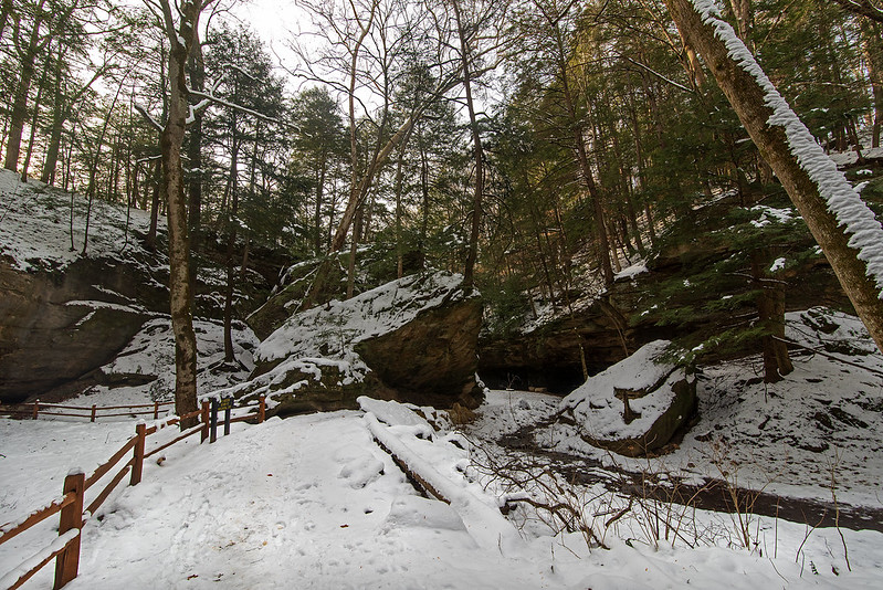
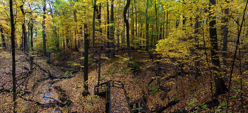
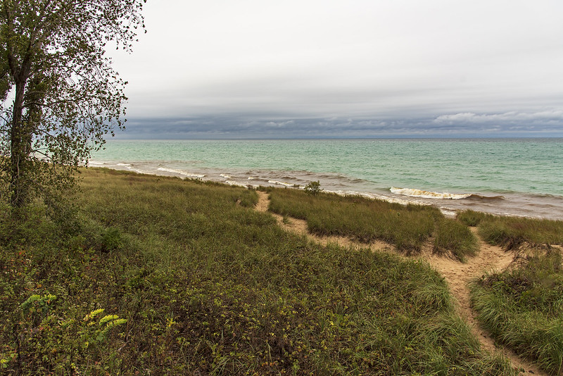
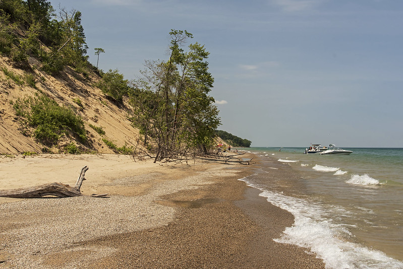
Contrary to what many people believe, the dunes along the southern shore of Lake Michigan are ever-changing - have been, and will continue to be. The forces of nature such as rain, wind, and the waves erode parts of the beach and dune, and build another.

Rising water levels this year, along with some "starving" of the beach are contributing to the collapse of portions of the windward sides of the dunes in the Indiana Dunes National Park. A starving beach is one where the natural replenishment of sand is slower than the loss of the sand due to wind and wave action, so the beach and associated dunes lose sand.

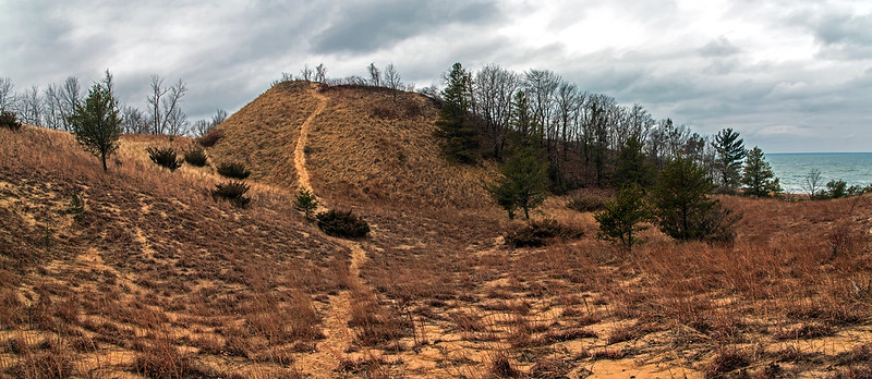
These dunes are crumbling at a relatively fast rate.  The paths and trails that once meandered along the ridge are long gone - washed into Lake Michigan - not because of people walking on them, as many will attempt to mislead the visitor. Walking on some sand dunes and plants will certainly disrupt the natural state of the dunes, and often kill the plants that hold the dunes in place. But this is a case of the lake taking over, not human activity. The Michigan City pier a mile or so away has been blamed for some beach starvation, and while this may be true to some extent, it seems unlikely that the single pier could affect the beaches miles away to such a great extent.

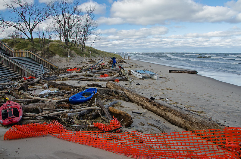
The trees seen in this photograph were growing on the top of the dune just a few weeks ago.  The waves undermined the foot of the dunes, and slowly collapsed the side.  Some trees fell sideways and were washed away by the waves, but these just slid down in an upright position, and the waves buried them in sand. They appear to have been there for years, but in fact, they have only been there a few short weeks.

Weathered Dune
Wind, rain, and gravity have all combined to create some interesting formations as the dunes erode.  These formations look a lot like the mountains and stone formations of Bryce Canyon National Park. They change right before your eyes, small amounts of sand slide slowly down the dune, others crumble and chunks roll down.  Some of this movement resembles waterfalls, but of sand. Beautiful fans of sand form at the foot of the dunes, but are quickly washed away by the waves as soon as the winds pick up on Lake Michigan.

Sand Details
While it's sad to see some of these majestic dunes crumble - especially the ones I used to frequent, it's all just a natural part of the dune's life cycle.

First Quarter Moon

First Quarter Moon

A perfectly clear evening gave us a great view of the first quarter moon in rural LaPorte County, Indiana.

Just a few days before the Perseid meteor shower the skies were fairly dark. The peak of the meteor shower will take place just a few days prior to the full moon, so the meteors will be just a bit difficult to see due to the bright sky. I'll certainly brave the mosquitoes and attempt to photograph some meteors this weekend.