Breakup Begins on Lake Michigan

Pancake Ice Cove 
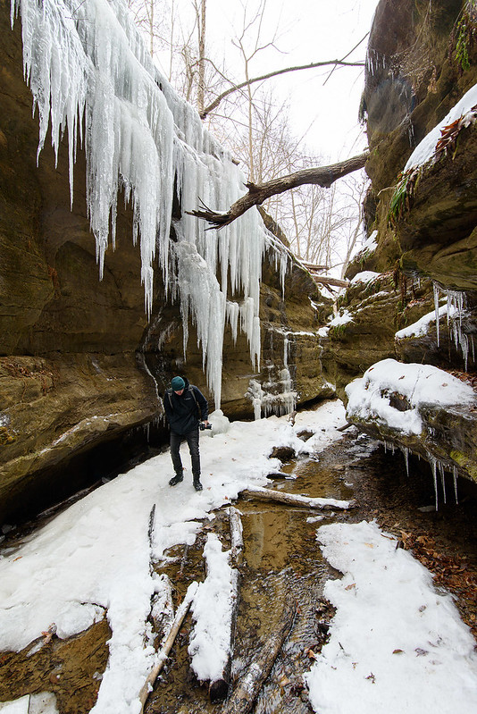
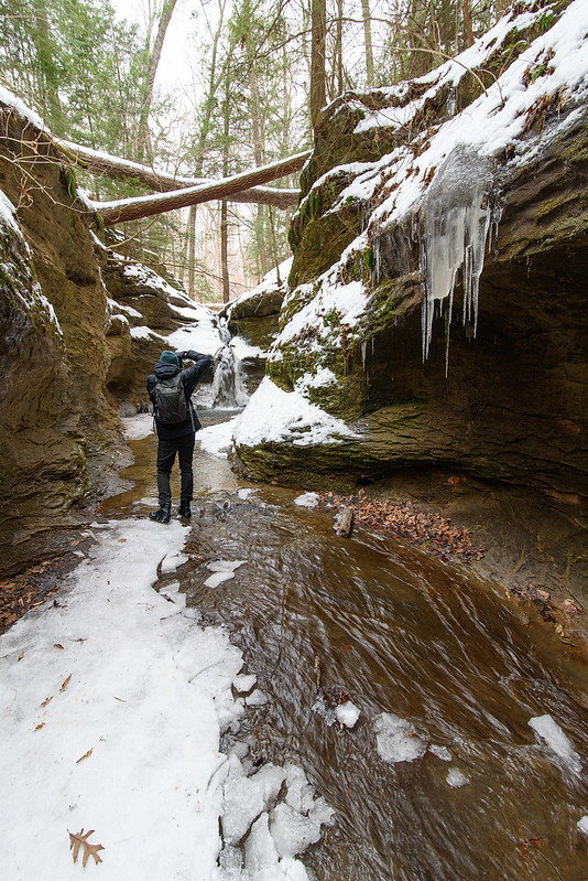
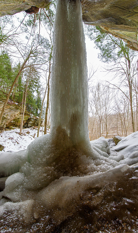
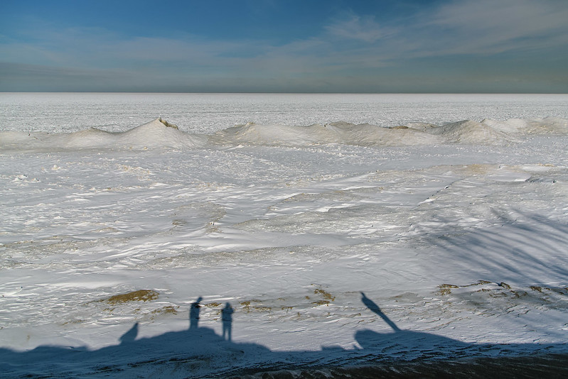
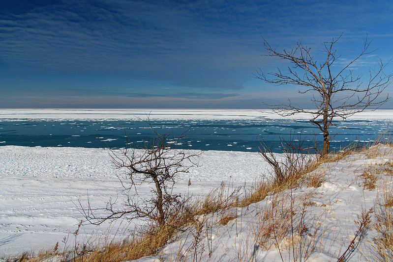
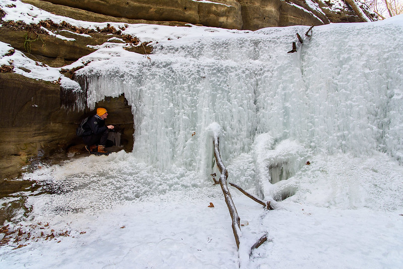
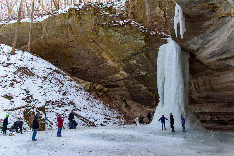
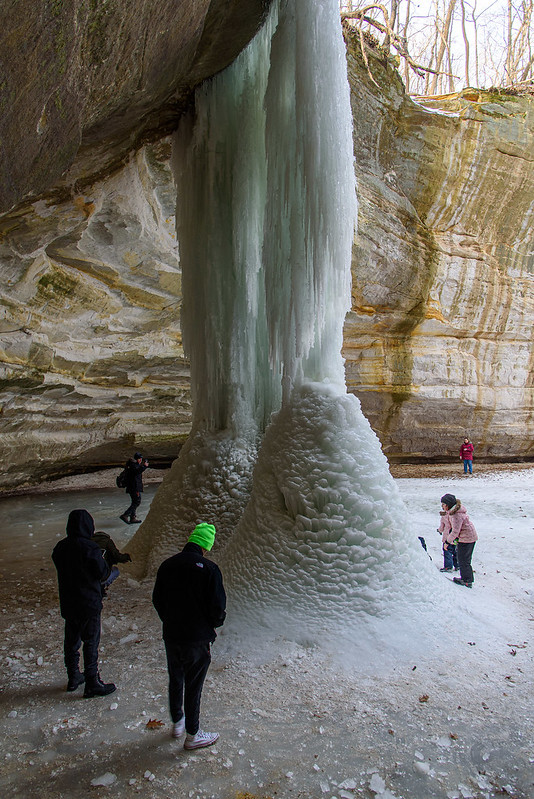
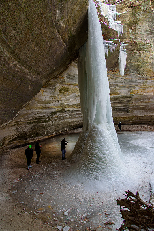
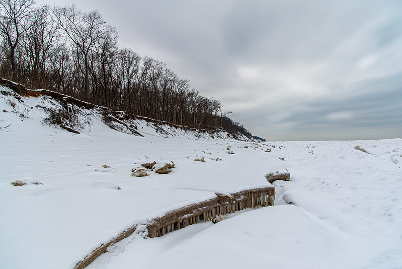
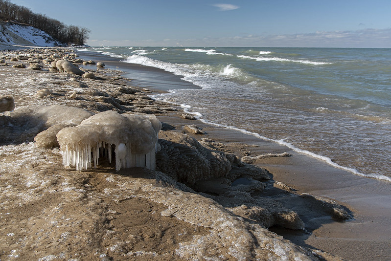
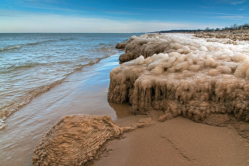
Things happen quickly at this time of year. Single digit temperatures at night, snowfall one day, 45 degrees the next day, and the cycle repeats over and over until Spring. The warmer temperatures and the high winds we've experienced last week have broken up most of the solid ice on Lake Michigan. 

Only the thicker chunks of shelf ice remain, along with a large amount of floe ice that is driven toward the shore with the waves. The breaking ice creates little coves in the shelf ice, and the floe ice chunks are then trapped inside, pushed around by the waves, they hit the edges of the ice and collide with each other. These collisions spin the ice slowly, and form disc-shapes called pancake ice. They do look a bit like pancakes. Almost every spring I can find pancake ice in these relatively small coves of ice at breakup. Pancake ice forms all winter, but mostly when the water is mostly liquid and the wind is pushing things along. Some of these pancakes can grow very large, sometimes larger than a car.
  Breakup Begins 
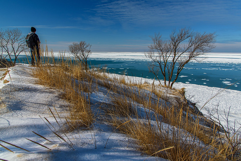
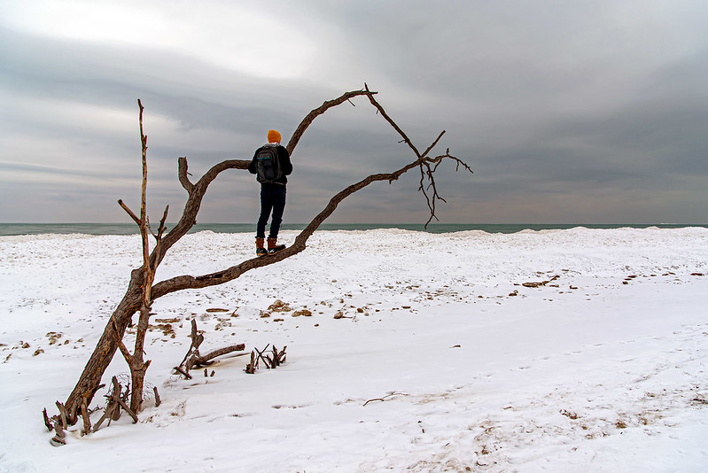
 Our hike took us up to a relatively secluded place along Lake Michigan; most of the trail used to be asphalt roads with homes on both sides. The houses and almost every sign of them are now gone, with the exception of some plants normally associated with home gardens, and the tell tail-flat spots on the dune where driveways used to be. 

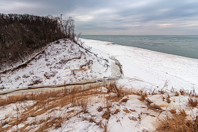
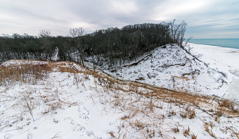
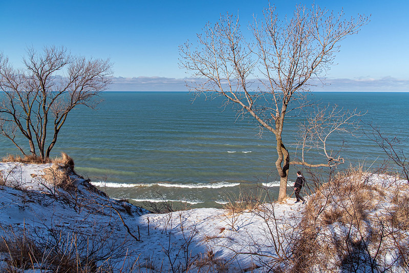
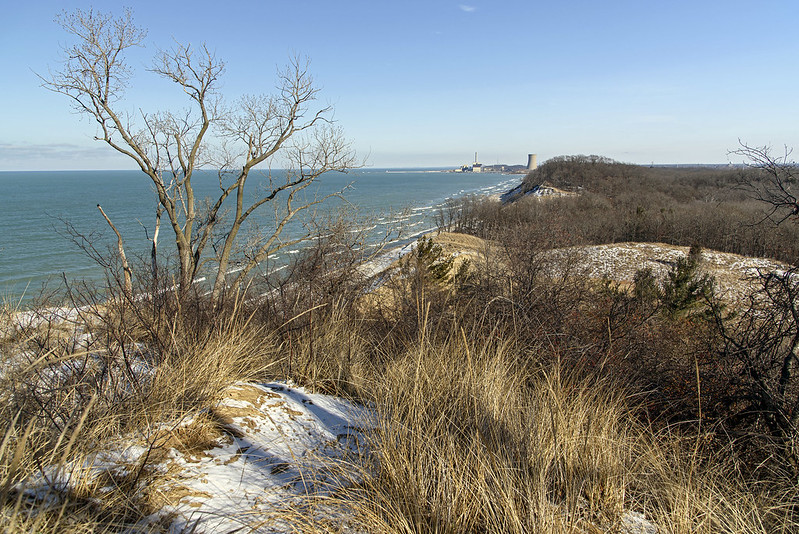
Then the trail turns into a narrow path used mostly by deer (judging by the footprints) up to some dramatic dune blowouts and overlooks. It's from this point where you can obtain a panoramic view of Lake Michigan as well as the landscape for miles inland. there aren't too many places left at this park where you can get this view of the landscape - most have been closed for some poor excuse or another.

The Icy Canyon

Flowing Ice 
Nearing the end of our hike through the canyons of Turkey Run's trail 3, the canyon narrows once again. Though not as deep as other portions of the park, this area has many more areas where the water cascades slowly over the canyon walls. In warm weather, there would be evidence of moisture, and not much running water, but every drop of water now freezes and creates huge icicles on the rocky walls. 

Not spectacular waterfalls, yet these somehow overshadow some of the frozen falls here, because of their number and intricate details. The cascades line the canyon walls in this part of the park, creating an impressive and breathtaking environment for a winter hike.
  Cascading Ice 
Careful not to walk beneath any of the free-hanging ice for fear of portions falling down (these can weigh a ton or more), the view is spectacular from below. 

Most narrow canyons are relatively dark, but somehow the canyons of trail 3 have an unbelievably perfect light all year round. In warmer weather, the light is filtered through the green leaves of the trees above, casting a yellow-green light into the depths of the canyons. It's something everyone I've brought to the park notices.

  The Icy Canyon 

 As one exits this canyon, there's a desire to turn around and view it again from the opposite direction. Maybe we would have done that if portions of this hike weren't so difficult due to high water and icy conditions. Then again, what lies ahead on the trails we didn't get to see yet? A day isn't enough to soak in all that Turkey Run has to offer.... we'll be back!

Descending the Ladders

The Ladders of Trail 3 
About a mile after navigating the waterfall and narrow canyons with swift running water, we reached The Ladders. Quite literally, these are ladders built to assist hikers into Bear Hollow, a narrow canyon otherwise unreachable without climbing gear. 

There are three tiers of rock the ladders span, each about 15 feet tall, so not terribly high, but rather slippery. One summer, one of my sons slipped while waiting for others to climb down the ladder. I heard a scraping sound and then a splash, he slid down into a knee-deep pool of water about five or six feet below on a narrow ledge. Luckily he didn't fall all the way into the canyon below. At the time he was about six feet tall, so he found his way back up with little effort. One of the reasons it's become habit to stop and look before I move anywhere after taking a photo - even when I'm firmly on the ground.
  Narrow Canyon 
The canyon walls are filled with intricate cuts and textures, and can be seen from the vantage point of the ladders. It's interesting how may plants actually grow on these walls, and even in winter are snow and ice covered, but still green. 

Another trail intersects trail 3 at the ladders, you can see the boardwalk at the top of the image. Most trails between the ladders and other portions of the park are more wooded than canyon, with the exception of the trail through Bear Hollow, which continues all the way to Sugar Creek.
  Down the Ladder 
The ladders are rather deceiving in height, they are only about 15 or 20 feet per level, but when you actually look down to the floor of the canyon, it's quite a distance. You can see one person standing at the foot of the ladder on the canyon floor. This gives a bit of perspective of the height of this portion of the canyon. 

While it would be quite exciting to get down without the ladders, in winter, it's all but impossible without climbing gear. In fact, the ladders are difficult enough with 4o pounds of camera gear on your back, a camera on a strap, and worst of all, ice cleats on the boots!

The Icy Punch Bowl

Icy Punch Bowl 
Arriving at Turkey Run State Park, the sign near the visitor center stressed the importance of wearing ice cleats, and listed some trails as flooded and impassable. Portions of Trail 3 were on the list, specifically the Punch Bowl feature, a narrow slot canyon with a 15 foot waterfall at the end. The end of the canyon is round, and resembles a punch bowl, hence the name. 

High water was listed as the reason for the closure, and having hiked trail 3 many times before, I could understand why it would be difficult to reach this portion of the canyon. The trail heads up a small waterfall, and follows the stream for a couple hundred feet through the very narrow canyon, in dry parts of the summer, you can still get your feet wet. 

As we approached the waterfall, we noticed it would be a bit of a challenge to climb, but with ice cleats and some planning, we managed to get up the running waterfall without getting water over our boots. Once up the waterfall, the fast running water got deeper, with fewer and fewer areas to place our feet. We heard two younger men hiking toward us, splashing and yelling about getting wet. They didn't have ice cleats, in fact, they wore cowboy boots, and had to step into the knee-deep freezing water from time to time just to get through the trail.

  Capturing the Punch Bowl 

We waited on a block of ice for them to pass, and relayed to them what I thought was the safest route for negotiating the rest of the trail (the way we came). We proceeded to head upstream with the water flowing beneath us. I found the best way to walk was to place a foot on each side of the canyon, which at this point is about four feet wide. Trying not to get ourselves hemmed up, we carefully planned our route several steps ahead instead of step by step. This way, we could quickly execute each step with the next in mind, rather than taking a step then figuring out where to go. Often taking too much time to navigate each step will cause a slip or fall, or get you to a point where you can't move forward. At least the worst thing that could happen to us was to step into a foot or two of cold water, or perhaps slip into the water - a very uncomfortable walk back to the car.
  The Punch Bowl 
As we turned the corner of the canyon toward the Punch Bowl, the stream was bordered by ice, making the walk into the canyon much easier. We could have walked most of the way to the waterfall, but we would have certainly gotten wet. Besides, photographing the waterfall in the context of the entire punch bowl was more appealing. 

On our way out of the park, we crossed paths with a tour group. The ranger announced that it was too difficult to get to the punch bowl that day, and we mentioned to him that it was a difficult trek, but worth our attempt.

Gypsy Gulch in Winter

The Falls at Gypsy Gulch in Winter 
 Indiana's Turkey Run State Park protects some of central Indiana's most interesting natural features. These canyons, hollows, gulches, and ravines all give visitors a look at our geologic past, and are fascinating to explore in any season. 

Just a few hundred feet from Sugar Creek sits Gypsy Gulch, and boulder filled ravine with a periodic waterfall that freezes each winter into a solid column of ice. This icefall is approximately 35 feet tall, and cascades from an overhang, allowing hikers to walk behind it to view the ice from a most
interesting perspective.

  Translucent Falls 

This box ravine holds the most impressive icefall of the 2022 winter season, and quite possibly the most interesting in the park. The 35 foot tall column of ice has thousands of intricate tiny icicles all along it's height. At the base, spherical formations build where droplets of water splash repeatedly on the boulders and canyon floor. 

A moderate hike in the summertime, the trail leading to the gulch is very slippery in winter, and shouldn't be attempted by anyone without ice cleats, and excellent sure-footedness. We encountered a group of hikers without cleats, and they were having a very difficult time with the narrow, winding trail up, over, and around boulders. Some were sitting down to gently slide from place to place. Even wearing ice cleats doesn't ensure a non-slip hike; one of our group (an excellent skateboarder with great balance) slipped and fell on this trail.
  Entering Gypsy Gulch 
 In the image above, visitors can be seen along the far wall of the gulch hiking toward the frozen waterfall. The people give scale to the ravine, and to the column of ice. 

Not only do hikers need to watch for ice and slippery obstructions in the trails of Turkey Run, some of the trails on the canyon floor are actually waterfalls and narrow slot canyons with fast running water on the floors. Hikers are guaranteed to get wet boots and pants on these trails. Portions of Trail 3 were "closed due to high water" on our visit, but we managed to explore them all without getting too wet - other visitors were not as lucky, as they passed us wet to the knees. Our ice cleats gave us a bit of an advantage in these situations, but in others, ingenuity helped get us past some obstructions that would otherwise get people hemmed up.

The Living Dune: Mt. Baldy

Sunny Morning on Mt. Baldy 
 Sand dunes are the most unstable landforms on earth; they undergo constant change from forces such as wind, water, and gravity. Not every dune changes so quickly, once covered in grasses, shrubs or trees, they become more stable, but the ones called "living dunes" change constantly, and relatively quickly. 

 Mt. Baldy is an example of a living dune right here in the Indiana Dunes National Park. Formed of sands from the Lake Michigan shore, by wind, this dune is "walking" inland at quite a fast pace of and estimated four feet per year. Here, against the bright blue sky and the snow, the sands stand out. Warmed by the sun, the snow melts relatively quickly at the top of the dune, and some of the snow is also covered by sand blown from the windward side of the dune. There's a distinct snow line across the top, where the wind has prevented the snow from sticking, and the sun has warmed things up.
  Taking over the Road 
 At such a rate of movement, the Indiana Dunes National Park is experiencing an unusual situation. The dune has already claimed part of the woods, and has now moved onto the parking lot road, blocking it.

In the not so distant past, there was a flat, grassy area to the right of the road, and just behind the camera, were several parking spaces. They are now all buried under the dune, not to be exposed for a few hundred years. This is also the dune where a young boy was walking in a roped off area and he fell into a sinkhole, burying him for hours. Luckily, he survived. It turns out that the void in the sand under the surface was caused by an ancient buried tree that eventually rotted, then the sand finally caved in as he walked over the exact spot. The dune was closed after this incident for about two years, then opened once again but only for ranger guided tours a few times a year.
  Buried Forest 
 It's unfortunate the public is not allowed to explore the top of this dune as we once were prior to the cave-in, it had one of the most panoramic views of Lake Michigan and the surrounding countryside. Perhaps the park service will eventually find a way to mark the safe areas and once again allow people to walk in designated area. It seems people can't explore the namesake of the park at all. 

 To get an idea of how much this dune has moved, here is a composite of images I've taken over the years, showing the exact same spot of the dune. You can see the two individual trees get into deeper and deeper sand until you can no longer see them. The broken, dead branches behind the evergreen in the photo above, are the remnants of the trees pictured below.
  Mt. Blady Progression

Marshmallow Snow

Marshmallow Snow 
A bit of lake-effect snow fell overnight, and as we hiked the trail from the parking area to Mt. Baldy, the woods were a wonderland of fluffy white. Almost every branch of shub and tree had a clump of snow stuck to it. When the trail turned a bit and I looked back, this area had a huge amount of snow stuck to the branches and looks amazing. With each breeze, a few clumps of snow fell to the ground, this type of snow doesn't last long, sometimes only an hour or two before it all falls to the ground. 

The girl in the photo is from Thailand, and really hasn't had all that much experience with snow - especially when it covers the woods as this did. She was also very surprised to see the extent of the ice on Lake Michigan! I've seen this form decades, but it still amazes me, I can only imagine how it was for her to experience this.
  Snowy Trail 
 It isn't the same to look out the window at Winter, you have to get out and experience it all - the beauty and the extreme conditions. Like I always say, get out in the freezing cold and wind, it makes you appreciate Summer all that much more.

Ice Volcanoes Of Lake Michigan

Ice Volcanoes  
As I spent time on the beaches of Lake Michigan during the hard winter months, I began comparing the lakefront to the arctic, and at times, it looks as if you're standing on a high mountain overlooking a mountain range. I've also noticed the cone-shaped mounds look a lot like volcanoes, and after watching them over time, I've realized they are formed by very similar physics. While they're not formed by seismic activity and heat, the physics of liquid and chunks of debris being pushed upward with a lot of force, then landing around the opening from which they came, is exactly like a volcano. The waves provide the material and the force, gravity and the cold temperatures does the rest.

If it's windy when the weather turns cold, the shelf ice mounds up along the shore - often forming these conical formations. If it's relatively calm when the ice forms, the shelf ice is rather flat. If we look at the photos from this year, the beginning of the freeze up was relatively calm because the ice near the shore is flat; then some windy days occurred creating some 15 foot tall mounds a bit further away from shore. 

When the ice forms flat near the shore, it's a bit more hazardous for visitors who are unfamiliar with the beach and the lake. I met some first time visitors to the Indiana Dunes on Central Beach, and they casually asked if I knew where the water began. They pointed to the tall mounds thinking the water line began there. I informed them that the water line was about 20 feet from where they were standing. They were shocked, and most likely would have walked out over the flat shelf ice to the mounds thinking all the way that they were safely on the beach.
  Morning Shadows 
 In the photo above, we are standing on the mound of sand at the entrance of Central Beach. The first line of sand colored snow is the water line - it's in the shadow of the dunes at the bottom of the photo. The relatively flat ice looks as if it's just sand, but in reality, it's shelf ice over the water. I approximate the depth of the water midway between the shore and the tall mounds of ice at 10 feet - maybe more. Those mounds are a couple hundred feet off shore, and look so inviting to run onto. There are no signs on the beach warning of the danger, only a couple of small signs in the parking area mentioning the possibility of falling through the ice. The problem is, if visitors don't know where the ice begins, they could inadvertently walk out onto it thinking they are on solid ground.
  Lake Michigan Tundra 
I've referred to the view of Lake Michigan in winter as the "Indiana Arctic" and the image below sure looks like it could have been taken somewhere in the arctic. These ice mounds will only be around for a couple more weeks, and suddenly, they'll be gone. It's worth a trip to the dunes now before you miss these incredible formations.

The Growing Ice on Lake Michigan

Winter View of Lake Michigan 
A sunny morning for a long hike up the dunes to see the progress of the ice forming on Lake Michigan. From this point, you can see miles into the lake - well, actually in every direction because it's the highest point in the area. The view from the beach is often obstructed in winter, by the piles of shelf ice, so a gain in elevation is necessary to see the lake. 

The hike is half the fun, but watching the lake slowly reveal itself as you get higher and closer to the ridge of the dune is stunning. And this sunny morning was no exception. Bitter cold temperature and a stiff wind certainly wakes you up, but moments later when you head down the dune, the wind is blocked and you actually warm up quickly. I almost always need to open my coat or remove an outer coat on my return hike.
  From the Wooded Dune 
 Winter is a great time to see how the dunes were built, there are no leaves on the trees, and the snow highlights the topography, so the dunes can be seen clearly. 

It still amazes me that there were houses and a beach access with a road and parking are just to the left of the photo above. I remember a few of the homes, and walked the roads several times. Now, the roads are covered by sand and weeds. I hope the park service begins the process of marking these trails soon, they're asphalt, so nobody is going to hurt anything by walking on them.
  Ice on the Horizon 
From the highest point, there are terraces made out of old pipes, steel sheets, and cinder blocks, most likely someone's attempt to make the climb a bit easier when there were homes in this area. This would be a fantastic area for a trail up - even if the park service had to build a deck and stairway up to prevent people from walking all over the plant life. If constructed correctly, it wouldn't detract from the natural surroundings, and without a parking lot right at the foot of the area, people would need to walk quite a distance just to find the area. It's a win - win in my opinion.

Deep in French Canyon

Deep in French Canyon 
"Nobody can get into French Canyon in winter" said the park employee a few years ago. In fact, sometimes they have a sign at the entrance to the canyon informing visitors of the dangerous conditions that lie ahead, and recommending not to enter. I will admit, sometimes it is very difficult even while wearing ice cleats, but I've never turned back. 

This winter, it was relatively easy to walk up the slanted creek bed, I didn't need to place one foot on the right side of the canyon wall, and the other on the left canyon wall. And the variety of other visitors proved this as well. 

The waterfall at the end of the canyon has looked more interesting in the past, but this year it's quite iced up and full. Not a free-falling waterfall, this one cascades along the canyon wall, kind of like ice running down stairs. It is very impressive, especially when you look up inside this deep, narrow canyon. I used a wide lens to capture the waterfall and portions of the canyon and sky above.

  Into French Canyon 

Here the path into the canyon can be seen. The small waterfall in the center leads to a relatively deep pool, and would be the place a person would wind up if they slipped on the icy trail. Just past that portion where the trail narrows, is the are where generally you have to place your feet on either side of the creek - in summer you'll get wet, in winter you'll slip and fall. 

 Carefully navigating this slippery canyon can lead visitors into quite a remarkable environment.

KasKaskia's Frozen Waterfall

A Visit to Kaskaskia FallsOne of the smaller waterfalls and canyons of Starved Rock State Park is Kaskaskia. Located on a trail outside of the commonly visited area, it's grouped with two other interesting features of the park - Ottawa Canyon, and the Council Overhang. 

This trail is rather short, but packed with these three features all within a half mile, and it's one of the easiest to visit in winter. Of course, some of the trails are slippery, but it's generally not until you get next to or behind the frozen waterfalls that the ice becomes an issue. Admiring the falls from 20 or 30 feet away can be done safely by almost anyone. 

The trademark of this waterfall are the logs resting in the fall, they must have been deposited there by a flood, and have been there since I can remember. They offer a different look compared to most of the other waterfalls in the park, and tempt people to walk up the logs, but it's not as easy as it looks - especially in winter.
  From Inside the Cave 
 I was told by a friend a few years back, that he fell through the ice here, at the base of the waterfall. He thought the ice was thick enough, but it was weak in just one spot. The pool of water here (according to him) is about four feet deep, plenty deep to get you soaked and very cold. I always test the ice before walking on it, especially if I don't see any footprints. The only way to access the cave behind the waterfall is to walk on the ice, so I always take caution. 

 Once behind the fall, the cave is about 20 feet in diameter, and about four feet tall, so not very large, but enough to see the ice illuminated by the light filtering through the canyon. This column of ice is rather thick, so there aren't too many interesting colors to view, but nevertheless, it's always fun to explore the back of an icefall.
  Kaskaskia Falls 
 If anyone is interested in seeing some frozen waterfalls, but are concerned about icy trail conditions or long walks, this is the trail to explore. No steep inclines, not many stairs (maybe five or six), three interesting features with two very different icefalls, and a quick walk from the parking area.

The Ice Curtain

The Ice Curtain 
A smaller state park than Starved Rock, Matthiessen offers several frozen waterfalls to explore. One of my favorites is in a blind canyon just past Cedar Point. Visitors need to cross a creek to see this canyon, but in winter, it's usually frozen over, so it's easy. Last year it wasn't so easy. The creek was running high from melting snow and it wasn't frozen over, so we had to walk through knee-deep water in February. Funny how it was very cold at first, but after a half hour or so, we got used to the wet boots and it wasn't bad at all - until the last trail about 3 hours later when the cold began to reach our bones. 

 I mention this is one of my favorites because it's usually possible to venture behind the icefall. On this visit, the ice was almost blocking the path from right to left, but adventurous visitors could climb through the 16 inch opening to get into the cave. It's a bit difficult to do with camera gear!
  Into the Ice Cave 
There is one other icefall that's much easier to get into, but it's very small and the ice is quite thick, so the light does not penetrate through the ice quite so much. This ice curtain is approximately 25 feet wide, offering some fun exploration inside. 

The entrance to the ice cave is usually quite slippery, more so on the way down, and it's advisable to simply jump down the two or three feet to the canyon floor. Attempting to ease down seems to result in a slide down the rockface, or worse yet, a tumble onto the wet ice. This visitor found her way down the easy way.

The Slippery Canyon 
Nothing hurt but pride, the visitors kept on hiking to see the other waterfall in the canyon, and probably the other four spread out in the park as well.

The Frozen Waterfall of Ottawa Canyon

Visiting Ottawa Canyon 
 It's officially winter once the waterfalls of Starved Rock State Park freeze. We've had a couple of runs of very cold weather, and it only takes 32 degrees to begin freezing the trickling waterfalls of this part of the county.
 
Located in a blind canyon, the waterfall of Ottawa Canyon dramatically reveals itself as you walk down the canyon. This year was probably the most crowded I've ever experienced the canyons in winter. It was certainly a nice day for winter - temperatures in the 20's and sun - and it was a weekend. I generally visit these canyons on weekdays to avoid so many people, but it's really nice to see families visiting natural sites instead of looking at them on the internet.

  Behind Ottawa Falls 

I met a few visitors who said they were at the park for the very first time, while others mentioned it was their first winter visit. What a great day for this to be your first time at the park. All of the waterfalls were fully frozen, it wasn't too cold, and there were lots of people to ask questions if you were lost, and even take a family photo with your phone. 

 Ottawa canyon is one of the waterfalls you can walk behind in summer and winter. The ice cascades from an overhang, allowing plenty of room to explore the back of the falls. This fall is often the choice of climbers because it's an almost vertical shaft which is quite challenging to scale. We didn't see any climbers on this icefall today, but we did run into a few an another icefall.

  Under the Falls

This photo gives an idea of how much room there is behind the icefall. A few other falls allow you to walk behind, but in winter, the ice sometimes extends to the canyon wall making it difficult or impossible to walk behind. In many other cases, the ice hangs free from the canyon, and you wouldn't want to be anywhere beneath that in the event it lets go of the canyon wall and falls. Hundreds or even thousands of pounds of ice falling to the canyon floor would certainly cause serious damage. 

 Even though the weather has been cold for a while, I still don't trust walking on the ice around the falls. I do see plenty of footprints, so I can assume the ice can support the weight of people, but I have heard stories of people falling through the ice around some of these icefalls, and one in particular fell into a 4 foot deep pool. He said it was a long, cold walk back to the car, and a very uncomfortable drive home. 

Today I watched a couple walk down the center of the stream all the way out to the Illinois River where they kept walking for a bit. They were about 50 feet from the bank - I couldn't watch any longer, I hope they made it safely back to land. Falling through the ice in the creek is uncomfortable, falling through the river ice is a recovery - you fall through and the current takes you downstream with little hope of finding your way back to the small hole you fell through. 

 Plenty more photos to come from the trip to see seven frozen waterfalls.

The Cold beach

Cold Beach 
 Our visit to the beach on this day was typical of years past - not another person in view all morning. Many years ago, I would often be the only person walking on the beach on cold winter days, but a bit more recently, I would regularly encounter a few others exploring as well. The weather wasn't all that cold or windy, but the beaches were empty. Good! This is how I prefer it. 

 The shelf ice is slowly building along the beach, but because it was not too windy as it formed, it's not mounded up high along the shore, but rather flat as it extends into the lake. Walking here, I realized how easy it would be for someone to unknowingly keep walking onto the ice to the water's edge.
  Viewing the Ice 
 Walking on the beach, you don't get a good idea of the shelf ice because you're line of sight is too low. Getting up a bit higher is always best so you can see above the ice and far into the lake. Mt. Baldy offers a great view of the shelf ice from about 100 feet above the beach, but sometimes all you need is a few feet of elevation to change your perspective. That's exactly what Dan is doing here when he climbed up this dead tree that washed up on shore.

The Dune Point

The Shelf Ice Is Building 
 In just a few days, shelf ice has begun to form along the shore of Lake Michigan. This year, the ice formed when the lake wasn't as rough, so the shelf ice didn't form large mounds along the beach. This makes it a bit more dangerous for visitors because the ice looks like the beach when you're walking along unless you look for some subtle clues. I can easily see how someone could just dash out all the way to the edge of the ice thinking they are safe - especially if they have never visited the area before. When the ice mounds up, it's a lot easier to tell where the beach ends and the ice begins. It still doesn't matter to some who are either unfamiliar with the danger, or just think they're bulletproof.
 
I suspect in a few more days the ice will form almost as far as the eye can see; it's so interesting to visit in the winter to see these changes. The lake looks more like the Arctic Ocean when it freezes up.
  The Point 
 From the higher elevations on the dunes, one can see the extent of the ice much easier. Viewing areas are very limited now that much of the dune areas are closed or off limits, but there are a few left such as Mt. Baldy, and Central Beach. You can always put your camera on a kite and fly it high above for photo, because drones are not allowed in the park. 

Some older trails lead harmlessly to some dune overlooks. Many old homes were razed over the past few years, and the sand and weed covered asphalt roads still exist. Most locals know these trails, visitors would never find them. 

 Along the stream you can see the trail leading off to the old roads. It would be a great thing for the park service to mark these and perhaps make a viewing deck in this area, but they've all but closed off the dunes. As I've believed for a long time, and today's approval to charge admission to the park proves, the park service wishes to put more effort into keeping the public out of the park than providing a natural experience for visitors.

Contemplating

Contemplating 
Hiking with a camera is a lot different than just plain hiking. When I am with my camera, I'm looking around at the expanse of where I am for interesting views and angles. I am also looking at particular objects I encounter and their relationship to the landscape. And finally, I'm looking for small things that may normally get passed up if I was simply walking along. It's a constant scan - the whole, the large, and the tiny - over and over again. If you train your eye to do this as you're walking along, you don't miss much. In fact, you see far more than you ever thought you would. 

You really need to force your eye to look at things and places you would normally ignore, and not only will you find so many interesting things to photograph, you'll find so many more things to encounter and enjoy on your hike. 

With all that said, when you reach a special place in the landscape, get all the photos you want, but before leaving that area, STOP! Stop and take in everything you see, everything you hear, everything you smell, and everything you feel. It's amazing how just standing and staring out at Lake Michigan from atop a dune can make you feel. Forget all of the details around you and all of a sudden, you become part of the scene. You'll see, hear, and feel things you don't often encounter - small animals in the tall grass, singing birds, all sorts of things you don't hear if you keep walking, talking, and pulling out your phone. 

When we arrived at the top of the dune and followed the ridge trail, we stopped and just stood there soaking in the environment around us. At first we looked around for interesting things in the distance, but after a few moments, our eyes just glazed a bit as our minds began to take in everything around us. It really is magical.
  Hiking the Ridge of the Dune 
Not only do you want to look at the "interesting" view, turn around, look at what's behind and around you, often it's better than what you're looking at! Walking just a few steps and stopping again, often brings a whole new experience once again. 

Remember to take a bit of time to remove yourself from your hike, your walk, or your relaxing rest on a bench. Take in what's around you, look at things again - for the first time as they say.

On the Tallest Dune

In the Distance 
On our hike to the beach, we ended up following a well known trail from the old neighborhoods surrounding the park, up to what used to be a parking area. Now, this entire area is overgrown with marram grass and oak trees, so it's hard to imagine any cars could have driven right in this spot, but there are still remnants of signs and pieces of the old homes. 

 Out a bit from the parking area and former homes is the tallest dune in the area. There are old pipes and sheet metal terraces leading up to this point, at one time, it must have been someone's yard - what an incredible view! From this point, you can see all the way past Michigan City into Michigan. The Michigan City lighthouse can be seen close to the horizon, near the Nipsco Power Plant (which is scheduled to be razed in a few years).
  From the Highest Dune 
 Looking in the opposite direction from the same dune, you can see Chicago's skyline on clear days, and if you look closely, even the buildings and industry all along the horizon. This is a relatively quiet area, but looking at the footprints in the fresh snow, we weren't the only visitors on this morning. 

The tails lead in and out of the old parking area and former homes to a couple of wide, winding trails that were once roads. Every so often you can see the asphalt - but again, it's been so long since these were driven on, it's hard to imagine a car fitting down these trails. 

 Walking through this area, I can't imagine how great it must have been to own one of these properties. Incredible location, beautiful views, and deer for neighbors.

Central Beach in Early Winter

A View of the Beach

If you don't like crowds, then visit the beach in winter! Seriously, Lake Michigan beaches are all but abandoned in the cold weather, and that's exactly the time I love to explore them. One great benefit is the lack of people, there simply aren't many, which makes exploration perfect. No need to worry about stepping on some kid's sandcastle, someone's towel, or having an umbrella or tent in the middle of your view. Better yet, the scenery is totally different than summer, the beach takes on a whole different attitude. 

The cold and wind certainly make things more interesting during the visit, but they also provide endless unique things to explore. This was relatively early in the winter, so ice is just forming, but Lake Michigan has still managed to toss up a bunch of ice boulders onto the beach. Chunks of ice float around in the water until they are tossed up on the beach. Wave after wave pushes and pulls the chunks until they finally end up high enough on land to stay put. This constant action rounds the edges of the ice, making them look a lot like boulders that have been in rivers or glaciers. These will eventually pile up 15 feet tall or more along the shore.
  Ice Boulders on the Beach

While the ice chunks are still close to the waves, the water splashes and pours over them, adding more drama to the formations. Looking closely, layer upon layer of ice and sand can be seen on them, and in some cases long icicles form where the water runs down the ice. 

This area is a bit difficult to walk on, because the crashing waves create very smooth ice on the beach. Generally, you won't slide too far because there are so many ice boulders, you'll eventually slide into one. But, walking on any ice between the boulders and the water is not advised. The shoreline is always angled toward the lake, when the sand freezes, the ice is very smooth and slick. It's possible, to walk onto this slick spot and slide all the way to the cold lake water, where it would be very difficult to walk out because the ice is so very slippery. Enjoy nature at a safe distance.

Ice Formations Along the Shore

Ice Stalactites The cold weather begins to build up some shelf ice along the shore of Lake Michigan. At this early stage, the ice has not yet formed a shelf, and is completely attached to the land, so it's still safe to explore. In a few days, it will begin to form over the water, and that will be dangerous to venture onto. When the waves begin to mound up the floe ice and ice chunks floating in the lake, the shelf ice will begin to pile up into mounds reaching 15 or 20 feet high. Before that, the ice now forms intricate shapes as the water flows back and forth on the beach. The formations created look a lot like stalactites and stalagmites in caves. I suppose both features are created in a similar manner, only the ice is fast and seasonal, while the limestone formations take thousands of years to form. Ice Layers In this small formation, almost every layer can be seen from the ground up, almost like a topographical map. These same layers can be seen all around the shore at this time, but will eventually be covered in large chunks of ice and snow. Only time will tell if the shelf ice builds hundreds of feet out into the lake, or if it will remain as is for the rest of the winter.

Haunting Ice

Haunting Ice What was a bright, sunny day as we arrived at the St. Joseph, Michigan lighthouse, turned to an overcast winter day quite quickly, and dramatically. In fact, the fleeting transition between sun and clouds lasted only a moment or two. An overcast day generally provides very flat light, no real bright spots, no dramatic shadows. Compare that to a sunny day where the dynamic range in light is extreme from sun to shadow. When the clouds rolled in, they blocked most of the sun quickly, but the last few rays of sun illuminated the ice against the dark clouds and water. This created a dramatic, haunting look and feel to this image.