Enjoying the Falls

Giant's Bathtub

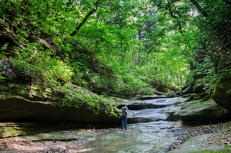
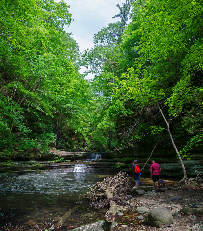
Illinois' Matthiessen State Park packs plenty of scenery in its mile-long upper and lower dells trail. At least seven waterfalls wait for exploration in this narrow canyon covered by trees from the woods above.

The largest pool of water is the Devil's Bathtub, just below a cascade of two waterfalls. (pictured above)  A few meters beyond is Lake Falls, at around 35 feet tall.  To walk from one to the other, visitors must step in the stream at the top of the falls to Devil's Bathtub - the stream is only two or three inches deep at this point, and perhaps 5 feet wide, so not a large obstruction.

The trail running along the top of the dells is wooded, but doesn't offer too many views of the canyon below, however, there are a few points leading down to the dells if one prefers not to walk in the often muddy trails along the stream.

Less crowded than it's larger sister, Starved Rock State Park, Matthiessen offers quite a bit of interesting scenery not found in too many places in Illinois.

Severe Weather

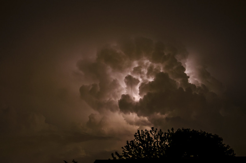
Illuminated Clouds

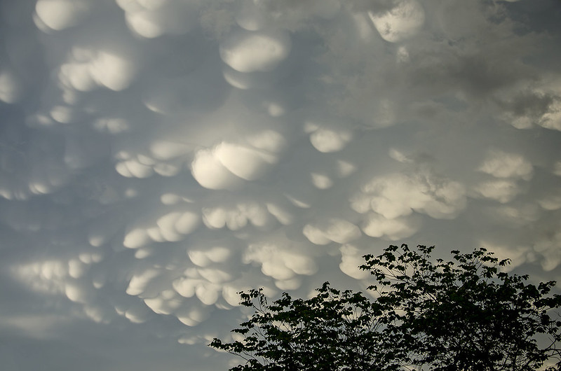
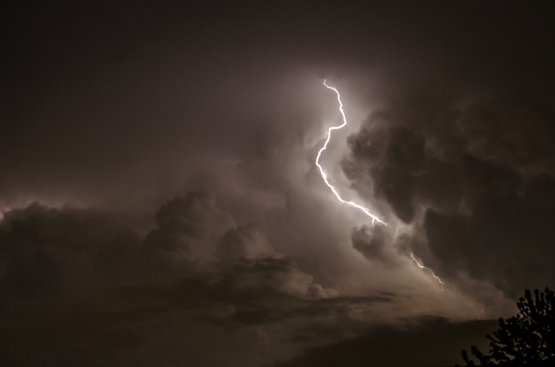
While the storms never reached us, the distant lightning and overhead mammatus clouds kept us intrigued throughout the evening.  A cold front just south of our position, stalled, and produced some severe thunderstorms that just didnt' seem to move away.

Mammatus Clouds

Just before sunset, mammatus clouds appeared overhead, spun off from the thunderheads a few miles south. Almost constant thunder could be heard in the distance as we looked above at the unusual puffy, clouds.

Usually, mammatus clouds last for a few minutes, as the storm approaches, but on this evening, they stayed for at least two hours, perhaps longer as we could no longer see them after dark.

Lightning Bolt

The storm continued into the late evening. Around 10pm, constant flashes of distant lightning to the south kept us watching the horizon. Aside from the streaks of lightning, the illuminated clouds interested me even more.

Peaceful Sunset

Peaceful Sunset

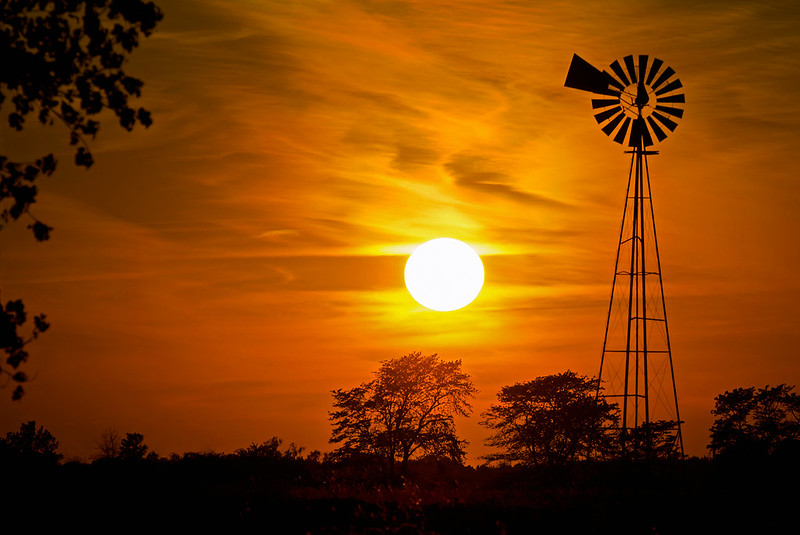
The end to a beautiful spring day in rural America.

Hoping to arrive at our destination before the sun set below the horizon, I was a bit disappointed the sun was too low to illuminate the landscape.  The distant trees blocked the light, and the subjects that I intended to photograph during the "golden hour" were now in shadow.  Looking around a bit, I noticed the sun on the horizon, filtered by high, wispy clouds; providing the perfect back lighting for a great silhouette- especially next to the distant windmill.

Sometimes the landscape dictates what's going to happen, and when you listen, the outcome is usually better than the one you planned.

Dark Falls

Dark Canyon Falls

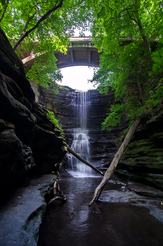
Early morning at the bottom of the canyon was quite dark, even though the sun illuminated the falls and the trees some 30 feet above us.  We spent the morning following trails we normally don't explore, and encountered some interesting new landscapes, but we came back to visit one of our favorite waterfalls.

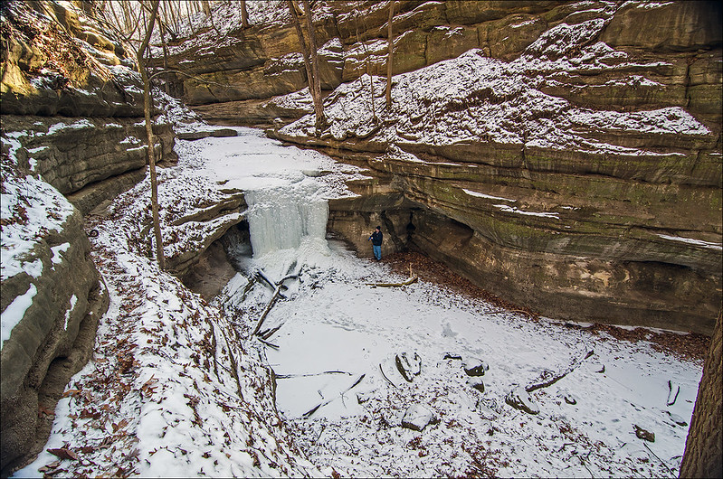
At around 30 feet, Lake Falls, is the tallest waterfall in Matthiessen State Park, and one of the most popular.  It's relatively easy to view from the trail above, or the bottom of the canyon, but if you wish to get close to it, you'll probably get your feet wet.  If you know where to park, this waterfall is only a few steps away from your car - great for freezing cold days when you wish to view the frozen waterfall but don't want to hike in the cold.  The best way to experience this fall is to hike in along the stream from the main parking lot. You'll experience a few other waterfalls, and wander through plenty of moss covered canyon.


Beyond the Falls at Cedar Point

Beyond The Falls of Cedar Point

I've explored and photographed the falls just beyond Cedar Point in all seasons, but I especially love these falls in winter.  The slow trickle of water freezes across the entire surface of the canyon ledge, creating an ice cave large enough to enter.  The image below shows the waterfall beyond Cedar Point. The photo above shows what lies further upstream - above the waterfall.

Falls Near Cedar Point

In winter, the path through the canyon turns to ice, so it's very difficult to walk the trail above the falls.  I always wondered what features were above these falls, but I didn't expect several more small waterfalls.  On this day, we followed a narrow trail up the side of the canyon, and onto the top of the falls, where the path led us to more waterfalls and interesting canyon features.

An interesting morning exploring some of the lesser known canyons and waterfalls of the park.

Parallel To Shore

Parallel To the Shore

Kintzele Ditch runs parallel to shore on this day, virtually eliminating all of the beach on the Mt. Baldy side of the stream. Lake Michigan has eroded most of the beach over the years, and collapsed a good portion of the foredunes in this area of the National Lakeshore.

Despite predictions for cold weather and rain, the beach was very comfortable on this morning.  The cold front rolled in a bit later, bringing with it rain and much colder temperatures.  A wall of fog can be seen on the horizon over Lake Michigan; it slowly made it to shore, as we left the beach.

fog2sm

fogsm

Dividing the Dunes

Dividing the Dunes

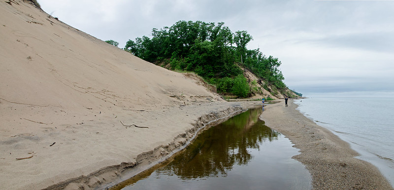
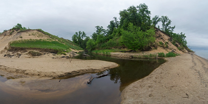
Kintzele Ditch flows into Lake Michigan from the waters of the Great Marsh, a 10 mile long wetland just behind the large sand dunes along the shore.  The two dunes it divides appear drastically different from one another - one is rather bare, while the other is lush with trees and vegetation.  Lake Michigan is slowly wearing away the beach, and collapsing the dunes little by little.  With each collapse, grass and full grown trees fall onto the beach, and are washed away by the waves of the lake.

The dune at the left has seen some major erosion over the past few years (not to say it was completely covered with trees previously), most of the front of the dune is gone. This erosion is evident on the lakeside surface of the dune at the right. Once covered in shrubs and trees, many have fallen victim to waves and gravity.

This panoramic image is composed of eight photographs stitched together. The effect gives an interesting vantage point to the stream and dunes.

Convergence

Convergence

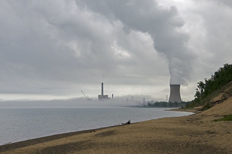
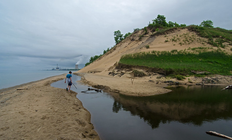
So many things converging in this image. The land with the water; the stream with the lake; grass with the sand; dunes with the beach; sky with water; nature with industry; steam with clouds, and warm and cold weather.

A morning with warnings of rain, wind, shoreline flooding, fog, and cold temperatures, was tolerable for the most part, and seems to have scared everyone off the beach - we were the only ones in sight.

The gloomy morning enhanced the mood of the industry on the horizon - Michigan City's electric plant, with the landmark cooling tower allowing steam to touch the clouds.

Moments after this image was captured, a line of clouds appeared on the horizon as far as the eye could see.  Knowing the predicted storms were on their way, we hastily headed the 1/2 mile to the parking area.  The wall of clouds quickly moved toward us, and with no way of making it to shelter, we readied ourselves for a drenching.

Much to our surprise, as the clouds approached, and the cold winds hit us, the wall of clouds turned out to be fog - no rain.  The beach ahead of us and behind us disappeared, as did the tops of the dunes, as the thick fog rolled in off the lake.

The weather created an almost surreal view of so many things converging at one time.

Established Dune

Established Dune

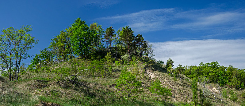
Parallel to the shore of Lake Michigan, this sand dune seems well established - supporting a wide variety of vegetation.  Grasses, flowers, shrubs, deciduous trees, and even a small stand of conifers thrive on the dune.  The foot of this dune touches the beach, without a prominent fore dune, allowing the crashing waves to reach it during storms. At least once in the past, a storm eroded a portion of the dune, collapsing a large area.  You can see evidence of this collapse at the right of the center dune in the photo above.

Without natural sand replenishment, Lake Michigan is slowly eroding away these dunes. Man made structures such as the pier in Michigan City, prevent waves from carrying sand to this beach, so a prominent fore dune has not developed.  Without a fore dune, this established dune is threatened by wind and waves.

Dunes a bit closer to Michigan City, near Kintzele Ditch, have all but lost their vegetation on the lake side of the dunes.  These dunes are eroding at an alarming rate, as the waves wash away the sand, collapsing the dune, taking mature trees with.

The dunes are an ever changing feature along the shore of Lake Michigan. They've changed every day for the last 4000 years, and won't stop anytime soon.

Marsh Patrol

Marsh Patrol

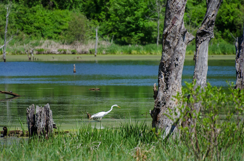
Restoration continues in the Great Marsh of the Indiana Dunes National Lakeshore. Efforts seem to have positive results - plenty of wildlife are calling this place home.  On our last visit, we encountered numerous species of bird, water birds such as the egret in this image, several great blue herons, turtles, frogs, and lots of insects. All without looking too closely.


The Great Marsh

Great Marsh

Once stretching over 12 miles, the largest interdunal wetland on Lake Michigan is getting a well deserved restoration.  Following years of draining, farming, industry, and road building, the Great Marsh is returning to its former glory as a haven for water birds, insects, and native wetland plants.
Thanks to volunteers and the National Park Service, invasive species are being removed, native plants planted, and ditches filled in - all to return the marsh to a more natural state.

Drive or walk near the intersection of Broadway Road and Beverly Drive in Beverly Shores, Indiana, and observe a portion of the marsh for yourself.  This is the Derby Ditch section of marsh, and it's come a long way in just a few short years. A relatively new parking area near the Beverly Shores Station of the South Shore electric line, allows visitors to park and walk along Beverly Drive, or walk the trails winding through the marsh. Expect to run into biting insects such as ticks and deer flies (they can dominate the experience in the summer), but long pants, repellent, and a wide-brimmed hat, can help keep the bothersome bugs at bay.  Wide-brimmed hats not only keep the sun off of your head, they also keep the biting flies from landing on your face. I guess the brim messes with their navigation a bit.

The Great Marsh includes the Derby Ditch section near Beverly Shores and extends past Cowles Bog, to the wetlands near Burns Harbor.

Backlit Blossom

Backlit Blossom

Unfortunately, due to an illness, I missed most of the flowering trees this year. I did manage to capture a few close to home, and using a variety of stacked filters, achieved this image. I usually strive for sharper images, however, I liked what the multiple filters did with the light and the edges of the flower petals.

Shooting into the sun created some lens flare across the image.  This is also something I generally wish to avoid, but here, it seemed to add a bit of interest to the pear tree blossoms. It can be seen both on the left of the image, and at the right- I'm guessing one artifact for every element the light passed through.


The Mouth of Kintzele Ditch

The Mouth of Kintzele Ditch

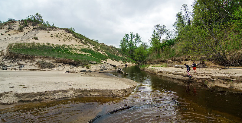
Shaped by the waves of Lake Michigan, the mouth of Kintzele Ditch changes constantly. The changes can be subtle, or extreme - sometimes 180 degrees in direction and hundreds of feet in distance.

The stream itself is a difficult waterway to explore. Walking along the bank is not possible because of the steep sand dunes on either side, and kayaking or canoeing is often impeded by fallen trees. Perhaps it's this difficulty that seems to attract us the most; always thinking we can explore a little further each time. But respect for the environment keeps us from trekking over the plants that boarder the stream, walking only where allowed and only where there are no plants to trample.

Every year I plan on following the stream as far as possible, and every year I'm stopped by some obsticle - natural or political.  I'll say it again- this is the year I'll find the source of Kintzele Ditch.

Effects of Winter

Effects of Winter

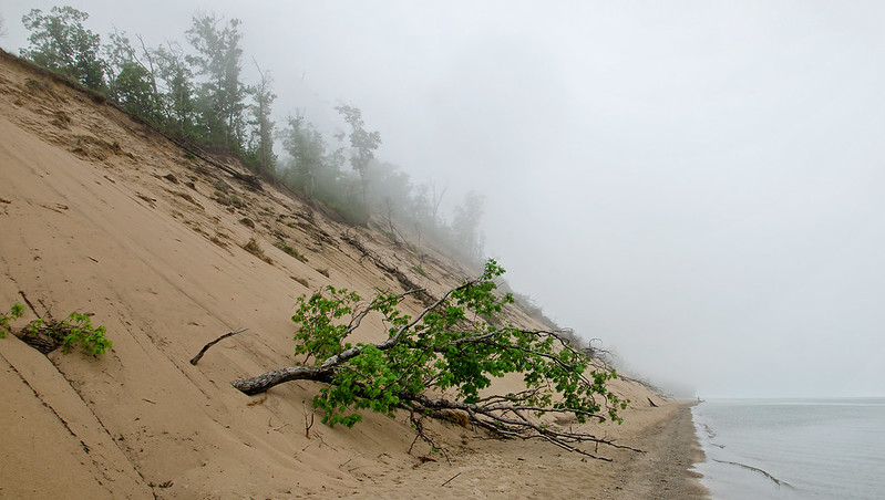
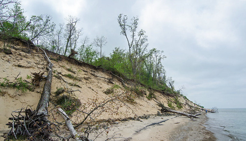
The effects of winter are quite evident on the dunes at Central Beach, part of the Indiana Dunes National Lakehsore. Waves washed away sand from the foot of the dunes, causing a collapse of the sand above, taking with it, large trees.  These trees litter this area of the beach, some even reach from the dune to Lake Michigan.

The Michigan City pier located about a mile up the shore has created a starving beach situation on the beaches downwind of the pier.  Wind and water carry away sand from the beach, but since the pier captures sand against it, the sand doesn't have a chance to replenish the beaches downwind.

Mt. Baldy is another example of a starving beach.  The living dune there is moving about four feet a year inland, yet new sand is not replenishing the moving sand.

Emergency conditions are in play here - people are no longer allowed to walk on most of the dunes in the National Lakeshore.  This is to prevent further erosion.

One look at the effects of winter on the dunes, and anyone can see the erosion is NOT due to foot traffic.  As a matter of fact, any erosion due to foot traffic on these dunes has long washed away into Lake Michigan by mother nature.

Keeping visitors off of all of the dunes only encourages people to walk around the barricades, killing the Marram grass, creating wider and additional paths.

The National Lakeshore needs to assess what is really at fault, instead of closing area after area to foot traffic in the name of conservation. Mt. Baldy remains closed following the sinkhole that swallowed a visitor who wandered into a closed area of the dune. Efforts to determine why it happened and if it could happen again are moving at glacially slow speeds. Coincidence?  I think not. It's a great excuse to keep visitors off of the newly planted Marram grass.

Greening Up

Greening Up

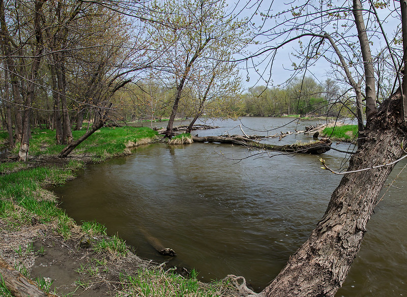
Hiking near the Des Plaines River as nature wakes up from a long winter.  The grass is turning green, the trees have buds, and creatures are out by the dozen.  We encountered some snakes wandering in the tall grass, and even climbing the trees.  The water levels were up a bit due to the recent rains, and portions of the wooded island were under several inches of water.

The water rushed between islands, and where the river narrowed, some pretty heavy rapids formed for short distances.  Warm weather birds are just beginning to make their appearance, adding some interest to the shore and sky.


Confluence

Kankakee Confluence

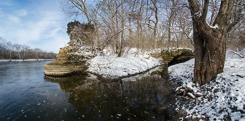
The morning after a spring snowfall, the outcroppings of rock on the bank of the Kankakee River were highlighted with snow. The Kankakee State Park was empty - as it often is on cold days, but signs of spring were everywhere.  The new fallen snow covered the early spring plants, but the river was once again free of ice, and birds were stopping along the river on their migration north.

This portion of the Kankakee River is quite scenic, with the outcropping of rock along the banks, and several overhangs and small caves nearby.  One of the overhangs can be seen on the right side of this photograph. About 15 feet high, it marks a turn in the stream just before it merges with the river. Over time, the stream and river have worn away the rock at the water level, forming a concave face on the rock wall.

The rock point seen in the center of the image has worn away much the same way.  The strata of the rock wall can be clearly seen, because each layer wears away at a different rate.  Standing on that point gives the feeling of being aboard a ship - as the water moves past the point, you feel as though you're standing on the prow of a moving ship.

One positive thing about a spring freeze - the muddy bank of the river was solid, so hiking was easy.

Symmetry

Symmetry

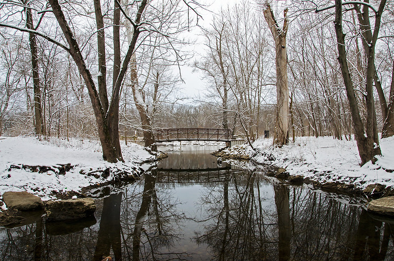
Visiting the area to explore the "Indian Caves" in what should be the area's last measurable snowfall of the Spring, the reflections of the bridge and trees in the stream were rather soothing after a cold, mile hike.  The stream was shallow enough to walk through without getting too wet, allowing me to not only capture this image, but also to explore one of the caves near the end of the canyon.  The mud was frozen - keeping me from sinking in, and the recent snowfall highlighted the contours and texture of the canyon walls, providing an attractive, yet difficult to capture photographic opportunity.

In summer months, local children climb the canyon walls, and follow the stream through the canyon. To me, the rocks don't seem stable enough to climb, but I am going back for a walk through the canyon stream....

View From the Indian Caves

The View from the Indian Caves

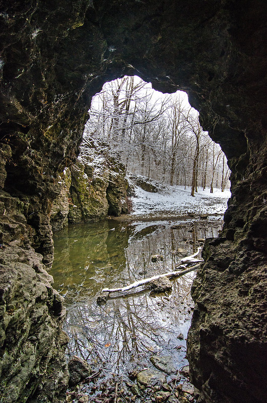
A spring snowfall highlights the walls of the canyon locals call "The Indian Caves".  This small canyon is riddled with holes and caves its entire length.  The elevation change is approximately 30 feet, with small waterfalls near the end of the canyon where the stream empties into the Kankakee River.

This cave was large enough to walk into, but only about 25 feet long; just deep enough for the walls and ceiling to create a dramatic frame for the snow covered woods on the other side of the stream.

Not the largest or most dramatic canyon in Illinois, it is, however, a very interesting place to visit and explore. Located in Bradley, Illinois, just a few meters away from the Kankakee River, and about a 3/4 mile hike from the nearest parking, one gets the feeling of being much farther away from town than they really are, even though the parking area is right in the business district of the town.

View From the Bluff

South Haven Overlook

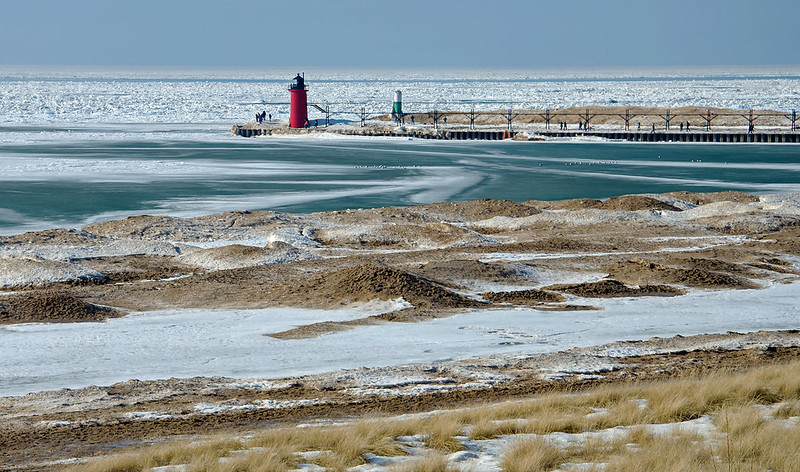
With hardly any snow left around land, walking on the bluff overlooking Lake Michigan surprised us, as the lake was still in winter's icy grip. Signs of a warm up are evident if you know where to look: Plenty of sand on the ice piles; smooth, grey ice between the ice mounds (melt water frozen again); and little or no ice on the lighthouse.  Yet, it still appeared we were looking at an arctic seascape, littered with car-sized drift ice. and bordered by snow covered mountains.

Days like these are some of the best for visiting the lakeshore - especially for those who can't cope with the freezing weather often associated with winter along the Great Lakes. Not only is it very comfortable to walk the shore, but you can witness so many changes happening right before your eyes, as the ice begins to retreat.

Mysteries in Ice

They Came in Peace

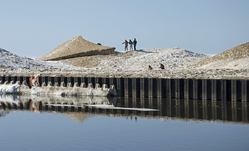
The frozen Lake Michigan shore is always interesting, but as the ice begins to melt, even more interesting things can happen.  With a little imagination, the shore can create some fun stories.

 For instance, this ice mound takes on the appearance of an alien ship that landed on the shelf ice.  Here, people are carefully approaching the craft to investigate the landing craft.

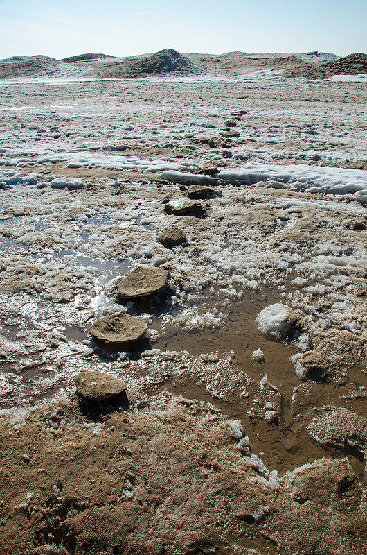
Inverted Footprints

Just a few hundred feet away, negative footprints lead out onto the shelf ice.  Perhaps related to the alien ship in the photo above?  Most likely, these were hard-packed footprints in deep snow that filled with sand, blown in by the wind.  When the ice began to melt, the sand shielded the ice from the sun, and the packed ice melted slower than the surrounding ice, leaving these stepping stones on the frozen lake.

It's a bit early for April Fool's day, but fun none the less.